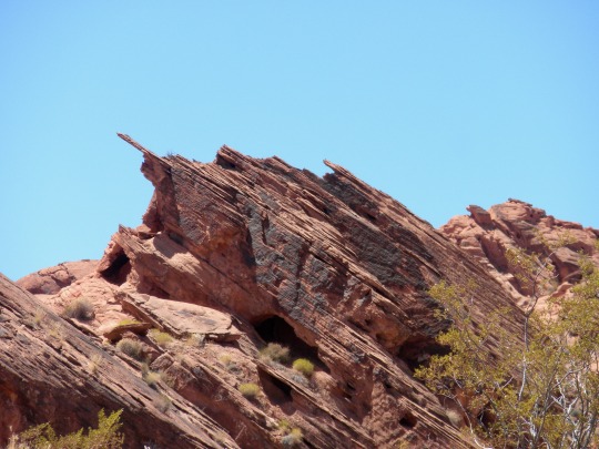
#red Aztec sandstone
Video
Fire and Ice by James Marvin Phelps
Via Flickr:
Fire and Ice South Virgin Mountains Valley of Fire State Park Nevada
#nevada#valley of fire state park#mojave desert#red rocks#aztec sandstone#landscape#desert#mountains#wildlife#wilderness#adventure#hiking#nature#beauty#james marvin phelps photography#snow#virgin mountains#winter#snow covered mountains#flickr
31 notes
·
View notes
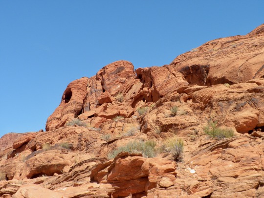
Text
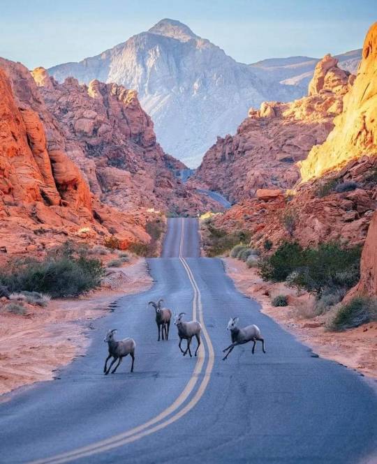
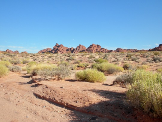
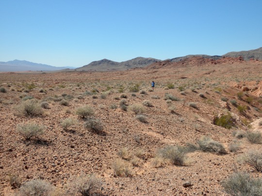
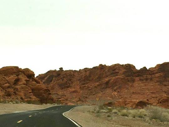
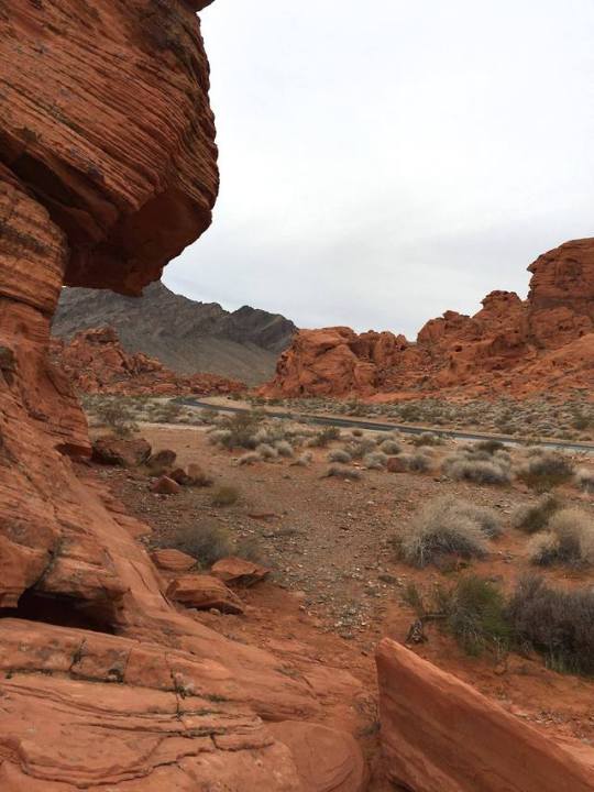
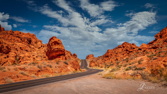
➤ Valley of Fire State Park is a public recreation and nature preservation area covering nearly 46,000 acres (19,000 ha) located 16 miles (26 km) south of Overton, Nevada. The state park derives its name from red sandstone formations, the Aztec Sandstone, which formed from shifting sand dunes 150 million years ago. These features, which are the centerpiece of the park's attractions, often appear to be on fire when reflecting the sun's rays. It is Nevada's oldest state park, as commemorated with Nevada Historical Marker #150. It was designated as a National Natural Landmark in 1968. Valley of Fire is located in the Mojave Desert 50 miles (80 km) northeast of Las Vegas, at an elevation between 1,320–3,009 feet (402–917 m). It abuts the Lake Mead National Recreation Area on the east at the Virgin River confluence. It lies in a 4 by 6 mi (6.4 by 9.7 km) basin.
📷@codymayer22
61 notes
·
View notes
Text
Temple of Earth = Temple of other elements
Anyways! Since Lloyd doesn't really have any predecessors, I think he would just be most connected to The Temple of Light. As for the other temples I have a lot of thoughts about them so..
Just in general I think that each temple generally has different vibes, and they all have keepers that tend to the building and whatever is inside, along with protecting it. While they are not elemental masters and have no powers, they are capable of entering the temple.
Earth - Obviously this one is located in the mountain of Shintaro. I think that the Munce and the Geckle are the keepers of this one because it's cannon that they built the statue of Lilly, and also have knowledge of elemental masters despite not having much knowledge of the outside world. Older Munce and Geckle carved the temple itself along with the statues of the previous masters. I think that after the events of MOTM they also carved one of Cole. (I have so many Cole thoughts about this but those are for a completely different post.)
Fire - This temple is located in the desert and is built from sandstone and glass. The design is a weird mix of Aztec and Chinese architecture. Where the Earth temple is one room, the Fire temple is multiple rooms: one atop the other. There is lots of carvings (similar to the Earth temple,) and paintings depicting different things related to the element of fire. Previous Masters of Fire are depicted in paintings lining the walls. There is a small library area with scrolls but most of the info in them has been carved into the walls. There are torches lining the walls, and a large fireplace in the center. The keepers of the Fire temple are Cobra Serpentine that are colored like the sand and have red markings.
Lightening - This temple is located in that lighting/thunder city from that one concept art. I imagine it to be pretty much a library. Just endless walls of scrolls and books and loose papers. The temple is in the center of the city and there are a few monks that are the keepers. Anyone in the city can enter the temple, however only the master of lightening can view many of the library's contents. It's one tall room with a spiral staircase in the center. The stairs and shelves are all sharp edges and irregular shapes (like lightening haha), and the building is made completely of a dark wood. The light source for the building is a constant flow of electricity/lightening circling the perimeter of the space. The previous Masters of Lightening's names are documented in a large book in the center at of the temple.
Ice - ok this one is in whatever Ninjago's version of the arctic is. Carved into a glacier and kinda like Ahtohallan in Frozen 2 because it's cool af actually. The previous Masters of Ice are depicted as ice sculptures in a fancy statue room like the ones in the air temples in ATLA. Other info like special spinjitsu moves and stuff are carved into the walls, and pillars/columns. The keepers are arctic fox formlings. (And yeah, I know there's "no formlings in Ninjago" but this is my au so I say there are but these ones are the only ones actually and nobody knows about them except masters of ice that have been to the temple obv but they keep secrets pretty good.)
Water - the water temple is deep in the ocean (separate from the temple of wojira obv) and is made from basalt stone. It's based greek architecture and the style to be like a tholos. It's a closed space and the inside is somehow not submerged (idk lets say its magic.) The lighting inside is provided clusters of glowing algae and glowing crystals and there is decorative bits made with pearl. On the wall is a huge painted mural of Nyad's battle with Wojira. The floor has carvings of spinjitsu moves and information about controlling water. There are simple doric columns surrounding the outside that have the names of previous masters carved around at the very top. The keepers of this temple are whatever type of seaperson Benthomaar is.
#haha#ninjago#ninjago headcanons#ninjago kai#ninjago cole#ninjago jay#ninjago zane#ninjago nya#ninjago lloyd#headcannons.
12 notes
·
View notes
Text
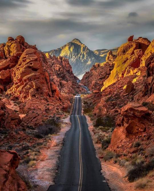
Escape the Glitter: 13 Awesome Places to Visit Near Las Vegas by Car
Las Vegas, the dazzling city of lights, beckons with its world-class casinos, extravagant shows, and electrifying nightlife. But beyond the neon glow lies a vast and diverse landscape waiting to be explored. Buckle up and hit the open road – here are 13 incredible destinations, all accessible by car from Las Vegas, that offer a welcome escape from the Vegas buzz:

Red Rock Canyon National Conservation Area: A mere 23-minute drive west, Red Rock Canyon stuns with its fiery red sandstone cliffs, sculpted by millions of years of wind and erosion. Hike scenic trails, witness ancient petroglyphs, or take a scenic drive for panoramic views. Click here
Valley of Fire State Park, Nevada: Travel 56 minutes northeast to discover a photographer's paradise. Valley of Fire boasts vibrant red Aztec sandstone formations, petrified trees, and ancient petroglyph panels. Hike scenic trails like the Mouse's Tank Loop or marvel at the landscape from scenic overlooks.
Hoover Dam, Nevada/Arizona: A 45-minute drive southeast takes you to a marvel of human engineering - the Hoover Dam. Witness the immense power of the Colorado River harnessed by this colossal concrete structure. Explore the dam's interior on a guided tour or take in the breathtaking views from the Mike O'Callaghan-Pat Tillman Memorial Bridge.Click here
Lake Mead National Recreation Area: Cool off at Lake Mead, just 40 minutes from the Strip. This massive reservoir offers boating, fishing, swimming, and stunning desert scenery. Explore the various coves and beaches, or visit the historic Mormon settlements and viewpoints surrounding the lake.

Grand Canyon National Park – West Rim: Embark on a 2-hour and 13-minute adventure to the Grand Canyon's West Rim. Witness the awe-inspiring grandeur of this natural wonder, walk along the thrilling glass Skywalk, or take a helicopter tour for unparalleled aerial views.
Death Valley National Park, California: For a taste of extremes, head 2 hours and 22 minutes east to Death Valley National Park, the hottest, driest place in North America. Explore otherworldly landscapes like Badwater Basin, the lowest point in North America, or hike through Zabriskie Point for panoramic vistas. Click here
Seven Magic Mountains, Nevada: Take a 35-minute southwards jaunt for a whimsical art installation. Seven Magic Mountains features colorful, towering rock sculptures set against the stark desert backdrop, making for a unique and Instagram-worthy stop.
Zion National Park, Utah: A 2-hour and 35-minute drive leads to Zion National Park, a wonderland of red sandstone cliffs, slot canyons, and cascading waterfalls. Hike the iconic Narrows, a slot canyon carved by the Virgin River, or explore the park's diverse trails offering breathtaking scenery.
Mount Charleston: Escape the desert heat with a 48-minute drive up Mount Charleston. This forested mountain range offers cooler temperatures, scenic hiking trails, and a chance to spot wildlife like bighorn sheep. During winter, enjoy snowshoeing or skiing at the Lee Canyon Ski Resort. Click here
Oatman, Arizona: Cruise 1 hour and 13 minutes south to Oatman, a quirky wild west ghost town. Burros roam freely, and visitors can interact with these friendly (and sometimes mischievous) creatures. Explore the historic buildings and shops lining the dusty main street.
Sedona, Arizona: Immerse yourself in the spiritual energy of Sedona, a 2-hour and 30-minute drive away. Hike amidst majestic red rock formations, visit ancient Native American ruins, or embark on a jeep tour for off-road adventures. Sedona is also known for its vibrant arts scene and metaphysical shops.
Laughlin, Nevada: Seeking a change of pace but craving Vegas vibes? Head 90 minutes south to Laughlin, a mini Las Vegas on the banks of the Colorado River. Enjoy casinos, riverboat cruises, and a more relaxed atmosphere compared to the bustling Strip.
Bryce Canyon National Park: For an unforgettable stargazing experience, take a 4-hour drive to Bryce Canyon National Park. Hike along the rim, marveling at the unique hoodoos (tall, thin rock spires), or descend into the amphitheater for breathtaking views. At night, witness a dazzling display of stars due to minimal light pollution.
Learn more:
Top Places to Visit In Chikmagalur in 3 Days 2024
Hirekolale Lake Itinerary: Complete Travel Guide.
Best Area To Stay In Costa Rica 2024
0 notes
Text
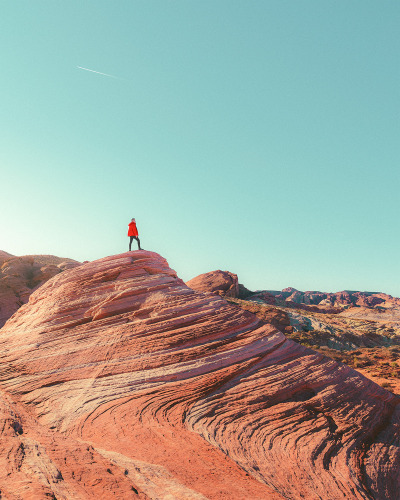
HE SAID, "i HAVE CONQUERED JABBA THE HUT."

NO YOU HAVE NOT. YOU'RE STANDING ON TOP OF AN AZTEC SANDSTONE.
Valley of Fire State Park is located 16 miles south of Overton, Nevada. The state park derives its name from red sandstone formations, the Aztec Sandstone, which formed from shifting sand dunes 150 million years ago.
0 notes
Text
See Surprisingly Stunning Views From An Airplane Window Seat!
— Photograph By Julieanne Kost
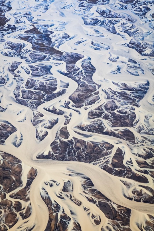
SOUTHERN ICELAND 🇮🇸! Kost considers a few factors before taking off. When possible, she recommends choosing seats that are in front of the engines to avoid distortions caused by the jet’s exhaust and wearing dark clothing to minimize window reflections.
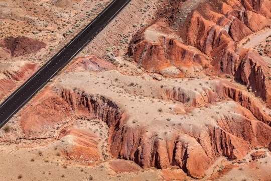
VALLEY OF FIRE STATE PARK, NEVADA, USA 🇺🇸! Named for its striking red Aztec sandstone formations, the Valley of Fire State Park, Nevada’s oldest and largest park, sits 50 miles northeast of Las Vegas and is a popular hiking and photography destination.
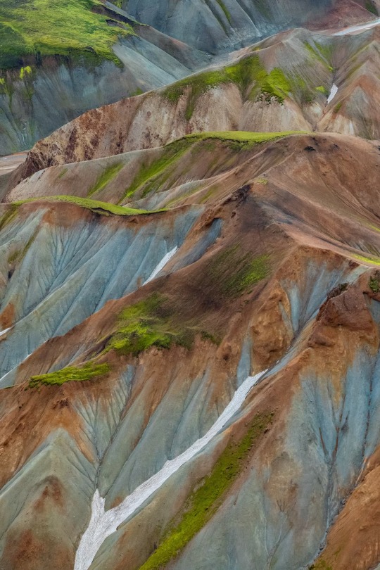
LANDMANNALAUGAR, ICELAND 🇮🇸! The colorful rhyolite mountains in Landmannalaugar, located inside Fjallabak Nature Reserve, hide pockets of geothermal hot springs that are open for a relaxing dip.
GREAT SALT LAKE, UTAH, USA 🇺🇸! Great Salt Lake’s shoreline is a hot spot for migratory birds, such as the tundra swan, American white pelican, white-faced ibis, California gull, eared grebe, peregrine falcon, and bald eagle.
MOJAVE DESERT, NEVADA, USA 🇺🇸! When photographing through an airplane window, Kost says avoid using a polarizing filter. Most commercial airplane windows have a coating that reacts with polarizing filters, resulting in images with artificial-looking colors.
LAKE MEAD NATIONAL RECREATION AREA, NEVADA, USA 🇺🇸! With three deserts and views of Hoover Dam, Lake Mead National Recreation Area became the country’s first congressionally designated National Recreation Area in 1964.

SOUTHERN ICELAND 🇮🇸! “I’ve always been drawn to photographs of ice,” says Kost. Here, Kost captures the frozen landscape of a country that is 11 percent ice.
LAS VEGAS, NEVADA, USA 🇺🇸! When taking a window-seat photograph, Kost suggests using the widest aperture setting on your camera to help minimize the appearance of dirt or scratches on the window.
GREAT SALT LAKE, UTAH, USA 🇺🇸! One of the largest saltwater lakes in the western hemisphere, the Great Salt Lake’s salinity levels—nearly four to 10 times the ocean’s—keep swimmers buoyant in its warm, shallow waters.

SAN FRANCISCO BAY, CALIFORNIA, USA 🇺🇸! These unmanipulated images from Kost’s window seat help change perspectives and encourage travelers to leave the shades open. In this photo, microorganisms brighten up the San Francisco Bay salt ponds with vibrant colors.
0 notes
Photo
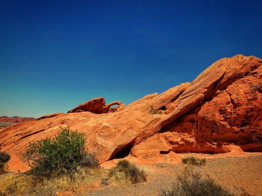
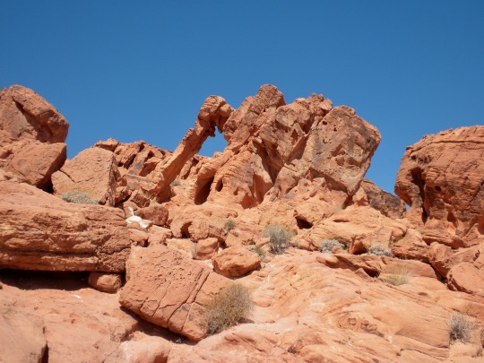
Can you see it? We're still pretty far away on this part of the hike, but that's Arch Rock in Valley Of Fire State Park. This red Aztec Sandstone arch is an easy hike and really cool up close ( stay tuned for some up close photos coming soon). @valley.of.fire #valleyoffirestatepark #valleyoffire #archrock (at Valley of Fire State Park) https://www.instagram.com/p/Cp4q_BvOTT8/?igshid=NGJjMDIxMWI=
0 notes
Text
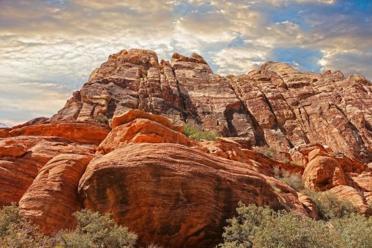
Top Guide To Red Rock Canyon National Conservation Area
The Red Rock Canyon is such a unique location with a scenic drive that it's definitely on the bucket list of any geography enthusiast. This is located in Southern Nevada, Las Vegas, and it's one of the best places for adventurers to go experience and witness unique geographical formations like Grand Canyon National Park, Colorado River, Redwall Cavern and Marble Canyon in Arizona. Are you planning on taking a trip to the Red Rock Canyon any time soon? Then you must read this guide to help you out!
youtube
Where In Las Vegas Is The Red Rock Located?
The exact address of this hiking spot is 1000 Scenic Loop Drive, Las Vegas, Nevada, United States. You can travel to Nevada by driving or by flying in.
Top Viewpoints At Red Rock Canyon National Conservation Area
These viewpoints are the ones you must see when you go to the Red Rock Canyon National Conservation Area in Las Vegas.
Turtlehead Peak
This has one of the most impressive views in the area, perfect for any hiker or rock climbers due to Turtlehead Peak's impressive elevation gain. You will need to endure 4.6 miles of an upward trail but the view at the top makes the trail all worth it. Make sure to pack a windbreaker to protect yourself from the harsh winds.
At the top, you will have a clear view of the Las Vegas Strip, the desert, Lake Mead, and more.
North Peak
This particular location on the Red Rock requires a very long hike - 11.8 miles to be exact. You can skip the hike and drive the North Peak trail with an all-terrain vehicle, and then just finish off with a short hike, as some people do.
This is definitely one of the more challenging hikes because of the elevation and the winding trail, but it's definitely worth it. This point overlooks Rocky Gap Road, Bridge Mountain, and many more scenic spots such as red rock formations and sandstone formations.
Calico Hills
This location can be accessed both within and outside the Red Rock Canyon National Conservation Area. Calico Hills is named as such because of the "calico"-colored hills and rock formations. This is because of the Aztec sandstone composition that yields and orange-red and tan-colored mountain range. This is not too far from the visitor center so it's pretty accessible to start with.
This trail can be accessed from different points. You can try to go through the visitor center or the Sandstone Quarry.
The entire hike on this grand canyon is about 6 miles, but you can always go for the shorter hike which is only 2 miles.
If you want a better view, check out the Calico 1 and Calico II viewing deck so that you can see more sand dunes, Calico tanks trail, the Willow Spring Loop, and other gorgeous trails surround the grand canyon. These paths also have a parking area at the entrance. If you want a memorable hike with a recreation area, loop road, and reasonable elevation gain, Calico Hills is the destination to aim for.
This park is full of red rock canyon formations that are truly remarkable. Immerse yourself in these redstone structures.
High Point Overlook
Looking for another scenic hike in Nevada, Las Vegas near the grand canyon? Try the High Point Overlook. This is perfect for hikers and people who like mountain biking with scenic views.
This location has stellar reviews from tourists and trailheads because of the gorgeous winding roads, clean area, accessibility to the canyon, hiking trail opportunities, and countless other things to do outdoors.
This can be a bit challenging compared to most hiking trails because the said point is situated up to 4000 feet above sea level. Whatever happens, a trip or drive to this location will surely be memorable. Make sure to take lots of photos to commemorate this spot.
Pine Creek Canyon
This location got its name because it literally follows a creek. This offers one of the most gorgeous outdoor scenes, with lush and green scenery with tons of pine trees in the conservation area. It has a reasonable elevation gain that makes it enjoyable to hike, even for beginners.
Pin Creek Canyon is a special location because it's a nice break from the usual desert views with sand dunes and very sunny hike pathways. This special park has a willow spring picnic area, some picnic tables, and other outdoors attractions. The road to the picnic tables has sandstone stairs that will surely look great in photos. It is also an excellent pathway for hiking.
Mount Wilson
This is technically not part of the general conservation area but it is still the highest peak among the Spring Mountains which are located on the Red Rock Canyon. This is actually so tall that it reaches 7,000 feet high. Such an elevation gain will surely make hikes more challenging so if you want some extreme outdoors hike, go for this canyon trip.
Don't worry because not all the hike trails are difficult. There are some for newbies or the people who don't know where to start but they just want to do nature things in a canyon. There is also an extreme trail for the experts. You may even try a loop trail in the conservation area.
The view from the top of Mount Wilson will make all the hiking worth it.
First Creek Canyon
Looking for a short and easy loop trail? Go for the First Creek Canyon trails! The hike only takes up to 2 hours and at the end of the pathway, you will witness a stunning grotto and the most beautiful little waterfall.
This is actually located just outside of the Red Rock Canyon National Conservation Area, near the Spring Mountain Ranch State Park. It is definitely one of the shorter trails as it only measures 1.9 miles. It got its name because it follows a creek. Some parts of the trail may have dried streams but most of the area should have a light flow.
The highlight of this trail is the end of the hike where you witness a small waterfall that emerges from a boulder-filled area. The views along the hike are stunning. The waterfall area of the canyon has various vegetation and greenery, and some tend to be overgrown. There's also a Willow Springs picnic area where you can enjoy your food.
Ice Box Canyon
The Ice Box Canyon is a unique section of the Red Rock Canyon National Conservation Area. It got its name from the cool water and low level of sunlight which keeps it cold. This is one of those hiking trails that is best traversed during the heat of the summer so that you can enjoy the cool breeze and not overheat.
This has a reasonable elevation gain and a variation of hikes for all types of adventurers. The general trail stretches for an hour long and you get scenic views along the way. At the end of the trail you'll see some seasonal waterfalls particularly during the months of December to April.
As a pro tip, it's important to dress in layers as you go on this trail. The elevation gain makes it a cold journey so dressing in layers will help keep you warm. You may also just remove some of your clothes if you feel the need to cool yourself down.
Petrogylph Wall
This is yet another exciting trail that is short yet extremely enjoyable. It is located in the Red Rock Canyon within the Willow Springs Picnic Area. This is the parking area and where the park entrance is located. Simply follow the trail from this location and proceed for 30 minutes until you reach the Petrogylph Wall.
This is one of the most unique hikes because of its historical trail. The petrogylphs on the wall are said to be 800 years old. You can secure a trip to this canyon and see the historical rock art yourself by consulting the Southern Nevada Conservancy.
Keystone Thrust Trail
This feature's one of the most important geological formations in the Red Rock Canyon - the Keystone Thrust. This is the mark left behind by the collion of the North American and Pacific Continental plates.
The trail will start at the White Rock Parking Lot and as you follow along, you will circle back to where you started. The trail is technically classified as easy but the 400-feet elevation may be challenging for some. The path gradually goes upward until you reach a saddle, and then you will see a gorgeous red rock ridge. Just follow the trail into a high red rock ridge where it will end. Every turn along the trail gives you a new and unique view of the red rock canyon which is what makes this so unique. You can even see the Calico Hills park from a distance.
This is one of the most enjoyable and easiest paths in Las Vegas. You start on a 2.2-mile journey that is roundtrip and gives you a holistic experience of the Red Rock Canyon.
Moenkopi Loop
This is one of the best desert hikes because of its relaxed pace and scenic trail. There are parking areas at the beginning of this canyon journey so that you can leave your vehicles behind and walk the rest on foot.
The Moenkopi Loop is a special trail because it's one of the historical spots in the entire park. Along the two-mile hike, you'll witness fossilized remains from centuries ago, perfectly preserves in the geological formations.
You will also see a smattering of unique flora and fauna that you can only witness in the desert. The Moenkopi Loop closely follows a limestone ridge. Red rock canyon formations can be seen from a distance.
White Rock - Willow Spring Loop Trail
This is another striking location in the red rock canyon because of the diverse mix of scenery and trails. You will see deserts, cacti, pictographs, a bridge mountain, and even wildlife. The White Rock Willow Spring Loop trail also features the La Madre Spring trail. However, this detour will turn your two-mile hike into a 6-mile one but trust me when I say that the views make it worth it.
This trail begins in the parking area and it loops behind the White Rock Mountain. You will go through a dense forest of junipers and pines. It's very nice and gorgeous. Savor this section because it's one part where you are sheltered and cool before you experience the elevation if you to decide to go for the spring. You also have the option to follow the main trail where you will be brought back to picnic areas..
Where Can You Stay Near The Red Rock Canyon?
Don't worry, because the area around the Red Rock Canyon in Las Vegas has so many lodging options! The vast range will give you budget flexibility. These hotels are also very near to the aforementioned spots in Las Vegas so all it will take is a short ride and then you'll be ready to hike.
Luxury Hotels
Las Vegas is known for its fair share of luxury hotels. One of the most popular ones is the Red Rock Resort & Spa which is only 5 minutes away from the park. Hotels like this offer luxurious rooms, mega suites, outdoor pool complex, a diverse dining experience, and more. As a bonus, you're only 30 minutes away from the ever-famous Las Vegas Strip!
Mid-Range Hotels
These hotels are about 5 minutes away from the Strip but 30 minutes away from the Canyon. These offer spacious rooms and lovely villas for everyone.
Some of the most famous mid-range hotels include Marriott's Grand Chateau, Staybridge Suites Las Vegas, and The LINQ Hotel.
Budget Hotels
There are plenty of budget hotels that are located about 10 minutes away from the Red Rock Canyon. Check out popular options like La Quinta Inn & Suites.
Pro Tip For Beginner Hikers
The best part about hiking the Red Rock is that you have a myriad of trails you can choose from. All types of adventurers are welcome, from beginners to experts. Here are some tips that you can apply before you set out on your hiking journey.
Invest In The Right Equipment
The hiking equipment that you wear will greatly impact your comfort level and performance. Invest in good quality hiking shoes that will keep your feet free from callouses and strain despite the long trails. Check out countless options of hiking shoes online. Be wary of affiliate links because that means the person who endorsed the product may get a portion from the sales. Take your time comparing your options and reading up on the reviews.
Research The Trails
Make sure to assess your skill level before going on hikes in the park. You may be tempted to go to a specific site but if the trail's length and elevation are too much for your skill level, then you'll end up not enjoying yourself. It's best to go for something you can perfectly handle. Each park is usually marked by the difficulty level so only go for what you can handle.
Follow The Local Rules And Guidelines
Going to the Red Rock Canyon is more than just a tourist activity. It's a chance to appreciate nature in its full glory. Out of respect to nature's beauty, make sure to follow the local guidelines. You can usually see these rules at the entrance or printed on the informative brochures handed out to tourists.
Pay the entry fee which is often used for the maintenance of the park. Take nothing but pictures and leave nothing but footprints. Do not litter and do not go into restricted areas. Always keep an eye on the guide and do not stray far from your tour group. For further information or assistance, feel free to contact us
#advantagegrandcanyon#grand canyon rafting trips#advantage grand canyon#advantagegrandcanyon.com#grand canyon rafting#rafting adventure#grand canyon river rafting#full grand canyon rafting trips#full grand canyon river trip#red rock canyon#Red Rock Canyon National Conservation Area#Youtube
0 notes
Text
Meditative Week of Poetry: Michael Thompson

I’ve never stompdanced in Oklahoma, but full centuries of old Creek
newsreels have motion-stopped in me, twirling cycloned fenders into
loosened braids to the pitch-black refrains of settler philosophers at 3 am,
twisting counterclockwise each rusted bolt about your body next to me.
Oakbarks growl excavations from centuries of blood-mound memory,
catfish snapping Aztec blues through screen doors drenched in cornfield
sweat as green as Chuska cedar. Thighbone shells tied rawhide tight to
strands of hair, the hands of your air morning fog across my back.
My ribbon shirt sears like moss, and river mud stabs through missing
history as rotted as a slough-side lynching. Moonlight chokes in gashed
ravines of liquid crow where Fowltown elites once grappled stickball fields
weeping wild onion dreams. Broken arrowheads hide themselves.
I have resemblanced tattoos echoing cheek to chin, mirrors of denial and
acceptance—a dead quail posed solemnly sharing starry quilts with a
rabbling rabbit. Earth as dark and moist as sin releases my uncovering, my
un-mounding, my kidnapped wife, my arrowed erroring. Futurity.
Whiteshell moons escape your teeth in coondog winterness, emergence
story of barbed winter ice, splayed blackjacks cloaking footprints. Limbs
shout blood hymns to a slow spring glistening of chain gangs; sandstone
shadows climb scuppernong dawns. Exhausted, preachers flee.
The skull of Cowe Harjo cradles my gaunt irises. Eyelids rise on Crazy
Snake. Like a drowsing drum, Okmulgee loam prays dreams beneath my
feet. A map of sorts. That’s what she said. Like a deer’s heart gushing red,
Mvskoke songs drench my hands. You and I are tangled now. Fvtcv.
0 notes
Photo

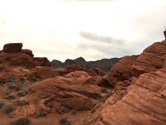
The Valley of Fire While in orbit over southern Nevada, an astronaut onboard the International Space Station took this photo of brightly colored rocks and deep canyons in the Mojave Desert. The Muddy and Virgin Rivers cut through the desert to deliver water to Lake Mead reservoir. The Muddy River flows through Moapa Valley, where it is bordered by agricultural fields and towns. The nearby Virgin River, by contrast, is bordered by dark vegetated areas and lacks urban structures. Both rivers empty into the Overton Arm, the northern part of Lake Mead that eventually merges with the Colorado River to the south. Red-orange rock exposures near the center of the photo mark the Valley of Fire State Park, located approximately 40 miles (60 kilometers) to the northeast of Las Vegas. At sunset, valley outcrops made of bright, rust-colored Aztec sandstone appear to be on fire, which led early European explorers to give the area its colorful name. This sandstone here formed from ancient sand dune fields that covered the area during the Jurassic Period. The slab was subsequently faulted and uplifted by tectonic forces, and then eroded by water and wind into the current landscape. Significant archaeological artifacts have been found throughout Moapa Valley, with some dating back to 300 BCE. Among the finds are ancient petroglyphs (not visible in this photo) etched into the sandstone. Anasazi Native Americans occupied the area during that time, hunting, gathering, and building pueblo villages. The discovery of pit houses, pueblo walls, and other ancient cultural artifacts in what was to become Lake Mead caused people to dub the area “the Lost City.” At the top of this photograph, the southern part of the Moapa River Indian Reservation is visible. Astronaut photograph ISS062-E-55262 was acquired on February 25, 2020, with a Nikon D5 digital camera using a focal length of 400 millimeters. It is provided by the ISS Crew Earth Observations Facility and the Earth Science and Remote Sensing Unit, Johnson Space Center. The image was taken by a member of the Expedition 62 crew. The image has been cropped and enhanced to improve contrast, and lens artifacts have been removed. The International Space Station Program supports the laboratory as part of the ISS National Lab to help astronauts take pictures of Earth that will be of the greatest value to scientists and the public, and to make those images freely available on the Internet. Additional images taken by astronauts and cosmonauts can be viewed at the NASA/JSC Gateway to Astronaut Photography of Earth. Caption by Sara Schmidt, GeoControl Systems, JETS Contract at NASA-JSC.
5 notes
·
View notes
Photo
August 19th, 2019
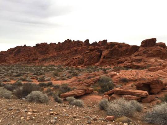
Charlies’s Spring, Elephant Rock, Natural Arches, Valley of Fire, Nevada, USA
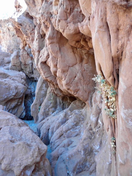
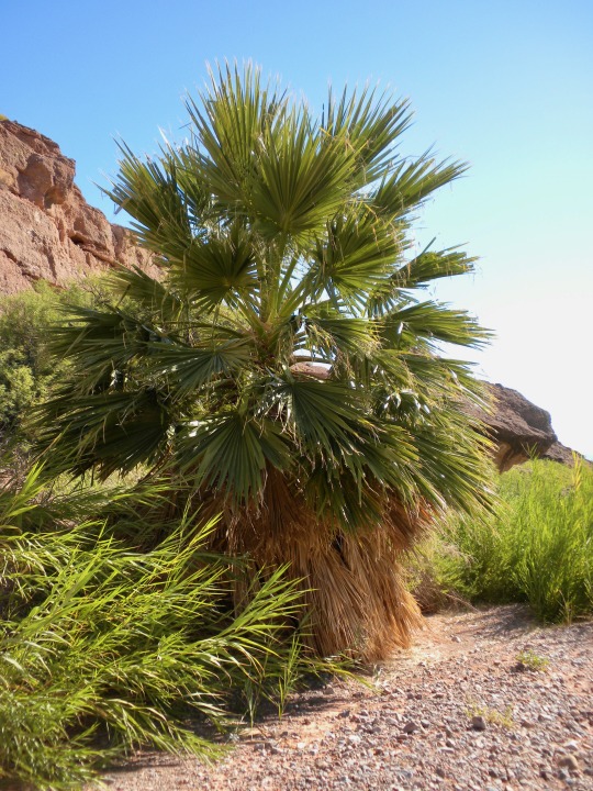
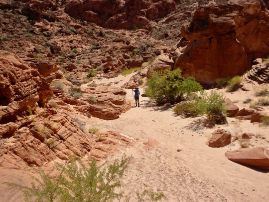
Again the marvelous bright and red Aztec sandstone of Valley of Fire! Anyway, you can also find more: wide and intriguing paths that bring you suddenly in a green oasis, then into the true, beautiful desert... We hiked 16,5 km (10.3 miles) among three different trails. Even though you are never far from the main street within the park, you feel lost in the loneliness of the desert.
7 notes
·
View notes
Video

flickr
Fire Canyon Sunset by James Marvin Phelps
Via Flickr:
Fire Canyon Sunset Valley of Fire Nevada October 2023
#nevada#valley of fire#red rocks#aztec sandstone#geology#mojave desert#landscape photography#sunset color#nature#outdoors#sunset#clouds#sky#fire canyon#silica dome#james marvin phelps photography#flickr
38 notes
·
View notes
Text
➤ Valley of Fire State Park is a public recreation and nature preservation area covering nearly 46,000 acres (19,000 ha) located 16 miles (26 km) south of Overton, Nevada. The state park derives its name from red sandstone formations, the Aztec Sandstone, which formed from shifting sand dunes 150 million years ago. These features, which are the centerpiece of the park's attractions, often appear to be on fire when reflecting the sun's rays. It is Nevada's oldest state park, as commemorated with Nevada Historical Marker #150. It was designated as a National Natural Landmark in 1968. Valley of Fire is located 50 miles (80 km) northeast of Las Vegas, at an elevation between 1,320–3,009 feet (402–917 m). It abuts the Lake Mead National Recreation Area on the east at the Virgin River confluence. It lies in a 4 by 6 mi (6.4 by 9.7 km) basin.
📷@daniel_kaufman_photography
69 notes
·
View notes
Photo
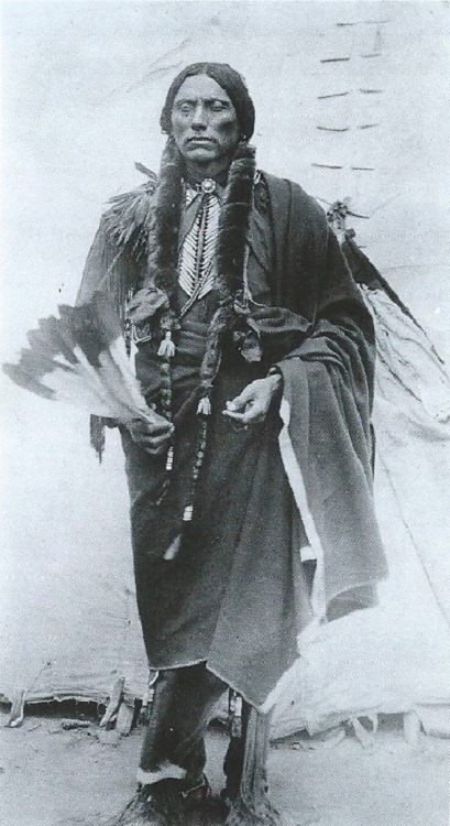
PORTRAIT [1]
QUANAH PARKER AND THE SACRED PEYOTE [First Part]
QUANAH PARKER had grown up on the Southern Plains as the son of a Comanche chief, Peta Nocona, and a white mother, Cynthia Ann, who has been captured as a child from her settler family. When he was fifteen she had been found and forcibly returned to civilisation, where she spent the last ten years of her life begging without success to be returned to her tribe. Though despised for his white blood - Quanah, the name given him by his elders, meant 'bad odour' - he submitted to mockery without complaint and proved himself in battle, becoming a member of the feared Quahada warband. He was barely more than a child when the Plain tribes were finally forced onto the reservations by the Treaty of Medicine Lodge in 1867, but he was among those who refused to submit and become an outlaw. When the campaign to eradicate them escalated into the Red River War, they hid out in the sandstone bluffs and canyons of Palo Duro in far northwest Texas. In 1875, after the ruthless cavalry commander Colonel Ranald Mackenzie shot a thousand of their horses, QUANAH's band finally submitted to forced captivity.
[...] QUANAH's authority rested on the delicate balancing act of remaining a trusted broker to the federal government while also defending his people against exploitation and the existential threats to their culture. In 1890, unlike many other tribal leaders, he firmly rejected the Ghost Dance. Such messianic prophecies had cost him dearly once already: the destruction of his warband had been set in motion by their failed raid on a USA Army batallion at Adobe Walls in 1874, into which they had been enticed by a medicine man named Eschiti, who had prophetised that QUANAH and his fellow warriors would be immune to the white man's bullets. QUANAH had no interest in following Wovoka down the same road. "Having just got fixed to live comfortably", he remarked, "I would be worse than an idiot to incite my people to do something that would make beggars and vagabonds of them".
By this time he was a prominent advocate for the peyote religion, which had become established in the reservation after the Texas-Mexico railroad opened. It was said that QUANAH first encountered peyote in 1884 when he was cured by it of a serious stomach illness; he may also have learned its rites from one of his wives, who was a Lipan Apache.
[ (…) Peyote had reached the Plains tribes via the New Texas-Mexico railroad, and their ceremony drew on deep roots in Spanish chronicles of the Nahua (Aztec) people. Before that, an unwritten history attested by art and archaeology unrolls the story of mescaline-containing cacti all the way back to deep prehistory and the earliest temple cultures of the New World. (…) ]
"Some histories credit him [QUANAH PARKER] as the originator of the Plains peyote ceremony, and he was certainly one of his most effective proselytes: during the 1890s he presided over meetings among many tribes including the Cheyenne, the Arapaho, the Pawnee, the Osage and the Ponca. But it was no one's invention; it was at once a creation of all and none. Setting the ceremony within a tipi was in part a response to the new strictures of forced captivity that included prohibitions on openly singing and dancing, though the form of the tipi circle took its charter from older traditions such as the Kiowa sacred stone ceremonies. [...]
"QUANAH , like MOONEY [see my next post, entitled, QUANAH PARKER, JAMES MOONEY AND THE SACRED PEYOTE (Part Two) ], saw peyote as an alternative to the self-destructive path set by the Ghost Dance. The federal government, however, treated it from the beginning as another movement to be crushed. An 1886 report on "Gambling and Other Crimes" in the Fort Sill reservation described it as a vice that 'produces the same effect as opium'. in 1888 the trade in peyote was banned on the reservation but it remained on sale at nearby trading posts, and the clandestine nature of the tipi ceremony made it impossible to police. 'They kept it hid out like the whites do whisky in Kansas', the exasperated new agent Charles Adams wrote in 1891. QUANAH stood his ground, insisting to the agency and to the missionary council that it was both a sacred tradition and a valuable medicine. Picking his battles carefully as always, he relaxed his opposition to Christian schooling but insisted firmly on his right to peyote, as he did with his polygamy. He counted on the government to recognise that persecuting him on either count would be more trouble that it was worth.
[...] Like MOONEY, QUANAH recognised that the peyote religion needed to accommodate itself within the Protestant culture that surrounded it. He presented the tipi ceremony not as a rival of the mission school and the prayer meeting but a complement to them. Unlike in tribal Mexico, there was no caste of shamans who cultivated their spiritual power: the roadman who led the ceremony was mere a facilitator, humble in his role and careful to pass the sacred wand, rattle and drum around the circle for every participant to touch. Peyote made every man his own conscience and his own priest. QUANAH resisted Christian conversion to the end but he spoke its language fluently, and he presented peyote as a distinctively Indian expression of the same higher truth: 'the white man goes into his church house and talks ABOUT Jesus, but the Indian goes into his tipi and talks TO Jesus'. Christ's crucifixion was the white man's sin, and Indians had no need to atone for it. Peyote, the form in which God had always been with them, was their communion."
See the next post, PORTRAIT (2) - QUANAH PARKER, JAMES MOONEY AND THE SACRED PEYOTE - (Part Two)
© excerpts from MIKE JAY's - "Mescaline - A Global History of the First Psychedelic" - Yale University Press - New Haven and London, 2019
#Ancestors Alive!#Quanah Parker#Mike Jay#Mescaline - A Global History of the First Psychedelic#2019#Ancient Ways#Sacred Ways#Peyote#Medicine#Part One#First People#Sacred Peyote#plains tribes#ceremony#rituals#storycatching
27 notes
·
View notes
Photo
Nevada’s Valley of Fire - The Valley That Was
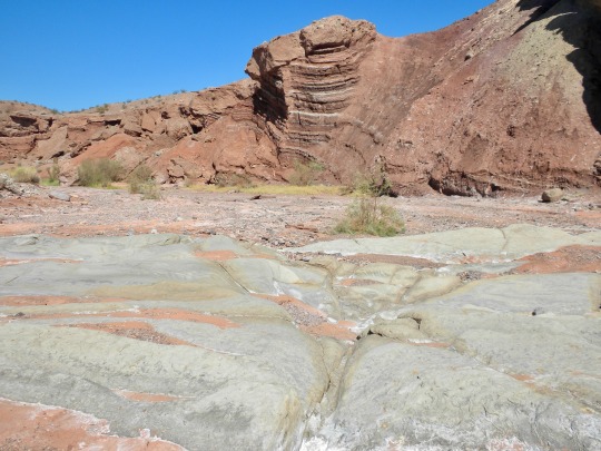
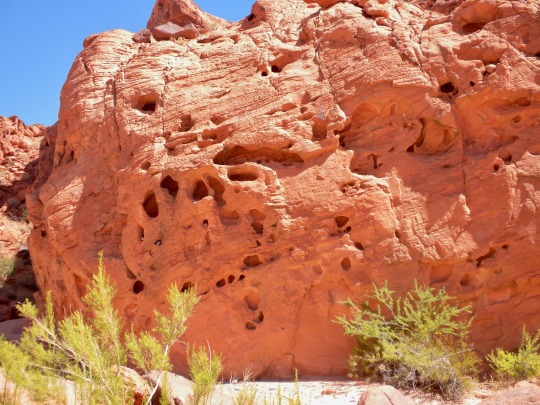
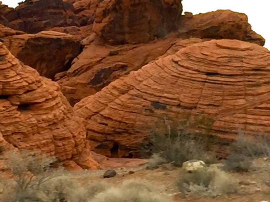
Valley of Fire is a vivid land of bold cliffs of red and white sandstone set in the midst of the grandeur that is the Mojave Desert. So many stories of powerful earth forces, adapting life forms, and early man are all revealed in this Nevada State Park. Anyone visiting this park scarcely needs a reminder of the awesome power of the desert. The searing heat and lack of water seem almost unbearable, even in the winter the aesthetics of the place is overwhelming and the silence is profound. But in the past, the Valley was subjected to desert conditions even more demanding on life than the desert of today. For tens of millions of years the area that is now the park was a barren desert covered by lofty sand dunes.
Wind carved and swirled the sands into fantastic formations of multi-angled layers. Thousand of feet of sand piled up in the region, carried there by winds from the erosion of other areas of highland around Nevada. Today, almost half-mile thick, these “fossil” dunes comprise the beautifully shaped red and white sandstone bluffs, the most scenic aspects of Valley of Fire.
The perfectly-preserved, swirled layers of wind-blown sand illustrate a page of Mesozoic history more than 140 million years old. This sandstone, termed Aztec sandstone by geologists, extends over large areas of the Southwest. The sandstone varies in colour from deep reds and purples to tans and whites. Delicate and subtle changes in tones are thought to be the result of groundwater percolating through the sand and leaching the oxidized iron.
By tracing individual layers of sandstone, one can follow the paths of ancient, slow-moving, subterranean waters. The passage of these waters altered and transformed the chemistry of mineral grains. The result is a pleasing, artistic intermingling of colours. It is a rather poetic place as well as unbelievable past geological history.
~JM
Photo Credit: My Own
Further Reading: Nevada State Parks: http://parks.nv.gov/parks/valley-of-fire-state-park/ Valley of Fire: http://www.valley-of-fire.com/ Desert USA: http://www.desertusa.com/nvval/ Gilgoff, J. (2005). Valley of Fire. Lulu. com. Eichhubl, P., Taylor, W. L., Pollard, D. D., & Aydin, A. (2004). Paleo-fluid flow and deformation in the Aztec Sandstone at the Valley of Fire, Nevada—Evidence for the coupling of hydrogeologic, diagenetic, and tectonic processes. Geological Society of America Bulletin, 116(9-10), 1120-1136.
#valley of fire#sandstone#rock#nature#jurassic#aztec sandstone#cross bedding#the earth story#geology
320 notes
·
View notes
Photo
Valley of Fire by JuanJ Valley of Fire State Park is a public recreation and nature preservation area covering nearly 46,000 acres (19,000 ha) located 16 miles (26 km) south of Overton, Nevada. The state park derives its name from red sandstone formations, the Aztec Sandstone, which formed from shifting sand dunes 150 million years ago. These features, which are the centerpiece of the park's attractions, often appear to be on fire when reflecting the sun's rays.[5] It is Nevada's oldest state park, as commemorated with Nevada Historical Marker #150. It was designated as a National Natural Landmark in 1968. Valley of Fire is located 50 miles (80 km) northeast of Las Vegas. https://flic.kr/p/2ipTKBL
2 notes
·
View notes
Last Seen Blogs

hitomiyami
Could we maybe find a peaceful resolution instead?


footballhotties
Hot Football Players

lesbx
t’was barely a candle’s flame…