#Japan map

Photo
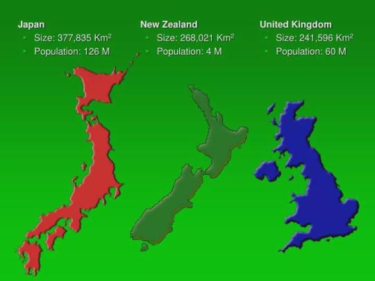
Japan, New Zealand and UK Size Comparison
754 notes
·
View notes
Text
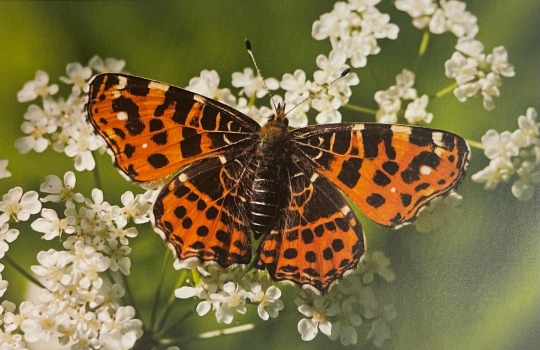
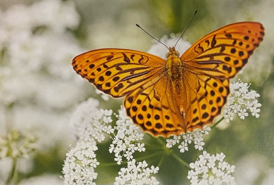
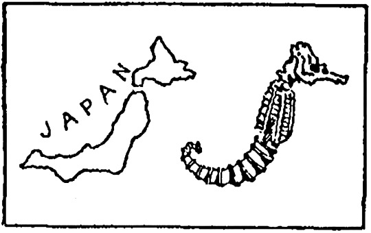
Silver-washed fritillary, Japanese Map Butterfly
2K notes
·
View notes
Text
One of my favourite maps is the Valeriepieris circle which is a circle in the south china sea that includes more than half of the world's population
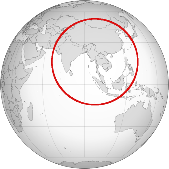
As of 2015, half of the world's population lived within a 3,300-kilometer (2,050 mi) radius of the city of Mong Khet in Myanmar.
816 notes
·
View notes
Text
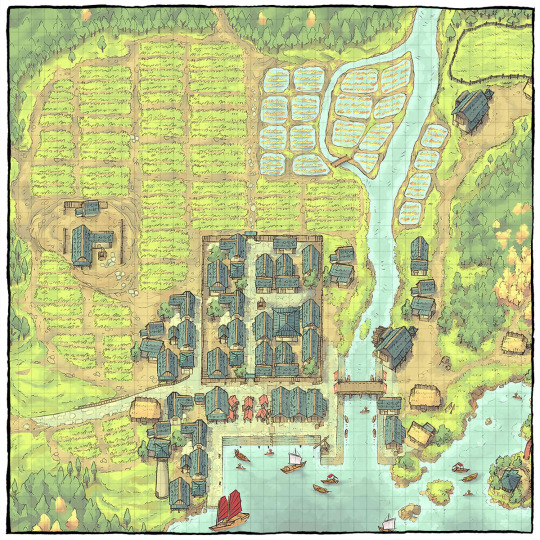
The Coastal Town Expansion by Inku No Neko
It's Community Spotlight time again! This time we dive into a lore-rich map expansion inspired by feudal Japan, and expertly built upon a treasured 2MT map! ⛩️
→ Check it out here!
#ttrpg#tabletop#dungeons and dragons#dnd#dungeons & dragons#d&d#d&d5e#pathfinder#gurps#rpg#top-down#battle map#map#cartography#encounter#geomorph#community#fuedal japan#sekiro#ghosts of tsushima
296 notes
·
View notes
Text
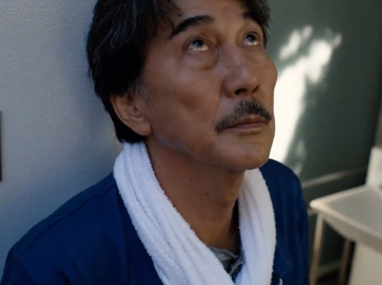


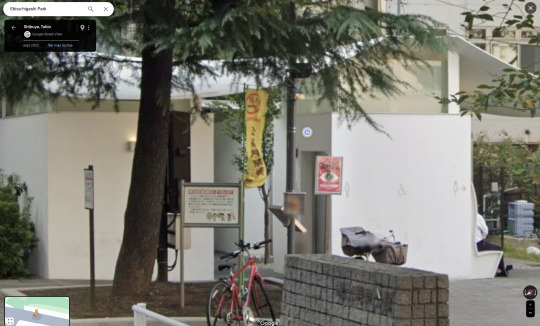
Perfect Days
Wim Wenders. 2023
Toilet 1
1 Chome-2-16 Ebisu, Shibuya City, Tokyo 150-0013, Japan
See in map
See in imdb
#wim wenders#perfect days#kōji yakusho#ebisu#tokyo#japan#fumihiko maki#toilet#movie#cinema#film#location#google maps#street view#2023
68 notes
·
View notes
Photo

Jumy-M
I'm completely lost / 完全に迷った
322 notes
·
View notes
Text
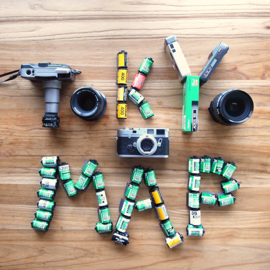
I’ve made a map with my recommended Tokyo Photo World locations. Tokyo has a rich photographic culture and this map is an expression of over twenty years of experience in- and love for- this wonderful city.
link: TOKYO PHOTO MAP
It includes (with commentary) photo galleries, camera shops, photobook shops, museums, places to visit, places to get your film processed and a bunch of my favorite places to eat.
You can toggle between topics to find places to go or see what’s near where you are.
You may note that I’ve left off some obvious places (Shibuya Crossing) and cheesy tourist traps like Omideyokocho and Golden Gai (no Go-Kart tour places, either!). Certainly there will be places which you know and love that I haven’t listed but that’s ok because this map is by no means a comprehensive list- it’s merely a personal one.
I hope that it adds enjoyment to your time in Tokyo.
50 notes
·
View notes
Text
bus trip above the sea@瀬戸大橋

地理院地図
30 notes
·
View notes
Text
#world trigger#hyuse#there's a very real chance everyone said 'youre from canada' and then didn't explain what that meant#and given the difference in geography between Meeden and Neighborhood Planet-Nations#he might not even understand that there's more to Meeden than Japan#you show him a map and go 'where is canada' and he points to Hokkaido
28 notes
·
View notes
Photo
Source details and larger version.
Japan and Japanese art of old: see my Japan gallery.
56 notes
·
View notes
Photo
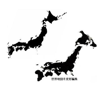
An old Japanese meme about ''how the world is shaped like Japan''
by BerryBlue_BlueBerry
Google images for ''日本は世界の雛型'' and you'll find even more, some also mentioned that :
Caspian Sea = Lake Biwa (Largest lake in Japan)
Himalayas = Mt. Fuji
Central-South America = Okinawa/Taiwan
1K notes
·
View notes
Text

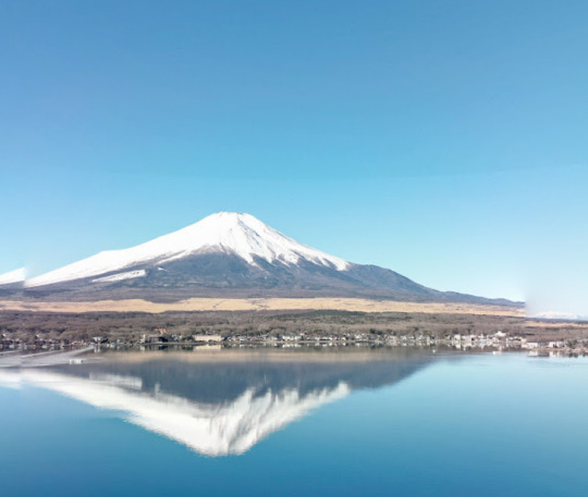
Kamikawa, Japan (x)
11 notes
·
View notes
Text
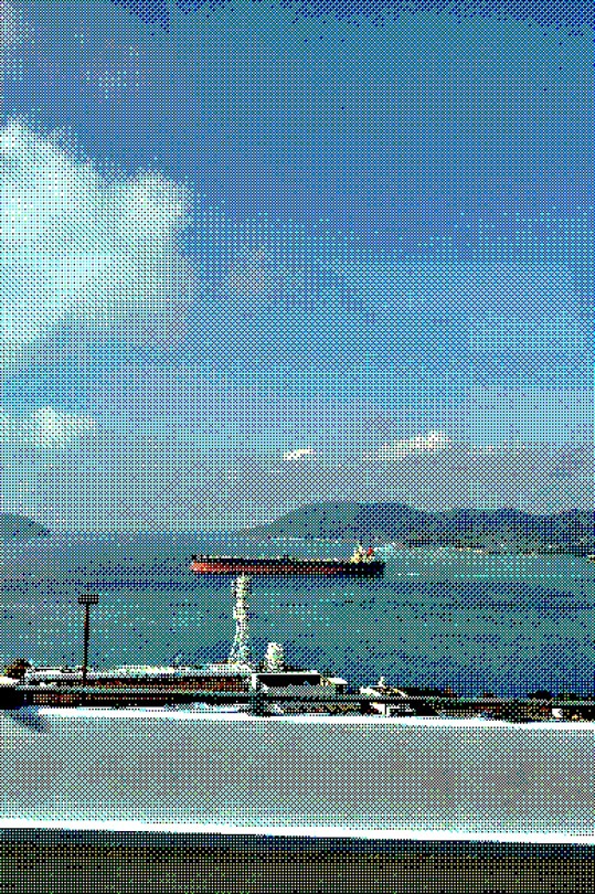
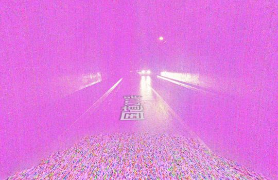
Somewhere in Japan...
14 notes
·
View notes
Photo

All That Glitters – Onsen Monkey Encounter for D&D 5e
A troop of monkeys steals from the onsen’s customers, taking their treasures to a kami that makes its home in the mountain springs.
→ Read the whole thing on 2-Minute Tabletop
#ttrpg#tabletop#dungeons and dragons#dnd#dungeons & dragons#d&d#d&d5e#dnd5e#pathfinder#gurps#rpg#top-down#battle map#map#cartography#encounter#geomorph#onsen#fey#japan
149 notes
·
View notes
Text
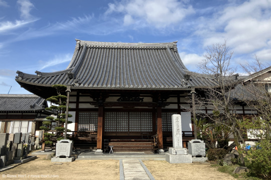
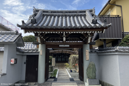
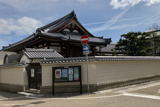
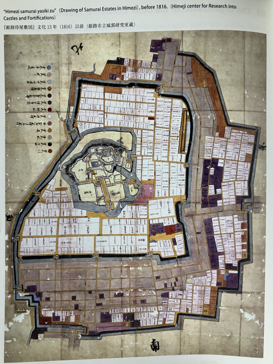
A few weeks ago I went to Himeji armed with a history book. Within its bilingual pages was a map of the city from the 1800s showing how it probably was laid out at the end of the 1700s.
I spent a while with the map (see below), walking the streets and working out what was what. The modern map aligns reasonably well with this drawn one, and it is possible to see where plots of land have merged and how part of the moat has been taken over by a road.
A whole island has been lost after being infilled and now serves as a zoo, and large parts of the outer moat have been lost under roads.
If I'm right, the three temples in the photos are the purple blocks on the right hand side of the map. Much of the road layout around them looks intact too. Where it has been lost there appear to be echoes of it in shortened side roads and property boundaries.
I'll head back there in a month or three and take another look. The area on the backside of the castle from the station looks interesting. It's now a library and driving school (I think).
If you're interested in Japanese Castles and how they are laid out and evolved, The Castles and Castle Towns of Japan by HIRAI Kiyosi and translated by Watanabe Hiroshi is my source. It's a bilingual book that's part of a series covering different aspects of Japanese architecture.
(I posted a version of this on my blog)
#photography#japan#original photographers#History#Himeji#Castle#Castle Town#old maps#Maps#photo blog#travel blog
7 notes
·
View notes
Last Seen Blogs

rajsuri
RAJ SURI

clausgender
Untitled

the-tidekeepers-comic
The Tidekeepers of Atlantis

formularecordscom
Formula Records

phillysimmer
PHILLY SIMMER