#dunkard creek
Text

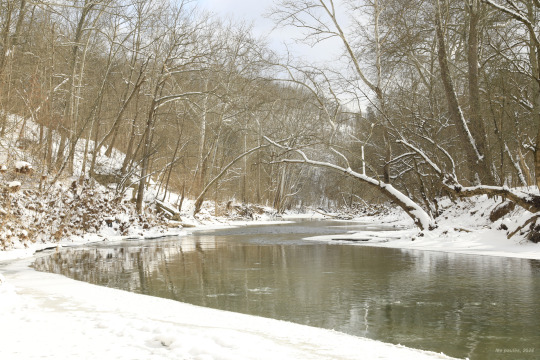
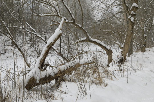
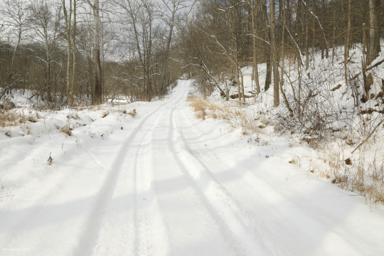

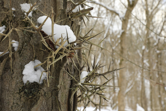


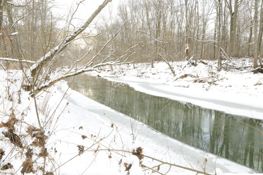

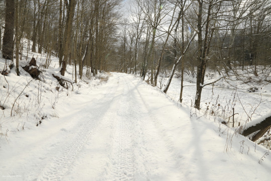
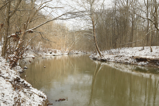
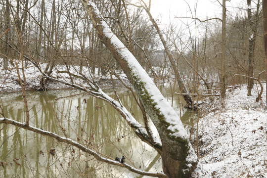
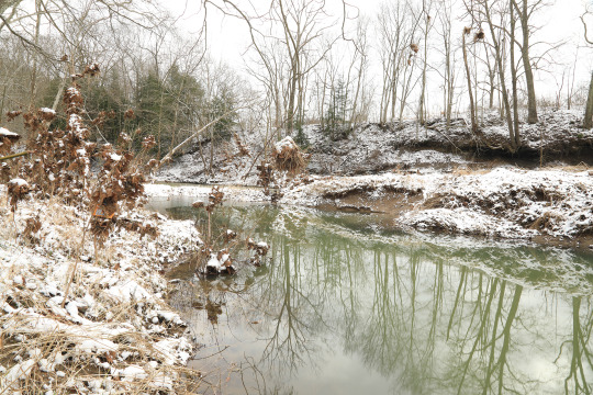
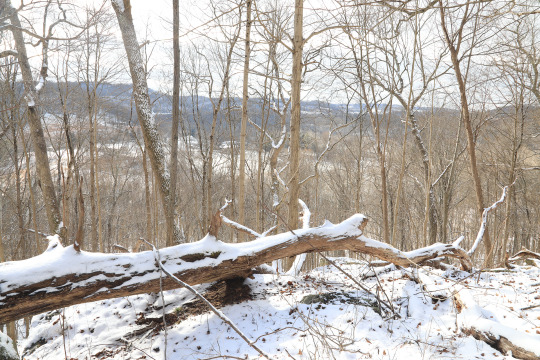
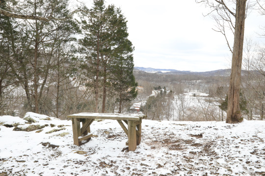
N-C West Virginia received its first real dose of winter this past week. The temperature barely rose above 15 degrees Fahrenheit today, and with a strong westerly breeze, it felt much colder than that. But the aftermath of a winter storm is one of the most gorgeous events imaginable and worth a couple frozen body parts.
Photos taken at Mason-Dixon Historical Park and along the ever-beautiful Dunkard Creek.
#appalachia#vandalia#west virginia#winter#january#ice#snow#mason-dixon historical park#dunkard creek#pennsylvania
221 notes
·
View notes
Text
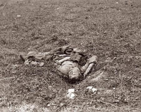
The World Changed 161 Years Ago Today
The Civil War defined us as what we are and it opened us to being what we became good and bad things. It was the crossroads of our being, and it was a hell of a crossroads. - Shelby Foote
Less than a week ago, the world remembered the twenty-second anniversary of 9/11 and no matter the radio station, TV program, or sporting event all took time to pause and remember and even New York City’s Fashion Week is paying tribute. It is well and good that we honor that day, the lives lost, and how it changed the world, the shock and horror of the attacks coupled with the heroism of those who rushed in where everyone was trying to run out plus those who fought back over Pennsylvania. Today is another anniversary in American history. This is a day that changed the country forever and cost more lives than 9/11, yet it is unlikely anyone will see one news story about it, no sporting events will take a moment for reflection, and certainly, no fashion show will remember it. One hundred and sixty-one years ago in the countryside of Maryland outside of the small village
of Sharpsburg along the banks of Antietam Creek, 113,000 men fought a battle that changed the United States forever.
The battle started shortly before 5:30 a.m. on the right-hand side of the Union battle line when Northern soldiers advanced on Southern positions believed to be just beyond a fully grown cornfield near a small white church. This church was the gathering place of a German-American pacifist denomination, called the “Dunkards” by locals, as the congregation would submerge or “dunk” new members in Antietam Creek. The church looks more like a schoolhouse as this sect believed a steeple immodest. As the Union soldiers advanced towards the cornfield, officers noticed the shiny glint of bayonets among the corn stalks, and the epic struggle began. The fighting seesawed back and forth with each side charging, taking positions, and then being forced back when the other side countercharged. By 10 that morning little territory had changed hands but the armies on both sides in this area were spent and this section of the battlefield grew quiet. While this part of the battle lasted just four and a half hours, over 13,000 were casualties. A soldier after the battle said the corn stalks were cut down with bullets and shells so close to the ground that one could not have done it better with the sharpest of knives.
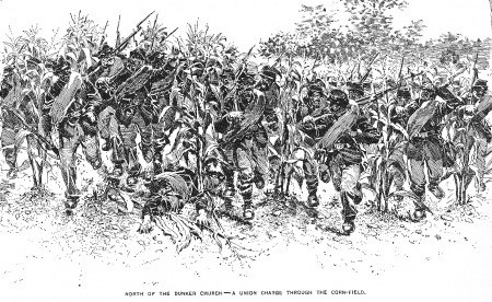

The sketch is from Battles and Leaders of the Civil War 1887, p. 687, and the cornfield as it is today from the New York Monument. ©CWTK
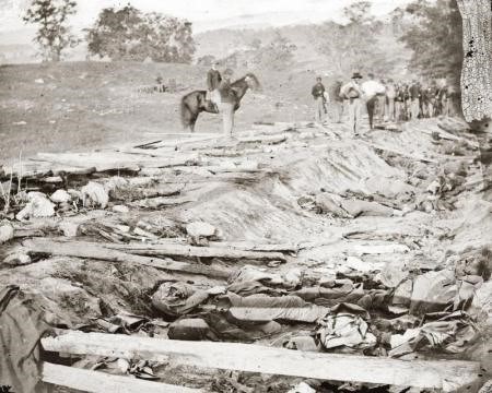
As the roar of war died down to their right, the Union soldiers positioned near the center of the battle line prepared to enter the fray. The area where this fighting occurred is compact in size, roughly eight soccer pitches in size. Here the Confederate troops had taken a position along an age-old wagon road that years of rain and use wore away the earth causing the road to be five feet below ground level. This “sunken road” offered ideal concealment and the Union troops attacked in wave after wave. Each attack melted away as snow does when it falls on the warm ground. Eventually, remnants of the famed Union Irish Brigade who were trapped on the battlefield by this murderous position found a way to bring their guns to bear on the sunken road creating such carnage this section of the battlefield is now called Bloody Lane. One of the many ironies of the Civil War is that the Northern troops who fought here were primarily of Irish background and the Southerners in the Bloody Lane were Irish as well. The Union forces were able to finally capture the sunken road but like before, they were not able to hold the positions gained. By 1 pm this area of the battle had grown calm and both sides were back in the positions they were in when the fighting started. Causalities now numbered over 19,000.
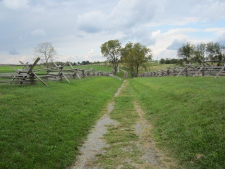
The Sunken Road ©CWTK
While the battle for Bloody Lane was concluding, on the far left, Union General Ambrose Burnside (best known for his unique facial hair that created a fashion trend that is still with us today, sideburns) set about forcing the Confederate forces facing him to retreat. Although Burnside had a great numerical superiority in men 12,500 to 3,500, the defenders were located on a hilltop with Antietam Creek between them and Burnside’s men. The creek was deep and the only way the Union troops could cross was on a stone bridge just over twelve feet wide. Even though they knew what they were facing, the Union men formed their lines, marched to, and attempted to cross the bridge while shot and shell rained down from the hill. For three long and horrific hours, the Union tried and retried crossing the stone bridge with each attempt failing. Finally, enterprising soldiers discovered a shallow section of the Antietam downstream shielded from view allowing them to wade across and finally capture the hill. This success was short-lived as Southern reinforcements arrived and pushed the nearly victorious soldiers of Burnside’s command back to near where their day started.

The stone (Burnside) bridge over Antietam Creek ©CWTK
It is now just after 5:30 pm and the battle has essentially ended. After nearly twelve hours of bloodshed, the battle has left 3,650 dead, 17,300 wounded and 1,770 missing for a total of 22,720 casualties. Twenty percent of the men that went into battle that day were wounded or dead. The story does not end here for those unlucky souls who were wounded as modern medicine of that time required the amputation of limbs when an arm or leg was struck by a bullet. The ammunition used at the time was made from soft lead, unlike the modern steel jacketed rounds that ‘clip’ bone possibly allowing leg/arm wounds to heal, the soft lead destroyed bone and tissue leaving the surgeons no choice but to amputate. Those who received wounds to their arms or legs were far luckier than those who received a wound to their core. That same soft lead that would destroy bones would severely damage internal organs and the doctors did not yet have the knowledge or tools to repair such trauma. Soldiers at the time called it being “gut shot” and knew it was a death sentence (often a painful and very slow process that could take days to weeks). This is why if you see photographs of the Civil War dead, it will often look as though someone has rummaged through the dead soldiers' clothing in search of valuables. This was the wounded men themselves ripping away their clothing frantically looking and hoping the wound they received would not mean death. Since even state-of-the-art medical care then was crude and unsterile, twenty-two percent of those wounded later died of their wounds. When the dead on the field of battle are combined with those soldiers whose battle for life ended at a hospital, this day cost 7,456 lives.
This battle produced three significant impacts that touch every American even today.
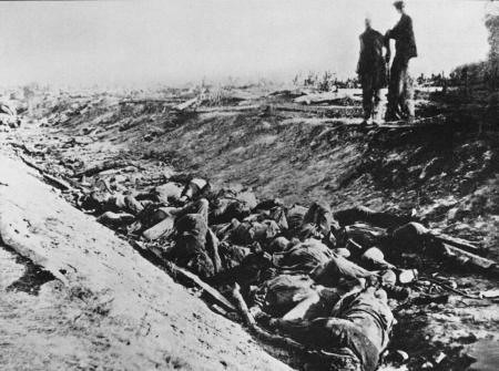
First, the American Civil War occurred as the art of photography was developing. Alexander Gardner, a Scottish immigrant, became well known as well as connected because he managed famed photographer Matthew Brady’s Washington DC gallery (In fact many of Gardner’s Civil War photographs were originally credited to Brady). Through his connections, Gardner became the staff photographer for the Union Army that fought at Antietam. While the cameras of this era did not have fast enough shutters to capture ‘action’ photographs, Gardner’s proximity and the wagon he converted into a traveling darkroom allowed him to record the first photographs of the war that the public had ever seen. Until these photographs were exhibited, the only images of war seen by the lion’s share of people were products of artists’ imaginations which often glorified combat. Starting with Antietam, images of war would no longer be from imaginations but would be told through the lenses of photojournalists.
Here are some of Gardner’s images from Antietam including the iconic photo of Bloody Lane. He was able to gain access to the battlefield on September 19, 1862, two days after the battle.
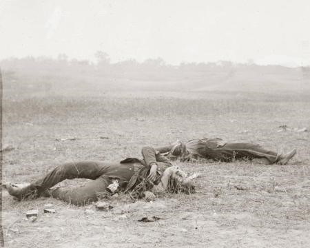

Below is Alexander Gardner’s famous “Bloody Lane” photograph:
Another outcome of this battle was the Union victory at Antietam kept the world's superpowers, England and France, from involving themselves in the conflict. A quick history lesson for those who do not know, the United States was not a superpower in 1862. Until this point in the war, all the major battles fought in the Eastern Theater, roughly meaning near Washington DC, (Antietam is less than an hour and 1/2 drive from Capitol Hill even with notorious D.C. traffic) had resulted in Confederate victories. These repeated victories caused the governments of England and France to consider recognizing the Confederacy as an independent country, just as France had done for the Colonies during the American Revolution. France and England were considering this action primarily to get their massive textile factories producing again and bring large numbers of their citizens back to work. The South’s cotton was the raw material that fed huge mills and the Union blockade as well as the South’s decision to drastically limit exports had cut this flow of raw material off. Because of a lack of cotton, these massive mills were shuttered leaving thousands of their employees out of work. In England alone, job losses were around 60% in the textile industry, leaving approximately 295,000 unemployed and the majority of the unemployed being in Lancashire. There was no unemployment insurance at the time and the politicians had a large number of their constituents needing to return to work simply to feed their families. However, the resolve of the Union to repel this invasion led to England and France withholding recognition. Without foreign assistance, the Confederacy would struggle to acquire the provisions needed to wage war as well as develop and grow an economy. The failure to secure diplomatic status as an independent country was a death blow to hopes for the Confederacy.
Most Americans today when asked what caused the Civil War, will answer slavery and with most momentous events, simple one-word answers sound great but there is much more to the rest of the story. Slavery was the root cause and always an emotional undercurrent to the conflict however, if you asked the average Southerner what they were fighting for they would share that they were fighting for states’ rights, and in the North, the majority of the public felt they fought to preserve the Union. This view can be seen in President Lincoln’s open letter to newspaper editor Horace Greeley who had attacked him for not ending slavery:
My paramount object in this struggle is to save the Union, and is not either to save or to destroy slavery. If I could save the Union without freeing any slave I would do it, and if I could save it by freeing all the slaves I would do it; and if I could save it by freeing some and leaving others alone I would also do that. What I do about slavery, and the colored race, I do because I believe it helps to save the Union; and what I forbear, I forbear because I do not believe it would help to save the Union. I shall do less whenever I shall believe what I am doing hurts the cause, and I shall do more whenever I shall believe doing more will help the cause.
An amazing note about this letter to Greeley, Lincoln wrote it on August 22, 1862, exactly one month after he had decided to issue the Emancipation Proclamation and was waiting for the correct time to release the proclamation. The pundits of the era attacked him for this saying this letter showed a lack of commitment to the abolition of slavery. What Lincoln was doing in reality was subtlety informing the public that when he released the proclamation it was part of the plan to save the Union and preserve the coalition of Unionists and Abolitionists in Congress working together.
On July 22, 1862, Abraham Lincoln summoned his cabinet for a meeting, which was a surprise to its members. At this meeting, the President announced he had made up his mind to issue an Emancipation Proclamation and this was not up for debate. William Henry Seward, the Secretary of State and today best known for what was called Seward’s folly the purchase of Alaska from Russia offered a piece of advice by suggesting that Lincoln wait until the army had achieved a major victory because “such a proclamation ought to be borne on the bayonets of an advancing army, not dragged in the dust behind a retreating one”. Issuing the proclamation without achieving a substantial victory would give the English and French governments the impression Lincoln’s government was grasping at straws to retain power. Antietam was the victory that Abraham Lincoln needed to release the Preliminary Emancipation Proclamation. The repulse of the invasion of Maryland provided him with the victory needed. Just five days after the victory at Antietam, President Lincoln announced the Preliminary Emancipation Proclamation and that it would be formally issued on January 1, 1863.
“. . . on the first day of January . . . all persons held as slaves within any State, or designated part of a State, the people whereof shall then be in rebellion against the United States shall be then, thenceforward, and forever free.” President Abraham Lincoln, preliminary Emancipation Proclamation, September 22, 1862“
For the full document, click here.
So as we go through our normal lives today, take a second and remember the battle that changed the world for the better. Because of the Battle of Antietam, one hundred and sixty-one years ago, photography gave us images of war’s terrible price for the first time, England and France stayed at arm’s length from the American Civil War, and allowed Abraham Lincoln to transform the war from a conflict about states’ rights/preserving the Union to a struggle to end slavery.
I am naturally anti-slavery. If slavery is not wrong, nothing is wrong. - Abraham Lincoln
©CWTK2023
7 notes
·
View notes
Text
cheat river new 711&
💾 ►►► DOWNLOAD FILE 🔥🔥🔥🔥🔥
The Cheat River is a mile-long tributary of the Monongahela River in eastern West Virginia and southwestern Pennsylvania in the United States. Via the Ohio River, the Cheat and Monongahela are part of the Mississippi River watershed. The magnificent Cheat River flows from five major tributaries, known as the “Forks of the Cheat”, which originate in the rugged Monongahela National Forest. Located in Albright, in North Central West Virginia, the Cheat Canyon section of the Cheat River is West Virginia's premier springtime Class V whitewater run. The Cheat River is amazing! This river canyon is full of great rapids and we loved the guides on our trip. I can't stress how important it is to go with. The Cheat River in West Virginia is again a haven for whitewater rafting and smallmouth bass fishing after years of Clean Water Act funding. Its 1,square-mile basin drains parts of southwestern Pennsylvania, western Maryland, and, in West Virginia , parts of central Preston County , western Tucker County , eastern Randolph County , northern Pocahontas County , and eastern Monongalia County. The Cheat River is a popular whitewater rafting stream in spring. Thousands of rafters and kayakers run its lower course when snowmelt produces highly technical rapids. The Cheat is a popular fishing stream throughout the year. The character of the two forks or the Cheat River contrast strongly: the drainage of the Black Fork and its Dry Fork are fan-shaped, and that of the the Shavers Fork is long and narrow. The river is impounded as Lake Lynn, colloquially known as Cheat Lake, near the end of its course. Much of the upper Cheat and its forks drain the Monongahela National Forest. In , the Dunkards, a religious sect, were the first Europeans to settle on the Cheat River. They established a village near Kingwood, West Virginia. An iron industry along the lower reach of the river supported roughly 3, settlers at Cheat Neck Cheat Lake and Ices Ferry in the early 19th century. As a result of pollution from coal mining, poor timber management, and construction of a private dam built in , fish had all but disappeared from the lower course of the river by the s. The Cheat was considered the eighth most endangered river in the United States during the s. Read also: The day they "knocked a hole" in the Cheat River. From sources to mouth, the following select towns and villages are located on or near the Cheat River. Information on lodging, dining, and recreation on and near the lower Cheat River, downstream of Rowlesburg, may be found in our guide to travel in the Monongahela Valley Region in northern West Virginia. Similar information regarding its upper course may be found the the Allegheny Highlands Region. Log in to leave a comment. Wednesday, October 5, Sign in. Forgot your password? Get help. Privacy Statement. Password recovery. West Virginia Explorer. Downtown Beckley getting even odder, say fair organizers. Peculiar rock face near Ripley, W. Remarkable stone face attracting curious in New River Gorge. Scenic parkway explores some of West Virginia's highest peaks. Farm-to-Table dinners return to W. State Parks. Blackwater Falls visitors can expect far more in Tucker County. Promotion of high bridge, continental divide gains support. Despite rain, state fair among most successful ever. Monument raised to memory of well-known goat in West Virginia. West Virginia tourism releases fall foliage map. Did the first teddy bear come from West Virginia? Mystery surrounds tale of frontier slave who defended fort. Legend of beast resurfaces near Fireco, West Virginia. Horse Creek Ghost said to foretell the demise of presidents. Capon Springs offers percent state resident discount. Glade Springs resort suspends operations until April Beckley tourism leaders welcome Hilton hotel, growth. Capon Springs celebrates 88th season by changing very little. New River Gorge ranked second among fall fishing destinations. State reminds hunters to buy stamps before archery season Saturday. Early bear gun seasons launch in September in W. Cheat River. A quiet pool on the Cheat River belies a whitewater run on its lower section. Read also: The day they "knocked a hole" in the Cheat River Cheat River Communities From sources to mouth, the following select towns and villages are located on or near the Cheat River. Stay Connected. Latest Articles. Scenic parkway explores some of West Virginia's highest peaks October 4, Monongahela Forest officials stress caution during Ian September 30, New River Gorge ranked second among fall fishing destinations September 27, September 24, All rights reserved.
1 note
·
View note
Text
cheat river working 5QC?
💾 ►►► DOWNLOAD FILE 🔥🔥🔥🔥🔥
The Cheat River is a mile-long tributary of the Monongahela River in eastern West Virginia and southwestern Pennsylvania in the United States. Via the Ohio River, the Cheat and Monongahela are part of the Mississippi River watershed. The magnificent Cheat River flows from five major tributaries, known as the “Forks of the Cheat”, which originate in the rugged Monongahela National Forest. Located in Albright, in North Central West Virginia, the Cheat Canyon section of the Cheat River is West Virginia's premier springtime Class V whitewater run. The Cheat River is amazing! This river canyon is full of great rapids and we loved the guides on our trip. I can't stress how important it is to go with. The Cheat River in West Virginia is again a haven for whitewater rafting and smallmouth bass fishing after years of Clean Water Act funding. The Cheat River is a Owing to the ruggedness of the surrounding Allegheny Mountains , the Cheat remains largely remote with few settlements or developments along its banks. It then flows through an impressive gorge — Cheat Canyon — northeastwardly from Albright, collecting Big Sandy Creek before entering Monongalia County , where a hydro-electric dam just south of the Pennsylvania border causes it to widen as the Cheat Lake reservoir. It then flows for a short distance through southwestern Fayette County, Pennsylvania , before joining the Monongahela River at Point Marion, Pennsylvania. Upstream of its dam, the Cheat is one of the largest undammed watersheds in the eastern United States. Cheat Mountain , a high and rugged ridge, runs about 50 miles 80 km southward from its northernmost tip, just a few miles west of the confluence at Parsons. They, and a few in the surrounding region, were soon forced to abandon their homesteads by hostile Indians and no further attempts at settlement were made until after the conclusion of the French and Indian War The party was forced to stop a few miles west at Dunkard Creek near present-day Mount Morris, Pennsylvania. Their Iroquois guides had refused to go any further, having reached the border of their lands with the Lenape , with whom they were engaged in hostilities. Atkinson , "From to there were comparatively few attacks made upon the white colonists by the Indians. The Treaty of Paris [] resulted in general peace along the frontiers, had been pretty generally adhered to by all the savage tribes. The peace, however, which had for nine years blessed and fostered the frontier settlements, was suddenly broken by the murder of several friendly Indians, in , on the Monongahela and Cheat rivers. This unfortunate aggression on the part of these white men gave rise to a general raid by the Indians upon all the settlements of the frontier. The Cheat River Valley was part of a much larger area disputed in the s by the Colonies of Pennsylvania and Virginia. This was before the parties agreed to extend the Mason—Dixon line westward from Maryland. Virginia attempted to administer this vast region as the District of West Augusta between and , after which it subdivided the District into three counties, the Cheat River becoming part of Monongalia County. Meanwhile, Pennsylvania tried to oversee it as part of the overlapping Westmoreland County. After additional surveys, and the resolution of the Virginia-Pennsylvania border dispute in the s, it became established that all but the lowermost 3 miles of the Cheat were within the state of Virginia. The Cheat River country remained part of Monongalia County until when that county was divided into a smaller Monongalia County and Randolph County. The Virginia General Assembly authorized the first two ferries on the Cheat in Another act in authorized to conduct a lottery to fund the construction of a toll bridge across Cheat River near Dunkard's Bottom. Along with the rest of western Virginia, the Cheat River Valley became part of the new state of West Virginia in A state militia facility, Camp Dawson , was established on the banks of the Cheat in Preston County in and continues in operation today. The river flow was estimated at , cubic feet per second, much larger than normal flows ranging from 1, to 5, cubic feet per second. The massive flood also caused the Cheat River to leave its banks and flood the small town of Rowlesburg. The town lost many businesses, and many families left their homes or the land that they owned. The flood also wiped out the school in Rowlesburg, which caused the consolidation of a high school for the county. The devastation was caused not so much by the steady-state flow of water, but rather by the repeated damming of the river by debris under the various road and railroad bridges that crossed the Cheat. Thus as the flood proceeded down the river, the water would rise behind the obstructed bridge, break through the inadvertent dam, and pick up more debris that would block the river at the next bridge site, repeating the process. In the vicinity of Albright, the Cheat has been plagued by pollution , notably acid mine drainage. Although the rocks downstream of Albright have been stained a rust brown, and the river has a very low fish population below Albright, water quality has been making slow improvements since the s. Friends of the Cheat , the local river advocacy organization, has been instrumental in promoting remediation, cleanup, river stewardship, and education. On the first weekend in May of every year, paddlers gather from many states to attend the Cheat Festival. A very popular whitewater race—the Cheat River Race—takes place in the mile 16 km Cheat Canyon on the Friday of that weekend. Unlike the overwhelming majority of whitewater races , which employ a staggered start, this race uses a mass start in which all participants start at the same time. For the first few miles, paddlers must avoid one another, in addition to the whitewater hazards that the river presents. The race, which usually attracts people, is often cited as the largest whitewater race in existence. From Wikipedia, the free encyclopedia. River in West Virginia, United States. Main article: Election day floods. Geological Survey. National Hydrography Dataset high-resolution flowline data. John Wiley and Sons. History of Kanawha County. Since then, the Cheat has flowed through these three West Virginia counties and one Pennsylvania county. Charleston, WV. Retrieved October 26, Monongahela National Forest. Bickle Knob Olson Tower. US Forest Service. Authority control. Israel United States. National Archives US. Namespaces Article Talk. Views Read Edit View history. Help Learn to edit Community portal Recent changes Upload file. Download as PDF Printable version. Wikimedia Commons. Map of the Monongahela River basin, with the Cheat River highlighted. Pennsylvania , West Virginia. Shavers Fork. Black Fork. Hendricks , West Virginia. Parsons , WV. Monongahela River [1]. Point Marion , PA. Rowlesburg, WV [3]. Parsons, WV [4]. Monongahela River.
1 note
·
View note
Photo

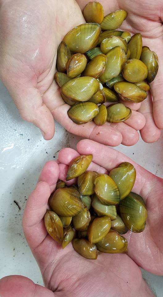
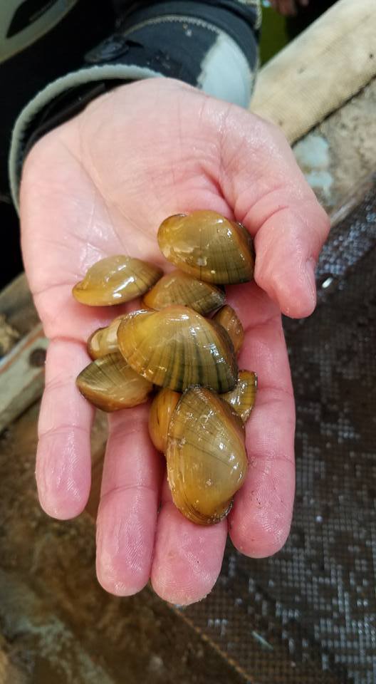

Saving Endangered Freshwater Mussels
Burrr! Staff from White Sulphur Springs National Fish Hatchery, Pennsylvania Department of Environmental Protection, West Virginia DNR, and the Pennsylvania Fish and Boat Commission joined forces to do a late season stocking of freshwater mussels.
Despite the chilly temperature, biologists with frozen fingers "planted" 4,000 mussels in Dunkard Creek which suffered a devastating mussel and fish kill in 2009.
Water quality has since recovered and this effort is just one of the many things local, state, and federal agencies are doing to help return this stream to its former state. From all of us here at WSSNFH, we would like to give a big shout out to all those who helped out!
These mussels were tagged and measured in the lab at WSSNFH and will be monitored in future years. The individually unique tag numbers will allow biologists to track growth and survival for these mussels in their new home!
#freshwater#mussel#bilvalve#mollusk#rivers#animals#nature#conservation#north america#aquatic#environment#restoration ecology
47 notes
·
View notes
Photo

Results of the Dunkard Creek fish kill of 2009. The hits keep on coming. Take a look at the sweetheart deal Consol Energy signed after destroying a Pennsylvania State Park this year.
2 notes
·
View notes
Text


Early October on Dunkard Creek at Mason-Dixon Historical Park. Even with the first frost just around the corner, life abounds along the stream, including: sulphur shelf fungus (Laetiporus sulphureus), more commonly known as chicken-of-the-woods; fall phlox (Phlox paniculata); and the flamboyantly-beautiful New England aster (Symphyotrichum novae-angliae). The park is also at the eastern-most range of the thorny-trunked honey locust (Gleditsia triacanthos), whose common name derives from the sweet taste of its edible fruit pods.
#appalachia#vandalia#west virginia#pennsylvania#mason-dixon line#mason-dixon historical park#dunkard creek#fall#october#fungi#flora#wildflowers#sulphur shelf fungus#fall phlox#new england aster#honey locust
108 notes
·
View notes
Text
Light is a teasing spirit
conjured by the shallow sun
of a short winter's day,
in one instant pushing long shadows
across freshly fallen snow,
before it wavers and vanishes,
only to appear in the next instant
at a far place on the road,
a playful if elusive companion
at each step to journey's end.
#appalachia#vandalia#west virginia#winter#snow#light#january#dunkard creek#mason-dixon historical park#pennsylvania
45 notes
·
View notes
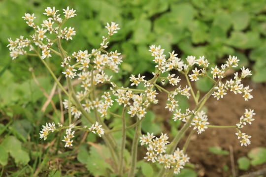
Photo
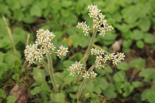

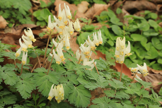

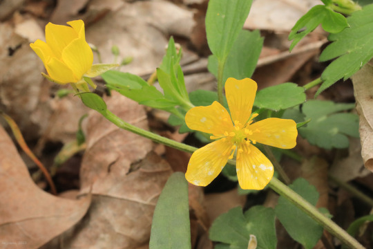


Early spring on Dunkard Creek. From top: early saxifrage (Micranthes virginiensis); great white trillium (Trillium grandiflorum); Dutchman’s breeches (Dicentra cucullaria); rue anemone (Thalictrum thalictroides); hispid buttercup (Ranunculus hispidus); red trillium (Trillium erectum); twinleaf (Jeffersonia diphylla); and Virginia bluebells (Mertensia virginica).
#appalachia#vandalia#west virginia#april#spring#wildflowers#dunkard creek#mason-dixon historical park#early saxifrage#great white trillium#dutchman's breeches#rue anemone#hispid buttercup#red trillium#purple trillium#wake robin#twinleaf#virginia bluebells
111 notes
·
View notes
Photo


”Winter’s blade
Lands a blinding white cut,
Through moss and stone
And ice-bound pools,
Where skeletal reeds
Bend and repel the blow.
Ghostly denizens,
Eyes wide
And breath alive,
Rustle, flinch, and scatter,
Leaving gossamer tracks
In the soft white glow.
Go, go, go.
Safely nestled
In burrows deep,
Pent-up dreamers
Forage in warm, moonlit woods,
Where Winter runs
Through a cold, swift stream.
Above their heads
Drifting snow
Melts and endlessly seeps
Into shattered rock
And clay
Life absorbed by every seam.
Dream, dream, dream.
Leafless crowns
Whisper a bleak siren’s song
Bound to the bone-breaking chill
And the drip-drip-drip
Of Winter’s seep.
Time loses track
As minutes turn to days
And gray-blue overcast
Consumes the sky.
Time loses track,
As the world goes to sleep.
Sleep, sleep, sleep.”
My winter hike this morning inspired yet more awful nature poetry. Photos from the Mason-Dixon Historical Park.
#appalachia#vandalia#pennsylvania#west virginia#winter#snow#dunkard creek#mason-dixon line#mason-dixon historical park#moss#lichen#bad poetry
79 notes
·
View notes
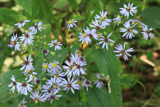
Photo


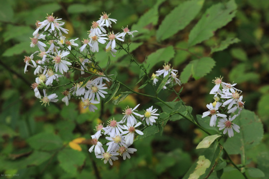
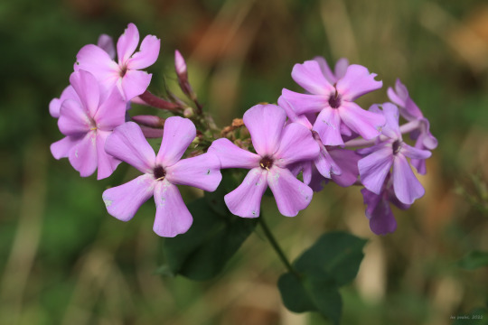
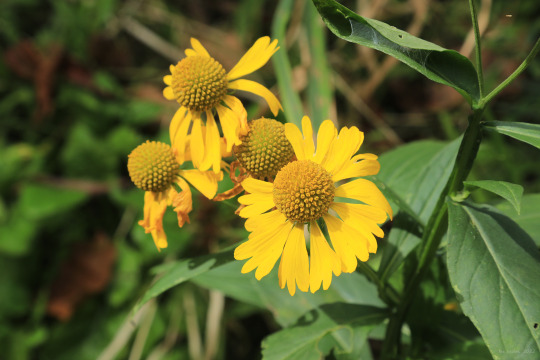


Early fall color along Dunkard Creek at the Mason-Dixon Historical Park. Most notably, broadleaved goldenrod (Solidago flexicaulis), also known as zig-zag goldenrod, is now in bloom. This is one of my favorite wildflowers of any season - it grows in gorgeous clumps with brilliant gold flower spikes and broadly-ovate, sharply serrated foliage. It’s better behaved than most goldenrods and is ideal for a bright pop of autumn color in a native wildflower garden.
From top: broadleaved goldenrod, one of two species in this area with flowers growing from the leaf axils; blue wood aster (Symphyotrichum cordifolium), a common woodland aster that blooms right up to the first frost; garden phlox (Phlox paniculata), also known as tall phlox and fall phlox, a tall, wetlands-loving perennial that blooms from July through early October in Central Appalachia; sneezeweed (Helenium autumnale), which loves the marshy edges of ponds, lakes, and streams; short’s aster (Symphyotrichum shortii), a woodland aster with a special fondness for limestone bluffs.
#appalachia#vandalia#west virginia#pennsylvania#fall#autumn#dunkard creek#mason-dixon historical park#solidago flexicaulis#broadleaved goldenrod#zig-zag goldenrod#symphyotrichum cordifolium#blue wood aster#phlox paniculata#garden phlox#tall phlox#fall phlox#helenium autumnale#common sneezeweed#symphyotrichum shortii#short's aster#wildflowers#flora
56 notes
·
View notes
Photo


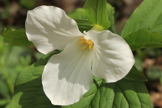
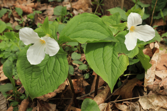

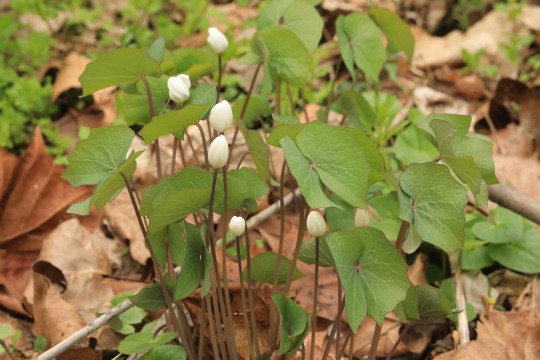

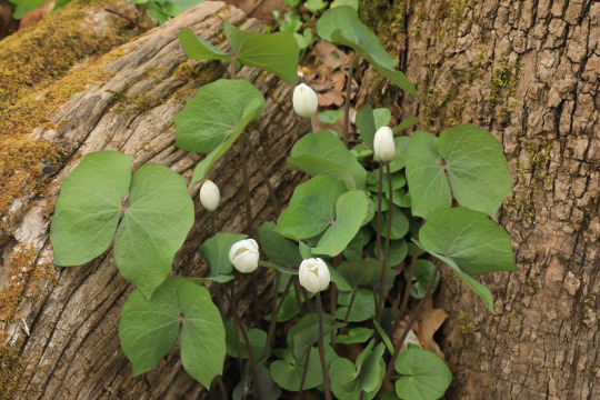
In honor of fishdetective, yet another barrage of tiny flower close-ups - courtesy of the riparian habitat along Dunkard Creek.
From top: early saxifrage (Micranthes virginiensis); azure bluet (Houstonia caerulea), also known as Quaker ladies; Dutchman’s breeches (Dicentra cucullaria); great white trillium (Trillium grandiflorum); swamp buttercup (Ranunculus septentrionalis); twinleaf (Jeffersonia diphylla); and sessile trillium (Trillium sessile), also known as toadshade and toad trillium.
Field Notes:
1. Early saxifrage is most at home in the moist cracks and crevices of rock outcroppings, but occasionally takes to streambanks. All the saxifrages are quite beautiful and many are edible, although somewhat bitter-tasting.
2. Although botanists dispute whether or not swamp buttercup is a distinct species from hispid buttercup (Ranunculus hispidus), both plants are capable of producing striking pops of yellow color along seeps and springs from mid-spring to early summer. Our native buttercups can be distinguished from the infamously-invasive creeping buttercup (Ranunculus repens) by their upward growth habit, more deeply-cleft leaves, and lack of white blotches on the leaves.
3. Easily identified by its twin-lobed leaves resembling angel wings, twinleaf is one of Appalachia’s most unusual wildflowers. The plant’s fragile, white flowers have a very short bloom period (less than a week), in part because the petals are easily blown apart by the slightest breeze. Twinleaf is extremely picky about where it grows and is becoming increasingly rare throughout its range.
4. How could you not love a plant with the name of “toadshade”? I always lift the bracts just to check.
#appalachia#vandalia#west virginia#pennsylvania#spring#flora#wildflowers#dunkard creek#mason-dixon historical park#micranthes virginiensis#early saxifrage#early small-flowered saxifrage#houstonia caerulea#azure bluets#quaker ladies#dicentra cucullaria#dutchman's breeches#trillium grandiflorum#great white trillium#ranunculus septentrionalis#swamp buttercup#jeffersonia diphylla#twinleaf#trillium sessile#sessile trillium#toadshade#toad trillium
180 notes
·
View notes
Photo


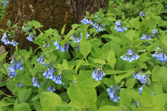

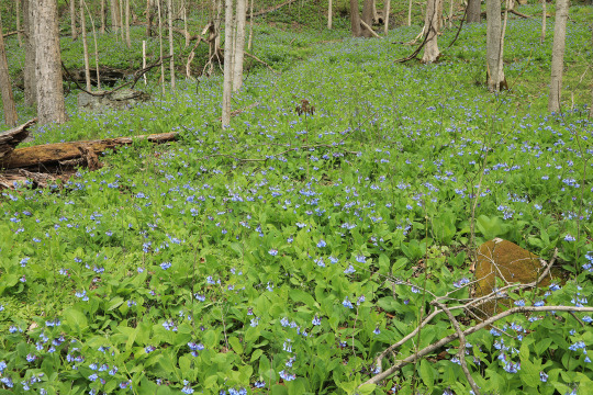
I made my annual pilgrimage to the Mason-Dixon Historical Park this morning to pay homage to Mertensia virginica, the Virginia bluebells. Upon reaching peak bloom in Mid-April, this gorgeous spring ephemeral cascades down the gentle, rich slopes above Dunkard Creek in fantastic waves of blue. Too bad the plant’s dazzling green foliage goes dormant in early summer.
#appalachia#vandalia#west virginia#pennsylvania#dunkard creek#mason-dixon historical park#flora#wildflowers#spring#mertensia virginica#virginia bluebells#ephemeral
172 notes
·
View notes
Video
Spring birdsong from Dunkard Creek at the Mason-Dixon Historical Park. The park straddles the state line between Pennsylvania and West Virginia.
#appalachia#vandalia#west virginia#pennsylvania#dunkard creek#mason-dixon historical park#mason-dixon line#spring#birdsong
58 notes
·
View notes
Photo
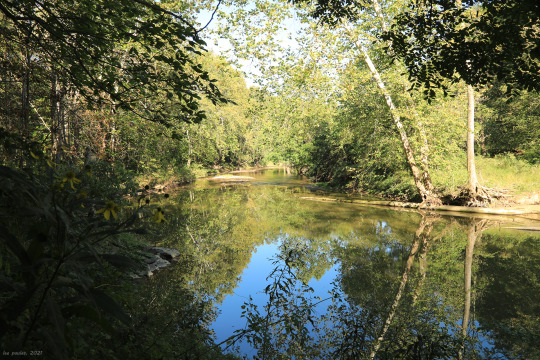
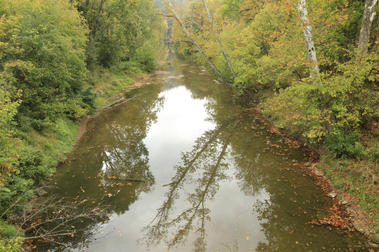
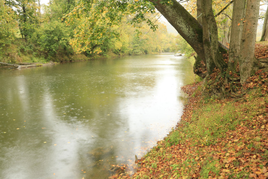
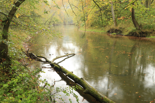
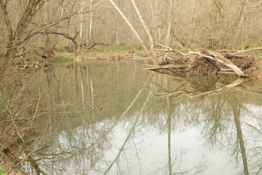
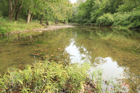
Reflecting pool on Dunkard Creek (Mason-Dixon Historical Park).
#appalachia#vandalia#west virginia#pennsylvania#dunkard creek#mason-dixon historical park#mason-dixon line#fall#autumn#reflection
43 notes
·
View notes
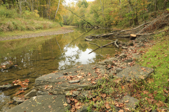
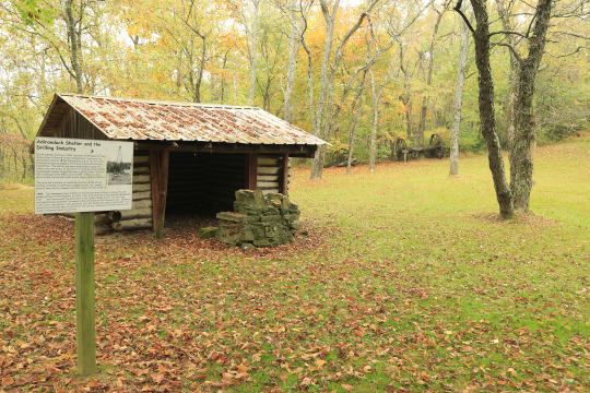
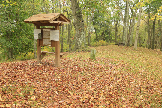
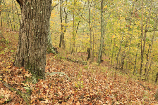
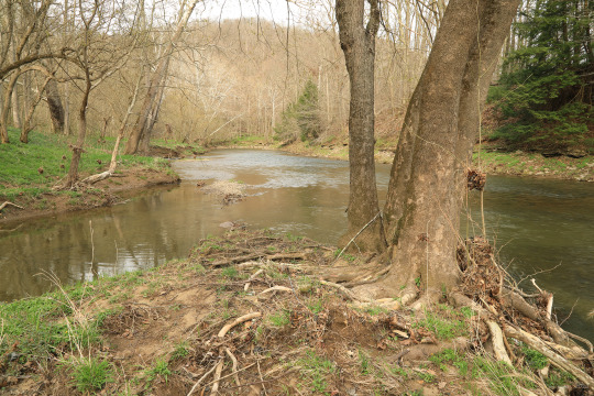
Photo


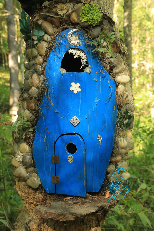
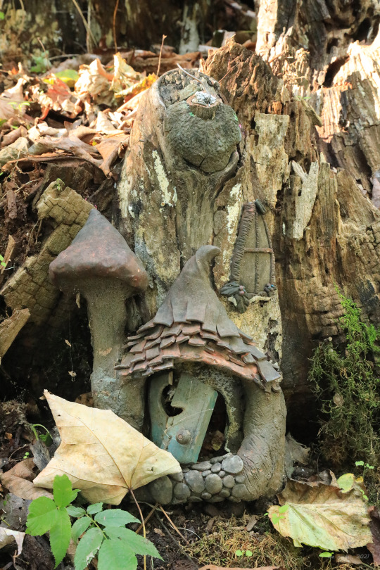

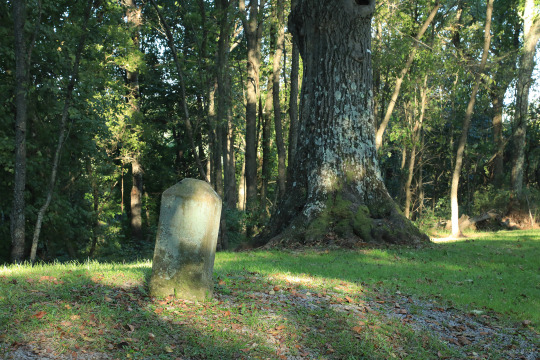
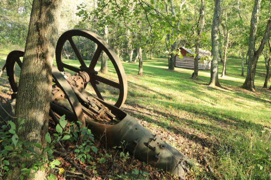

The photos above are from an early fall stroll through Mason-Dixon Historical Park, which straddles the state line between West Virginia and Pennsylvania along Dunkard Creek and the historic Catawba War Path of the Six Nations. The park commemorates the farthest progression to the west of the Mason and Dixon Survey in the mid 1760′s. Hostile Shawnee and Delaware tribes put a stop to the survey at Brown’s Hill, where numerous stone markers denote the demarcation line between north and south. In addition to the artifacts of the area’s pre-Revolutionary War history and oil and gas industry, the park features a network of easy to moderately-strenuous trails traversing Brown’s Hill and Dunkard Creek, as well as a popular fairy trail.
#appalachia#vandalia#west virginia#pennsylvania#mason-dixon historical park#mason-dixon line#brown's hill#catawba war path#catawba trail#native american history#six nations#colonial history#artifacts#dunkard creek#helianthus strumosus#pale-leaved sunflower#pale-leaf sunflower#phlox paniculata#fall phlox#symphyotrichum shortii#short's aster#fall#autumn
47 notes
·
View notes
Last Seen Blogs

unionstationnorthampton
Union Station Northampton

awiwannii
I'm Ariwa!!

povtv
Official PointOfView Development Blog

pirate-scum1741
🏴☠️~70'𝖘~🏴☠️

serachuu
max