#lemhi pass
Conversation
U.S. Daily High Temperature Records Tied/Broken 10/6/22
Anchorage, Alaska: 60 (previous record 56 2015)
Unincorporated Bristol Bay Borough, Alaska: 63 (previous record 59 2018)
Unincorporated Fairbanks North Star Borough, Alaska: 56 (previous record 55 2001)
Unincorporated Fairbanks North Star Borough, Alaska: 92 (previous record 51 2003)
Hoonah, Alaska: 60 (previous record 58 2014)
Kanuti National Wildlife Refuge, Alaska: 48 (also 48 2017)
Kenai National Wildlife Refuge, Alaska: 63 (previous record 58 2004)
Mt. Ryan summit, Alaska: 49 (previous record 46 2003)
Tetlin National Wildlife Refuge, Alaska: 60 (previous record 56 2003)
Utqiagvik, Alaska: 42 (previous record 38 2012)
Unincorporated Yakutat Borough, Alaska: 60 (also 60 2016)
Unincorporated Yukon-Koyukuk Census Area, Alaska: 47 (also 47 2005)
Klamath National Forest, California: 96 (previous record 94 2014)
Quartz Hill summit, California: 88 (previous record 87 2014)
Unincorporated Siskiyou County, California: 87 (also 87 1991)
Slater Butte summit, California: 84 (also 84 2014)
Stockton, California: 96 (also 96 1987)
Trinity National Forest, California: 98 (also 98 2002)
Weed, California: 89 (previous record 84 2020)
Big Creek Pass summit, Idaho: 70 (also 70 2020)
Unincorporated Blaine County, Idaho: 75 (also 75 2020)
Coeur d'Alene Reservation, Idaho: 84 (previous record 82 2020)
Unincorporated Lemhi County, Idaho: 74 (also 74 2020)
Nezperce National Forest, Idaho: 71 (also 71 2020)
Unincorporated Owyhee County, Idaho: 86 (previous record 85 2003)
Salmon, Idaho: 74 (also 74 2003)
Sawtooth National Forest, Idaho: 71 (previous record 70 2020)
Ness Township, Minnesota: 73 (also 73 2011)
Unincorporated McCurtain County, Oklahoma: 87 (also 87 2002)
Arlington, Oregon: 84 (also 84 2003)
Unincorporated Baker County, Oregon: 82 (previous record 80 2020)
Unincorporated Descutes County, Oregon: 84 (also 84 2014)
Harl Butte summit, Oregon: 71 (also 71 2020)
Unincorporated Josephine County, Oregon: 91 (previous record 90 2014)
Klamath Falls, Oregon: 83 (also 83 2014)
Morgan Mt. summit, Oregon: 81 (also 81 2003)
Mt. Hood National Forest, Oregon: 74 (also 74 2014)
Mt. Stella summit, Oregon: 85 (previous record 84 2014)
Sugarloaf Mt. summit, Oregon: 87 (also 87 1987)
Whitman National Forest, Oregon: 73 (previous record 72 2003)
Willamette National Forest, Oregon: 91 (previous record 89 2014)
Umpqua National Forest, Oregon: 92 (also 92 1987)
Colville National Forest, Washington: 68 (previous record 66 2003)
Corral Pass summit, Washington: 70 (previous record 68 2020)
Cougar Mt. summit, Washington: 76 (previous record 67 2020)
Harts Pass summit, Washington: 62 (previous record 60 2003)
Mt. Baker National Forest, Washington: 69 (previous record 66 2003)
Mt. Catherine summit, Washington: 70 (previous record 64 2003)
Mt. Crag summit, Washington: 68 (previous record 64 2020)
Mt. Rainier National Park, Washington: 71 (previous record 69 2020)
Quartz Peak summit, Washington: 71 (also 71 2003)
Rainy Pass summit, Washington: 67 (previous record 66 2003)
Stampede Pass summit, Washington: 69 (previous record 66 2020)
Wenatchee National Forest, Washington: 78 (previous record 77 2020)
0 notes
Photo
May your National Wildflower Week be as beautiful as this scene from @mypubliclands's Lemhi Pass in Idaho. Wildflowers are beautiful, they can be eaten, they are medicine, and they are home to so much wildlife. Wild spaces provide habitat for these blossoms to bloom, and the benefits they provide are endless! Photo by Bureau of Land Management
535 notes
·
View notes
Photo

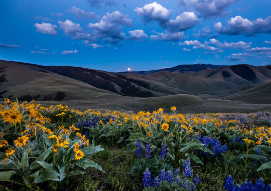
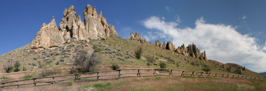
On the west side of Lemhi Pass in Idaho, where Lewis and Clark crossed over the Continental Divide from present day Montana in 1805, lies beauty beyond compare. The arrowleaf balsam-root (yellow), lupine and delphinium (purple) can grow in mass at mid elevations and look even more magical under a dusky night sky lit by a full moon. Photo by Bob Wick of the Bureau of Land Management.
1 note
·
View note
Text
100 Days, 100 Prompts, 100 Words
Day 18: Prompt - Lemhi Pass Character - N. Italy
Italy frowned. It was desolate here, in the pass between the mountains. He could see clear sky every way he looked. Beautiful in its harsh beauty. This place was unconcerned about the affairs of humans. Here he could almost pretend to be fine, to have no problems. Here he could paint all day and never run out of inspiration. But he couldn’t afford to stop. There were things he needed to do, places he needed to go. Places uglier than here. Places where the sky was clouded, and the mountains were concrete buildings, devoid of the beauty of these mountains.
1 note
·
View note
Photo
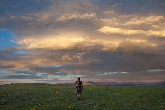
#FindYourWay on the Continental Divide National Scenic Trail!
Welcome to the King of Trails! The Continental Divide National Scenic Trail covers 3,100 miles through Bureau of Land Management, U.S. Forest Service and National Park Service managed public lands in Colorado, Idaho, Montana, New Mexico and Wyoming.
Designated as a national trail for its scenic significance, the Continental Divide trail is more difficult than its sister long-distance trails, the Appalachian and Pacific Crest. It navigates dramatically diverse ecosystems through mountain meadows, granite peaks and high-desert surroundings.
Upon designation in 1978, Congress identified a corridor for this trail, straddling along the backbone of the North American continent, the Divide, for the future placement of the trail. When complete, the trail will climb and descend the peaks and cross the high-deserts of the Rocky Mountains from Canada to Mexico.
Are you ready to plan your hike on this amazing trail?
Throughout this summer, we are highlighting national scenic and historic trails in anticipation of the 50th anniversary of the National Trails Act on Oct. 2, 2018. #FindYourWay and follow along with on Instagram!
#bureau of land management#continental divide trail#continental divide#public lands#trails#find your way#national trails act#nature photography#photography
172 notes
·
View notes
Photo

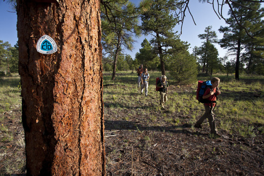
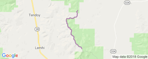
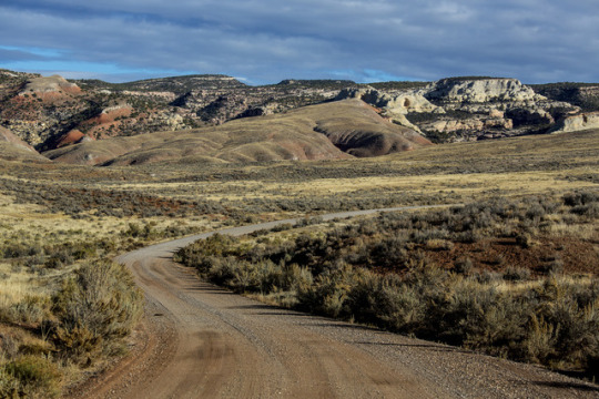
CDT (Goat Mtn-Lemhi Pass) Trail
The CDT between Goat Mountain and Lemhi Pass is a two-track and follows the crest of the divide.Portions are very pleasant. Portions are steep, rocky and loose. Areas of open ridgetop and sage meadow offering views into both Montana and Idaho are...
view more trail info & map
1 note
·
View note
Photo

Closeup of an old Pony Express cabin at Lemhi Pass, Montana. Prints for sale at TheThrillSociety.com ⛺️📸⛺️ #log #logcabin #woodlovers #ponyexpress #bnw_demand #bnw_mystery #bnw_users #bnw_photography #logcabinlife (at Lemhi Pass)
1 note
·
View note
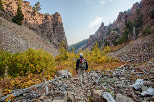
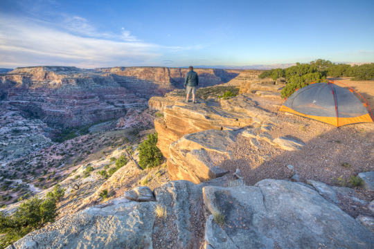
Photo
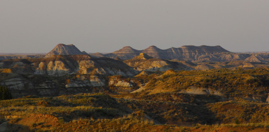
On a recent camping trip to Idaho and Montana, we drove through Lemhi Pass. Approaching from the Montana side on a hot, clear June day, we wandered around the summit, marveled at the sweeping views, and visited the Sacagawea Memorial. Mid-week, we were the only visitors and could take our time to soak up the history and majesty of our surroundings.
The Shoshone Indians and other tribes commonly crossed what later became known as the Continental Divide. Their footsteps and horse hooves created a clear trail for Lewis and Clark to follow in 1805. The trail through the rugged Bitterroot Range of the Rocky Mountains is a passageway between the Salmon River Valley to the west, and Horse Prairie to the east. Later, mountain men and fur traders called it “North Pass.”
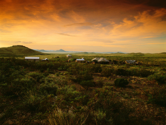
A high mountain pass in the Beaverhead Mountains and part of the Bitterroot Range in the Rocky Mountains, Lemhi Pass is within Salmon-Challis National Forest. The pass lies on the Montana-Idaho border on the continental divide, at an elevation of 7,373 feet above sea level.
The name Lemhi dates back to 1855 when Mormon pioneers built Fort Limhi, named after a king in the Book of Mormon. Later the spelling was changed to Lemhi and the name remained with the land and its people, the Lemhi Shoshone.
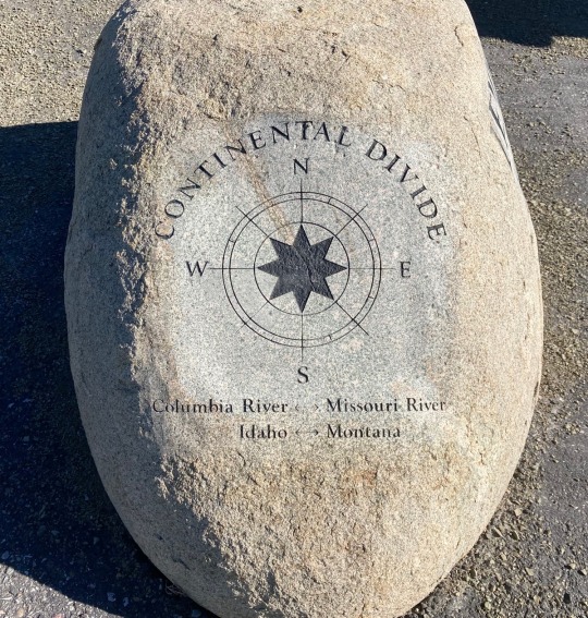
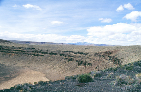
Falling rain creates an interesting phenomena in this area. Rain falling east of Lemhi Pass drains to the Missouri and later the Mississippi River, then into the Gulf of Mexico. However, rain falling west of the pass drains into the Salmon, Snake and Columbia Rivers and eventually into the Pacific Ocean.
Lemhi Pass is a spectacular place. If you have an opportunity to visit, don’t pass up this high-level delight.
0 notes
Photo
What a weekend. #bzntrek2017 (at Lemhi Pass)
45 notes
·
View notes
Conversation
U.S. Daily High Temperature Records Tied/Broken 9/28/22
Dauphin Island, Alabama: 90 (also 90 2019)
Kenai National Wildlife Refuge, Alaska: 60 (also 60 2014)
Chilao Flat summit, California: 87 (also 87 2020)
Unincorporated Los Angeles County, California: 91 (previous record 90 2010)
Santa Ysabel Reservation, California: 100 (also 100 2010)
Unincorporated Kaua'i County, Hawaii: 90 (also 90 2020)
Bear Mt. summit, Idaho: 72 (previous record 69 1994)
Camas Creek Divide summit, Idaho: 82 (previous record 81 1994)
Clearwater National Forest, Idaho: 77 (previous record 75 1989)
Coeur d'Alene, Idaho: 90 (previous record 89 1967)
Coeur d'Alene National Forest, Idaho: 88 (previous record 82 2006)
Ketchum, Idaho: 79 (previous record 77 2003)
Unincorporated Lemhi County, Idaho: 83 (previous record 82 2010)
Unincorporated Lincoln County, Idaho: 90 (previous record 89 2010)
Lolo Pass summit, Idaho: 81 (previous record 78 1989)
McCall, Idaho: 84 (also 84 2010)
Unincorporated Minidoka County, Idaho: 93 (previous record 92 1994)
Nezperce National Forest, Idaho: 77 (previous record 75 2010)
Unincorporated Owyhee County, Idaho: 92 (also 92 2010)
Pierce, Idaho: 89 (previous record 85 1994)
St. Joe National Forest, Idaho: 80 (also 80 2016)
Salmon, Idaho: 83 (previous record 80 2016)
Salmon National Forest, Idaho: 79 (previous record 78 2010)
Savage Pass summit, Idaho: 78 (previous record 73 2016)
Swan Valley, Idaho: 86 (also 86 2010)
Badger Pass summit, Montana: 74 (previous record 72 1994)
Beaverhead National Forest, Montana: 72 (also 72 1994)
Bitterroot National Forest, Montana: 81 (previous record 78 2009)
Blackfeet Indian Reservation, Montana: 91 (previous record 87 1967)
Unincorporated Blaine County, Montana: 89 (previous record 85 2016)
Bob Marshall Wilderness, Montana: 83 (previous record 78 1994)
Bozeman, Montana: 88 (previous record 84 2021)
Butte, Montana: 83 (previous record 82 2010)
Unincorporated Cascade County, Montana: 91 (previous record 90 1967)
Choteau, Montana: 90 (previous record 88 1967)
Deerlodge National Forest, Montana: 81 (previous record 78 2010)
Flathead National Forest, Montana: 84 (previous record 82 1994)
Flathead Reservation, Montana: 78 (previous record 73 1994)
Flattop Mt. summit, Montana: 73 (previous record 67 1991)
Gallatin National Forest, Montana: 79 (previous record 77 2010)
Unincorporated Garfield County, Montana: 89 (previous record 86 2010)
Glacier National Park, Montana: 84 (previous record 76 2012)
Helena National Forest, Montana: 78 (previous record 75 2010)
Unincorporated Hill County, Montana: 93 (previous record 90 1967)
Kootenai National Forest, Montana: 78 (also 78 1989)
Lewis & Clark National Forest, Montana: 79 (previous record 78 1994)
Livingston, Montana: 89 (also 89 2010)
Many Glacier, Montana: 79 (previous record 77 1994)
Monument Peak summit, Montana: 74 (previous record 73 2010)
Moss Peak summit, Montana: 73 (previous record 71 1994)
Unincorporated Phillips County, Montana: 86 (previous record 85 2021)
Unincorporated Powell County, Montana: 75 (previous record 71 2010)
Shelby, Montana: 85 (previous record 84 1957)
Skalkaho Pass summit, Montana: 76 (previous record 73 2010)
Stahl Peak summit, Montana: 73 (previous record 66 1991)
Stanford, Montana: 87 (previous record 83 2010)
Upper Missouri River Breaks National Monument, MT: 91 (previous record 90 2010)
Unincorporated Valley County, Montana: 90 (previous record 85 2021)
Unincorporated Chelan County, Washington: 88 (also 88 1994)
Unincorporated Teton County, Wyoming: 74 (previous record 73 1994)
0 notes
Photo


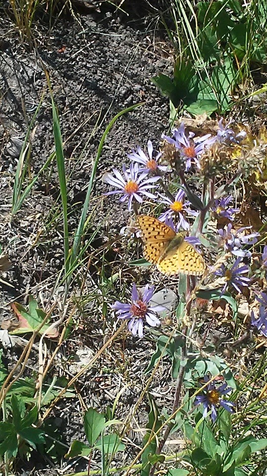
A butterfly on some wildflowers- Lemhi Pass, ID. (My photos.)
3 notes
·
View notes
Photo

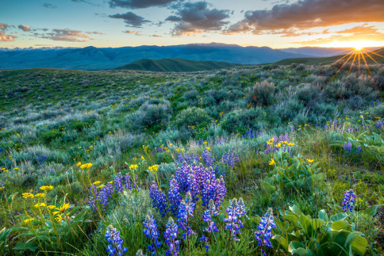
The Lemhi Pass in #Idaho is where Lewis and Clark crossed over the Continental Divide in 1805. This marked a major milestone in the U. S. westward expansion, but Lewis and Clark were not the first people to use the pass. They followed a well-traveled Shoshone Trail. Sacajawea lived as a child below the pass along Agency Creek until age 12 when she was captured during a battle with another another tribe and forced to North Dakota. It was here that she became part of the Corps of Discovery with Lewis and Clark and proved to be invaluable to the success of the expedition. Today the pass is traversed by a 35-mile long graded unpaved Backcountry Byway through public lands where colorful wildflowers like arrowleaf balsam-root, lupine and delphinium rival the sunset. Photo by Bob Wick, Bureau of Land Management (@mypubliclands).
#usinterior#mypubliclands#bureau of land management#lewis and clark#North Dakota#Idaho#beautiful flowers#spring#landscape photography#publiclands
809 notes
·
View notes
Text
Shoshone Falls: A Natural Wonder On The Snake River In Idaho
The fifth stop in our series Off The Beaten Path brings travelers to Shoshone Falls located in Idaho. The waterfalls are part of the Snake River and are sometimes referred to as the Niagara of the West. Shoshone Falls is 212 feet (65 meters) high, which is 45 feet higher than the far more famous Niagara Falls.
Shoshone Falls flows over a rim between 900 and 1,000 feet (300m) wide. It is one of the largest natural waterfalls in the United States. It is located outside the city of Twin Falls.
The Columbia River Gorge facing east toward Beacon Rock.
The water flows over the falls are comprised of the seasonal runoffs from the Snake River. Over the years the force of erosion and floods, has carved its way through the various canyons and ravines, as the largest tributary of the Colombia River makes its way west.
Being located in an arid region, Shoshone Falls naturally receives most of its water from snow melt in the Rocky Mountains of Idaho and Wyoming. The watershed is near Yellowstone and the Grand Teton National Parks and to a lesser extent, a number of springs in the Snake River Canyon above the town of Twin Falls.
The Snake River
The place drew national attention in 1974, when the American daredevil Evel Knievel made an unsuccessful attempt, to jump over Shoshone Falls to a crowd of 30,000. He survived the dangerous stunt after nearly drowning.
Shoshone Falls are named for the Lemhi Shoshone or Agaidika people, so named because of their consumption of salmon. They descended on the area near the falls, because of the immense salmon runs in the Snake River.
The Bannock people also traveled to the Shoshone Falls each summer, to gather salmon and to trade.
The noteworthy Expedition by Lewis and Clark, during the years 1805 to 1806 did encounter the Shoshone, but did not pass through the Falls area.
A Shoshone encampment in the Wind River Mountains of Wyoming, photographed by W. H. Jackson, 1870
The 1811 Wilson Price Hunt Expedition, looking for new routes to assist the growing fur trade, were traveling on the Snake River, at least as far as the present-day American Falls.
They did not make it to Shoshone Falls, because of the increasingly unsafe conditions of the river. The members of this party turned back, at a place they called the Devils Scuttle Hole.
The route they set would become part of the famous Oregon Trail, which would facilitate the eventual arrival of migrants, from the eastern part of the United States to the area of the Falls. Some early settlers named the cataracts Canadian Falls. It is still not clear where this moniker originated from.
John C. Fremont an American military officer, explorer, and politician.
In the 1840’s John C. Fremont would pass by Shoshone Falls. In his now famous 1843 expedition, in which he attempted to map the western portion of the Oregon Trail, he would name the cataracts the Fishing Falls.
He further added that the salmon were so abundant, that the Shoshone could throw their spears at random and still catch the tasty fish.
The Shoshone encounters with Americans were generally friendly, but would later end in conflict over land ownership. After the Bear River Massacre of 1863, the Shoshone were forced onto reservations.
There would be a Geological Exploration in 1868. The director of the survey Clarence King, would be the first to suggest, that the canyons and falls might have been created by a great catastrophe, rather than forces of slower paced regular erosion.
Shoshone Falls and the Snake River Canyon as it appeared before damming, photographed by Timothy H. O’Sullivan, circa 1874
Thomas H. O’Sullivan also on this expedition, is the first known person to photograph the falls. He would later return in 1874, for a second photography trip.
Despite barren and isolated surroundings, Shoshone Falls still managed to become a major tourist attraction from the mid-19th century onward. The reason for this was the close proximity it had to the Oregon Trail. Only a slight deviation to the north, was necessary to see the Falls.
By the 1860’s it was already being referred to as The Niagara of the West. The falls would become even more famous, once they were painted by Thomas Moran, well known for his depictions of Western landscapes.
Shoshone Falls on the Snake River by Thomas Moran, c. 1900
The discovery of gold in the Snake River Canyon during 1869, would bring a rush and subsequent boom that would end rather quickly, as local geology made mining somewhat difficult.
It was in 1876, that Charles Walgamott as a local homesteader, finally saw the true potential of Shoshone Falls as a tourist destination. He would later start the construction of the first lodge for visitors.
In 1883, the Oregon Short Line Railroad would be extended to Shoshone, Idaho making traveling to the falls far easier. The true isolation of the place, had at last ended.
Milner Dam
The vast Snake River Aquifer is a creation of the region’s porous volcanic rock and gets recharged every year, by the melting snows throughout this mountainous area.
Since the Shoshone Falls canyon lies lower in elevation than the surrounding terrain, groundwater is forced to the surface, through the motion of large springs located throughout the canyon walls.
Even though Milner Dam can often divert almost all the water up stream, these canyon streams can provide up to 3,000 cubic feet per second of water to the falls. Flows can vary according to the season, although it has increased since the 1950’s, due to the irrigation water on the surrounding land trickling into the aquifer.
Map of Pleistocene lakes in the Western US, showing the path of the Bonneville Flood along the Snake River.
Shoshone Falls was formed by a catastrophic outburst of water, known as the Bonneville Flood at the end of the last ice age, that geologists refer to as the Pleistocene. This is estimated to be between 14,500 and 17,500 years ago.
Sometime during that period the immense freshwater lake known as Lake Bonneville that covered much of the Great Basin, overflowed through the Red Rock Pass and into the Snake River.
At that time about 1,100 cubic miles, the equivalent of 4,600 km3 of water was released. This is 1,500 times the average annual flow of the Snake River at Twin Falls. This incredible flow of water carved the entire Snake River Canyon in a matter of several weeks.
During this dramatic event, a number of local geographic features would be created, including Shoshone Falls, where the local geology interacted with the much harder underlying rock layers.
Shoshone Falls Dam, located directly above the falls, diverts water for hydro-power generation and can greatly reduce the flow of the falls in the dry season.
The Falls mark the historical upper limit of fish migration in the Snake River. This would include the commercially important salmon. The entire region remained an essential fishing and consequently trading place, for native tribes of the Americas for numerous millennium.
Shoshone Falls was already being mentioned by Americans and Europeans as early as the 1840’s, despite the isolated location of the site.
Within the next 20 years it had become a tourist attraction, although it was not easy to access during those early days.
In the early 20th century, the Snake River became a primary contributor to economic development in southern Idaho. The irrigation diversion for the Magic Valley and hydroelectric power plants, built right above the falls, provided the needed resources for an influx of settlers.
Shoshone Falls high flow of about 20,000 cubic feet per second (570 m3/s) in June 2011
These alternative uses of the water were quite controversial, because it greatly reduced the amount of water available to Shoshone Falls. This greatly impacted tourism, especially during the dry season.
As a result, this makes a trip to the Falls a seasonal event, if you wish to view the cataracts at their full potential. Peak water flows can be expected between the months of April and July. Many travelers recommend May and June as the ideal months for a visit.
The seasonal variation is quite dramatic. The water flow over the falls ranges from 20,000 cubic feet per second during late spring of wetter years, to a minimum 300 cubic feet per second in dry years.
Water is often released from the dams ahead of the falls, to ensure what is known as a scenic flow. Shoshone Falls has become a major tourist attraction for the area and therefore, water is discharged periodically for that specific purpose.
A nearly dry Shoshone Falls on July 7, 2013
Idaho Power’s Dam which is upstream from the falls, is required to provide this minimum flow of water from April through Labor Day in early September.
The multipurpose use of the waters of the Snake River, makes the various stakeholders competitive for a scarce resource.
The water diverted to the Shoshone hydroelectric plant for example, continually reduces the water flow throughout the year. The facility requires up to 950 cubic feet of water per second.
There are a large number of reservoirs and huge diversions of water from the Snake River for irrigation purposes. The cultivation of some 2 million acres (810,000 hectares) of farmland, depends on this water source during the dry season.
Downtown Twin Falls. Idaho
The deficit of water can easily be measured. The stream gaging station at Twin Falls averages about 3,530 cubic feet per second. At Idaho Falls, just 190 miles (310 kilometers) upstream, the flow can be measured at 5,911 cubic feet per second.
The average flow just below the Milner Dam, a mere 24 miles upstream, is just 884 cubic feet per second and frequently hits zero discharge in the late summer and fall.
This results in the local canyon springs, being the main source of water during the summer, for the spectacle at Shoshone Falls. That is why a spring visit is crucial, for experiencing the falls when their optimum effect can be viewed.
The highest flow of water ever recorded at Twin Falls was 32,200 cubic feet per second, all the way back in June of 1914. The lowest recorded to date was 303 cubic feet per second, on April 01, 2013.
On a monthly basis, June witnesses the highest average flows at 6,280 cubic feet per second. August bring the lowest numbers, at only 956 cubic feet per second.
In 2015, Idaho Power finally initiated the Shoshone Falls Expansion Project. This involved reconstructing portions of the Shoshone Falls Dam, to reduce its aesthetic impact on the area.
In addition, it directed low water releases to the most scenic part of the falls, mainly the Bridal Veil Falls on the north bank of the river.
Location
Shoshone Falls is located at Falls Avenue 3300 East, Twin Falls, Idaho 83301. Phone numbers are (208) 736-2265 and (208) 736-2266.
The electronic contact is https://visitsouthidaho.com/adventure/shoshone-falls/
There is a park overlooking the Shoshone Falls, that is owned and operated by the City of Twin Falls. It encompasses the south bank of the Snake River at the falls. A $3.00 USD (United States Dollar) vehicle fee is collected from March 30th through September 30th.
Season passes can be purchased at $25.00 and are available at the Parks and Recreation Department building and the ticket booth at Shoshone Falls.
The park includes an overlook, interpretive displays and a trail system along the south rim of the Snake River Canyon. The trails provide access to a number of points of interest, including Dierkes Lake and Evil Knievel’s jump site.
About 250,000 to 300,000 vehicles enter the park annually.
Amenities Include a boat launch to Snake River, 11 grills, a drinking fountain, a concession stand, picnic tables, restrooms, and the overlook of the falls as well as the nature trails.
How To Get There
Visitors will arrive by using Interstate 84, turning south on Route 93 and crossing the Snake River by using the Perrine Bridge. Continue on 93 also known as the Blue Lakes Boulevard North into the City of Twin Falls. Take a left on Falls Avenue East for 3 miles and another left at 3300 East Road. Drive for 0.9 miles. This will run directly to the park and canyon about 1.1 miles further on.
Shoshone Falls is located about 130 miles east of Boise, Idaho. It will take about a two hour car drive on Interstate 84, to reach your destination. It is about 113 miles west from Pocatello, Idaho. It will take about 1:45 hours to reach the falls by I-86 and I-84.
One can also use the Magic Valley Regional Airport, located about 5 miles south of Twin Falls.
Hours of Operations
Shoshone Falls Park is open daily for most of the year from 7:00 am to 8:00 pm.
Lodging
Is available in the city of Twin Falls.
The post Shoshone Falls: A Natural Wonder On The Snake River In Idaho appeared first on WanderingTrader.
from Updates By Jane Heart http://wanderingtrader.com/travel-blog/united-states/shoshone-falls-natural-wonder-snake-river-idaho/
0 notes
Text
Analysis on New Product Launches in Covid-19 Related Markets-Global Rare Earth Metal Market 2020-2024 | Rising Demand for Electronic Appliances to Boost Market Growth | Technavio
The global rare earth metal market size is expected to grow by USD 5.76 billion during 2020-2024. The report also provides the market impact and new opportunities created due to the COVID-19 pandemic. The impact can be expected to be significant in the first quarter but gradually lessen in subsequent quarters – with a limited impact on the full-year economic growth, according to the latest market research report by Technavio. Request a free sample report

Rise in disposable incomes, technology breakthroughs, and falling microprocessor prices are among factors propelling the demand for personal gadgets such as laptops, mobile phones, and tablets across the world. Rapidly expanding mobile networks and internet penetration in India, Bangladesh, Indonesia, Thailand, and other countries in Southeast Asia are further aiding the demand for mobile gadgets and personal equipment. There is a significant untapped market in these regions, which presents an immense growth opportunity for the sale of personal electronic equipment. Rare earth compounds of yttrium, terbium, cerium, and gadolinium are used as phosphors in various electronic appliances such as LCDs and smartphones. These rare earth metal compounds exhibit electro phosphorescence wherein an electric discharge in the compound results in color variations. Thus, the growing demand for electronic appliances and personal equipment will drive the growth of the market.

To learn more about the global trends impacting the future of market research, download a free sample: https://www.technavio.com/talk-to-us?report=IRTNTR43187
As per Technavio, the rise of new production capacities will have a positive impact on the market and contribute to its growth significantly over the forecast period. This research report also analyzes other significant trends and market drivers that will influence market growth over 2020-2024.
Rare Earth Metal Market: Rise of New Production Capacities
China has remained the key producer and supplier of rare earth metals for the previous three decades. However, the country's practice of restricting export quotas and raising duties is forcing various countries to evaluate alternative sourcing agreements. In order to capitalize on the same and on the growing demand from end-users, various countries have embarked upon the exploration of their untouched and underutilized reserves. This increase in production capacities outside China is greatly supporting the growing demand for rare earth metals. Some notable exploration and development assessments in the US include Bear Lodge, Bokan Mountain, Elk Creek, Lemhi Pass, Diamond Creek, La Paz, Thor, Pea Ridge, and Round Top. Similarly, large numbers of projects are underway in Australia, Brazil, China, Greenland, India, Madagascar, Mozambique, South Africa, Sweden, Tanzania, and Vietnam. The rise of new production capacities across the world will lead to the growth of the market.
“Factors such as the growing popularity of green mining and environment-friendly refining, and surge in demand from APAC will have a significant impact on the growth of the rare earth metal market value during the forecast period,” says a senior analyst at Technavio.
Rare Earth Metal Market: Segmentation Analysis
This market research report segments the rare earth metal market by application (permanent magnets, metal alloys, catalysts, polishing powder, glass additives, ceramics, and other applications), element type (light rare earth metals, heavy earth metals, and other element types), and geography (APAC, Americas, and EMEA).
The APAC region led the rare earth metal market in 2019, followed by the Americas and EMEA respectively. During the forecast period, the APAC region is expected to register the highest incremental growth due to the increased demand for rare earth metals from the automotive and electronic industries.
Technavio’s sample reports are free of charge and contain multiple sections of the report, such as the market size and forecast, drivers, challenges, trends, and more. Request a free sample report
0 notes
Photo


#NewYearNewAdventures: Our favorite road trips/byways
We’re continuing to share some of the top spots on #yourpubliclands to start the New Year off right. Explore the outdoors with these road trips and byways this year to BLM-managed public lands.

Dalton Highway, Alaska
The Dalton Highway stretches 414 miles across northern Alaska from Livengood (84 miles north of Fairbanks) to Deadhorse and the oilfields of Prudhoe Bay. Built during construction of the trans-Alaska oil pipeline in the 1970s, this mostly gravel highway travels through rolling, forested hills, across the Yukon River and Arctic Circle, through the rugged Brooks Range, and over the North Slope to the Arctic Ocean. Along most of its length, you'll see no strip malls, no gift shops, no service stations, just forest, tundra, and mountains, crossed by a ribbon of road and pipe.The BLM manages a swath of public lands along the highway from the Yukon River to the north side of the Brooks Range. Within the Dalton corridor, the BLM maintains campgrounds, rest areas, interpretive panels and the award-winning Arctic Interagency Visitor Center in Coldfoot.This is no ordinary road -- it pays to be prepared. There is no cell phone service or public Internet connection along the Dalton Highway.

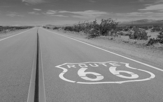
Route 66 Historic Backcountry Byway, Arizona
This 42-mile stretch of two-lane blacktop is one of the last and best-preserved segments of the original Route 66, one of America's first transcontinental highways. This portion of the highway once included one of the most fearsome obstacles for "flatland" travelers in the 1930's: the hairpin curves and steep grades of Sitgreaves Pass, which characterize Old Route 66 as it makes its way over the Black Mountains of western Arizona.
Bodie Hills, California
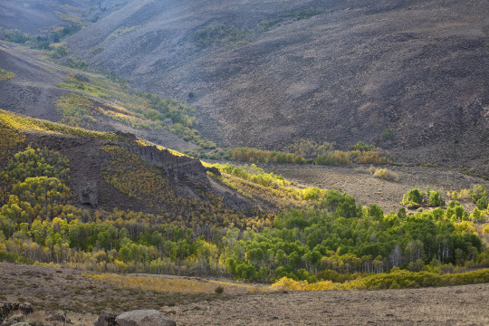
Always on our #roadtrip #bucketlist! California’s Eastern Sierra region is a dramatic transition zone between the snow-capped granite spires of the Sierra Nevada and the endless sagebrush covered uplands of the Great Basin. A trip at the right time of year will reward visitors with a diversity of wildflowers.
One great wildflower viewing area is just north of Mono Lake and east of Yosemite National Park in the rolling Bodie Hills – hills being an understatement since they top out at over 10,000 feet! Because of their high elevation, wildflower blooms are later here than much of California – typically arriving in May-June on the lower slopes and into July on the highest peaks. Several back roads traverse the area and offer access to view the displays of phlox, penstemon and paintbrush to name a few of the many wildflower species. More than 100,000 acres of BLM lands cover most of the Bodie Hills and include several wilderness study areas.
Bodie State Historic Park is the best-preserved ghost town in California, and arguably in the United States. Wildlife viewers can see antelope, mule deer, and if lucky, get a glimpse of a sage grouse. If you visit later, around early October, crisp clear nights will turn the scattered aspen stands to gold, giving a second opportunity to see Bodie Hills in color.
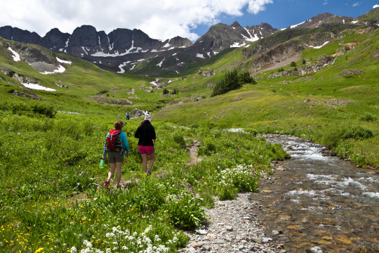
Alpine Loop National Backcountry Byway, Colorado
A #roadtrip to the #AlpineLoop should be on your #bucketlist for 2018! Located northeast of Silverton, Colorado in San Juan and Hinsdale counties, the Alpine Loop Back Country Byway is a premiere visitor destination. The epic scenery draws off-highway-vehicle enthusiasts across the country who are treated with a network of roads that climb above the timberline, accessing unparalleled vistas in an alpine environment. The hiking, biking and camping in the area is also fantastic. Scattered along the Alpine loop are remnants of our nation’s frontier history, where visitors can learn about the bustling mining towns that once thrived here.
While many roads are accessible by regular, two-wheel drive vehicles, getting into the alpine areas require high-clearance, four wheel drive vehicles. Plan your trip accordingly.
Washington-Rochambeau Revolutionary Route National Historic Trail, Virginia
Journey through early American history and walk in the footsteps of our nation’s founding fathers as you explore the Washington-Rochambeau Revolutionary Route. This National Historic Trail commemorates over 680 miles of land and water trails followed by the allied armies of General George Washington and the French Lieutenant General Comte Jean de Rochambeau. During their 1781 march from Newport, Rhode Island to Yorktown, Virginia, the French army established an encampment on what is now the Meadowood Special Recreation Management Area (SRMA). A segment of this trail connects with a BLM system of trails crossing the SRMA on the historic Mason Neck Peninsula, just a short drive from the nation’s capital. At Meadowood, the trail transects open meadows, enters into mature hardwood forests, and crosses riparian wetlands. While in the area, visit Gunston Hall, the home of Founding Father George Mason, a strong supporter of individual liberties and the author of the Virginia Declaration of Rights. Many of the concepts in that document found embodiment in the first ten amendments to the U.S. Constitution, the Bill of Rights.
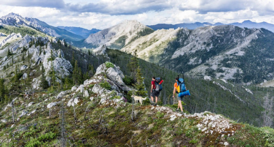
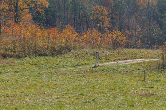
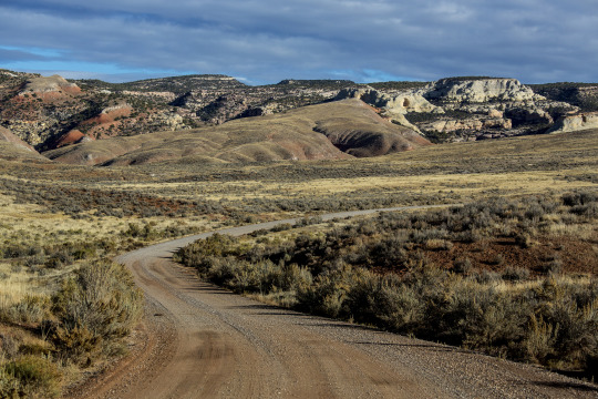
Lewis and Clark Backcountry Byway, Idaho
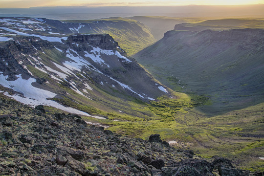
The Lewis and Clark Backcountry Byway and Adventure Road is a 36-mile loop drive through a beautiful and historic landscape following the Lewis and Clark National Historic Trail and the Continental Divide National Scenic Trail. Experience incredible views of the Lemhi Valley and the surrounding mountain ranges; truly some of the finest scenery in America!
The mountains, evergreen forests, high desert canyons and grassy foothills look much the same today as when the Lewis and Clark Expedition passed through in 1805. Take a slow and meandering journey along this drive with time to stop along the way for hiking, fishing, mountain biking and exploration. With a 4,000 foot gain and loss in elevation, expect some steep grades too.
Lemhi Pass is well-known for its wildflower displays in the spring and summer. Captain Lewis collected three new plant species in this area: mountain maple, common snowberry and Lewis’s monkey flower. You might see elk, mule and whitetail deer, black bear, moose, pronghorn antelope, coyotes and many smaller mammal species. Early mornings and evenings are the times to look for wildlife, particularly where the forest and meadow meet.
By late September, shorter days and cooler temperatures release hues of red, yellow, and gold in aspens, cottonwoods, willows and shrubs. Don’t miss Agency Creek in October – it’s beautiful! Download a visitor guide for your roadtrip from our website.
Big Sky Byway, Montana
The 105-mile Big Sky Back Country Byway begins in Terry, MT, and travels north and south covering badlands and rolling prairies. The byway ends in Wolf Point, MT, on the beautiful Missouri River, part of the Lewis and Clark National Historic Trail. The route is part of the National Scenic Byways Program, linking Terry with Wolf Point. Taking 2 hours one way, you can stop to take a look at the information kiosks in Terry, Circle, and Wolf Point, which describe byway attributes, local history, and culture. Visitors can enjoy the scenic badlands of eastern Montana year round from this all-weather road.
Lunar Crater Backcountry Byway, Nevada
The scenic loop (the Lunar Crater Back Country Byway) passes by the crater with a stopping point near the crater where visitors can get out to view the impressive volcanic feature. Vehicles are limited to existing roads and trails.

Lake Valley Backcountry Byway, New Mexico
A meandering 48-mile drive on paved roads takes visitors through ranching and mining country and past the ruins of the 1880s mining town of Lake Valley. The Lake Valley Backcountry Byway is nestled between the Mimbres and Caballo Mountains and the Cooke's Range in southwestern New Mexico and offers spectacular scenic views. Rich in history and scenery, the Byway offers an outstanding trip for travelers with an hour to spare.
Steens Mountain, Oregon
How about this for a scenic byway: Glacier-carved gorges, pristine alpine lakes and wild and scenic rivers, all accessible via the highest elevation road in Oregon!
Come take a drive on the 52-mile-long Steens Mountain Backcountry Byway! There are four campgrounds along the byway for those wanting to stay a little bit longer in one of the most remote places in the U.S.!
Photo/video: https://goo.gl/VOkTFg
San Rafael Swell, Utah
Make the most of your road-trip to Moab or the Skyline Drive! Take the scenic route through the San Rafael Swell. Emery County Road 332 is a gravel road that connects approximately 45 miles between Huntington, Utah to Interstate 70 in the heart of the San Rafael Swell. Enjoy the amazing desert scenery, stop at the wedge overlook for a view of the “Little Grand Canyon,” view the ancient rock art of the Buckhorn Draw Panel, and maybe even take a side trip to the Cleveland-Lloyd Dinosaur Quarry. While there is primitive-style camping in the area, there are no other services. Come prepared with everything you need, and take home everything you bring. Flat tires are common.
Red Gulch/Alkali National Backcountry Byway, Wyoming
The Red Gulch/Alkali National Backcountry Byway is a 32-mile scenic drive on improved gravel and dirt roads through the foothills of the Bighorn Mountains. Near each of the two entrances to this historic route you will see a National Backcountry Byway kiosk which provides historical information about the byway as well as road conditions. The steep, rugged canyons cut into the mountains along the byway and offer many challenging and interesting hiking opportunities. Among the wondrous sights you may see are hoodoos. These strange, artistic rock formations were carved over the centuries by Wyoming’s wind.
#bureau of land management#explore#yourpubliclands#recreation#roadtrip#byway#outdoors#getoutdoors#outside#newyearnewadventures#newyear#2018#solitude#nature#photography#wilderness#alaska#arizona#california#colorado#virginia#idaho#montana#nevada#newmexico#oregon#utah#wyoming
42 notes
·
View notes
Text
Tweeted
We moved a year-old fence on Lemhi Pass from its very accessible place next to a road down the hill to a much steeper and more uneven spot, but finished it much faster than we anticipated! With our extra day, we worked on the ranger station, installing a door and making signs. pic.twitter.com/HgmSlhQX3m
— J Cowan (@quantum_scribe) June 15, 2019
0 notes
Last Seen Blogs

zam-dio
Zam_dio

dschroeder1014
Life: The Most Exciting Journey You'll Ever Have

darabokra-tepsz
Még ha azt hiszed nem is bántassz, Darabokra Tépsz

buyukbaskan22
Gökmen Altay

m3teoraaa
limbo