#curecanti
Text

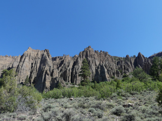

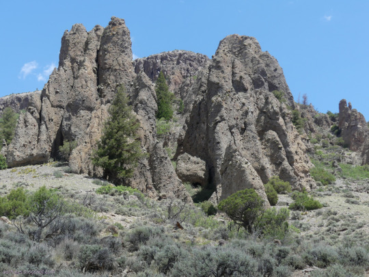


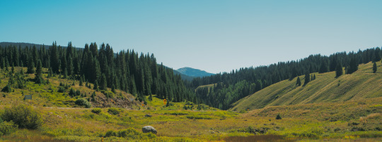
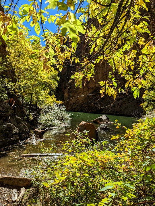
Curecanti National Recreation Area, Colorado.
The Dillon Pinnacles was the hike I needed -- it includes explanations of the geology.
#hiking#day hike#Curcanti National Recreation Area#Colorado#Dillon Pinnacles#pinnacles#nature#geology#outside#landscape#travel#hike#Curecanti
0 notes
Text
Day 6
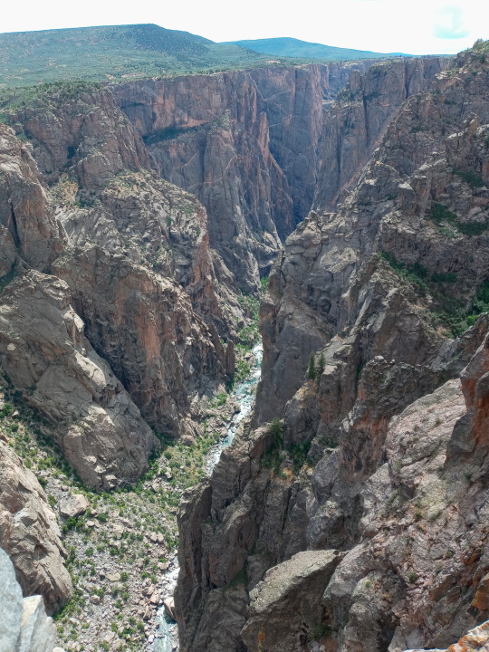
My next stop was just a few hours north, Black Canyon of the Gunnison National Park. Unfortunately, they were all booked up for camping, so I stayed at the local KOA, which consists of a bunch of people sitting outside their camper, watching you. I booked here specifically because they had a pool, which is really great physical therapy for most people with a connective tissue disorder. So far on this trip, my health has held up generally well; I definitely can attribute being able to do this at all to a medication I got on in May. For the last few years, I have been on any number of pain medicines and have had absolutely none of them be affective whatsoever (I’m lookin’ at you, emergency room morphine!) I may as well have been eating Smarties. This isn’t all together uncommon with hEDS/HSD; most people either have absorbency/metabolism issues that render certain medicines useless, and/or they are prescribed ineffective medicines because a lot of doctors know very little about it. This medicine that’s made a world of difference for me, unfortunately has some draw backs/side effects that can be devastating at times. In fact, just a few weeks ago they landed me in the emergency room where they told me I had a viral infection in my abdomen or bowels and couldn’t do anything about it. It wasn’t for another week my PCP casually and easily knew it was a side effect of my new meds. Honestly, I can’t get off of them at this point. This trip wouldn’t be possible. Do you choose evil or some evil?
So, these few days of the trip have been like Fear and Loathing in Colorado; driving around poppin’ anti-diarrheal and pain meds, swerving around suicidal marmots. Black Canyon of the Gunnison surprised me – it is stunning! Deep and dark, it’s narrow at the bottom, jagged throughout, and wide at the top. The sound of the river from the rim is impressive knowing you’re thousands of feet above it. The walls fall an average of 95 feet per mile, meaning at the bottom, where the Gunnison River cuts through creating the canyon, the walls at The Narrows are only 40 feet wide. This dramatic canyon is a hidden gem of the park service. I heard a ranger say she hopes it stay that way, and I couldn’t agree more.
Shout out to Ranger Randy, who I spoke with for a while. He’s worked at over 20 parks in his time and was just as friendly as can be. I love meeting a ranger who really, truly cares about what they do. With Randy, I earned my Junior Ranger Badge!

This one is dedicated to Husband, who doesn’t like to be on the internet. We are coming up on our anniversary of 20 years together, 15 years married. He has unabashedly supported my fundraiser; in fact, pretty much unabashedly supports everything I do (except that time he didn’t think I could build a full blown Skeksis Halloween costume from The Dark Crystal in 21 days. Ha, proved ya wrong, buuuuddy. Don’t tell me what I can’t do!). So, thanks for being the very best thing in the world and being the most massive support through this rocky chronic illness journey I’ve been on. I literally couldn’t have done it without you.
I did a few hikes to various over looks, but it was getting hot so I couldn’t do longer hikes. Heat intolerance is a real jerk. But the views were amazing!
Since I couldn’t do any long hikes in the heat, I decided to head to the Museum of the Mountain West down the road, outside of the park. When Richard Fike was just 4 years old, he collected his first memorabilia; a clock which you can see at the museum. When he was only 8, he opened his first museum in his parent’s guest room.
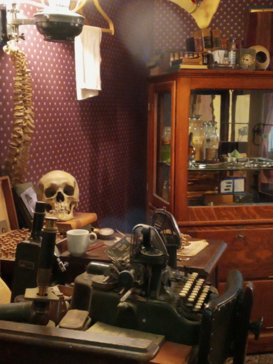
He continued gathering artifacts as he became an archeologist focusing on items excavated from outhouses. This was interesting because I’ve studied the Wild West and the Victorian Age a lot as an author, and I never considered how people threw things away; I assumed they burned them, but many just through stuff into the outhouse pit.
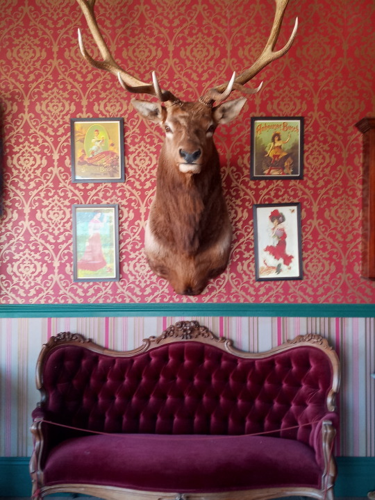
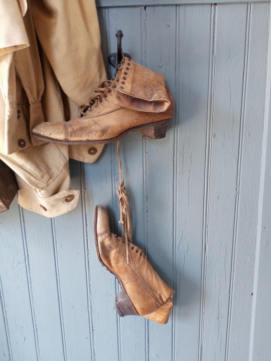
His extreme and unmatched dedication to collecting is beyond evident in his museum, founded in 1997. The indoor portion is impeccable; a collection like nothing I’ve seen, and painstakingly detailed in its exhibition. I’ve always wanted a pair of Victorian shoes, and I suppose I’ve never been able to find any because Fike has them all in his museum.
There is a massive outdoor portion akin to Old Trail Town and Four Mile Town, though of higher quality. The saloon is a standout room, as well as the house.
Thanks to modern medicine, I decided I should try to get one more Junior Ranger badge in at Curecanti National Recreation Area, east of the canyon. The Gunnison River cuts through creating manmade lakes backed by painted desert hills and pinnacles. The ranger there was the opposite of Ranger Randy, and my badge will have to be mailed to me.
Preemptively, I dedicate this badge we can’t quite see yet to the donors who have chosen to remain anonymous. You may be strangers, you may be people close to me that I love dearly, but you have really accounted for so much of my total so far. Thank you, for your kindness that goes silent through the wires. The Ehlers-Danlos Society recently made a $400,000 donation to fund the genetic research for hEDS. When I saw that, that’s when I knew I wanted to try to raise funds for them somehow; to be a part of the most historic move for this condition. There are 13 types of EDS, and Hypermobile type (hEDS/HSD) is the ONLY one without an understood genetic marker. This research, being done in the Carolina’s, has cracked the edge of the code for the first time in history. This means with more funding and research the genetic markers can be found to detect it as early as in the womb. People will not have to wait 50 years for a diagnosis anymore! So, anonymous donors, your money is SO important to reducing future suffering.
Thank you, everyone. Talk to you soon,
Haylan
#hypermobility spectrum disorder#hEDS#HSD#ehlers danlos awareness#ehlers danlos society#ehlers danlos life#ehlers danlos#chronic illness#black canyon of the gunnison national park#black canyon#black canyon of the gunnison#national parks#curecanti#museum#museum of the mountain west#fundraiser#charity#road trip for a cause
1 note
·
View note
Text
0 notes
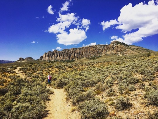
Text


Curecanti National Recreation Area, Colorado 2023
25 notes
·
View notes
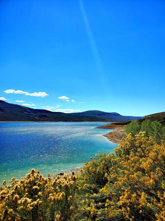
Photo
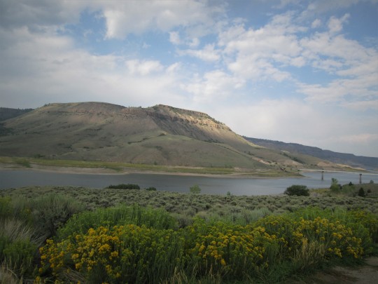
Curecanti National Recreation Area, Colorado
August, 2021
#nature#flowers#landscape#colorado#photography#nps#landscape photography#nature photography#original photography#photographers on tumblr#lensblr#my pics
20 notes
·
View notes
Text
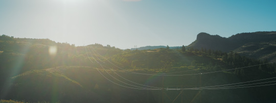
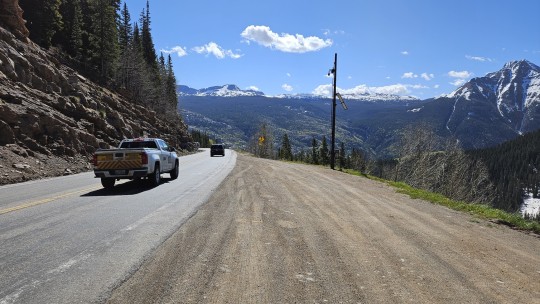
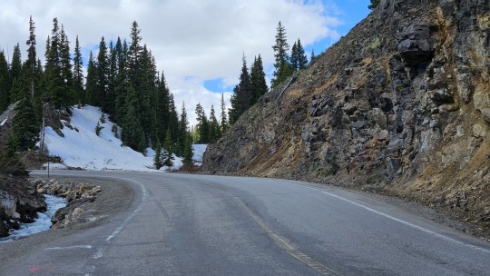
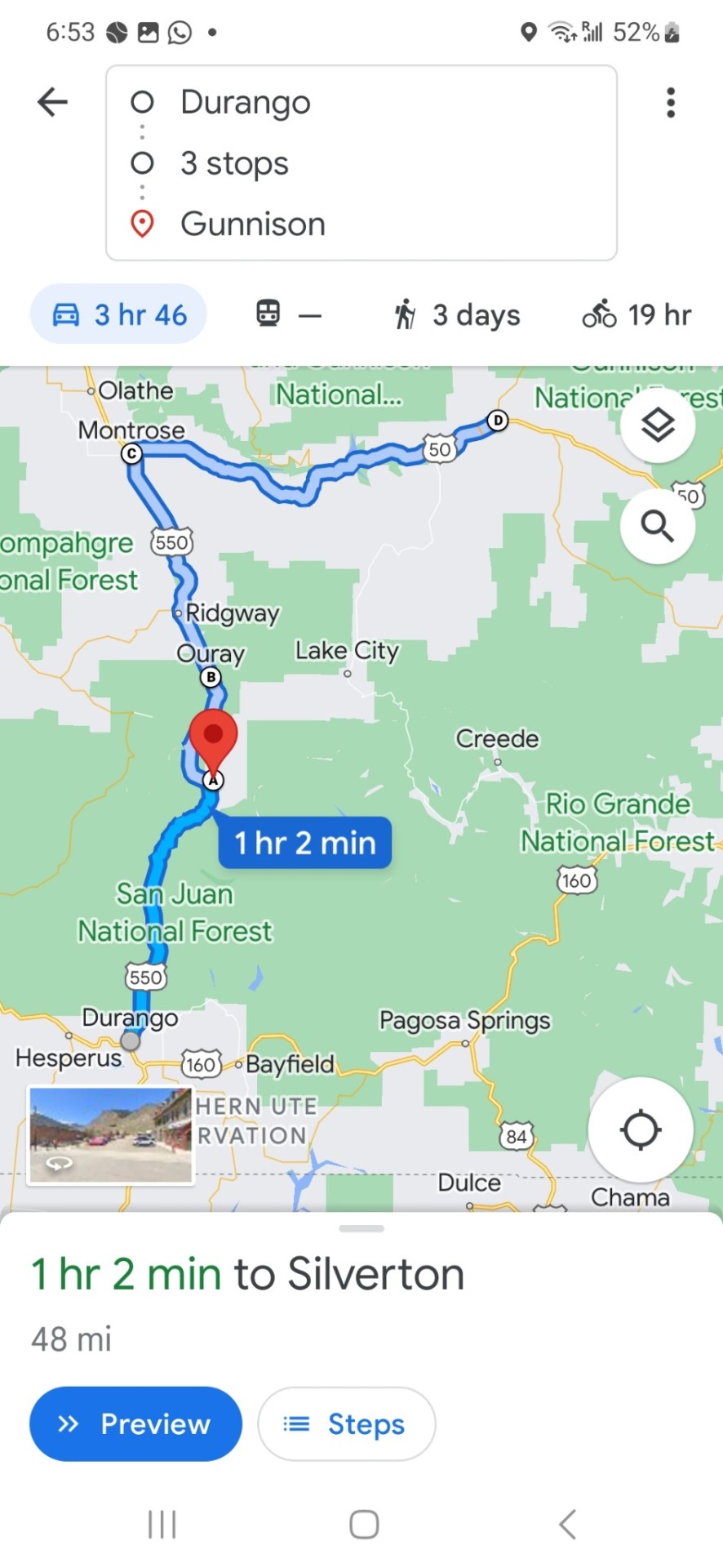
Day 13, Thursday June 8: Durango to Silverton to Ouray to Montrose via Hwy 550, then via 50 to Gunnison. 330 km
I'll be riding over the San Juan Mountains via the Million Dollar Highway today. At 6,522 ft, the road from Durango is a typical river valley, lush and green farms and ranches on the right and on the left, red hilltops, stained by the iron in the soil.
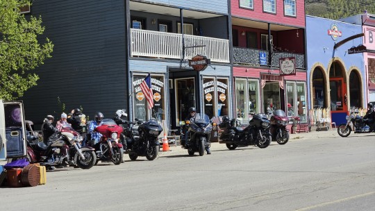
As I start the climb to Silverton (9,318', pop 651), the air gets typically cooler, the hills turn to mountains, and the scenery from lush to spectacular. Silverton was a booming silver mining area back in 1860 but is now mostly a cute and charming tourist town that lays claim to the world's highest Harley Davidson shop.
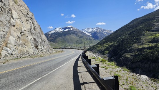
From Silverton, I pick up the section of Hwy 550 known as the Million Dollar Highway. Although the name could legitimately be attributed to the views, it actually stems from the cost. Originally constructed as a toll road by Otto Mears in 1883 to transport minerals, it was to rebuilt in the early 1920s at a purported cost of one million dollars per mile. Its twists, winds, climbs, and descents are both an engineering marvel and a dream to ride. To enable the snow plows to clear all the snow, much of the route has no guardrails, which partially explains why it has also been called America's most dangerous highway. It's also a long way down. Between Silverton and Ouray, I ride over the red mountain pass at 11,018'.
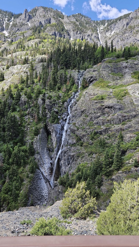
Ouray (7,792', pop 921) was once home to over 30 active mines. Today, its climate, natural alpine environment, and scenery have earned it the nickname "Switzerland of America".
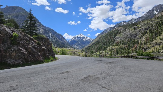
My final leg of Hwy 550 takes me north to Montrose (5,807', pop 20,648), the county seat of Montrose County. Back down from the mountains, it's essentially lower, flatter, hotter, and dryer.
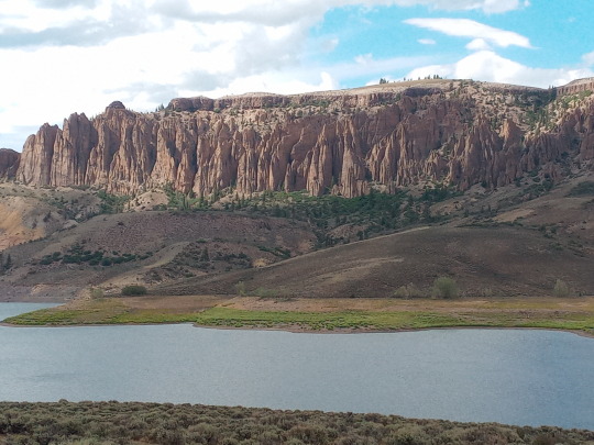
But not for long. As I head east on Hwy 50 towards Gunnison (7,703', pop 6,695) I climb up through the natural playgrounds for fishing, skiing, hiking, biking, motocross, boating and rock climbing, for which this area is known including the Gunnison River, Tomichi Creek and Blue Mesa Reservoir, Curecanti National Recreation Area, Tomichi State Wildlife Area, Sapinero State Wildlife Area, McIntosh State Wildlife Area, and Hartman Rocks.
It's been a short but taxing ride and a long day. Luckily, my hotel has a hot tub, so a long spell there, followed by a couple of local craft beers, I think I see an early bedtime in my future.


2 notes
·
View notes
Video
youtube
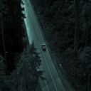
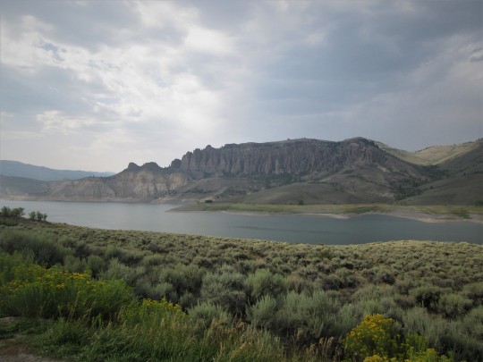
BLUE MESA DAM & RESERVOIR - GUNNISON - COLORADO
Le réservoir Blue Mesa est un lac de barrage situé dans le comté de Gunnison, au Colorado. Situé à 2292 mètres d'altitude sur le cours de la Gunnison, en amont du réservoir Morrow Point, il a été créé par le barrage Blue Mesa. Il est protégé au sein de la Curecanti National Recreation Area.
Ce magnifique lac aux eaux turquoises est propice à la pratique de plusieurs sports nautiques.
Si vous désirez obtenir plus d'informations à propos de ce parc, je vous invite à visiter ce site web:
https://www.nps.gov/cure/index.htm
***************
AUTRES VIDÉOS DE CE ROAD TRIP:
https://www.youtube.com/playlist?list=PLlRroQCNvchsdvRQOTUATm7OU6BabhYIF
ABONNEZ-VOUS ► https://www.youtube.com/c/SouthAngelVideo?sub_confirmation=1
SUIVEZ NOUS :
• BLOGGER ► http://southangelvideo.blogspot.ca/
• INSTAGRAM ► https://www.instagram.com/annestrasbourg/
• FLICKR ► http://www.flickr.com/photos/anne_strasbourg/collections/
• TWITTER ► https://twitter.com/AnneStrasbourg
2 notes
·
View notes
Text
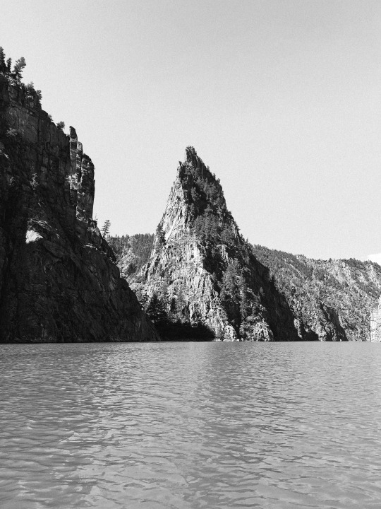
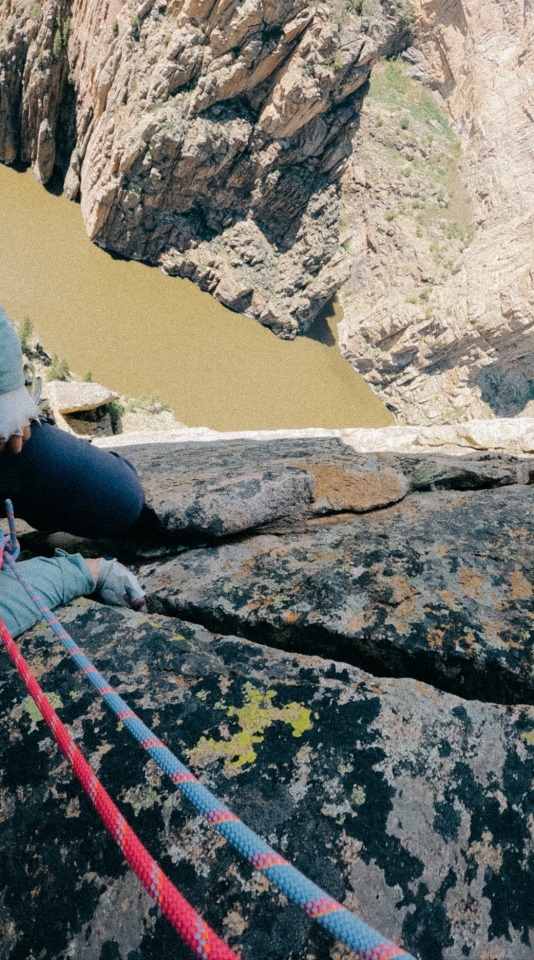
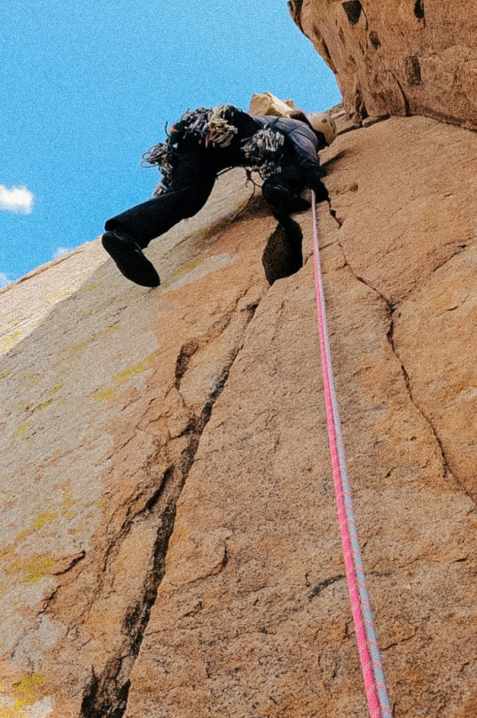

Curecanti Needle, Northwest Rib
#blackcanyon#climbing#rockclimbing#gunnison#colorado#curecantineedle#rafting#adventure#wanderlust#travel#tradisrad
1 note
·
View note
Text
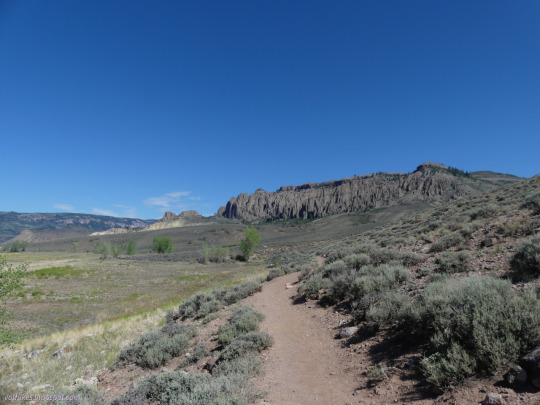
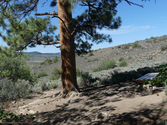
Curecanti Creek Trail - near Sapinero, CO
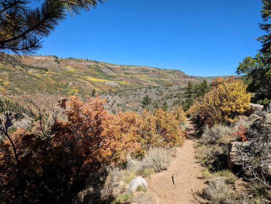
This is one of our favorite hikes to do when we come to Blue Mesa. It is only around 3 miles roundtrip, but it is different every time depending upon the water level in the creek. We had a beautiful fall day to hike the canyon. The hike takes you from the rim at Pioneer Point down to the river - the water wasn’t roaring today, but it was still spectacular. Recommend adding this one to your itinerary if you are in the area.


0 notes
Conversation
U.S. Daily Snowfall Records Tied/Broken 12/28/22
Unincorporated Yukon-Koyukuk Census Area, Alaska: 2.01" (previous record 0.71" 2001)
Flagstaff, Arizona: 11.42" (previous record 10.98" 1936)
Curecanti National Recreation Area, Colorado: 5.71" (previous record 2.52" 1970)
Unincorporated La Plata County, Colorado: 1' 0.99" (previous record 5.98" 2021)
Unincorporated Hill County, Montana: 5.51" (previous record 5" 2006)
Alta, Utah: 1' 10.99" (previous record 1' 0.01" 1948)
Bountiful, Utah: 3.7" (previous record 2.28" 2012)
Brighton, Utah: 1' 4.18" (previous record 1" 2.02" 1936)
Unincorporated San Juan County, Utah: 7.09" (previous record 4.21" 2020)
Uinta National Forest, Utah: 5.51" (previous record 3.7" 2021)
#Storms#Winter#U.S.A.#U.S.#Colorado#1970s#Utah#1940s#1930s#Alaska#Arizona#Montana#Crazy Things#Awesome
0 notes
Text
Mount Crested Butte, Colorado, USA

Mount Crested Butte's 3,709-metre-high snow-covered peak glimmers in the dark in today's homepage image. The prominent summit is in the Elk Mountains in western Colorado in the United States, perched over the quaint 1880s mining town of Crested Butte. Known as Colorado’s last great ski town, this is a place where skiers and snowboarders come to access Crested Butte Mountain Resort’s terrain. Visitors can also take part in Nordic skiing, snowmobiling and snowshoeing.
Mount Crested Butte is also a popular summer destination for keen mountain bikers – there’s more than a thousand kilometres of mountain biking trails that wind through wildflower-filled meadows. In fact, Mount Crested Butte is also known as the wildflower capital of Colorado. For something a little more laid back, there’s hiking in alpine and aspen forests, fishing in pristine rivers, lakes and streams, and water sports on Colorado’s largest lake, the Blue Mesa, part of Curecanti National Recreation Area. And if that’s not enough excitement, you can also experience the Adventure Centre's miniature golf, climbing wall and bungee jumping.
0 notes
Text
Final steps for crucial preservation of over 400,000 acres in Colorado
Final steps for crucial preservation of over 400,000 acres in Colorado
The Colorado Outdoor Recreation and Economy Act includes four measures — the Continental Divide Recreation, Wilderness, and Camp Hale Legacy Act; the San Juan Mountains Wilderness Act; the Thompson Divide Withdrawal and Protection Act; and the Curecanti National Recreation Area Boundary Establishment Act — that will protect over 400,000 acres in Colorado through new wilderness, recreation and…

View On WordPress
0 notes
Photo

Like pages in a book, the rock layers of Black Canyon and Curecanti National Recreation Area in Colorado tell a story of past environments, ancient animals, and dynamic processes of geologic change.
At the rate of about one inch per every 100 years, the Gunnison River has slowly worked its way through the resistant rock layers, forming the narrow, steep-sided Black Canyon and Curecanti. Only a high volume, high-velocity river like the Gunnison could produce such a breath-taking canyon!
Photo courtesy of Sophie Bechara
349 notes
·
View notes
Photo

We are getting way behind on posts so here are some pictures from Hartman Rocks and Blue Mesa Reservoir and Steven Creek Campground. This was home base for several nights while we explored Gunnison and Crested Butte. Only problem, no cell coverage for ATT or Verizon. Solar panels worked great though. Our rig was too big to stay at Hartman Rocks, but we drove the Cherokee around and took several forest roads all around Crested Butte. Pics to follow soon. . . #curecantirecreationarea #hartmanrocks #gunnison #curecanti #bluemesa #fallingbehind https://www.instagram.com/p/CDcvjvSJrzZ/?igshid=da6yd7r1pe9u
0 notes
Photo

#Colorado#labordayweekend#curecanti#national recreation area#gunnison#black canyon of the gunnison#wanderlust#adventure#hiking#camping#nature
43 notes
·
View notes
Photo
Gunnison River, Curecanti Natl. Recreation Area, Colorado USA [OC] 4032X3024 via /r/EarthPorn https://ift.tt/3ew7MiO
1 note
·
View note
Last Seen Blogs