#jostedal
Text
Jostedalsrypa
or The Grouse of Jostedal
As a child obsessed with the plague and disease, Jostedalsrypa was always one of my favourite tales. The utter devastation of society, as well as a girl turned wild bird, really caught my imagination.
Although the real Jostedal was not wiped out during the Black Death, Norway as a whole was devastated. Many towns and farms were entirely abandoned, and some farms remained empty for around 300 years.
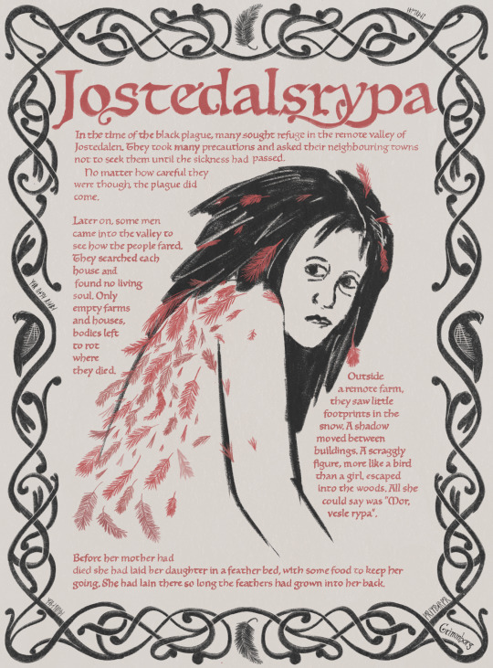
In the time of the black plague, many sought refuge in the remote valley of Jostedalen. They took many precautions and asked their neighbouring towns not to seek them until the sickness had passed. No matter how careful they were though, the plague did come.
Later on, some men came into the valley to see how the people fared. They searched each house and
found no living soul. Only empty farms and houses, bodies left to rot where they died.
Outside a remote farm, they saw little footprints in the snow. A shadow moved between buildings. A scraggly figure, more like a bird than a girl, escaped into the woods. All she could say was "Mor, vesle rypa".
Before her mother had died she had laid her daughter in a feather bed, with some food to keep her going. She had lain there so long the feathers had grown into her back.
#black death#jostedalsrypa#plague#middle ages#fairy tale#my art#runes#norwegian history#can the name rjupa/rypa please make a comeback#also yes i left out the ending bc thats just family legend building and idc about that lol#ptarmigan#grouse
15 notes
·
View notes

Text
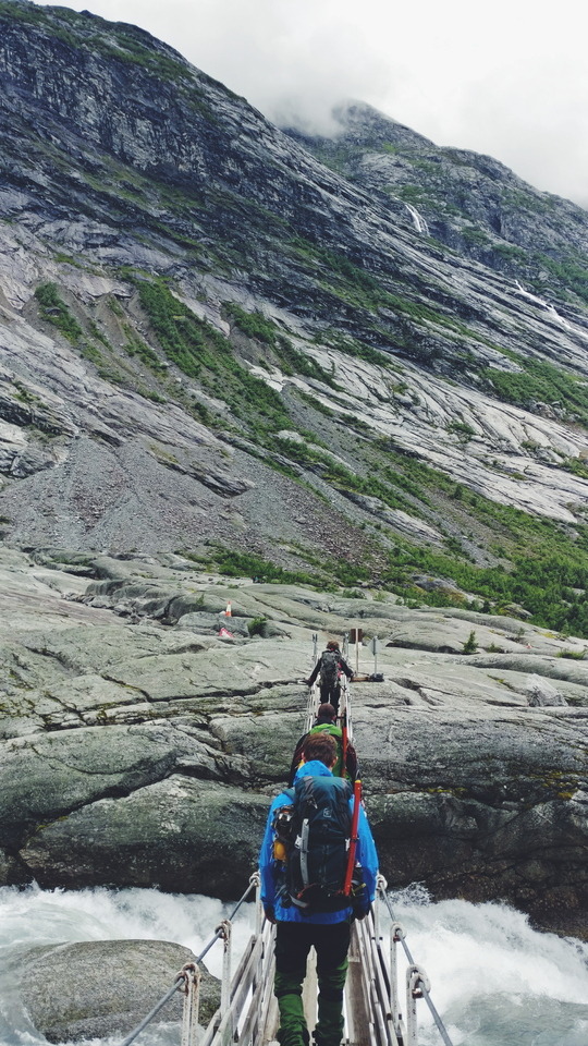
Norway Fjords Road Trip (3 of 3)
Part III: Geiranger, Trollstigen, Andalsnes/Romsdalseggen Ridge
Day 7: Scenic Drive to Geiranger
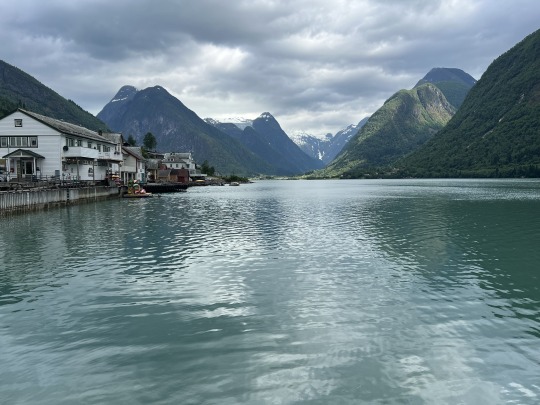
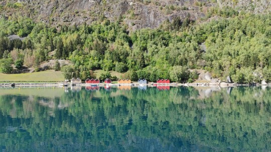
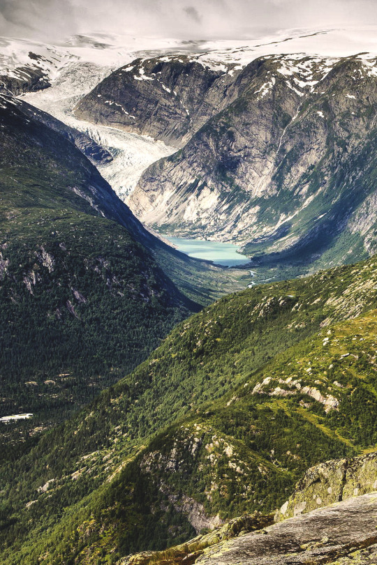
Fjaerlandfjord in the morning
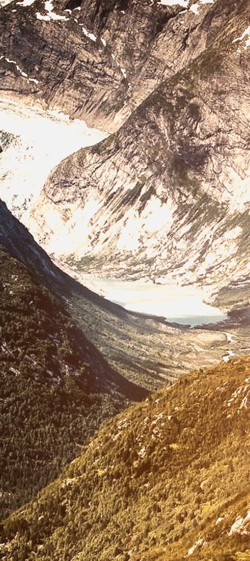
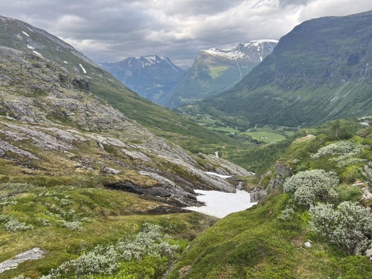
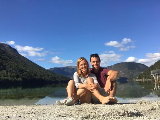
The drive from Fjaerland to Geiranger is one of the most beautiful drives we have ever been on. We saw so many different types of scenery: fjords, lakes, lush valleys, snow-capped mountains, glaciers. In my opinion, it was even more beautiful than driving Going to the Sun Road (the main road) and the Grinnell Glacier Hike (one of my favorite hikes of all time) in Glacier National Park – and that is saying a lot! If we could, we would have budgeted more time to spend in Fjaerland and some of the towns along the drive to enjoy the views, hikes, and water activities.
10:45 AM – Checked out of Fjaerland Fjordstove Hotell.
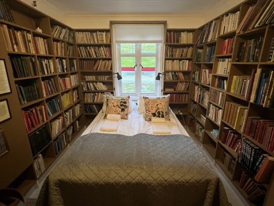
Our hotel room
Logistical note: Like Hotel Ullensvang, Fjaerland Fjordstove Hotell is on a beautiful fjord, but this hotel was significantly less nice for a similar price. The room was so small we could barely move and there were very few amenities (no A/C, refrigerator, or tea/coffee in the room, limited outdoor seating on the fjord). We stayed at a similar (probably somewhat nicer) B&B in Picton, New Zealand – which is on the beautiful Marlborough Sound, not dissimilar to the Norwegian fjords – a few years ago for ¼ of the price. Even accounting for inflation, the Norway version was comparatively very expensive. Still, there are limited options to stay in the area and it was one of our favorite areas of the trip.
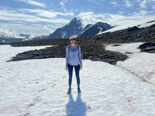
11 AM – Tried the Mundal Valley Hike (~3 min drive from our hotel). I think it would have been great to do a hike in the area, but we were initially confused about where this hike started (it was not well marked) and once we figured it out, the hike did not seem that impressive so we turned back after a little bit.
There was a helpful information booth just across the street from the Mundal Hotel with a written description (in English, yay!) of activities in the area, including a bunch of hikes. There were a few other hikes that looked really nice but were longer / more strenuous. Next time we’d try to book a hike (such as the Nesabraugen Mountain Hike or the overnight excursion to Besshovden) or other activity in advance through Fjaerland Guiding.
Fjaerland also seemed to have a bunch of other nice things to do that we’d love to explore more next time:
It’s apparently a “book town” with >60k books spread across many different book shops
There is a glacier museum (~$15 pp) that our B&B told us has a really good video about glaciers
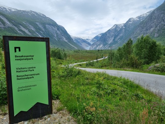
You can see and/or walk on glaciers, like the massive Jostedalsbreen Glacier
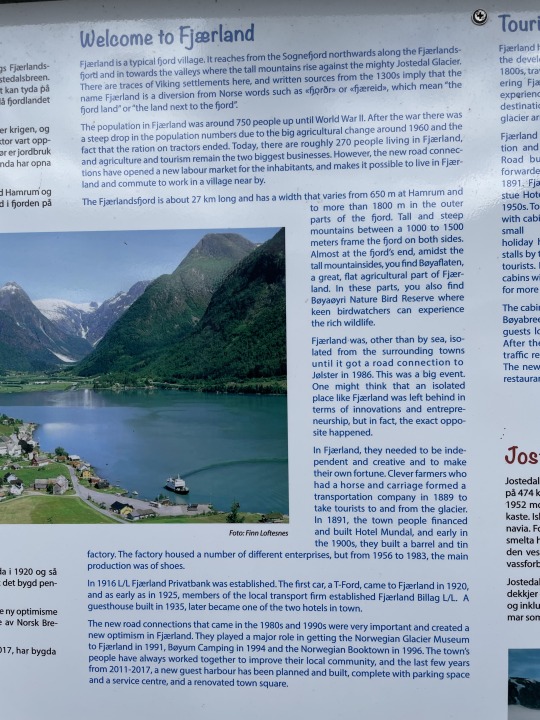
Some info about Fjaerland
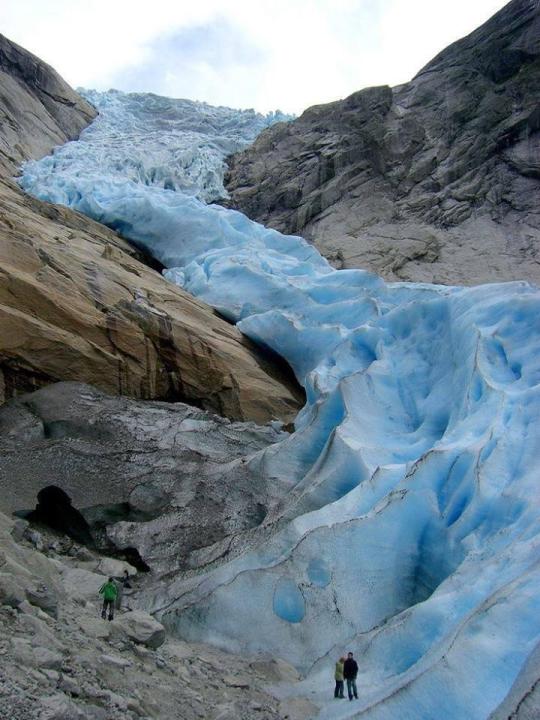
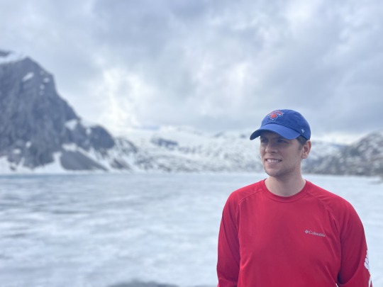
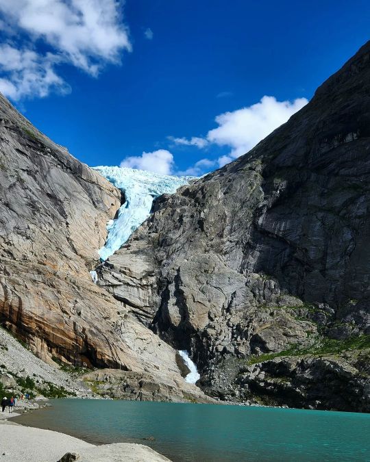
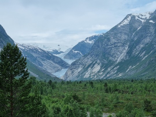
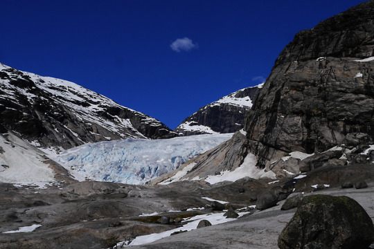
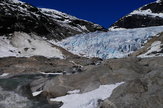
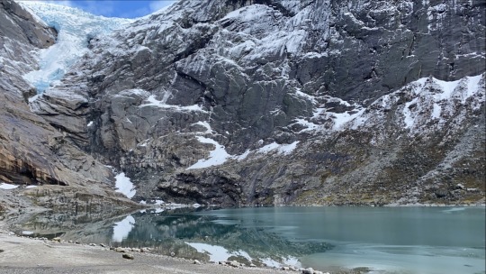
11:30 AM – Stopped by the fabulous Boyabreen Viewpoint. This is a view of part of the Jostedalsbreen Glacier and it genuinely made my jaw drop. It’s a bit reminiscent of a glacier I saw on the road from Banff to Jasper National Park, but even more awesome.
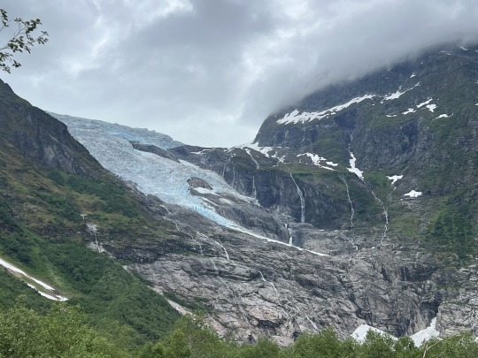
Photos definitely don’t do this glacier justice. It was incredible to see in person.
Logistical note: If you go here, drive past the first parking lot; there is a second parking lot closer to the glacier. There are also picnic benches and a cafe in the area. It’s cold, so dress warmly!
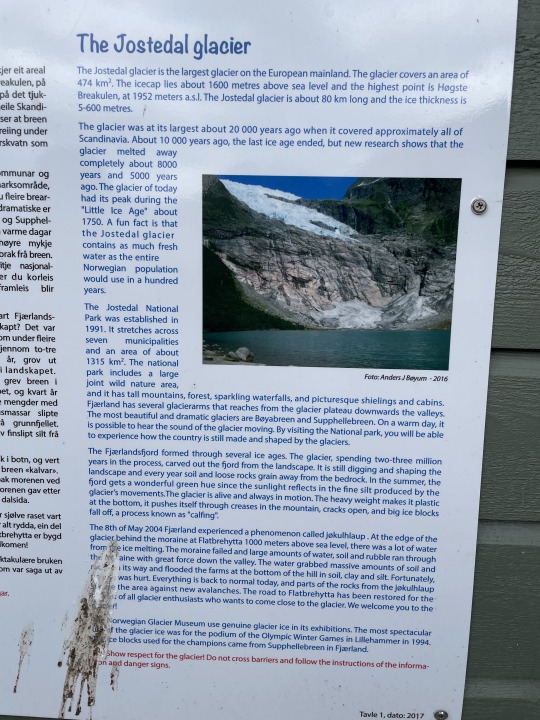
Some info about the Jostedal Glacier, of which Boyabreen is a part.
The rest of the afternoon was spent driving along various fjords and lakes en route to Geiranger. Some things I’d want to do for next time:
Hike in Jostedalsbreen National Park (would need to do more research on which hikes)
Stay at the Olden Fjordhotel – it’s right on one of the most scenic fjords we saw. The hotel seems to have great reviews and it looked like such a pretty place to kayak!
Do the Skalatarnet hike from Loen – this seems like a very difficult hike (6k meters elevation gain) and we read that it is recommended to stay in a cabin overnight at the top – this needs to be booked in advance.
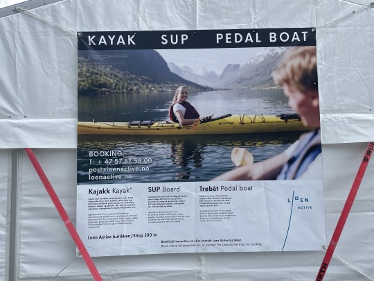
Other activities – there were lots of pretty spots to kayak in these small towns, and we saw people paragliding in Loen. Loen also has a cable car that goes extremely high (~$60 pp) – this might appeal to folks who are less mobile and aren’t able to do hikes that provide similar views.

Info about local activities
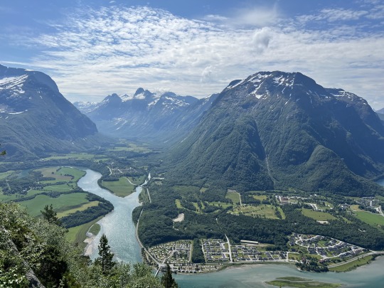
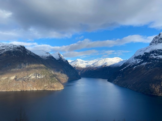
~4:30 PM – Arrive in Geiranger. This is another very touristy town, but I liked it more than Flam. It’s a bit larger and feels a bit more “real” than Flam, and the drive to Geiranger is truly stunning.
You go up through snow-capped mountains and then steeply down into a beautiful valley in which Geiranger is nestled. The drive in the mountains is like nothing I’ve ever seen before, and the drive down reminded us a bit of the beautiful drive down to Queenstown, New Zealand. We thought it was even more beautiful than the famed drive down Trollstigen.
We stayed at Hotel Utsikten in Geiranger, which was a bit of an upgrade from the Fjaerland B&B.
To get a few steps in, we tried the very short (~20 min) Waterfall Walk. The walk starts at the town center and ends at the Norwegian Fjord Center. Signposts clearly mark the path, which takes you up ~330 stairs to the top of the waterfall. It was a good pre-dinner walk to work up a bit of an appetite after a day spent mostly driving.

Overlooking Geiranger from the waterfall walk
The vegetarian dinner options in Geiranger were a bit disappointing, but we made do with vegetable pizza (we went to Restaurant Olebuda aka Cafe Ule, but several places offered this).
Day 8: Geiranger & Trollstigen
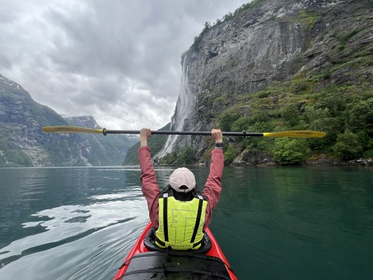
We started the day doing a 3-hour kayak rental with Active Geiranger (990 NOK, we didn’t come across less expensive kayak options elsewhere). They did a great job explaining everything to us and even gave us skirts to wear that fit over the kayak to keep our legs dry (typical practical Norway, we loved it!). Over ~10 km out and back on the water, we saw several beautiful waterfalls.
Given the sad vegetarian food options in town, we made peanut butter sandwiches and set off on the ~2 hour drive to the start of Trollstigen, one of the most famous drives in Norway due to its iconic hairpin turns (though by the time we got there, we had already been on a number of drives with hairpin turns). This was another beautiful scenic drive, and the route also involves a ferry that seems to come every ~30 minutes.
On the drive to Trollstigen
At the top (beginning) of Trollstigen, we parked at the visitor center for a bathroom break and a short walk to some beautiful views (parking appeared to be free). From here there are also options to walk uphill on a 1 km or 5 km (each way) route for more views – if you want to do that, hiking shoes and water will be helpful.

View of Trollstigen from the visitor center
Then we did the ~20 minute drive down Trollstigen, and from there another ~20 minute drive to our hotel in Andalsnes. Lucky for us, Andalsnes has a Thai restaurant, so were able to get some tofu and vegetables for dinner.
Day 9: Andalsnes & Romsdalseggen Ridge
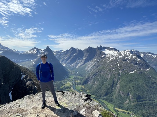
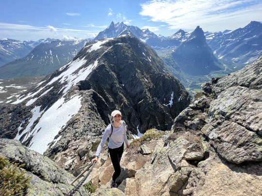
Romsdalseggen Ridge was perhaps the most epic, and most exhausting, hike of our trip.
It’s typically done as a one-way hike that’s just under 7 miles / ~4k feet elevation gain – more elevation than any of the other hikes we did in Norway. Overall, the hike took us ~5 hours with no stops.
Earthtrekkers wrote that their 8 year old daughter cried on this hike when they did it in 2013. Even though they note that this hike is not recommended for kids under the age of 10, their kids have done some very impressive hikes, so I took this seriously. It did not take me long to see why she was crying. After the first mile of the hike, which was relentlessly uphill under a beating hot sun, my calves were crying. Over the next 2 miles, in which you climb nearly vertically through boulder fields (great if you love rock scrambling), and at times really need to watch your step to not step off a cliff on either side, my brain was crying.
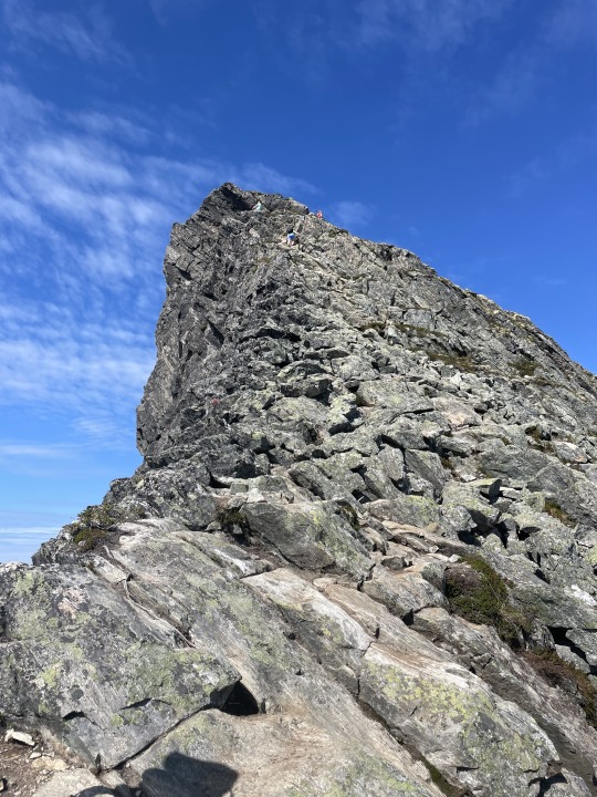
We somehow made it up this pile of rocks (you can see humans at the top if you look closely!)...
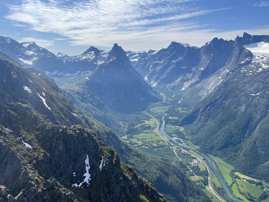
For this epic view!
On the way down, we passed the Andalsnes cable car and then went downhill through a nondescript forest with minimal views for ages – it felt like the opposite of Florli 4444 (so many steps!).
The views, however, were totally worth it. I am so glad we did it.
Logistics:
When & where to hike: The Romsdalseggen Ridge hike typically opens in June (depending on the weather/snow conditions). We weren’t sure if it would be open by the time we got there, so as a backup we were planning to hike to Rampestreken, a viewpoint you pass on the way down from the Romsdalseggen Ridge hike. Since the Romsdalseggen Ridge descent encompasses the Rampestreken hike, we saw it and wouldn’t necessarily recommend it – the Rampestreken hike is relentlessly uphill with minimal views until the viewpoint, and even then you’ll get more of a view if you just take the Andalsnes cable car (which goes a bit higher than the viewpoint). So if Romsdalseggen Ridge is closed, the cable car might be a nicer option.
How to get there: The Romsdalseggen Ridge hike starts from a parking lot that is a ~15 minute drive from the Andalsnes city center. There is a shuttle bus that leaves at 9am and 10am from the city center (250 NOK pp) – I believe you can book a spot on it online. Our hotel, the Grand Hotel, also arranged a small van transport leaving directly from the hotel for the same price, and we were able to book spots on it when we arrived in Andalsnes the evening before our hike. The hike ends in Andalsnes, so it was just a ~3 minute walk from the end of the trail to our hotel. Note: The Rampestreken hike starts at the same spot that the Romsdalseggen Ridge hike ends, and there is a fairly sizeable parking lot just a block from there. We don’t think it would make sense to start the Romsdalseggen Ridge hike from here (and end at the parking lot on the other side) because the descent on the other side – going straight down boulder fields – seems dangerous.
Restrooms: The parking lot where the Romsdalseggen Ridge hike starts does have a bathroom. There was a long line for it and it was less nice than any other hike bathrooms we saw, but it was still clean (this is Norway, after all).
After hiking Romsdalseggen Ridge, we drove ~90 minutes to Alesund, where we spent our last night in Norway.
Day 10: Alesund
Trolling
We didn’t really do anything in Alesund. We got to our hotel room at the Scandic Parken downtown around 5pm and flopped down in our room for a bit, exhausted from the hike. A few dinner spots that looked decently vegetarian friendly, and the Asian grocery store (our potential tofu source) closed by 6pm on Saturday, so we tried pasta and pizza at Cinque Minuti, which turned out to be a disappointing Italian restaurant.
Note: Street parking is free in downtown Alesund outside of 8am-4pm, and on Sundays. Even though we arrived on Saturday evening, it was easy to find a spot.
In the morning we woke up early and drove to Alesund Airport – an easy 15-20 minute drive that is mostly on one road. We dropped off our rental car in the outdoor Hertz parking lot and left our keys in their indoor dropbox as the Hertz office was closed.
For anyone thinking about a similar trip, it’s worth noting that the one-way Hertz car rental from Bergen to Alesund incurred a ~6,000 NOK (~$600) extra dropoff fee, which nearly doubled the entire cost of the 6-day car rental. While we knew one-way car rentals are typically more expensive than roundtrip rentals, this was far more expensive than we’ve seen elsewhere.
Driving in Norway
We found driving in Norway to be a bit different than other places we’ve been in several ways. This included more difficult/narrow roads, unfamiliar road signage and rules, more punitive speeding fines, prevalent tolls and parking fees, and issues with Google Maps.
Difficult roads: Most roads are one lane in each direction, and it’s rare for an extra lane to open up for overtaking a slow driver. Many roads are so narrow that they look like they can barely fit 2 cars. There are hairpin turns galore. You really need to be paying attention and driving carefully.
Unfamiliar road rules & signage: It’s illegal to turn right on red (not that we encountered many traffic lights, given the proliferation of roundabouts). There are default speed limits for the countryside (80 km/hr) and the city (50 km/hr) and you’ll typically see a speed limit sign only in areas where the speed limit is lower; once that zone ends there will be a sign with that lower speed limit crossed out (at which point you can revert to the default speed limit).
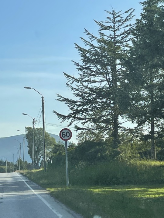
Meaning “the speed limit is down to 60 (from the regular 80 km/h) from here on out”
We also sometimes saw a yellow triangle sign, which apparently means you are on the road that has the right of way (vs. other roads that may converge / turn onto the road you are on).

Meaning “the 60 speed limit is over, go back to the default 80 in the countryside. Oh and also road 65B has the right of way here.”
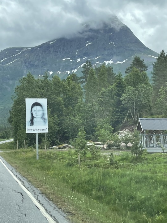
Last but not least, my favorite road sign was a reminder to abide by the speed (or as they say in Norwegian, “farts”) limit – thankfully not, as we initially thought, an Amber Alert/“face on the milk carton”-style sign for a missing child.

Speeding fines: We read that speeding fines are hefty (hundreds to thousands of dollars) if you’re caught going >3 km/hr over the speed limit. Fortunately, there seem to be road signs that warn you just before you pass speed cameras, and our understanding is that the police are less into trying to issue speeding tickets than in the U.S. (maybe they’re less needed when you have a massive sovereign wealth fund…).
Parking: Most, but not all, parking was paid, and we usually paid at a parking machine when we were leaving (the exception was at Kjeragbolten, where we paid when we arrived). You just input your license plate number and then it charges you based on the time you spent parked in the parking lot.
Tolls: Most tolls were charged automatically to our rental car bill without any action on our part, with the exception of Trolltunga where we paid a 200 NOK toll at a parking machine on the drive up.
Google Maps: The Google Maps app frequently got confused – usually when we were going through tunnels – and would incorrectly change the route mid-drive. It was important for us to carefully review directions before starting on a drive, and it was also useful to screenshot the directions at the start of the drive in case anything went wrong with them during the drive. That said, we did have cell phone reception (though it was sometimes slow) almost everywhere we went.
A Few Last Logistical Tips
Gas: Our first rental car took diesel, which I’d never heard of for a non-truck. We only knew this because Hertz happened to mention it. Our second rental car took regular petrol.
Gas Stations: Most unmanned gas stations only took a credit card with a PIN (credit cards without a PIN were declined) or a debit card (the exchange rate was a little bit worse than using credit). In this situation, one can use a debit card or pay inside at a manned gas station.
0 notes
Photo
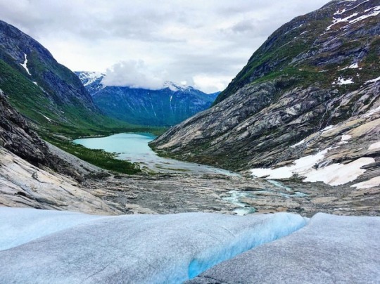
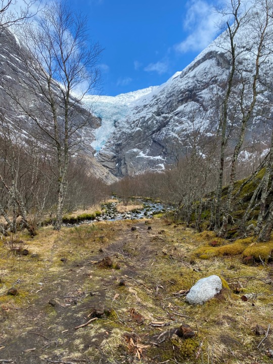
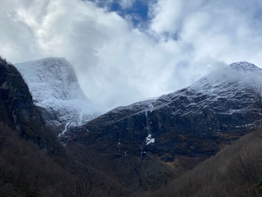
Jostedal Glacier or Jostedalsbreen is the largest glacier in continental Europe located in the western Norway. The glacier is covering over 500 square km and is up to 600 m deep and was established for 2000 years ago. Here is Briksdal Glacier (Briksdalbreen) which is one of the most accessible and best known arms of the Jostedal Glacier. #jostedalsbreen #norway #norway🇳🇴 #photooftheday #photo #photography #landscapelovers #landscape #nature #naturephotography #naturelovers https://www.instagram.com/p/Chy65matQQH/?igshid=NGJjMDIxMWI=
#jostedalsbreen#norway#norway🇳🇴#photooftheday#photo#photography#landscapelovers#landscape#nature#naturephotography#naturelovers
0 notes
Text
Dag 13 - 1 juli
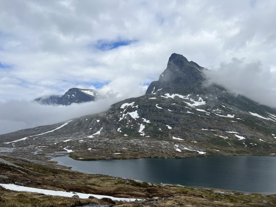
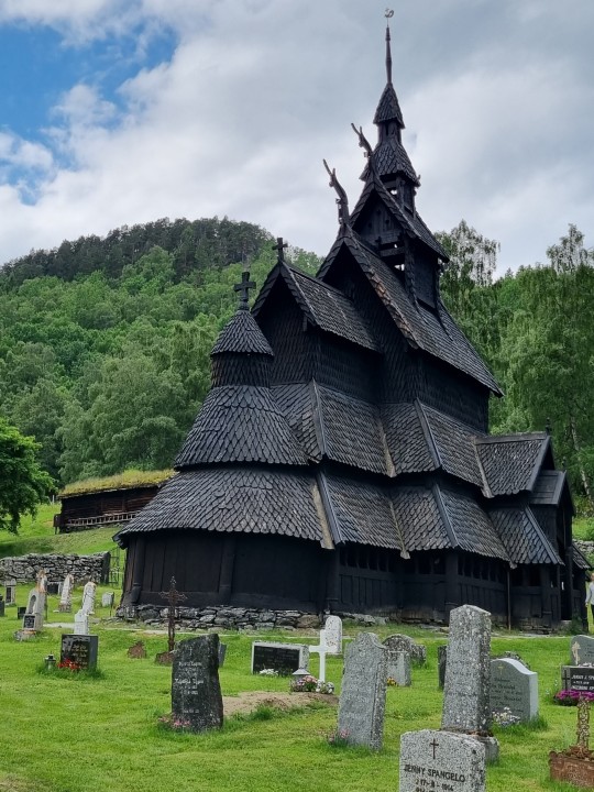
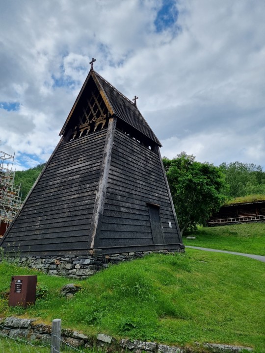
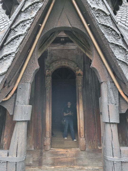
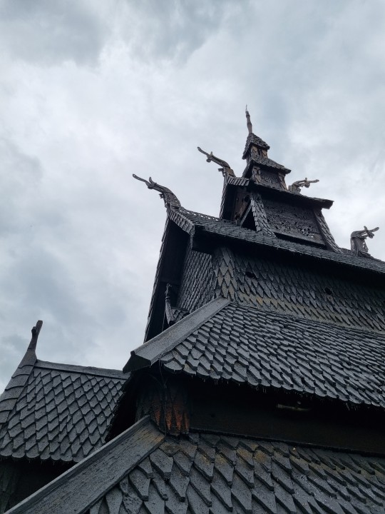
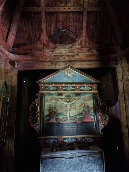
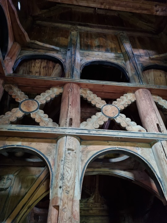
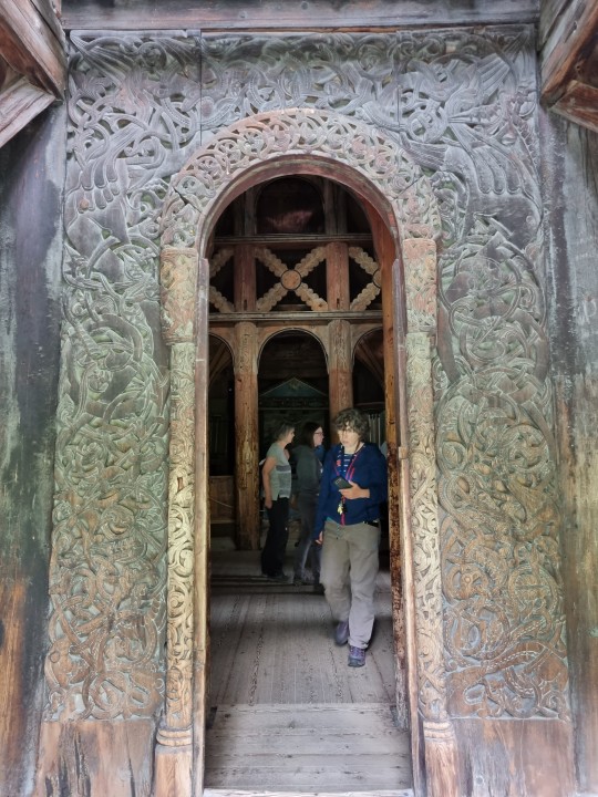
Er waren twee routes naar Jostedal. Een van 4,25 uur en een van 5,25 uur. Dus de kortste gekozen, wat achteraf misschien jammer was. Want de langere scheen heel mooi te zijn lazen we later. We reden o.a. door de langste tunnel van Europa, 24,5 km ! Ook hier weer af en toe mooie blauwe verlichting. We zagen weer een fantastisch mooi landschap aan ons voorbij gaan met vele grote watervallen en bruisende rivieren. Onze tussenstop was de staafkerk in Borgund. Dit is de oudste van de 18 overgebleven middeleeuwse staafkerken in Noorwegen. Mooi om te zien. In een deur waren nog runentekens te zien. Na het inchecken in Jostedal Hotell zijn we een eind het Breheimen nationaal park ingereden. Mooi !
Daarna naar het Visitors Center van het Jostedalsbreen National Park. Hier kregen we het advies een redelijk makkelijke wandeling naar twee gletsjers te maken van ca. 3 uur v.v. omdat het morgenvroeg gaat regenen. De Jostedalsbreen gletsjer is de grootste van Europa.
0 notes
Photo
“Forest Colors” by | Jan Erik Waider
Jostedal, Norway
3K notes
·
View notes
Photo
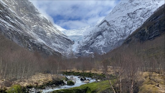
Norway: Arm of Jostedalsbreen/the Jostedal Glacier
8 notes
·
View notes
Photo
Glacier’s views 🌁 #nature #pure #art #inspiration #mountain #glacier #jostedal #norway #cold #view #landscape #naturephotography #hiking #adventures #explore #escape #memories #love #2017 #instanature #instadaily #sky #ice #snow #livinglife #water #white #beautiful #soul #instatravel #tourist #travellingtheworld #happy #feelings #myworld
#2017#livinglife#tourist#norway#glacier#explore#soul#cold#inspiration#nature#mountain#instanature#jostedal#happy#snow#landscape#myworld#beautiful#naturephotography#adventures#water#escape#ice#view#love#instadaily#sky#feelings#memories#white
1 note
·
View note
Photo

Jostedal In the Action
1 note
·
View note
Text
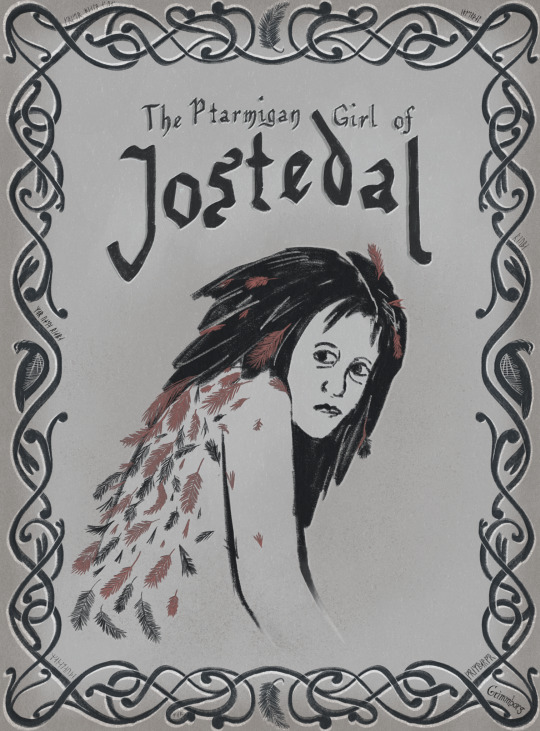
Ptarmigan Girl of Jostedal
Jostedalsrypa again? it's more likely than you think.
In the time of the black plague, many sought refuge in the remote valley of Jostedalen. They took many precautions and asked their neighbouring towns not to seek them until the sickness had passed. No matter how careful they were though, the plague did come. Later on, some men came into the valley to see how the people fared. They searched each house and found no living soul. Only empty farms and houses and bodies left to rot where they died. Outside a remote farm, they saw little footprints in the snow. A shadow moved between buildings. A scraggly figure, more like a bird than a girl, escaped into the woods. All she could say was "Mor, vesle rypa". Before her mother had died she had laid her daughter in a feather bed, with some food to keep her going. She had lain there so long the feathers had grown into her back.
#Fairytale#folktale#myth#black plague#norway#knotwork#scrollwork#norse#jostedalsrypa#grouse#ptarmigan#i might do more versions please forgive me
5 notes
·
View notes
Note
Not the most original one, but how about the Black Death/bubonic plague of 1349? 👀
so relevant of you 👀
Svartedauden – the Black Death – came to the coastal city of Bergen in 1349 with a merchant ship from England. The Black Death wiped out about 1/3 to ½ of the population of Norway, weakening the Norwegian elite and could have played a factor in Norway merging royal families with Sweden, and then eventually the Kalmar Union – but it is disputed how big the role was.
Many villages and towns were completely abandoned and/or everyone died – leaving many ghost-towns all over the country, something that is the origin of the surname “Ødegård” and “Aune”, meaning “desolate farm”.
During the 1800s, it became popular to depict The Black Death as an old woman walking around with either a broom or a rake. The broom meant that everyone in the town would die, while the rake meant that some would slip through the cracks and survive. Theodor Kittelsen has some amazing paintings of her that I recommend checking out – I might leave the most famous one under a read more here.
There’s this quite famous legend about “Jostedalsrypa” (The Grouse of Jostedal) from the black death where people came to an abandoned village where everyone had died and the only survivor was a young girl they found due to footprints in the snow. The girl was almost wild in nature, and I’ve heard that she got the name Rypa (The grouse) because of acting like a wild bird, but also because her mother had laid her on a bed of feathers before she died and that there were feathers growing out of her back. They managed to capture her and she she later because the matriarch of Rypeætta ( The Grouse lineage).
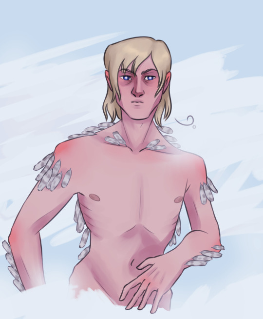
#historical hetalia#hetalia#aph norway#hws norway#this just became a collection of black death fun facts from norway😅#the black death#svartedauden#also not the prettiest piece I've ever done but I felt like trying to draw something creepy 😔#hope you like it anyway and thanks for sending an ask Random! 🥰🥰#jostedalsrypa#the legend is probably not true btw#but still interesting and fun
48 notes
·
View notes
Text
Jours 37 et 38
Réveil dans les bois très très tranquille
Nous nous posons en fin de matinée au fond d'un fjord sur une plage aux eaux translucides. Un semblant de Caraïbes 🌴
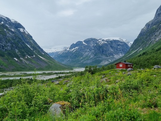
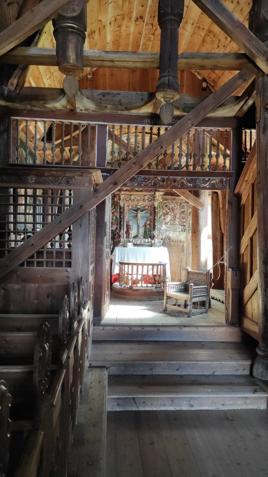
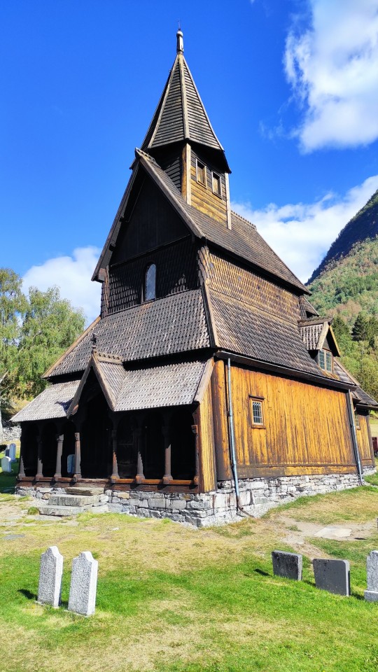
Puis nous grimpons en direction de Solvorn, très joli village en bord de fjord d'où nous prenons le bateau en direction d'Urnes. Là bas, on y visite la fameuse Stavkirke (église de bois noir) inscrite au patrimoine mondiale de l'UNESCO. Du XIIeme siècle, elle est la plus vieille des 28 restantes en Norvège. Juste splendide :). Elle a en plus une magnifique vue sur le fjord. Une fois descendus, nous reprenons le bateau en direction de Solvorn. Nous filons ensuite dans la ville de Gaupne et remontons la vallée de Jostedal dans laquelle nous nous posons pour la nuit. (On essaie d'y voir des aurores boréales car les conditions sont propices mais sans succès).
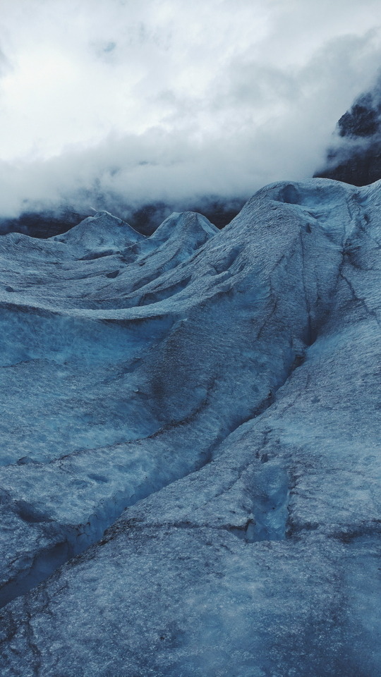
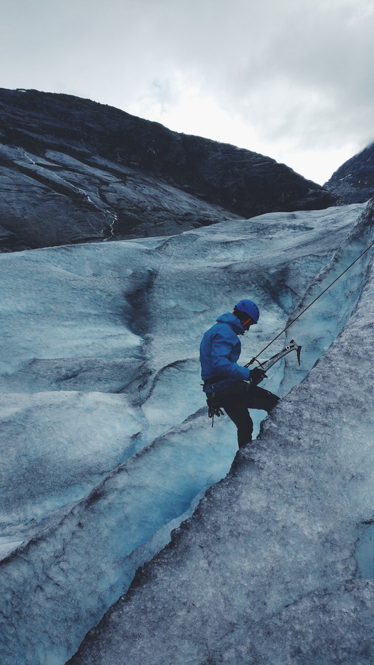
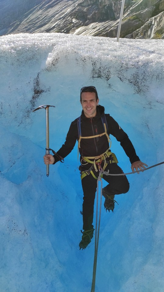
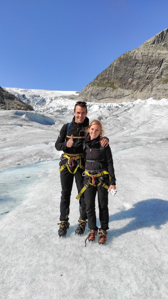
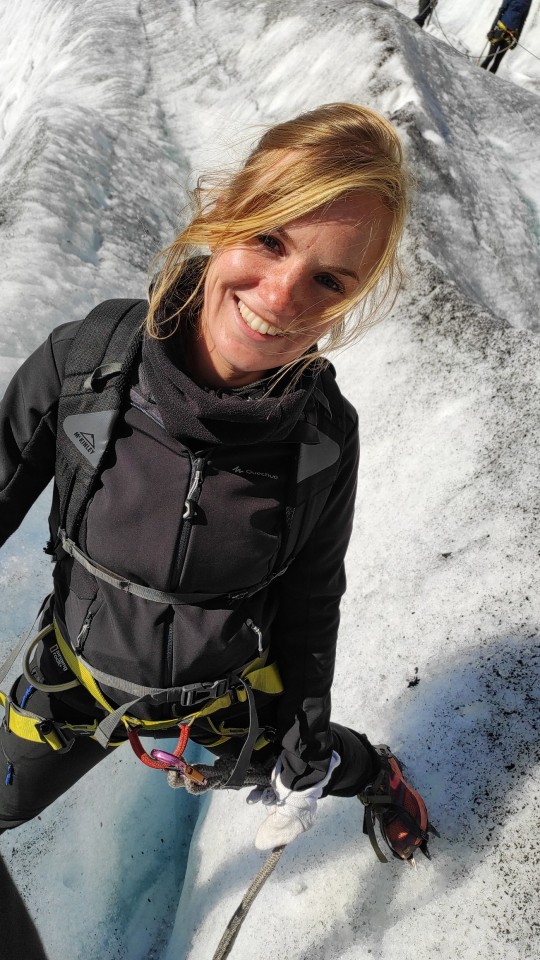
Le matin du jour 38, nous continuons à remonter la vallée de Jostedal en direction du parking du Nigardsbreen car aujourd'hui, nous randonnons sur le glacier. Nous nous équipons au niveau du parking de piolets et de crampons puis nous prenons le bateau sur le lac rejoindre le bas de l'ascension. Nous montons ensuite jusqu'au bas du glacier où nous nous équipons de baudriers et où nous formons les cordées. Nous commençons alors a grimper sur le glacier et c'est incroyable. On ne glisse pas du tout avec les crampons et on monte facilement. La vue est magnifique et les couleurs bleues sont extraordinaires. Après 1 h, nous nous posons pour déjeuner au sommet du glacier. Après celui ci, on continue sur la partie remplie de crevasses. C'est vraiment impressionnant. Nous redescendons ensuite à notre point de départ. Et on finit par rejoindre le parking. Pendant le trek, nous avons rencontré un français avec qui on partage une bière 🍺 (la première en Norvège) une fois arrivés au niveau du fjord. Enfin, nous reprenons la route vers l'est et nous posons sur un spot en altitude (1200 m) pour la nuit.


2 notes
·
View notes
Photo
Jostedal, Norway
1 note
·
View note
Text
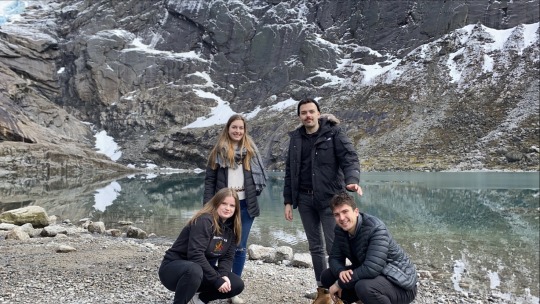
-ROADTRIP-
If you want to fully enjoy your trip/erasmus in Norway I advise you to have a car at your disposal...
Norway is a big country with many breathtaking landscapes. Thanks to friends who have a car we had the chance to do some roadtrips and discover some beautiful places.
In particular one day where we went to the Jostedal glacier. It was just AMAZING!
We stopped several times on the road to discover splendid places. We could also observe one of the most beautiful fjord of Norway.
(In more this day the weather was great)
FunFact : the water from the glacier was so pure that you could drink it directly from the source
I put you some photos to share you these incredible landscapes ;)
1 note
·
View note
Last Seen Blogs

ilianamilitza
IlianaM.Vigil

fledglingweeb
new weeb coming through

lucklessladies-blog
We won't break

hummingbird-hunter
cassian, apparently

sol1056
solitude 1056