#US Route 50
Text
... untitled (US Route 50) / photographer unknown
54 notes
·
View notes
Text

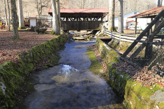
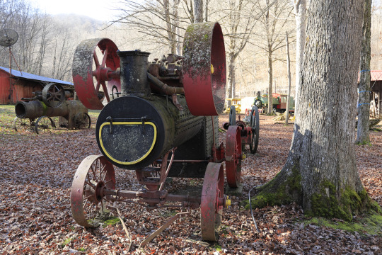
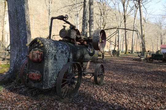
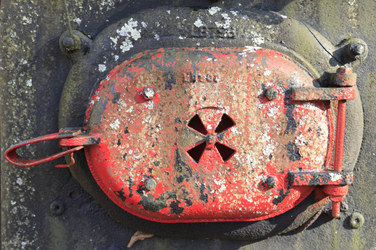


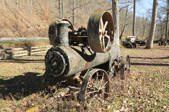
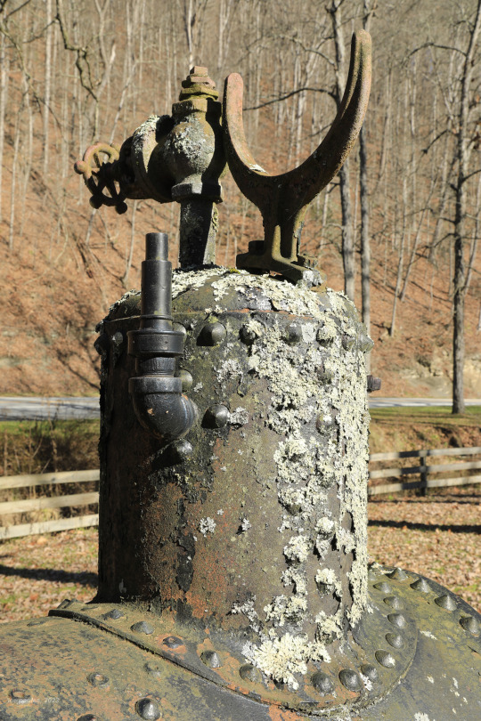

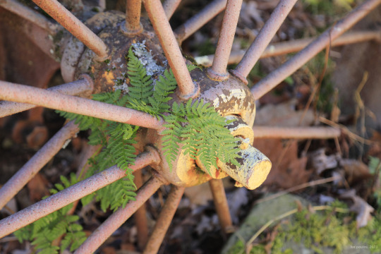


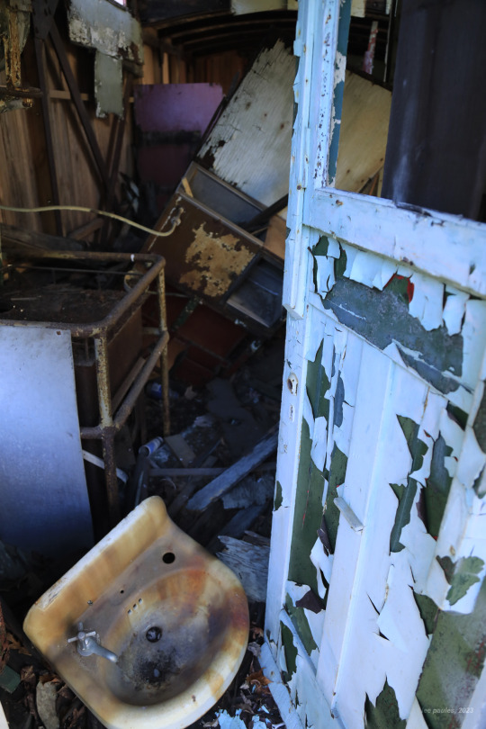
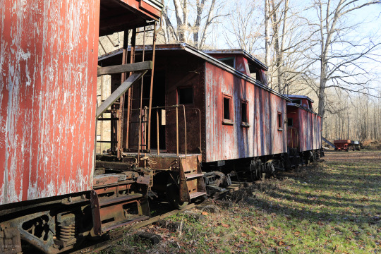


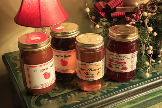
Apologize in advance for this very long post, but my seasonal affective disorder was out of control on Saturday and the only effective cure (I know of) is an impromptu road trip. In this case, the road trip went straight down memory lane to a place full of boyhood memories and joy for me - Cool Springs Park. An epic amalgam of outdoor mechanical contraption museum, domestic animal park, and touristy dive restaurant cum gift shop featuring foot-long hotdogs and Native American moccasins, Cool Springs was a mandatory pit stop during my family's regular trips to the mountains. I must admit the puffed-up Turkey tom lifted my spirits; he seemed particularly proud that he made it through Thanksgiving with his neck intact. And I walked away with my usual stash of holiday goodies, including local honey, jam, and butters.
#appalachia#vandalia#west virginia#fall#cool springs park#preston county#laurel mountain#destination#us route 50#rowlesburg#memories#roadtrip#americana
76 notes
·
View notes
Note
Space or spaces

u.s. route 50
#this got convoluted but like mental spaces u know#this ones longer than normal so im unable to tell if i hate it rn 😭#thank u for sending bestie <3#my writing#my writing tag#poetry#original poem#us route 50#metaphor#extended metaphor#spilled ink
11 notes
·
View notes
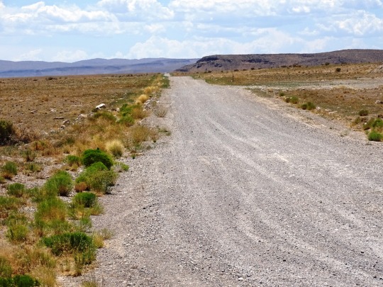
Photo


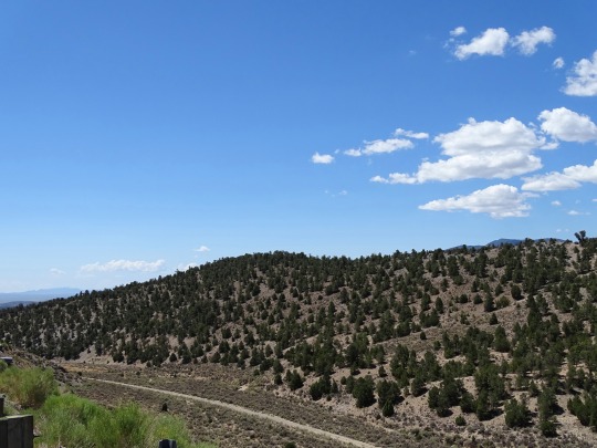


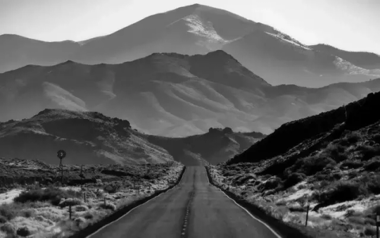
Highway 50 (No. 1)
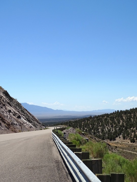
U.S. Route 50 (US 50) is a transcontinental highway in the United States, stretching from West Sacramento, California, in the west to Ocean City, Maryland, on the east coast. The Nevada portion crosses the center of the state and was named "The Loneliest Road in America" by Life magazine in July 1986. The name was intended as a pejorative, but Nevada officials seized it as a marketing slogan. The name originates from large desolate areas traversed by the route, with few or no signs of civilization. The highway crosses several large desert valleys separated by numerous mountain ranges towering over the valley floors, in what is known as the Basin and Range province of the Great Basin.
US 50 has a diverse route through the state, traversing the resort communities of Lake Tahoe, the state capital in Carson City, historical sites such as Fort Churchill State Historic Park, petroglyphs, alpine forests, desert valleys, ghost towns, and Great Basin National Park.
The route was constructed over a historic corridor, initially used for the Pony Express and Central Overland Route and later for the Lincoln Highway. Before the formation of the U.S. Highway System, most of US 50 in Nevada was designated State Route 2. The routing east of Ely has changed significantly from the original plans. The route change resulted from a rivalry between Nevada and Utah over which transcontinental route was better to serve California-bound traffic, the Lincoln Highway or the Victory Highway.
Source: Wikipedia
#Highway 50#The Loneliest Road in America#landscape#countryside#travel#road trip#street scene#Nevada#Major Place#Millard County#US 50#US Route 50#mountains#view#original photography#summer 2022#vacation#blue sky#clouds#forest#woods#flora#nature#tourist attraction#landmark
9 notes
·
View notes
Text
one thing i do appreciate about cycling is the relative simplicity with which most events are named. stage race around Portugal? Volta a Portugal, easy. one-day race from Milan to San Remo? no need to bother with a complicated name, let's call it Milano-Sanremo. one-day race that leaves Liège, goes to Bastogne and returns to Liège? you got it.
#there are of course some exceptions#binckbanck tour / super 8 classic / strade bianche / chrono des nations etc as not being directly named after their location#even e3 used to be E3 Harelbeke and include its location#but i do like the naming conventions being very straightforward#(although so often it was the old route in the 50s that used to go directly from A to B and now the start and/or finish is actually -#- in another town in the vicinity of A)#cycling
12 notes
·
View notes
Text
As landback efforts here become more successful I can't help but wonder how long it will take for indigenous reclamation to be described as the predations of settler colonists
#"They don't even look/sound/act Indian!! [they're not tobacco store Indian or tintype photos]#[they look too white/hispanic/black/clean/well off etc they dont live by the old ways that europeans made inpossible to continue]#“They don't even have Indian last names!” [The surname tradition adopted from/imposed by Europeans with a variety of sources and styles#doesn't express indigenous identity enough to me even tho they're named fucking Peltier]#“a nice local family used to own this land [generations old white or black owned business on the site of an indigenous property] until it w#taken by strangers [the original owners who were forced off] with no connection to here from Oklahoma [the reservation they were removed to#and half of them died on route to.]#like will it be 50 years? 100? Am I going to have to live through it?#we're already getting criticism for tribes getting land back and having the audacity to use it and not just turn into nature reserves#they've already turned one genocided minority into race fakers and colonialists why not natives next??
4 notes
·
View notes
Text

Albuquerque New Mexico NM ~ Central Avenue U.S. Highway Route 66, 1950's
#albuquerque#new mexico#US Highway#route 66#1950s#1950s style#1950s fashion#1950s vintage#decade: 1950s#50s style#50s fashion#50s vintage#50s#road trip#postcard#vintage postcards#road travel#retro photography#classic
3 notes
·
View notes
Text
anyway I do still need to listen to the last two episodes of Worlds Beyond Number but I would like to know what Ame's deal is re: becoming a witch's apprentice at age 7; based on interviews I know why Erika wanted it but I'm interested in seeing how Ame got into it, especially since we have such a strong sense of why Suvi and Eursulon are the classes they are.
#worlds beyond number spoilers#unrelated but i want everyone to know i associate each actual play strongly with a particular location i've been while listening to it#and uh. unfortunately perhaps for it wbn is heavily associated with US Route 50.
32 notes
·
View notes
Text
hey hey
remember the other day when biden's top adviser for the latam region talked about the lithium in Argentina as 'ours'????
#fun times!!!!#i love it when they don't even bother to lie#just straight up letting us all know they consider our natural resources theirs lol. lmao even#us imperialism#and then you have shit propagandist like the economist publishing their op Ed's and articles like 'why argentina won't leave its crisis'#like idk fam maybe bc your country's stated policy for the last 150 years as been to systematicly fuck our economy so you can steal from us?#just food for thought#hahahahahaha#anyways people should be more watchful about the situation wrt the lithium in latam#how quickly we have forgotten about elon musk and the usa stagging a coup in Bolivia over it that ended with +50 deaths#the worst is they don't even have to go that route there. we have enough cipayos and dumbasses to do their dirty work
3 notes
·
View notes
Text

See? We're notorious for shitty parking lol.
#half the city has parking tickets right now lol#so parking is already in short supply#but when there's a snow emergency like the last 3 days you have to do alternate side parking#so can only park on one side of the street#and any road that's a bus route is no parking at all#but there's nowhere else to GO so $50 tickets all over#the city opens up school parking lots for people to use#but there's not that many of them and the closest one to me is a MILE away#so I'm very very very lucky to have gotten parking where i did#the idea is that if you park on one side they can plow the other#but that doesn't fucking happen anyway
2 notes
·
View notes
Text
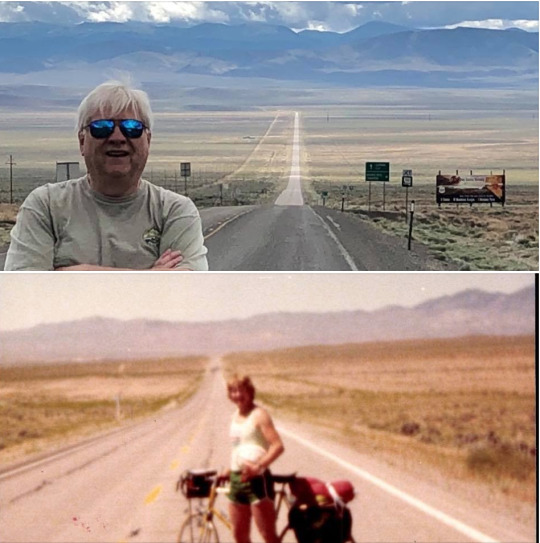
#My dad biked across the US in 1979. He revisited Route 50 in Nevada to take a new pic.#chartystine#oldschool
12 notes
·
View notes
Text
DONE WITH TERRA’S ROUTE
#memorie.txt#crying a little bit at the end credit music but ITS FINE#ONTO AQUA’S ROUTE#also i get why this playthrough was shorter because this game wanted to include three different routes but it IS a little disappointing that#i’m already done with terra’s route#also leveling up to level 50 before the eraqus battle uhhh REALLY helped against the xehanort battles LMAO#i was working on leveling up certain commands so i had rlly shitty commands in my deck#but because i was a crazy high level—i DESTROYED him#also i never ONCE used a healing potion or magic elixir SO. that was pointless to save during that entire game 💀#next time i’ll sell them for commands
4 notes
·
View notes
Photo


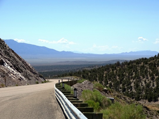
Highway 50 (No. 6)
Sevier Lake is an intermittent and endorheic lake which lies in the lowest part of the Sevier Desert, Millard County, Utah. Like Great Salt Lake and Utah Lake, it is a remnant of Pleistocene Lake Bonneville. Sevier Lake is fed primarily by the Beaver and Sevier rivers, and the additional inflow is from the lake's watershed that is part of the Escalante–Sevier hydrologic subregion. The lake has been mostly dry throughout recorded history and is a source of wind-blown dust.
The first recorded observation was in 1872, which stated that the lake's surface area was 188 square miles (490 km2), salinity was measured at 86 parts per thousand, two and a half times that of the ocean, and maximum depth was 15 feet (4.6 m). In January 1880, the lake was nearly dry and had been so for the past one or two years. The Sevier River, which once flowed to the lake, is now largely diverted for irrigation. In 1987 however, the lake was again similar to the recorded description of 1872.
The Domínguez–Escalante expedition named it "Laguna de Miera" after Bernardo de Miera y Pacheco, a cartographer on their 1776 expedition. In 1825, trappers working for William Henry Ashley trapped the region, and Jedediah Smith named it after him, the Ashley Lake. On some maps, it was named after Joseph Nicollet in the mid-19th century. The lake is currently named for the river, which is derived from "Río Severo" (wild river [Wild in modern Spanish is Salvaje or Silvestre]), a local name given by early Spanish explorers.
Source: Wikipedia
#Millard County#Sevier Lake#old Highway 6#upaved#Sevier Desert#USA#Highway 50#The Loneliest Road in America#US Route 50#Highway 6#travel#road trip#landscape#countryside#tourist attraction#landmark#potassium sulfate#Utah#Western USA#summer 2022#original photography#vacation#flora#clouds#mountains
3 notes
·
View notes
Text
ghost has a bird watching book
nothing fancy, just a humble little pocket guide to britain’s most common avifauna. he carries it with him when he takes johnny out on walks; uses it to identify exactly which feathered bastard keeps chirping up a storm overhead, or perhaps to distinguish between a chaffinch and a robin. it’s silly, but filled with annotations in smudged pencil – comments ranging from when he wasn’t able to match a warbling song to its singer, to a ranking of which passerine’s have the most audacity. he’s found it relaxes him to train his eye on the sky, and so he’s made a hobby of it.
johnny also has a bird watching book.
gifted to him by ghost. unlike his partner’s guide, though, johnny’s book came empty. 50 pages of blank, acid free paper, bound by moleskin with a pencil pocket sewn into the side. he loves his walks with simon. really, he does. but they often meandered through boring paths and would stop in the most anticlimactic places. the sketchbook, then, had the express purpose of giving him “something to do, since your chattering scares away the little shits.”
it seems to work. their treks get quieter, more routine. they start taking the same route twice a week, and now, johnny’s book is filled with sketches upon sketches of one bird in particular.
(that is, the pretty thing who hikes their trail too)
#ghoap x reader#ghostsoap#simon ‘ghost’ riley x johnny ‘soap mactavish#simon riley x john mactavish#soap x ghost#johnny ‘soap’ mactavish x resder#soap x reader x ghost#soap x reader
564 notes
·
View notes
Text
going back to strive the game is so...... i dont even know whats going on with it
#its not even something wrong with it its just something to my taste that is subtly off#i think its how many characters just have insane infinite blockstrings JACK O PLAYER VOICE JACK O PLAYER VOICE#like rounds where youre both really really really aggressive and smart and use resources aggressively are fucking awesome#but when its some fucking ky player or gio player and theyre just hitting your FD for 50 seconds its like man#obviously a problem of playing a character with few defensive tools but at least against freaks like faust and axl i can do fun shit#like combos in this game arent even fun because the links are so generous and theyre all so hyper specific#its juts a lot of memorization without clear intuitive rationale the way xrd had#like a fucking dog could make an xrd combo in this game its like 2 hours in training mode to find one route
0 notes
Text
(which do you use most often, used most often as a kid, most memories, you identify with are all acceptable answers. which highway is THE highway, which one is yours?)
#highways#transit#america#american culture#poll#please answer this i have to know#if you're not from the us do you have a highway#mine is I-40#im going to blaze this i am very interested in the answer
2K notes
·
View notes
Last Seen Blogs