#Monterey County
Text
Carmel by the Sea, California, 1990.
17 notes
·
View notes
Text


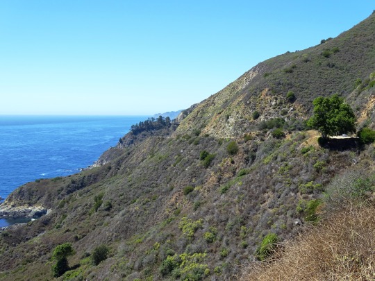
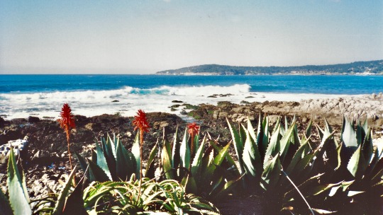
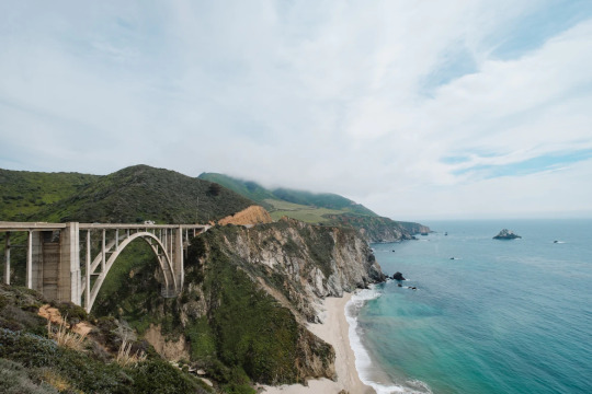
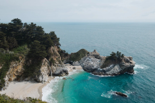
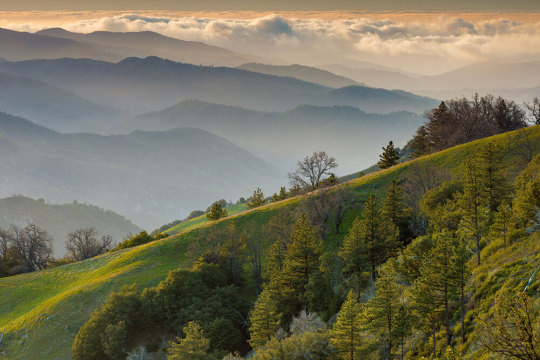
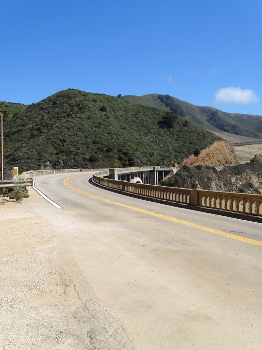
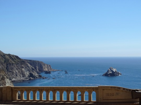
Julia Pfeiffer Burns State Park Vista Point, CA (No. 2)
The drive along Highway 1 has been described as "one of the best drives on Earth", and is considered one of the top 10 motorcycle rides in the United States. Highway 1 was named the most popular drive in California in 2014 by the American Automobile Association. Condé Nast Traveler named State Route 1 through Big Sur one of the top 10 world-famous streets, comparable to Broadway in New York City and the Champs-Élysées in Paris. Most of the nearly 7 million tourists who currently visit Big Sur each year never leave Highway 1, because the adjacent Santa Lucia Range is one of the largest roadless coastal areas in the entire United States; Highway 1 and the Nacimiento-Fergusson Road offer the only paved access into and out of the region. In January 2021, the Nacimiento-Fergusson Road was washed out due to the impacts of the Dolan Fire and closed, cutting off the only alternative route out of the area. It is not expected to reopen until December 2023.
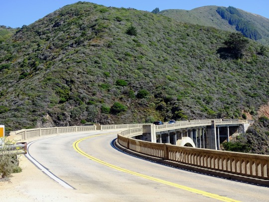
The beauty of the scenery along the narrow, two-lane road attracts enormous crowds during summer vacation periods and holiday weekends, and traffic is frequently slow. Visitors have reported to the California Highway Patrol hours-long stop-and-go traffic from Rocky Creek Bridge to Rio Road in Carmel during the Memorial Day weekend. The highway winds along the western flank of the mountains mostly within sight of the Pacific Ocean, varying from near sea level up to a 1,000-foot (300 m) sheer drop to the water. Most of the highway is extremely narrow, with tight curves, steep shoulders and blind turns. The route offers few or no passing lanes and, along some stretches, very few pullouts. The sides are occasionally so steep that the shoulders are virtually non-existent.
Source: Wikipedia
#Julia Pfeiffer Burns State Park Vista Point#Monterey County#California State Route 1#Highway 1#Pacific Coast Highway#National Scenic Byway#Big Sur#Pacific Ocean#travel#original photography#vacation#tourist attraction#landmark#landscape#seascape#countryside#street scene#road trip#summer 2022#California#West Coast#Big Sur Coast Highway#nature#flora#grass#tree#USA#blue sky#blue sea#beach
13 notes
·
View notes
Text
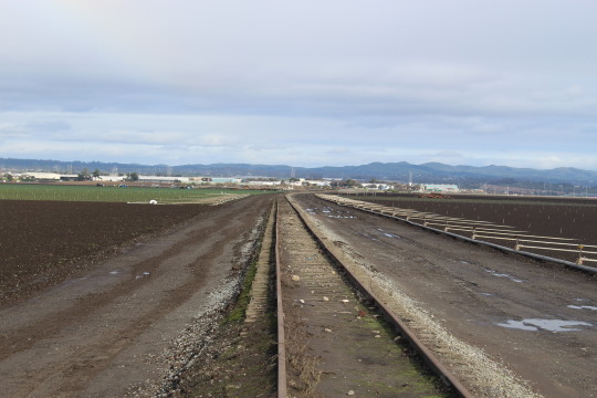
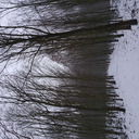
Abandoned Monterey Branch Line
35 notes
·
View notes
Text

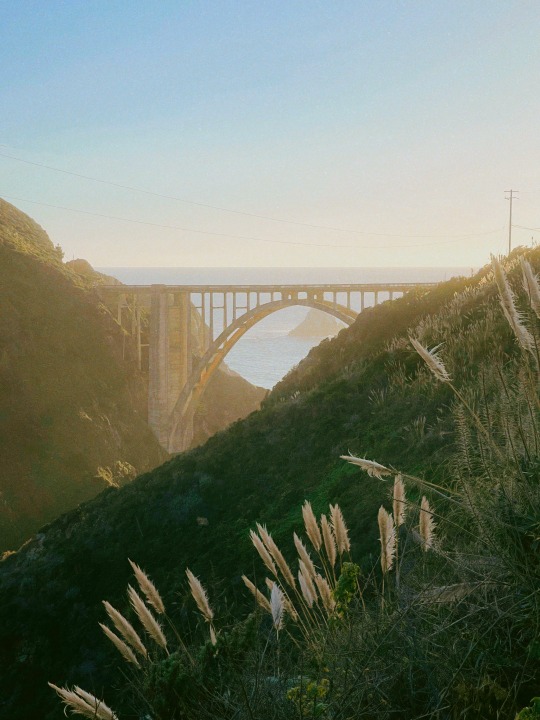
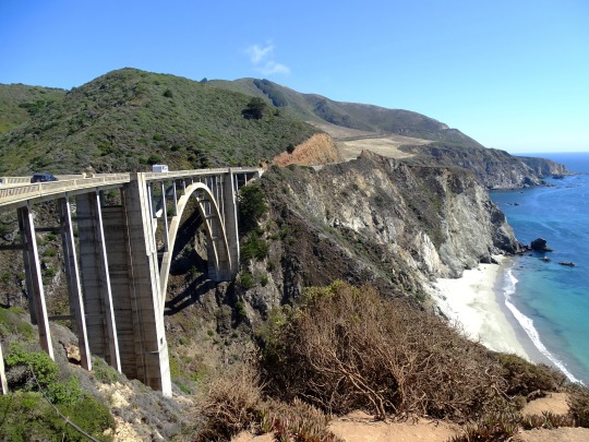
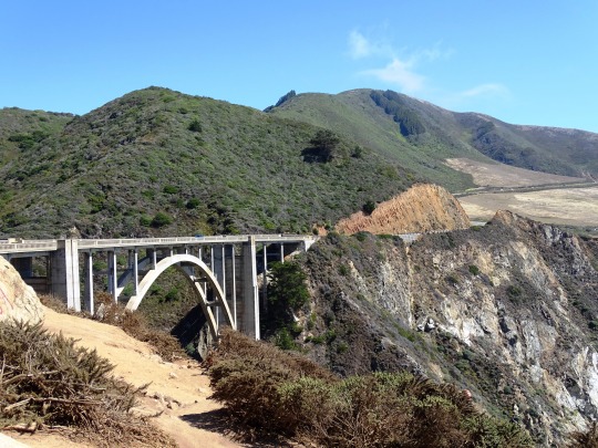
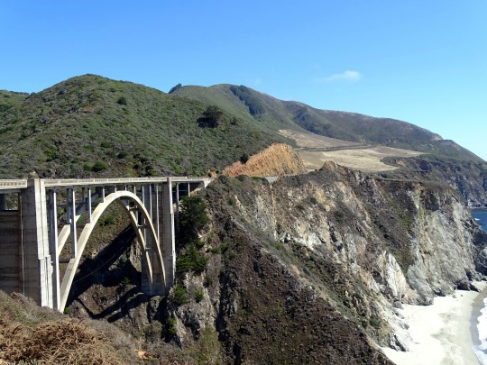
Magnificent Big Sur, Highway 1 and Bixby Bride in the distance.
#Big Sur#california#california coast#bixby bridge#pacific northwest#pacific coast#California state highway#monterey county#road travel#travel photo blog#travel#photographers on tumblr#photography#fujifilm#curators on tumblr#landscape#nature#beautiful#Fujifilm x100t#x100t#fujifilm x series
71 notes
·
View notes
Photo
bixby bridge.
big sur. monterey county, ca.
my instant gram.
#bixby#bridge#bixby bridge#monterey county#sunset#sun light#coast#ocean#california#architecture#arch
96 notes
·
View notes
Text


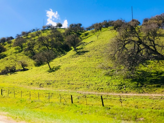
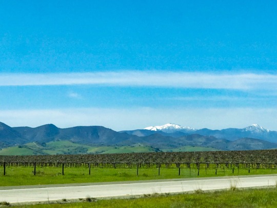
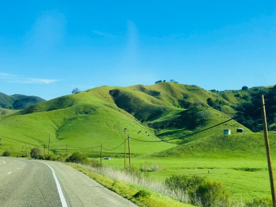


Highway 101 between Los Angeles and San Francisco, March 2023
#iphonography#california#spring#pacific coast#highway 101#road trip#road#green#mountains#central california#san luis obispo#pismo beach#monterey county#southern california
53 notes
·
View notes
Text
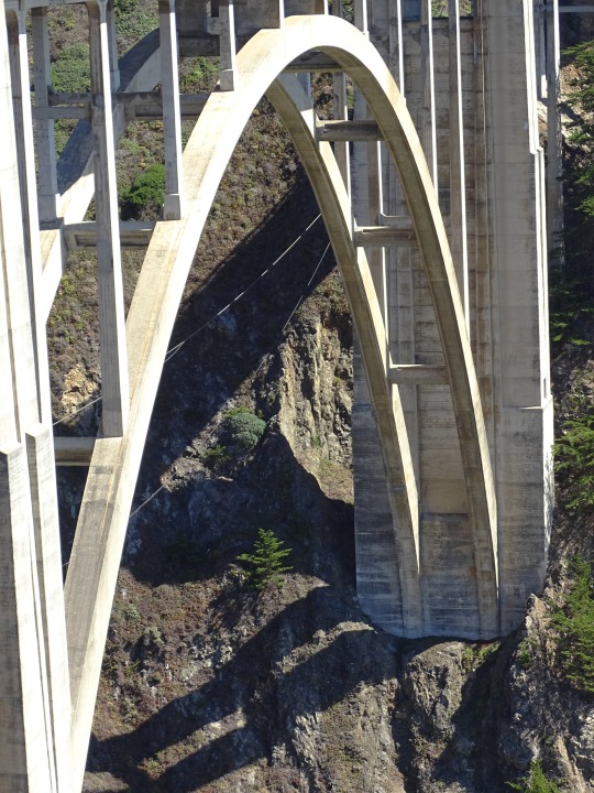
Bixby Creek Bridge, Big Sur, Monterey County, California
Robert Bye
#Bixby Creek Bridge#Big Sur#Monterey County#California#Beach#Bridge#CANature#USA#US#United States of America#United States#North America
9 notes
·
View notes
Text
#my videos#California#Monterey County#Point Lobos State Natural Reserve#Point Lobos#ocean#there’s a great blue heron in there#I have photos from here today and I’ll probably post them Eventually#fun fact! this particular cove is called The Pit!
10 notes
·
View notes
Photo
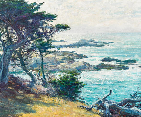
Guy Rose (1867-1925) - Off Point Lobos
Oil on canvas. Painted in 1918.
24 x 29 inches, 61 x 73.7 cm. Estimate: US$400,000-600,000.
Sold Bonhams, Los Angeles, 2 Aug 2022 for US$441,375 incl B.P.
Point Lobos is just south of Carmel-by-the-Sea, California, and at the north end of the Big Sur coast of the Pacific Ocean.
104 notes
·
View notes
Text
22 notes
·
View notes
Photo
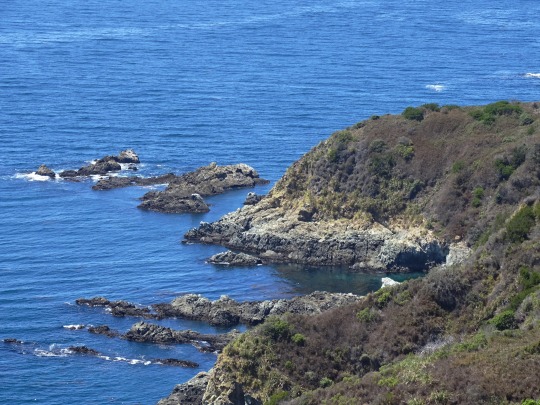
California’s Condor Trail is something of an upstart—a continuous thread of trails and roads that has become a 400-mile thru-hiking route (above in Monterey County).
PHOTOGRAPH BY ED CALLAERT, ALAMY
#el callaert#photographer#alamy#national geographic#california#condor trail#hiking route#monterey county#nature#landscape
16 notes
·
View notes
Text
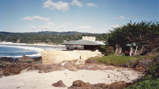
Frank Lloyd Wright House, Carmel-by-the-Sea, California, 1990.
Recently read that this house, on a fairly small plot of land, just sold for $22 million! Stunning location unless there is a tsunami.
#landscape#beach#house#frank lloyd wright#carmel-by-the-sea#monterey county#california#1990#photographers on tumblr
18 notes
·
View notes
Text
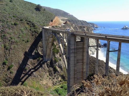
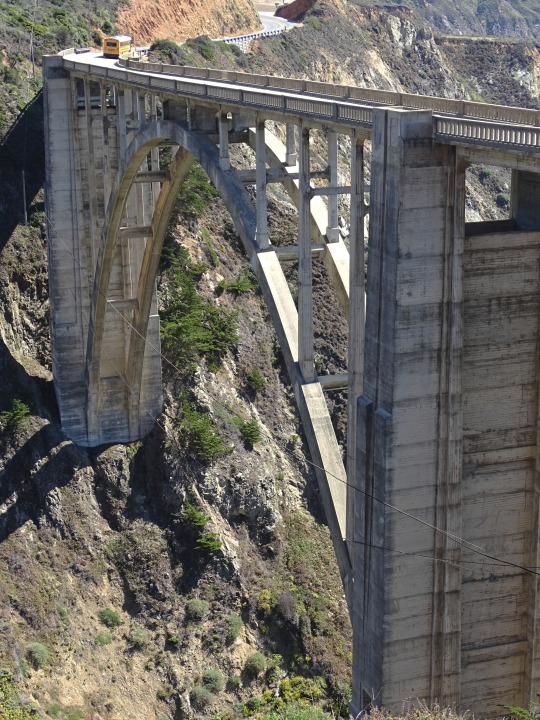
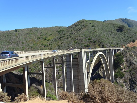
Bixby Bridge, CA (No. 4)
The bridge was already popular before the introduction of smart phones and social media, and visitors to the Bixby Bridge and other Big Sur attractions have dramatically increased since then. Due to the large number of visitors, congestion and slow traffic between Carmel and the bridge is frequently the norm during popular holiday and vacation periods. The bridge was rated as the No. 1 “Instagram-Worthy Destination for 2019 Travels” by the website Travelpulse.com. The California state tourism commission describes the bridge as "a must-see road trip spot for many and probably the most Instagrammed features [sic] along [the] Highway 1 coastline." It promotes the bridge world-wide, including a deal with China's online tourism operator Tuniu that put the bridge on a custom route.
During holiday weekends and most summer vacation periods, the bridge area is "like a Safeway parking lot" according to a local resident. Traffic can come to a standstill as motorists wait for a parking spot. There is a pull out to the north and west side of Highway 1, but when it is full, visitors sometimes fail to completely pull off the highway, leaving inadequate space for passing vehicles.
The area near the bridge has become overwhelmed by visitors. Tourists routinely ignore warning signs to stay off the cliffs, and walk across the narrow 24 feet (7.3 m) wide bridge, although there is no room for pedestrians. There are no toilets within several miles of the bridge, and visitors resort to defecating in nearby bushes. Residents complain about toilet paper, human waste, and trash littering the roadside. On December 29, 2018, two dozen residents and business leaders turned out with signs alongside the northern approach to the bridge to launch a campaign they've named The Big Sur Pledge, encouraging visitors to treat the region with more respect.
Source: Wikipedia
#Bixby Creek Bridge#Bixby Bridge Vista Point#Bixby Bridge#Monterey County#California State Route 1#Highway 1#Pacific Coast Highway#National Scenic Byway#Big Sur#Pacific Ocean#travel#original photography#vacation#tourist attraction#landmark#landscape#seascape#countryside#street scene#road trip#summer 2022#California#West Coast#Big Sur Coast Highway#nature#flora#grass#USA#blue sky#cliff
6 notes
·
View notes
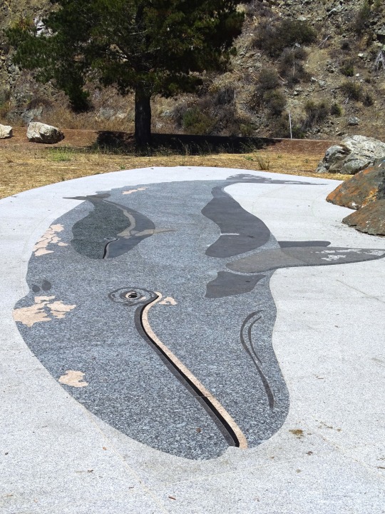
Text
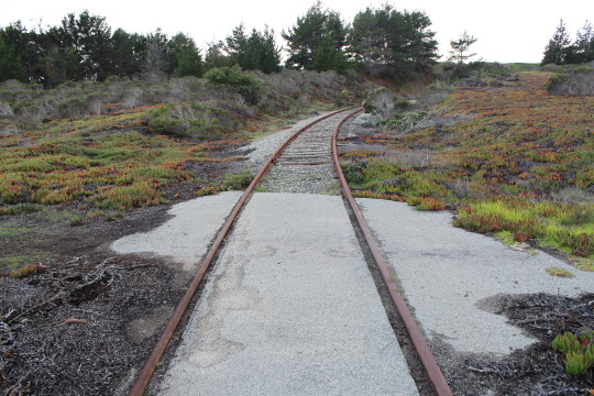
taken with family during Monterey trip. part of loop at coastal military base. track is abandoned, yet it was still reconstructed in the 80's for a freeway relocation project for future opportunities. the blooming plants on the right and left are ice plants, which were introduced to the environment during construction along the west coast. they thought this plant would be able to keep the ground together with it's roots keeping dirt stable, unfortunately this had the opposite effect. this plant quickly became invasive, and almost anywhere in the coast of California you will see the ice plant.
13 notes
·
View notes
Text
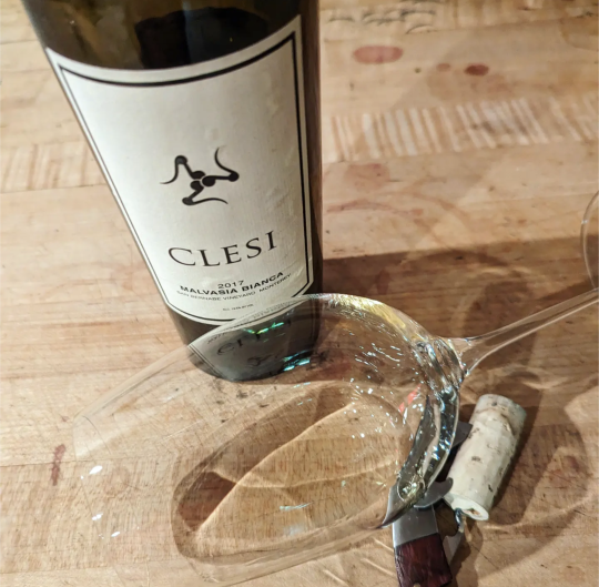
Clapsed
Another Malvasia… this one very popular around the Central Coast–LOTS of resty lists carry it–for obvious reasons. Pale straw in the glass, a nose slightly green and vibrant, but the sweetness overpowers most of the fruit. Ripe peach and lychee make for a full, almost-syrupy lavish bouquet.
Tasting it doesn’t spark any of the reasons well-made versions of the variety shine. It’s just a dull,…
View On WordPress
#Central Coast Wines#Clesi#Malvasia#malvasia bianca#Monterey County#San Bernabe vineyard#San luis obispo wineries#Stephen McConnell Wine Blog#Steve McConnell Wine Blog#Sweet white wine#Sweet wine#White Wine#wine1percent
2 notes
·
View notes
Photo
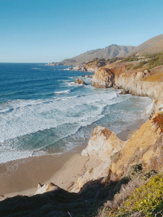
big sur.
monterey county, california.
my instant gram.
71 notes
·
View notes
Last Seen Blogs

socialmediavideomaker
Social Media Video Maker

amados-memes
Little moon ❤
shit-posts-and-trauma-thoughts
Shit Posts
wonderaroundtheglobe-blog
Sin título

redrabbit-pixel
Redrabbit's Work