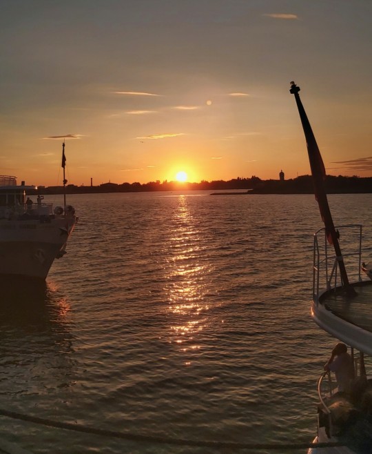
#embankment
Text
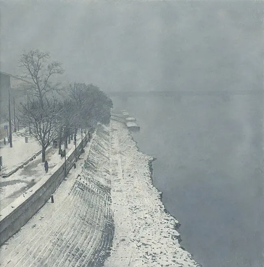
Snowy Embankment - Jozef Srna Sr. 1984.
Slovakian, 1930 - 1992
Oil on canvas
386 notes
·
View notes
Photo
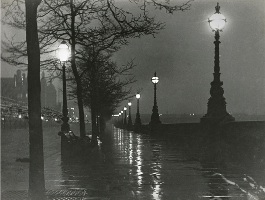
Paul Martin, A Wet Night on the Embankment, London, 1895 - 96
758 notes
·
View notes
Text
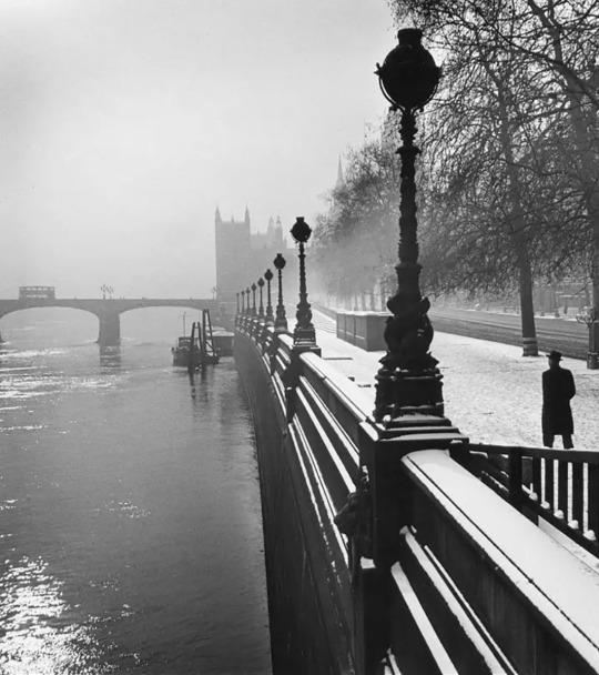
Embankment, London. 1947
Photo: Wolfgang Suschitzky
44 notes
·
View notes
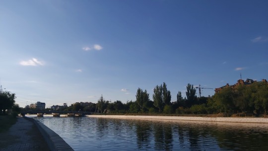
Text

Kacha river embankment
April, 2023
23 notes
·
View notes
Text

Cleopatra's Needle as it stood at its original site in Alexandria, Egypt
69 notes
·
View notes
Text
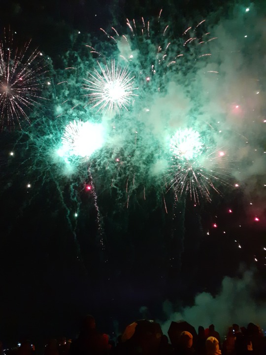

#fireworks#firecracker#phone pics#phone photography#bad quality#quay#embankment#lights#pyrotechnics#photo diary#night photography#night photo walk#night skies#night sky#night#night aesthetic#dark sky#dark skies#town photography#town#urban photography#urban landscape#urban#photography#photo#hiking#hiking photography#girlblogging#irkutsk#siberia
19 notes
·
View notes
Text
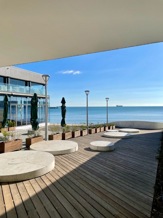
Varna City // Bulgaria // Black Sea Coast 🇧🇬
#bulgaria#bg#varna#black sea#balkan#travel#black sea coast#trip#sea#bulgara realty#varna city#embankment#sea view#sea vibes#november#november 2023#walkin#walking around
13 notes
·
View notes
Text
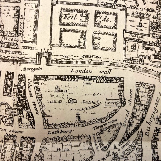
Squalor to Sanitation & A History of London

Squalor to Sanitation
With our Squalor to Sanitation exhibition drawing to a close, it seems like a good opportunity to recap and re-share, whilst highlighting another great item from our London Collection.
This was an interesting exhibition, looking at public health disasters in terms of the responses to those disasters and the conditions that led to the disasters themselves. The overarching take from the exhibition is probably an expected one; negligent attitudes towards environmental factors play key roles in cases of public health endangerment. Where there is squalor, population density, lack of hygiene, and poverty, there you find conditions for disease and disaster to germinate.
The exhibition focused primarily on London, looking at events as far back as the plague. Again and again the main cause of disease and disaster were unattended to plainly ignored environmental factors that became perfect catalysts to spread disease, fire, or stench.
The city moved on from plague and fire in 1666, rebuilding and renewing itself. It would grow and prosper thanks to industrialisation and migration, the population exceeding 1 million by the end of the 18th century. But though London was thriving and laying down foundations to become a business capital globally, the situation for the poor only seemed to worsen.
The slums were overcrowded and disease ridden and poverty was rife. It seems not much was done for the poor in the 18th century, but effort was certainly made to adjust the city infrastructure in order to ease the path for trading and business. One such effort was the removal of the seven ancient gates of London to ease congestion in the city, allowing for better flow of traffic.
These seven gates were built into the London Wall which once surrounded the city as a defensive measure, standing since Roman times and erected to oversee safe passage into the city. They are also feature in a map entitled The Cittie of London.
A History of London by W.J. Loftie (which you can access online via HathiTrust) is a two volume set published in 1883, looking at London's history since medieval times. One of the most enjoyable features of this work is the heavy inclusion of maps and illustrations detailing the changing face of the city. Looking at the maps you really do get a sense that London really has been through it.
Unfortunately, we could not include this work in the exhibition. Sometimes works simply do not fit the narrative, or in this case, literally do not fit the case. The map itself is quite contentious too, attributed to an engraver by the name of Augustine Ryther and dated to 1604.
Ryther died in 1593, which makes his cartographical efforts all the more remarkable. Or potentially the wrong person was attributed for this map, or perhaps there’s some error too in the dating of the map. And perhaps…there may be other inaccuracies also in regards to the content.
Despite knowing that this map has some inaccuracies related to it and potentially parts of it may be imaginatively rendered, the map seems accurate enough when it comes to some details. For our purposes, this would have been a great item to display as a visual aid on some of the topics discussed in our exhibition.
One such topic is the Embankment. One of the public health disasters we looked at was The Great Stink. A change that came about as a result of the Stink was a renewed and robust sewage system (which is still in use), amongst other infrastructural changes beneath the city to accommodate the safe removal of sewage. This involved the addition of new tunnels beneath the city and in order to facilitate these new additions the Thames Embankment was widened.
Ryther’s The Cittie of London illustrates how the Thames Embankment once looked, and of interest to the curators of this exhibition was seeing how the embankment edge once came right up against the grounds of the Inn. This would have been the case right up until 1862, when the river’s waters were still close enough for the then librarians to be able to throw breadcrumbs to the ducks below (allegedly – there is also some doubt to this story). In 1604 (the date on this map, also not to be trusted), one would have been able to walk down the Temple stairs to be ferried away down the river.
As maps go, it’s an incredibly enjoyable one. Names like Aldgate, Bishopsgate, Moorgate, Cripplegate, Aldersgate, Newgate, Ludgate are not unknown words to the present Londoner. We all recognise these names, though some of us may not be aware of their history. We walk through Ludgate and Newgate. We catch trains at Moorgate and Aldgate. We have a sense of these names reaching back into the past, despite not knowing their full stories.
To see them on a map which places them in context with the gates they are derived from is thoroughly exciting. It brings the past directly in contact with the present. How ironic it is that those gates were removed to ease congestion in the city and now many of us spend time stuck in trains in tunnels beneath the city directly under those long gone gates (with varied degrees of success when it comes to that ease of access).
Loftie’s A History of London sadly did not make the cut for the exhibition, but in some regards it may have been as useful as displaying a map of Narnia (Fleet Street still isn’t as wide as it is drawn on The Cittie of London). However, at the same time it’s not completely lacking in truth and makes for a great snapshot of a city that once was.
If you would like to see A Cittie of London in closer details, Yale University Library has an online copy for perusal.
If you would like to read more about Squalor to Sanitation, please do visit the online exhibition @ https://www.juncture-digital.org/middletemplelibrary/squalor-to-sanitation/
#london#books#maps#squalor to sanitation#london collection#middle temple library#london history#embankment
23 notes
·
View notes
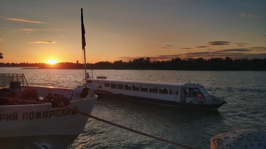
Text
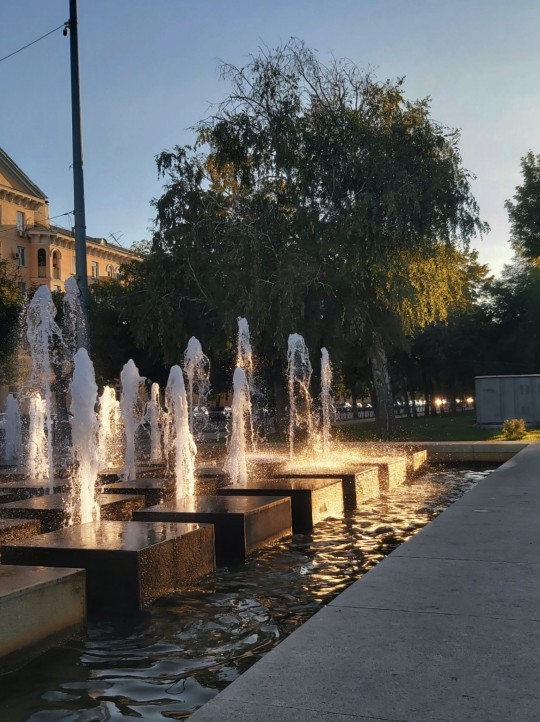


last summer days
mei ehara — you
перемотка — как тебя покорить
#my playlist#photography#my photography#aethestic#summer#my art stuff#russia#embankment#sunset#scenery#landscape#swan lake#artists on tumblr
17 notes
·
View notes
Text

The Embankment , London - Alexander Maclean
British , 1867-1940
Oil on canvas , 69.0 x 51.0 cm. 27 x 20 in
140 notes
·
View notes
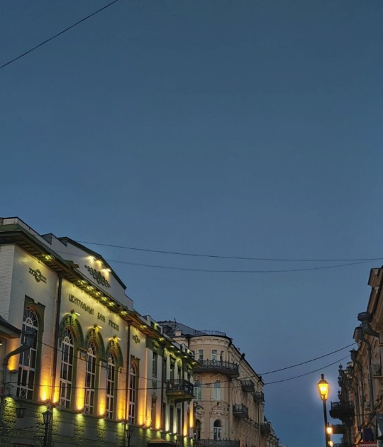
Text
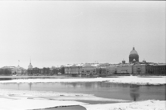
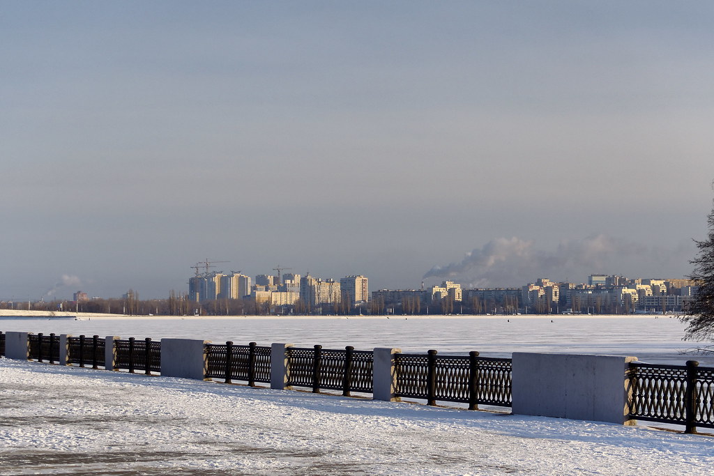
St.Petersburg, Russia [2023]
Camera: Zenit 122
Lens: Helios-44M
Film: TASMA 200iso
2 notes
·
View notes
Text
#embank
2 notes
·
View notes
Text
2 notes
·
View notes
Photo
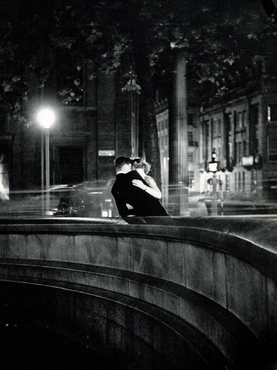
Love on the Embankment. Another fine photo by Izis Bidermanas from Charmes De Londres by Jacques Prevert, published in 1952.
79 notes
·
View notes
Video
flickr
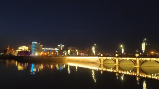
Voronezh 8 by Alexxx Malev
Via Flickr:
Russia. Voronezh. Voronezh Reservoir
Воронеж. Воронежское водохранилище
#2016#city#embankment#january#russia#voronezh#voronezh oblast#voronezh reservoir#winter#воронеж#воронежская область#воронежское водохранилище#город#зима#набережная#россия#январь#flickr#russian tumblr#русский tumblr
4 notes
·
View notes
Last Seen Blogs

rockvillemeditation
Rockville Meditation

killjoyjamie
I AM THE HIGH YOU CAN’T SUSTAIN

mixxedone
Can I make it better, with the lights turned on

danward-spiral-of-life
a Messy blog

fairfloweryfabulous-blog
Plants aren't as bad as everyone thinks