#point cloud
Text
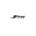
Dissolve - PointCloud with a Kinect sensor and body movement to particle reactivity made with TouchDesigner
#touch designer#creative coding#point cloud#sensors#kinect#artist on tumblr#artists on tumblr#l3v1at4#graphic art#graphics#works#work#animation#interactive art#visuals#interactive visuals#technology#digital arwork#digital artist#multimedia#multimedia art#glitchartistscollective#glitch#glitch art#particle simulation#glitch artists collective#GAC#glitch aesthetic
62 notes
·
View notes


Text

#IFTTT#Giphy#giphyupload#cat#gaming#pink#kawaii#purple#ar#augmented reality#skins#fighter#mortal kombat#tekken#blue hair#spikes#mobile gaming#point cloud#jadu#jadu ar#kneepads#ruben fro#shoulder pad
3 notes
·
View notes
Photo
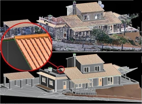
Disintegration
Lidar
2 notes
·
View notes
Text
0 notes
Text
Point Cloud to BIM: The Ultimate Guide for AEC Professionals

In the realm of architecture, engineering, and construction (AEC), the adoption of innovative technologies has revolutionized traditional processes. One such advancement is integrating Point Cloud data into Building Information Modeling (BIM) workflows.
Scan to BIM, also known as Point Cloud to Building Information Modeling (BIM) is a process used in the AEC industry to convert point cloud data captured from laser scanners or other reality capture methods into digital BIM models.
This fusion offers unprecedented levels of accuracy, efficiency, and detail, driving significant advancements in project planning, design, and construction phases.
In this comprehensive guide, we delve into the intricacies of Point Cloud to BIM, exploring its definition, Integration, software, application, benefits, challenges, and implementation strategies.
To get more insights - https://prototechsolutions.com/blog/point-cloud-to-bim-the-ultimate-guide-for-aec-professionals/
#point cloud to bim#scan to bim#point cloud#bim#laser scanning#reality capture#architecture#engineering#construction#civil engineering#surveying#drone#virtualreality#lidar#revit#digital twin#technology#mapping
0 notes
Text
Point Clouds and Scan to CAD in Revit
Introduction:
In the dynamic world of architectural design and construction, technological advancements continually redefine the boundaries of creativity and precision. One such groundbreaking integration that has reshaped the industry is the fusion of Point Clouds and Scan to CAD processes within Autodesk Revit. This transformative combination represents a paradigm shift, offering architects and designers an immersive and efficient approach to modeling real-world spaces. In this article, we embark on a journey to unravel the intricacies of Point Clouds and Scan to CAD in Revit, exploring how these technologies collaboratively breathe life into design, elevate precision, and unlock new dimensions of architectural innovation. As we delve into the synergies of data capture and digital modeling, a landscape of possibilities emerges, where the tangible and digital worlds converge seamlessly, reshaping the way we conceptualize and bring architectural visions to fruition.
How are point clouds generated, and what technologies are commonly used for their creation?
Point clouds are meticulously generated through advanced technologies such as 3D laser scanning or LiDAR, which employ laser beams to measure distances and create detailed representations of physical environments. Terrestrial Laser Scanning (TLS) and Mobile Laser Scanning (MLS) involve stationary or mobile scanners, respectively, capturing multiple scans to compile a comprehensive point cloud. Airborne LiDAR and satellite LiDAR leverage aerial platforms to emit laser pulses and gather 3D data on a larger scale. Photogrammetry, utilizing Structure from Motion (SfM) with overlapping photographs, contributes to dense point clouds. Time-of-Flight (ToF) cameras emit infrared light pulses, while underwater sonar technology maps submerged structures and terrain. The choice of technology depends on factors like project scale, required detail, and the scanning environment. Continued advancements in these technologies continually refine the precision and efficiency of point cloud generation, making them indispensable across various applications, from architectural design to environmental monitoring and industrial inspections.
SCAN TO CAD:
Scan to CAD services involve the conversion of raw point cloud data, acquired through advanced scanning technologies like laser scanning or LiDAR, into editable and usable Computer-Aided Design (CAD) models. This process is essential for translating real-world, physical environments into a digital format that can be manipulated, analyzed, and integrated seamlessly into various design and engineering applications. Scan to CAD services typically employ specialized software and skilled professionals to process large and complex datasets, ensuring accuracy and precision in the resulting CAD models. These services find widespread application in fields such as architecture, engineering, construction, and surveying, where the need for detailed and accurate representations of existing structures or landscapes is critical for effective planning, design, and decision-making. Scan to CAD services play a pivotal role in transforming the way professionals interact with and manipulate spatial data, offering a powerful toolset for creating, modifying, and optimizing digital designs based on real-world conditions.
Primary purpose of the Scan to CAD process in the field of design and architecture:
The primary purpose of the Scan to CAD process in the field of design and architecture is to bridge the gap between the physical world and the digital design environment. It involves converting three-dimensional point cloud data, obtained through laser scanning or other surveying methods, into a format compatible with Computer-Aided Design (CAD) software. This transformation allows designers, architects, and engineers to work with accurate and detailed representations of existing physical spaces in their digital models. The Scan to CAD process enhances precision, efficiency, and adaptability in the design workflow, providing a foundation for creating realistic and informed digital models that closely mirror real-world conditions. It is a crucial step in modern design practices, facilitating more accurate planning, analysis, and visualization throughout the entire lifecycle of a construction project.
How they work together SCAN to CAD and POINTCLOUD in Revit?
The seamless integration of Scan to CAD and point cloud technologies in Autodesk Revit represents a dynamic synergy that revolutionizes the architectural design process. Point clouds, generated through advanced scanning techniques, serve as a rich and detailed source of spatial information, capturing the intricacies of physical environments. Scan to CAD acts as the intermediary, translating this raw point cloud data into editable CAD models within the Revit environment. This transformative workflow empowers architects and designers to leverage the unparalleled precision of point clouds while working within the familiar and versatile platform of Revit. The integration facilitates the creation of highly accurate digital models that mirror real-world conditions, allowing for immersive visualization and informed decision-making. Designers can navigate existing structures, capture minute details, and seamlessly incorporate this data into their Revit projects, resulting in a more efficient and precise design process that bridges the gap between the physical and digital realms.
CONCLUSION:
In conclusion, RVTCAD the harmonious collaboration between Scan to CAD, point cloud technologies, and Autodesk Revit is reshaping the landscape of architectural design and digital modeling. Point clouds, acting as detailed 3D snapshots of physical environments, provide an unparalleled level of accuracy and realism. Scan to CAD, as the intermediary process, smoothly translates this wealth of data into editable and adaptable CAD models within the intuitive framework of Revit. This integration not only expedites the design process by eliminating manual measurements but also enhances precision and visual fidelity. With the capabilities of Revit, architects and designers can seamlessly navigate, analyze, and manipulate these detailed digital models, fostering a more immersive and informed design experience.
0 notes
Text

😔 Oh Crowley..
#good omens#good omens 2#crowley#ineffable husbands#the sketch got out of hand#this series has so much stuff I love to draw like clouds fabrics historical fashion flowy hair wings religious imagery stars sad old men-#I'll get better at drawing actors at some point just bear with me for now#my art
10K notes
·
View notes
Photo

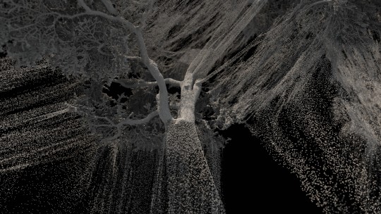
Accurate Building 3D Modeling with Scan to BIM
Scan-to-BIM is a process that leverages scanning technologies to capture detailed 3D data of existing buildings and convert it into a digital BIM model.
This process enhances project understanding, coordination, and collaboration, ultimately improving the efficiency and accuracy of building design, construction, and management.
This article will help you in understanding Scan to BIM: Converting Physical Buildings Into 3D Models Using Scan To BIM
0 notes
Text
Structural BIM Services In India, USA - Cadeosys
Cadeosys is one of the leading names in the field of structural detailing. We are known for providing a comprehensive range of Structural BIM services. Cadeosys provide services in the fields of firefighting, BIM, 3D rendering, CAD, plumbing, electrical design, and HVAC.
Call: 090379 63633
http://cadeosys.com

#cadeosys#bim#cad#mep#structural BIM#point cloud#electrical design services#hvac#Fire Fighting#revit
0 notes
Text

6 Most Frequently Asked Questions About Point Cloud Modelling!
A pointcloud modelling is a collection of different data points that exist within three dimensions with each one having X, Y, and Z coordinates. Each of these points represents a portion of a surface within a certain area like an engineering work site.
0 notes
Link
In this article, we will explore the benefits of lidar pipe inspection and how it is revolutionizing the pipeline industry.
0 notes
Text
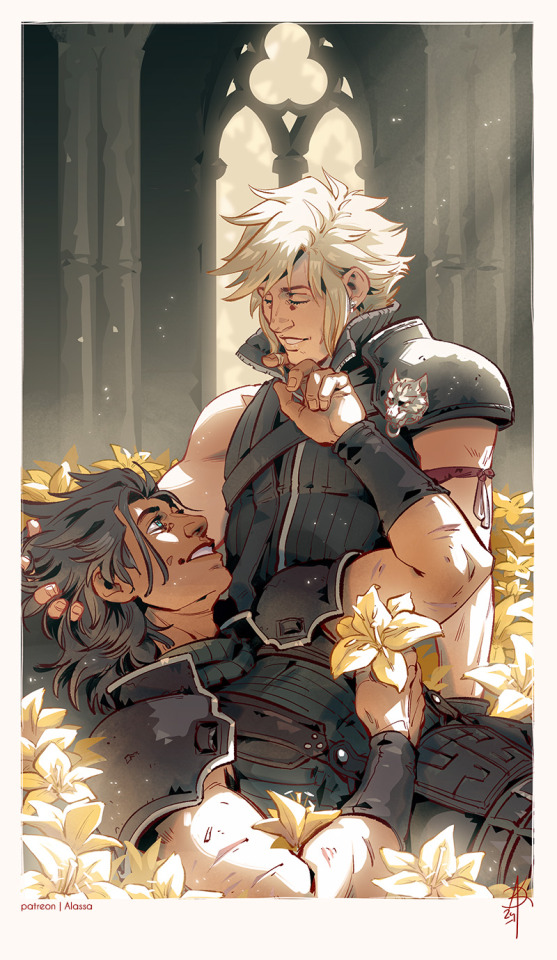
This time...
... I will never let you go
#zakkura#clack#zack fair#cloud strife#ff7#final fantasy 7#ff7 rebirth#one interaction between them is all i ask#i hope for more#but i'm also pretty sober and know that they are down the rare ship road at this point#so#yeah#loved drawing this one though
2K notes
·
View notes
Text
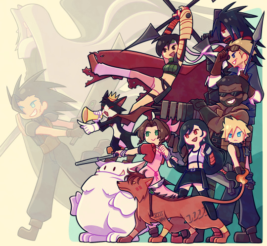
The rebirth demo has me so hyped how DARE you make me wait until the end of the month for the full game
#me & my dad literally finally bought a ps5 purely bc of the demo#we HAD been considering buying it for a while now especially since its getting to the point a lot of newer titles are only released there#but we watched the state of play trailer and was like '...okay so how much does a ps5 cost again?'#anyway the demo was fun as hell and i cant wait for the junon part to drop so i can continue to go crazy#cloud strife#tifa lockhart#barret wallace#cid highwind#vincent valentine#yuffie kisaragi#cait sith#aerith gainsborough#red xiii#nanaki#zack fair#sephiroth#final fantasy#final fantasy 7#final fantasy vii#ff7#ffvii#art#my art#xanders art#digital art#fan art
2K notes
·
View notes
Text
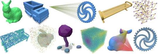
Point Cloud Utils:Pythonで3D点群・メッシュを扱うライブラリ
3Dコンピュータービジョンや
点群処理のライブラリも
GPLv2ライセンス。
Point Cloud Utils
Point Cloud Utils (pcu)は、点群や三角形メッシュの3D処理のために以下機能を提供するユーティリティライブラリです。以下機能の使用方法に関するドキュメントはExampleのセクションを参照してください。
多くの一般的なメッシュ形式(PLY, STL, OFF, OBJ, 3DS, VRML 2.0, X3D, COLLADA)を読み書きできるユーティリティ関数。MeshLabにインポート可能な形式なら読み込み可能です!
メッシュ上でポイントサンプルを生成するための一連のアルゴリズム:
“Parallel Poisson Disk Sampling with Spectrum Analysis on…
View On WordPress
0 notes
Last Seen Blogs