#Mono County
Text
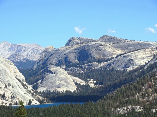
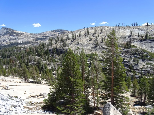

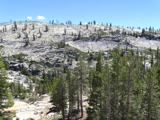
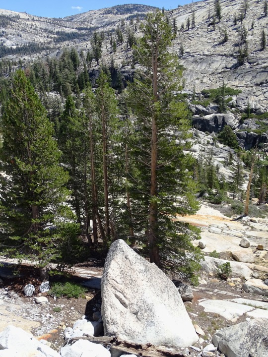
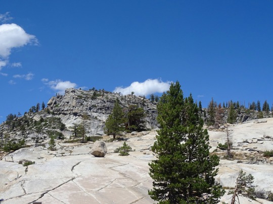
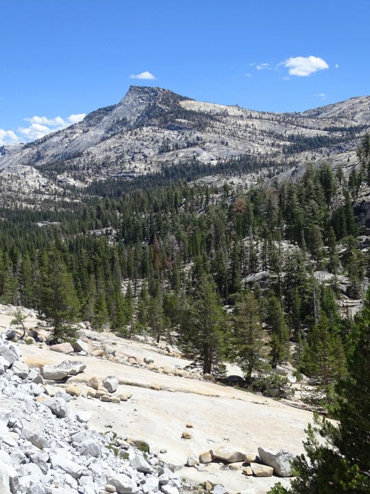

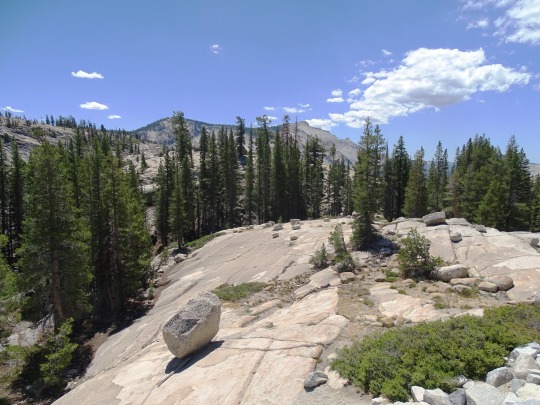
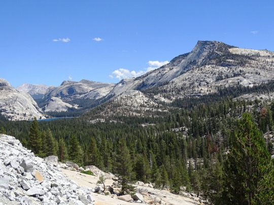
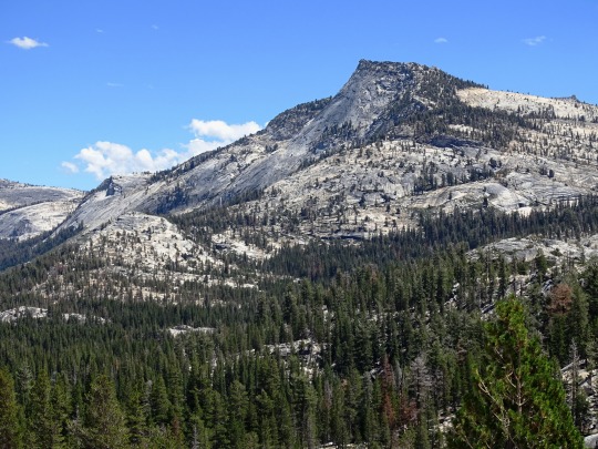
Yosemite National Park, CA (No. 8)
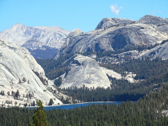
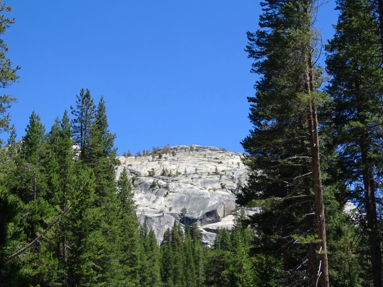
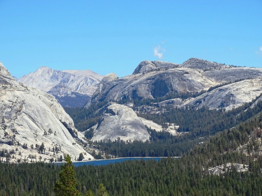
Olmsted Point is a viewing area off Tioga Pass Road in Yosemite National Park which offers a view south into Tenaya Canyon, giving, in particular, a view of the northern side of Half Dome, Clouds Rest, and a view of Tenaya Lake to the east. The granite slopes immediately south and southwest of the parking lot feature numerous glacial erratics scattered about, as well as a short 0.125 mi (0.2 km) trail leading south - through a small grove of trees - to the top of a small granite dome where the view of Clouds Rest and Half Dome is clearest.
The site is named after landscape architects Frederick Law Olmsted and Frederick Law Olmsted Jr.
Source: Wikipedia
#Yosemite National Park#Sierra Nevada#Mono County#geology#flora#California#summer 2022#tourist attraction#landmark#landscape#countryside#USA#nature#forest#woods#fir#pine#rocks#travel#original photography#vacation#granite#Tenaya Lake#blue sky#clouds#alpine lake#Olmsted Point#trail#Clouds Rest
18 notes
·
View notes
Video
flickr
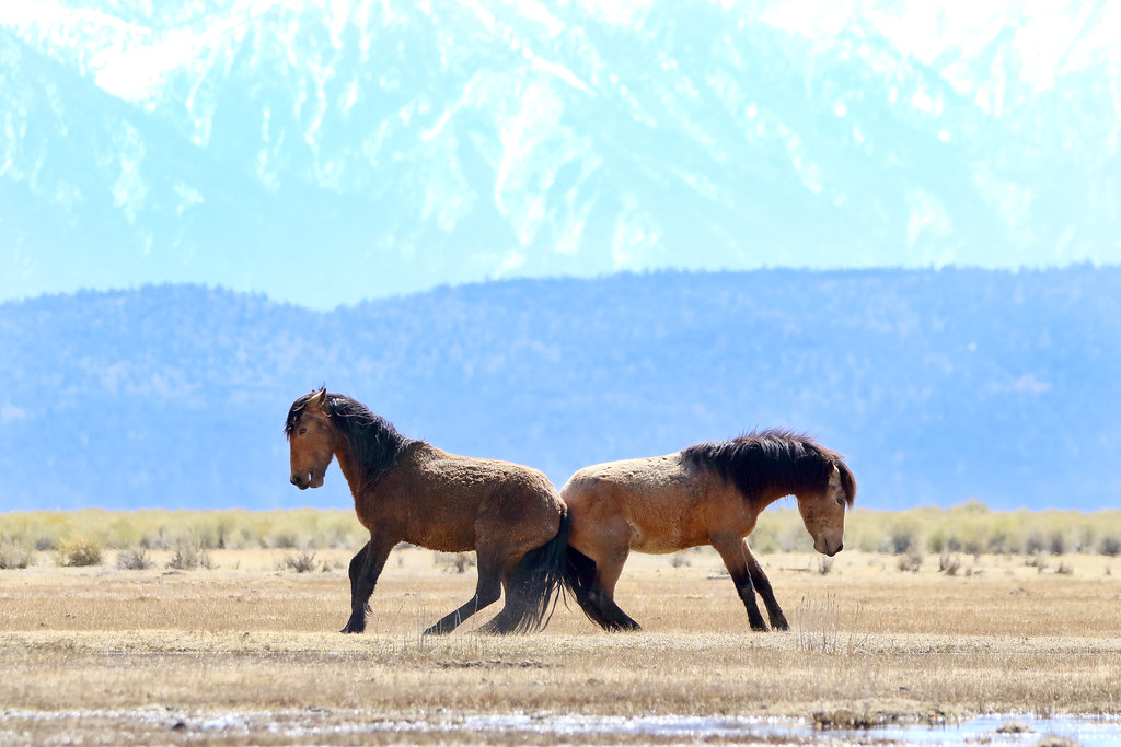
Wild Horse Tussle, Mono County, California by Rollie Rodriguez
18 notes
·
View notes
Text
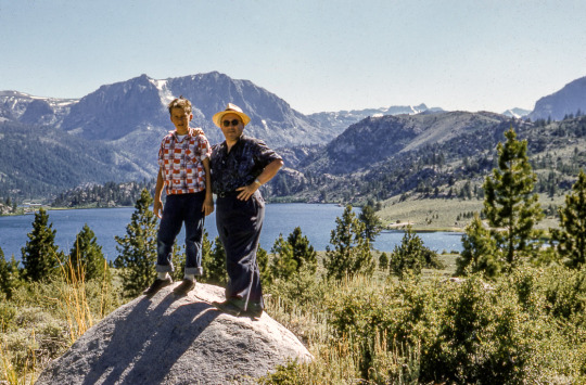
Father and son hike around June Lake
Mono County, California
1959
#vintage camping#campfire light#california#mono county#june lake#hiking#road trips#history#travel#outdoors
91 notes
·
View notes
Text
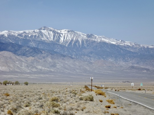
Highway: California 266 at Nevada Border, 2013.
#landscape#mountains#highway#california 266#snow#arid#mono county#california#2013#photographers on tumblr
34 notes
·
View notes
Text

Bodie State Historic Park
Mono County, California
Bodie was a booming mining town during the Gold Rush in California.
Photo by Boris Edelmann/Shutterstock
#boris edelmann#photographer#shutterstock#bodie state historic park#mono county#california#mining town#gold rush#history
3 notes
·
View notes
Text

Bishop, California 2019
#original photographers#photographers on tumblr#cali#california#california dreaming#bishop#eastern sierra#Sierra mountains#mono county#travel#explore#fernweh#adventure
25 notes
·
View notes
Text

Leavitt Falls Vista Point, Bridgeport, Mono County, California, United States
Denys Nevozhai
#Leavitt Falls Vista Point#Bridgeport#Mono County#California#United States#USA#US#North America#CANature
0 notes
Video

flickr
Eastern Sierra Rock Climbing par monocounty
Via Flickr :
Rock Climbing above the pines in the Eastern Sierra, Mono County, California.
0 notes
Text
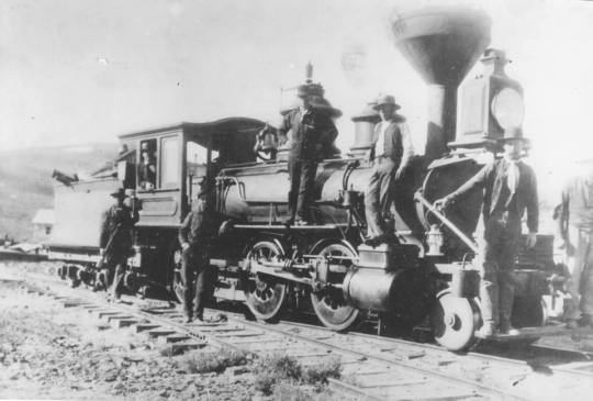
Bodie and Benton Railway
The Bodie and Benton Railway operated for about thirty eights years, supplying the town of Bodie, California. The narrow gauge railroad travelled north, from the forests south of Lake Mead up to the townsite of Bodie.
Bodie Railroad Station, Bodie State Historic Park, Bodie, Mono County, CA. Historic American Buildings Survey (Library of Congress) – DeHaas, John N, Jr, photographer
The Bodie…
View On WordPress
0 notes
Photo

50 years ago beneath the lake by zxwang
#500px#tufa#california#mono lake#mono county#water#lake#astrophotography#astronomy#milky way#nightsc
0 notes
Video

flickr
Laurel Mountain by Dustin Blakey
Via Flickr:
11,812 ft.
#Convict Lake#California#Laurel Mountain#Lake#Mono County#mountains#Eastern Sierra#Mammoth Lakes#United States#US#evening#Sierra Nevada#water#granite#geology#flickr
1 note
·
View note
Text

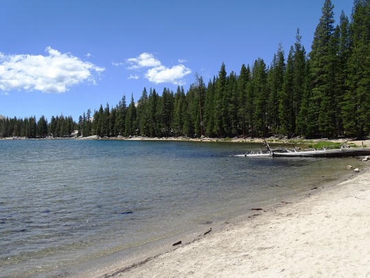

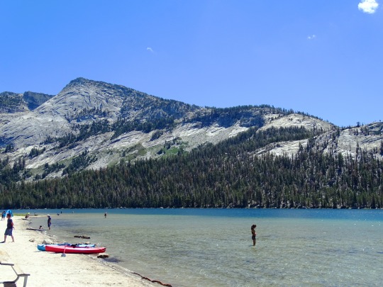
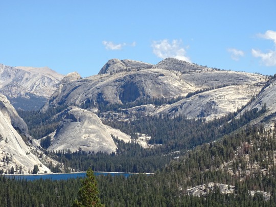
Yosemite National Park, CA (No. 7)
Tenaya Lake is an alpine lake in Yosemite National Park, located between Yosemite Valley and Tuolumne Meadows. The surface of Tenaya Lake has an elevation of 8,150 feet (2,484 m). The lake basin was formed by glacial action, which left a backdrop of light granite rocks, whose beauty was known to the Native Americans. Today, Tenaya Lake is easily accessible by State Route 120 and is a popular lake for water activities.
Tenaya Lake is named after Chief Tenaya, who was the chief of the native people who lived in Yosemite Valley before being driven out by the Mariposa Battalion. Tenaya protested that the lake already had a name: Pie-we-ack, or "Lake of the Shining Rocks." This original name is now attached to Pywiack Dome, a granite dome to the east of the lake.
As part of the 1864 Yosemite grant, the area became the first park land to be federally protected for preservation and public use. Yosemite became a national park in 1916 with the advent of the National Park Service.
In 1868, John Muir wrote about the Tenaya Lake's beauty and timelessness in My First Summer in the Sierra.
Tenaya Lake was created by the Tenaya Glacier, which flowed out of the vast Tuolumne Ice Sheet and down to Yosemite Valley. This same glacier created Half Dome. The Tenaya Glacier was lightly loaded with debris, and did not leave a large amount of moraine material near Tenaya Lake.
The lake is supplied by a network of creeks and springs including Murphy Creek to the northwest and Tenaya Creek. Tenaya Creek is an outflow of Cathedral Lakes and serves as both the principal inlet and outlet of Tenaya Lake. Tenaya Creek also runs through Tenaya Canyon into Yosemite Valley.
Source: Wikipedia
#Yosemite National Park#Sierra Nevada#Mono County#geology#flora#California#summer 2022#tourist attraction#landmark#landscape#countryside#USA#nature#forest#woods#fir#pine#rocks#travel#original photography#vacation#creek#granite#Tenaya Lake#lake shore#blue sky#clou#alpine lake#canoe#beach
14 notes
·
View notes
Text
I am tired of touching grass, I need the sensation of cold on my face as I Shoot Down a mountain on Skis, the feeling of pebbles in my shoes from a long day of treading rocky paths. The touch of rust and wood of a Ghost Town, the scent of pine, pollen, and pittering rainfall. The crunch of Autumn leaves and the smooth face of natural obsidian. The sights of small plains and vibrant skies. The taste of local foods welcome in my soul.
All the glorious things that make me cry inside,
Because I cannot drive.
0 notes
Video
Previously-Loved by Gary
Via Flickr:
Benton Hot Springs, CA.
0 notes
Text

Mono Lake off the agenda! US 395 at Mammoth Lakes, California, 30 March 2023.
Did not have chains for our rental Subaru, and I am unaccustomed to snow driving, so we turned back 40 or so km before the lake. So much snow in the Sierra and adjacent areas!
#landscape#forest#snow#mammoth lakes#mono county#California#2023#photographers on tumblr#highway#us 395
17 notes
·
View notes
Last Seen Blogs

jcsrecords
JCS Records

verm1c1de
Blog for Deranged Peoples

luminities
LUMINITIES

haeechaaan
you drew stars over my scars

acepumpkinpatrick
why not everything?