#hiking alberta
Text
Skip to content
Troll Falls: Kananaskis (Alberta)
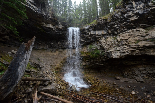
Location: Troll Falls, Kananaskis, Alberta, Canada
Distance: 2.1 miles
Hike Type: Easy, Out-and-Back
Troll Falls is a waterfall that is dramatically falls over a half-bowl of rock. It is a very easy and well-maintained hike, and likely one of the most popular in the area so expect many people on the trail with you.
I do not recommend climbing to the back of the waterfall. The rockface is very slippery and the fall could be deadly.
This hike is also popular in winter.
Update: Since I was last on this hike, trail additions, including railings, have been added.
#hiking#hike#hikes#AlbertaHikes#alberta hikes#HikingAlberta#hiking alberta#alberta#canada#travel alberta#TravelAlberta
3 notes
·
View notes
Text
Castle mountain, Banff National Park🇨🇦
#castle mountain#banff national park#Alberta#Canada#aimeekb#my photography#canadian national parks#canadian rockies#lesbians who hike#hiking#forest#adventure#explore#lake#glacier lake#mountains
3K notes
·
View notes
Text

Art students painting hoodoos.
Banff National Park, Alberta
1957
#vintage camping#campfire light#alberta#canada#banff national park#nature painting#NFB#history#hiking#travel#1950s
519 notes
·
View notes
Text
Waterton Park, Alberta, Canada. Photo by Jaime Reimer.
#rvlife#camping#rv living#adventure#traveling#rvadventures#travel#campfire#rvliving#travel photography#alberta#canada#hikingadventures#hiking#rvlivingfulltime#vanlove#vanlife#vanliving#beautiful photos#photooftheday#photography#landscape photography
103 notes
·
View notes
Text
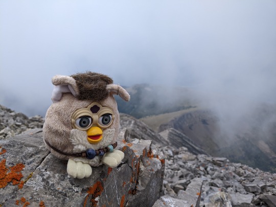


Furby brooding in the mist on Old Baldy today.
#furblr#safe furby#furby buddy#hiking#alberta#that was good im much more chill after the hell week now ✌️#personal
42 notes
·
View notes
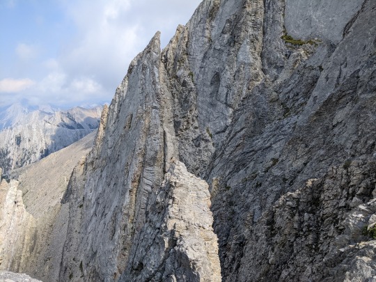
Text
Galatea, July
22 notes
·
View notes
Text
Alberta Wildfire Resource Links

Considering the ongoing wildfire impacts on our Alberta communities, environment & outdoor enthusiasts, we are revamping our info links post to be a more permanent resource on our socials & blog for easy access.
** Stay Up To Date On Provincial Fire Bans Across Alberta**
Alberta Wildfire Status Dashboard
This is an Alberta map showing all active wildfires in the province and their status (controlled / not controlled, etc).
Government of Alberta Wildfire Status Page
Find active wildfires on the wildfire dashboard, see wildfires of note and find the latest forest area updates.
511 Alberta Highway Closures
Highway Closure Webpage ; specific information on highway and road closures. This may also include roadway closures due to accidents or other natural disasters.
Alberta Parks Fire Bans Info
**There is a Fire Ban in effect Alberta Wide.
This website gives you fire bans and is searchable by area / location. Scroll down to find the map and location search table.
Water Levels & Other Environmental Planning Information
Alberta Parks and Environment River Basin Water Level Interactive Map
This interactive map gives specific information on all Alberta Rivers, including water levels and ice flow warnings and forecaster warnings for upcoming weather events that might impact water levels.
Government of Canada Water Level and Flow webpage
This page gives real-time hydrometric data (real-time water level data) and historical hydrometric data (historic water level data). Canada wide.
Government of Canada, Alberta Water Level and Flow webpage
This page gives real-time hydrometric data for the province of Alberta.
We strongly encourage you to:
Plan before travel / hiking.
Prepare an emergency backup plan incase fire breaks out where you are camping/hiking & leave a trip itinerary with a friend/family member at home. If you are caught in an emergency situation this will give first responders an idea where to look for you.
Know wildfire locations & risk levels
Know Highway/roadway closures
71 notes
·
View notes
Text
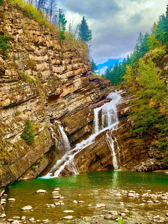
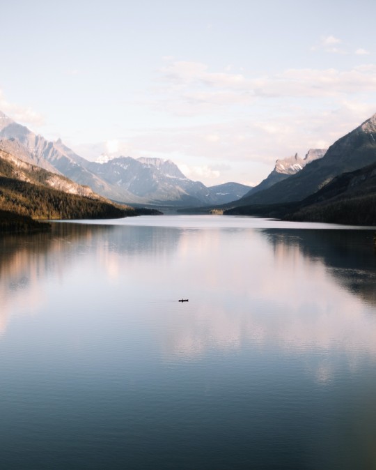
Waterton Lakes National Park, Rocky Mountains, Alberta, Canada, 26 September 2023. Photograph taken by Thomas Keith Tidwell.😎
#original photography on tumblr#utahphotographer#snapshot#phtotographers on tumblr#landscape#hiking#wanderlust#landscape photography#hikingphotography#wanderer#rocky mountains#mountainlandscape#nationalpark#national park#canadian#alberta#hikingtrip#hikingtrail#hikingcanada#hikingaddict#hikingtrails#hikingadventures#fall#mountain landscape#landscapephotography#rockymountainhigh
26 notes
·
View notes
Photo

Lake Minnewanka
#lakeminnewanka#alberta canada#albertamountains#banffcanada#banffalberta#explore#nature hikes#naturephotography#mountains#hiking#wanderlust#explorer#naturelover#travel#scenics - nature#scenic route#follow the blog i reblogged this from#reblog
37 notes
·
View notes
Text
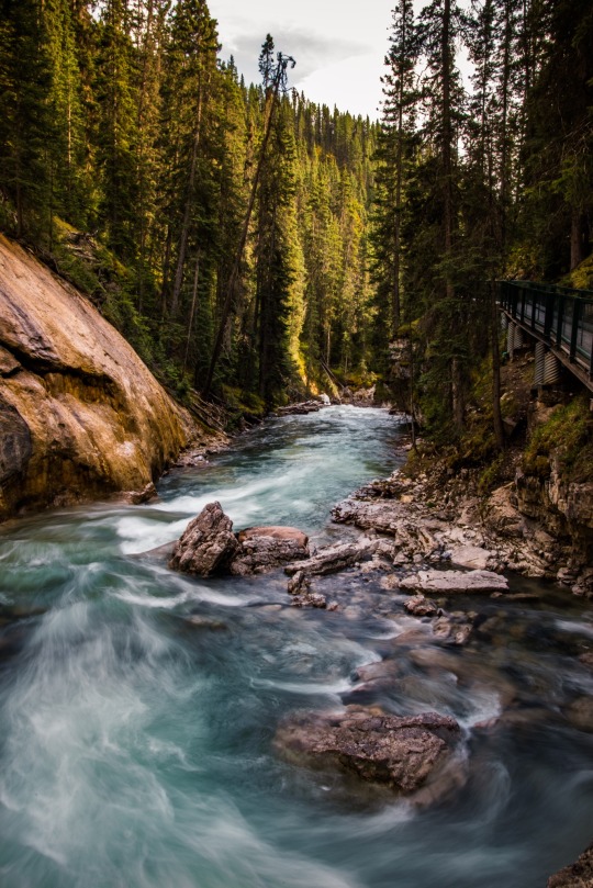
Johnston Canyon, Banff National Park🇨🇦
#johnston canyon#banff national park#Canada#aimeekb#Alberta#waterfall#river#lesbians who hike#hiking#forest#adventure#nature#explore#travel#mountains#canadian rockies#canadian national parks#my photography
4K notes
·
View notes
Text

Cooling down with some refreshing mountain water in the Valley Of The Ten Peaks.
Banff, Alberta
1977
#vintage camping#campfire light#banff#alberta#valley of the ten peaks#camping#hiking#history#nat geo#1970s
622 notes
·
View notes
Text
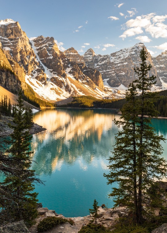
The stillness and colors of the scenery reminded me of fine paintings 🖼️
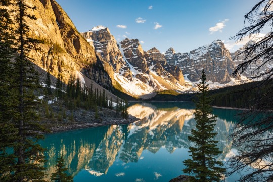
📍: Moraine Lake, Banff National Park, AB, CA
📸: Canon RP
© Mitchell Loh, 2023
#landscape#nature#adventure#hiking#outdoors#landscape photography#photographers on tumblr#canadian rockies#moraine lake#lake#national park#canada#alberta#scenic#naturecore#nature photography#beautiful
14 notes
·
View notes
Text
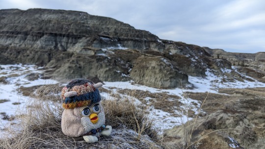
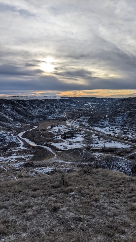
Furby in the badlands (what will he do?)
14 notes
·
View notes
Text

Larches of Highwood country, September 2022
7 notes
·
View notes
Text


First hike of the season 🏔️
#canada#solo travel#travel#working holiday#hiking#spring#jasper#hidden valley#mountains#alberta#geocache
3 notes
·
View notes
Last Seen Blogs

jaycriss-blog
Jay Criss presents Fresh Fuzion

zetsuboukana
Fran

songandcrest
Song & Crest Standard

carbajalglzdaniela-blog
Daniela

snarkysims-medieval
Snarky's Medieval Sims