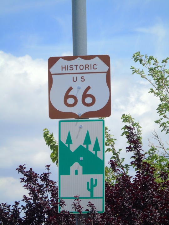
#Sitgreaves Pass
Text
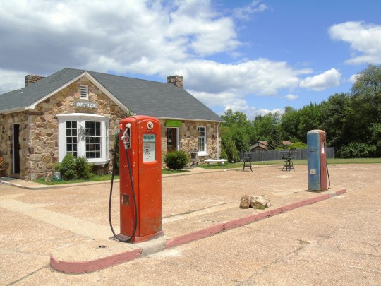


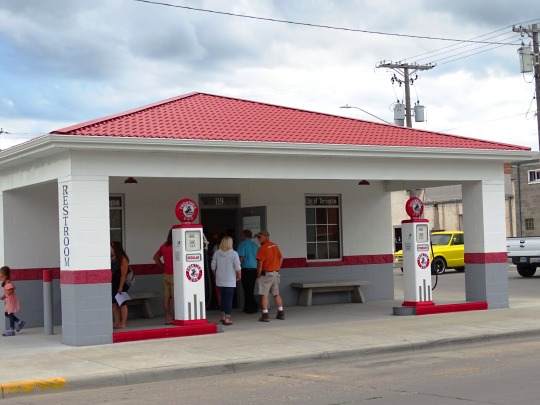
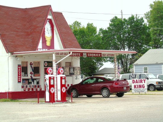
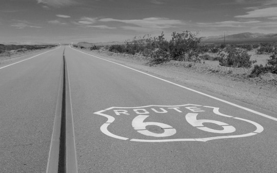
The first “drive-in” filling station, Gulf Refining Company, opened to the motoring public in Pittsburgh on December 1, 1913, at Baum Blvd & St Clair’s Street.
#Torrington#Wyoming#Sitgreaves Pass#Illinois#drive-in filling station#USA#gas station#1 December 1913#anniversary#US history#summer 2014#2019#Galena#Kansas#Dwight#Wagon Wheel Motel#Shamrock#Texas#Cuba#Missouri#Arizona#Los Angeles#old stuff#California#old gas station#architecture#Route 66 Roadside Attraction#landmark#tourist attraction#cityscape
3 notes
·
View notes
Video
flickr
Sky by Dave Lawler
Via Flickr:
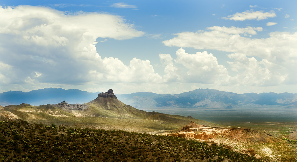
From Sitgreaves Pass. Just trying to show the rental car a good time.
#Arizona#sky#desert#landscape#Route 66#scenic#scenery#southwest#clouds#Nikon#Nikkor#Sitgreaves Pass#Mount Nutt Wilderness#cactus#cacti#flickr#photography#photographers on flickr#photographers on tumblr
0 notes
Conversation
U.S. Daily Precipitation Records Tied/Broken 8/7/22
Moulton, Alabama: 2.39" (previous record 1.25" 1959)
Atigun Pass summit, Alaska: 4.2" (previous record 0.8" 1999)
Chugach National Forest, Alaska: 0.5" (previous record 0.3" 2011)
Indian Pass summit, Alaska: 1.3" (previous record 1" 2018)
Apache National Forest, Arizona: 0.8" (previous record 0.3" 2012)
Sitgreaves National Forest, Arizona: 1.5" (previous record 0.8" 2005)
Gilroy, California: 0.01" (previous record 0" 2021)
Sonora Pass summit, California: 0.5" (previous record 0.4" 2014)
Denver, Colorado: 1.11" (previous record 0.95" 1973)
Great Sand Dunes National Preserve, Colorado: 1.2" (previous record 0.8" 2019)
Trinidad, Colorado: 0.9" (previous record 0.84" 1948)
Unincorporated Bear Lake County, Idaho: 1.05" (previous record 0.29" 1993)
Swan Valley, Idaho: 1.34" (previous record 0.65" 1986)
Targhee National Forest, Idaho: 0.2" (also 0.2" 2008)
Tetonia, Idaho: 0.64" (previous record 0.38" 2009)
Freeport, Illinois: 4.42" (previous record 0.9" 1969)
Mt. Carroll, Illinois: 1.97" (previous record 1.86" 1927)
Stockton Township, Illinois: 4.24" (previous record 1.89" 1991)
Charles City, Iowa: 3.1" (previous record 1.32" 1968)
Clear Lake, Iowa: 2.08" (previous record 1.75" 1991)
Cox Creek Township, Iowa: 2" (previous record 1.14" 1995)
Decorah, Iowa: 1.71" (previous record 1.41" 1925)
Eagle Township, Iowa: 2.89" (previous record 1.65" 1992)
Estherville Township, Iowa: 3.28" (previous record 1.42" 1938)
Fayette, Iowa: 2.7" (previous record 2.34" 1925)
Forest Township, Iowa: 3.75" (previous record 2.2" 1938)
Kanawha, Iowa: 1.03" (previous record 0.85" 1966)
Lake Mills, Iowa: 3.7" (previous record 0.78" 1966)
Manchester, Iowa: 2.75" (previous record 0.72" 1991)
Mason City, Iowa: 3.7" (previous record 2.67" 1968)
New Hampton, Iowa: 3.08" (previous record 2.47" 1925)
Rock Rapids, Iowa: 1.94" (previous record 1.26" 1918)
Sibley, Iowa: 3" (previous record 1.67" 2010)
Spirit Lake, Iowa: 1.38" (previous record 0.83" 2000)
Table Mound Township, Iowa: 2.23" (previous record 1.08" 1970)
Westlake, Louisiana: 0.84" (previous record 0.56" 1987)
Crystal Lake Township, Michigan: 2.44" (previous record 1.39" 1981)
Caledonia, Minnesota: 2.48" (previous record 1.61" 1980)
Owatonna, Minnesota: 1.83" (previous record 1.22" 1992)
Winnebago, Minnesota: 1.58" (previous record 1.51" 1992)
Unincorporated Jefferson County, Mississippi: 1.11" (previous record 0.62" 1987)
Colstrip, Montana: 0.52" (previous record 0.37" 2009)
Unincorporated Custer County, Montana: 0.85" (previous record 0.57" 2009)
Custer National Forest, Montana: 0.5" (previous record 0.4" 1993)
Humboldt National Forest, Nevada: 1" (previous record 0.5" 2017)
Ward Mt. summit, Nevada: 0.3" (also 0.3" 2017)
Silver Creek Divide summit, New Mexico: 0.9" (previous record 0.4" 2018)
Fremont National Forest, Oregon: 0.2" (also 0.2" 2015)
Unincorporated Edgefield County, South Carolina: 0.83" (previous record 0.73" 1991)
Unincorporated Spartanburg County, South Carolina: 1.86" (previous record 0.37" 2012)
Iroquois, South Dakota: 0.91" (previous record 0.59" 1951)
Sioux Falls, South Dakota: 5.44" (previous record 1.88" 1938)
Nashville, Tennessee: 1.35" (previous record 1.05" 1965)
Logan, Utah: 1.38" (previous record 0.24" 2014)
Manti-La Sal National Forest, Utah: 0.8" (previous record 0.7" 2016)
Wasatch National Forest, Utah: 0.2" (also 0.2" 2014)
Blacksburg, Virginia: 1.02" (previous record 0.79" 1960)
New Castle, Virginia: 0.87" (previous record 0.5" 1940)
Appleton, Wisconsin: 3.4" (previous record 1.53" 1980)
Cuba City, Wisconsin: 1.8" (previous record 0.89" 2013)
Ft. Atkinson, Wisconsin: 2.1" (previous record 1.33" 1960)
Genoa Township, Wisconsin: 1.6" (previous record 1.2" 2006)
Green Bay, Wisconsin: 1.3" (previous record 1.24" 2015)
Hancock, Wisconsin: 2.05" (previous record 1.67" 1980)
Kewaunee, Wisconsin: 2.25" (previous record 1.2" 1959)
Madison, Wisconsin: 1.94" (previous record 1.16" 2007)
New London, Wisconsin: 2.29" (previous record 1.38" 1920)
Prairie Du Chien, Wisconsin: 1.85" (previous record 1.74" 1920)
Stark Township, Wisconsin: 2.08" (previous record 0.28" 1998)
Stevens Point, Wisconsin: 2" (previous record 1.46" 1980)
Viroqua, Wisconsin: 2.35" (previous record 1.4" 1925)
Wisconsin Rapids, Wisconsin: 1.7" (previous record 1.52" 1980)
Afton, Wyoming: 1.09" (previous record 0.34" 2000)
Bighorn National Forest, Wyoming: 0.55" (previous record 0.37" 1967)
Bone Springs Divide summit, Wyoming: 0.5" (also 0.5" 2001)
Boysen State Park, Wyoming: 0.25" (previous record 0.07" 1977)
Dubois, Wyoming: 0.34" (previous record 0.22" 2014)
Grand Teton National Park, Wyoming: 1.22" (previous record 1.03" 2021)
Unincorporated Lincoln County, Wyoming: 0.61" (previous record 0.44" 1993)
#Storms#U.S.A.#U.S.#Alabama#1950s#Idaho#1990s#1980s#Illinois#1960s#1920s#Iowa#1930s#1910s#Louisiana#Michigan#Minnesota#Mississippi#Montana#South Carolina#South Dakota#Utah#Virginia#1940s#Wisconsin#Wyoming#1970s#Colorado#New Mexico#Arizona
2 notes
·
View notes
Video
vimeo
Oatman from William F Pittock on Vimeo.
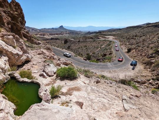
MINI Takes Route 66 2023 - the 30 minute ride over the Sitgreaves Pass from Oatman to Kingman, Arizona on June 24, 2023.
0 notes
Text
Galloping West for the Fun Run - Part 3
Galloping West for the Fun Run – Part 3
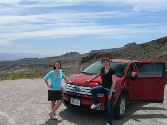
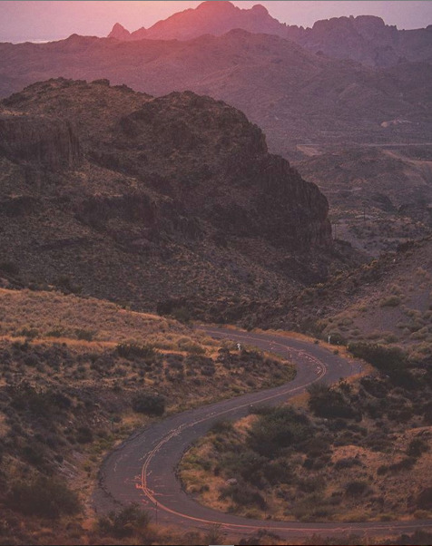
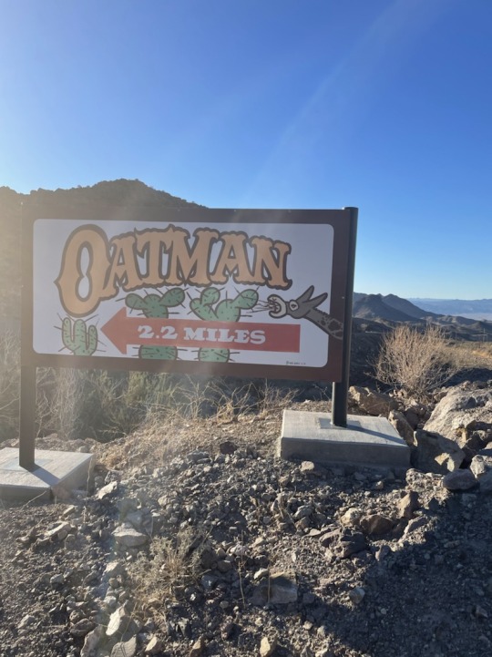
The second (and last) day of the Arizona Route 66 Fun Run took me through one of my favorite segments of the entire road: the Oatman Highway.
The original alignment of Route 66 between Kingman, AZ and the California border takes drivers through the Black Mountains for 48 miles, reaching a height of 3,586 feet at Sitgreaves Pass. The namesake of this little stretch is Oatman, a former mining town…
View On WordPress
0 notes
Video

flickr
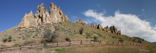
Sitgreaves Pass by James Marvin Phelps
Via Flickr:
Sitgreaves Pass Route 66 Golden Valley, Arizona November 2021
#Route 66#Arizona#Gold Valley#Sitgreaves Pass#Oatman#Kingman#History#Desert#Mojave Desert#Travel#Route 66 History#Cool Springs#James Marvin Phelps Photography#Road#Highway#Vintage
4 notes
·
View notes
Text
19. Tag 28.4.2009 Wieder auf der Route 66 über die Berge
19. Tag 28.4.2009 Wieder auf der Route 66
"Als wir aus dem Ort auf der Route 66 raus fuhren, kamen uns dann doch noch ein paar Esel entgegen. Wirklich "wild" waren sie zum Glück nicht - ganz im Gegentei - steckten ihre Schnauze ins Auto um zu betteln"
Strecke: Las Vegas – Barstowgefahrene Meilen: 337 mMotel/Hotel: Days Inn Barstow I-15Preis pro Nacht: ?
Las Vegas – Kingman – Oatman – Needles – Barstow
Nach dem Frühstück auf dem Zimmer – einen Kaffee gabs wieder von Starbucks – fuhren wir aus der Glitzerstadt wieder über den Hoover Dam zurück nach Kingman. So schön und bunt und unterhaltsam Las Vegas wieder war, sind wir doch froh, heute…
View On WordPress
#Amboy#Bagdad Cafe#Barstow#Black Mountains#California#Clark Gable#Las Vegas#O.C.California#Oatman#Out of Rosenheim#Roadtrip#Route 66#Sitgreaves Pass
1 note
·
View note
Photo
Meanwhile, just imagine what a Wacky Races or Fender Bender 500 such would have looked like through Sitgreaves Pass, on a pre-1953 alignment of the legendary Route 66 as passed through Oatman, Arizona.
0 notes
Video
youtube
The recurring battle of ranchers versus wild horses. Nobody wins those arguments, and nobody loses either. We have “policy” decisions to make. We either enforce federal law, as written and not as creatively interpreted (as it was during Obama’s first term), or we don’t. If we enforce, we seek out and prosecute those who kill wild horses and mustangs. If we don’t enforce, then we repeal the law and go through the process of a political debate before doing that.
Description of this video (or its players) from Time Magazine:
Three years later, Betty Nixon has chronicled the shootings of at least 40 wild horses in this forest in northeastern Arizona, where several hundred of the Heber herd, named for the unincorporated town surrounded by the forest, roam. Each day she sets out on often miles-long treks, recording the live horses she sees and the ones she finds too late. The most recent shootings that anyone knows of were in late December, when three dead wild horses were found. So far, necropsies have yielded few clues.
“I just don’t understand who would shoot a horse and leave it there,” says Jeffrey Todd, a spokesperson for the U.S. Forest Service, Apache-Sitgreaves National Forests. “It’s strange.”
After the December killings, the Forest Service announced a $10,000 reward for information leading to an arrest and conviction. Wild horses are federally protected, and killing one on public land is punishable by up to a year in jail and a $2,000 fine under the Wild Free-Roaming Horses and Burros Act of 1971.
But in the 51 years since the law passed, it has proved difficult to enforce. Most killings or abuse of the animals occur in remote areas, far from public view, and survivors can’t describe their assailants. And some people might be reluctant to turn in a shooter as population growth, climate change, and success in replenishing wild horse herds across the West heighten tensions between humans and beasts sharing the land.Prosecutions happen, but they rarely result in much jail time.
10 notes
·
View notes
Text
American Auto Trail-National Old Trails Road (Oatman to McConnico AZ)
American Auto Trail-National Old Trails Road (Oatman to McConnico AZ)--This video picks up where the earlier Colorado River to Oatman video left off. The route follows the National Old Trails Road, later U.S. Highway 66.--https://youtu.be/1F200UiDCBU
This video picks up where the earlier Colorado River to Oatman video left off. The travel route follows the National Old Trails Road, later U.S. Highway 66, east from Oatman, through Sitgreaves Pass, to McConnico. McConnico is located just west of the Railroad Pass outside Kingman.
There will be more burro sightings.
American Auto Trail-Devils Highway (Sanders to St Johns AZ)
For more of our…
View On WordPress
#4K#american history#arizona#Auto trail#auto travel#Beale#Black Mountains#Burros#Goldroad#Kingman#McConnico#Meadow Creek#Mohave#Mojave#Oatman#road travel#sacramento#Sitgreaves#slow travel
1 note
·
View note
Photo
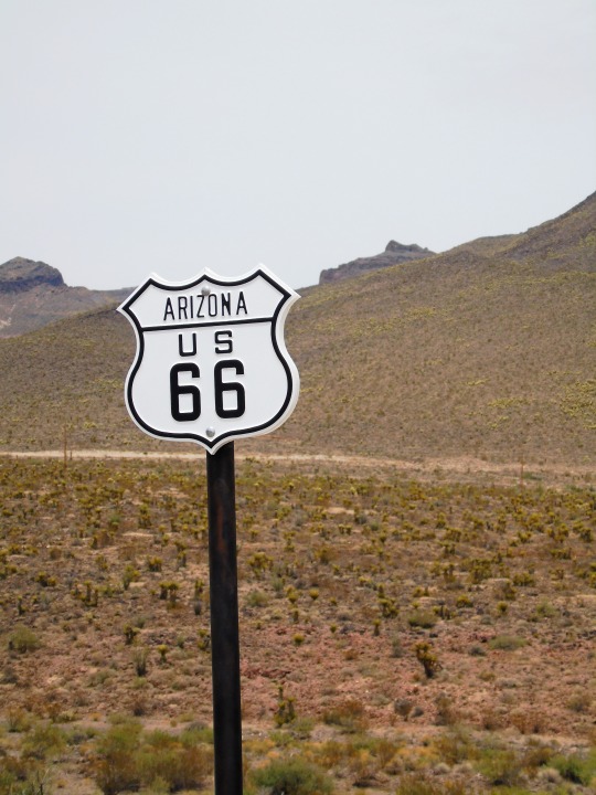


The United States Numbered Highway System is established on November 11, 1926.
#Wyoming#Sitgreaves Pass#Arizona#Santa Fe#New Mexico#Chicago#Illinois#Galena#Kansas#Winslow#Seligman#Adrian#Texas#highway#Route 66#Midpoint Route 66#Interstate 80#United States Numbered Highway System#established#11 November 1926#anniversary#US history#cityscape#landscape#original photography#summer 2014#2019#street scene
15 notes
·
View notes
Photo
Friday, June 29, 2012, continued...
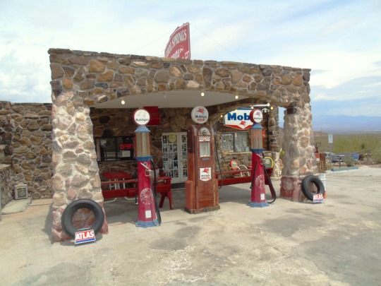
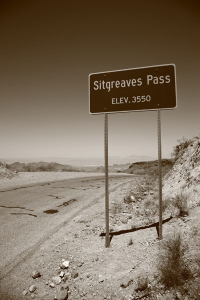
Sitgreaves Pass, the high point on the way to Oatman, Arizona.
"The Fine Art photography of Frank Romeo."
Look for my Route 66 Galleries here: http://frank-romeo.pixels.com/
#route66#route#66#arizona#highway#sepia#road#trip#mountains#buttes#wall#art#photography#buy#fine#prints
26 notes
·
View notes
Conversation
U.S. Daily Precipitation Records Tied/Broken 9/21/22
Unincorporated Copper River Census Area, Alaska: 1.18" (previous record 0.6" 2019)
Unincorporated Southeast Fairbanks Census Area, AK: 0.4" (previous record 0.3" 2021)
Baker Butte summit, Arizona: 0.7" (previous record 0.2" 2004)
Canyon De Chelly National Monument, Arizona: 0.2" (previous record 0.16" 1990)
Coconino National Forest, Arizona: 0.8" (previous record 0.3" 1991)
Coronado National Monument, Arizona: 1.69" (previous record 1.51" 2015)
Kaibab National Forest, Arizona: 0.7" (previous record 0.1" 2021)
Lost Dutchman State Park, Arizona: 0.35" (previous record 0.31" 1988)
Mormon Mt. summit, Arizona: 0.7" (previous 0.2" 1994)
Prescott, Arizona: 0.58" (previous record 0.27" 1952)
Sitgreaves National Forest, Arizona: 0.9" (previous record 0.2" 1994)
Tempe, Arizona: 0.17" (previous record 0.12" 1994)
Tonto National Forest, Arizona: 0.45" (previous record 0.44" 1933)
Chico, California: 0.01" (also 0.01" 1930)
Ebbetts Pass summit, California: 0.9" (previous record 0.8" 2017)
Eldorado National Forest, California: 0.7" (previous record 0.5" 2017)
Unincorporated Lassen County, California: 0.6" (previous record 0.32" 1953)
Unincorporated Napa County, California: 0.38" (previous record 0.07" 2013)
Unincorporated Nevada County, California: 0.24" (previous record 0.19" 2004)
Unincorporated Solano County, California: 0.06" (previous record 0.02" 2007)
Stanislaus National Forest, California: 0.2" (also 0.2" 2017)
Trinity National Forest, California: 0.4" (previous record 0.11" 2017)
Winters, California: 0.09" (previous record 0.02" 2007)
Unincorporated Costilla County, Colorado: 1.3" (also 1.3" 2006)
Unincorporated Costilla County, Colorado: 1.5" (previous record 0.8" 2006)
Cumbres Pass summit, Colorado: 1.2" (previous record 0.9" 1997)
Unincorporated Lake County, Colorado: 0.36" (previous record 0.31" 1952)
Unincorporated Las Animas County, Colorado: 1" (previous record 0.9" 1995)
Kissimmee, Florida: 2.12" (previous record 1.67" 1948)
Bitterroot National Forest, Idaho: 0.2" (previous record 0.1" 2006)
Malad City, Idaho: 0.78" (previous record 0.7" 2017)
Shoshone, Idaho: 0.3" (also 0.3" 1945)
Targhee National Forest, Idaho: 1" (previous record 0.6" 2008)
Cawker City, Kansas: 1.32" (previous record 1.17" 1985)
Beaverhead National Forest, Montana: 1" (previous record 0.8" 1984)
Centennial Mountains Wilderness Study Area, MT: 1.2" (previous record 0.6" 1997)
Deerlodge National Forest, Montana: 0.3" (previous record 0.2" 2008)
Unincorporated Douglas County, Nevada: 0.41" (previous record 0.2" 2013)
Unincorporated Pershing County, Nevada: 0.24" (previous record 0.03" 1998)
Slide Mt. summit, Nevada: 0.2" (also 0.2" 1985)
Toiyabe National Forest, Nevada: 0.5" (also 0.5" 2017)
Yerington, Nevada: 0.23" (previous record 0.02" 1988)
Greenville, New Hampshire: 0.18" (previous record 0.11" 1997)
Carson National Forest, New Mexico: 0.4" (previous record 0.3" 2021)
Gallup, New Mexico: 0.73" (previous record 0.4" 1997)
Unincorporated San Miguel County, New Mexico: 0.6" (previous record 0.59" 1947)
Arbuckle Mt. summit, Oregon: 0.2" (also 0.2" 1983)
Big Red Mt. summit, Oregon: 0.7" (previous record 0.4" 2013)
King Mt. summit, Oregon: 0.4" (previous record 0.2" 2013)
Malheur National Forest, Oregon: 0.3" (previous record 0.1" 1991)
Whitman National Forest, Oregon: 0.6" (previous record 0.3" 1986)
Willamette National Forest, Oregon: 0.3" (also 0.3" 2000)
Winema National Forest, Oregon: 0.25" (previous record 0.03" 1980)
Cache National Forest, Utah: 0.6" (previous record 0.5" 1984)
Dixie National Forest, Utah: 1.8" (previous record 0.8" 2014)
Fishlake National Forest, Utah: 0.5" (previous record 0.4" 2014)
Unincorporated Garfield County, Utah: 2.32" (previous record 1.26" 1952)
Manti-La Sal National Forest, Utah: 0.4" (also 0.4" 2014)
Scipio, Utah: 0.8" (previous record 0.3" 1917)
Uinta National Forest, Utah: 0.6" (also 0.6" 2014)
Wasatch National Forest, Utah: 0.9" (previous record 0.6" 1998)
Widtsoe Peak summit, Utah: 1.7" (previous record 0.8" 2014)
Bridger National Forest, Wyoming: 0.6" (previous record 0.5" 1984)
Triple Peak summit, Wyoming: 0.5" (also 0.5" 2006)
#Storms#U.S.A.#U.S.#Arizona#1980s#1990s#1930s#1950s#Florida#1940s#Idaho#Kansas#Nevada#New Hampshire#New Mexico#Oregon#Utah#1910s#Alaska#Colorado#Wyoming#Montana#Crazy Things#Awesome
0 notes
Photo
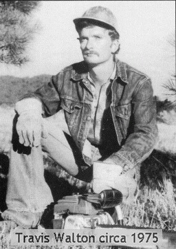

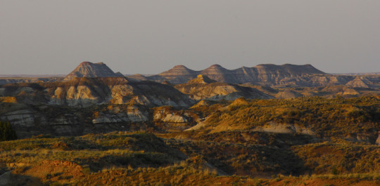
The Travis Walton Abduction
Travis Walton (born February 10, 1953) is an American logger who was supposedly abducted by a UFO on November 5, 1975, while working with a logging crew in the Apache-Sitgreaves National Forest in Arizona. Walton was nowhere to be found.
Originally it was thought that the crew he was working with, murdered him. The crew claimed that they saw a UFO in the woods at 6pm on Nov 5th (as they were driving home) and that Walton got out of the truck and walked towards this silver disc in the air. They claimed that Walton was “beamed” into the aircraft and that was the last they saw of him.
Police, of course, was suspicious of this claim especially since there was no physical evidence of anything near the abduction site. The police suspected homicide and began searching for a body as well as administering polygraph tests to all the crew members. It was determined that the crew members were telling the truth and that they had not brought any harm to Walton.
Five days after the abduction, Travis' brother-in-law Grant Neff said he received a midnight phone call from Travis asking him to come pick him up at a pay phone outside a gas station. Walton claimed that he awoke in a hospital-like room (after his abduction), being observed by three short, bald creatures. He claimed that he fought with them until a human wearing a helmet led Walton to another room, where he blacked out as three other humans put a clear plastic mask over his face. Walton has claimed he remembers nothing else until he found himself walking along a highway, with the flying saucer departing above him. He took a polygraph test which he passed. He went onto write a book which eventually turned into a movie (Fire in the Sky).
There were a lot of issues to this story and skeptics don’t believe Walton. Walton had a lot to gain financially from this story and even though him and all the crew members passed polygraph tests (which are a poor determiner of truth) skeptics believed this was a hoax. Its believed that the TV show The UFO Incident (story of Betty and Barney Hill Abduction) influenced this hoax.
This is probably one of the most famous UFO abduction cases in American history and there’s a lot of information (read the source below).
What are your thoughts?
SOURCE
1K notes
·
View notes
Text
Oatman, a fun tourist attraction with a great mining history!
Please subscribe to learn about great places and historical facts about some of these destinations! Desertexplorations.com
Oatman is still one of Arizona’s richest gold mines, located on Historic Route 66.
While driving through Sitgreaves pass, which has an elevation of 3, 586 in the Black mountains in Mojave county. Built Edward Fitzgerald Beales Wagon Road over the pass and named it John Howells pass for one the men in his expedition in 1857. This road is considered a dangerous rd due to the guard rails that are…
View On WordPress
1 note
·
View note
Photo


#NewYearNewAdventures: Our favorite road trips/byways
We’re continuing to share some of the top spots on #yourpubliclands to start the New Year off right. Explore the outdoors with these road trips and byways this year to BLM-managed public lands.

Dalton Highway, Alaska
The Dalton Highway stretches 414 miles across northern Alaska from Livengood (84 miles north of Fairbanks) to Deadhorse and the oilfields of Prudhoe Bay. Built during construction of the trans-Alaska oil pipeline in the 1970s, this mostly gravel highway travels through rolling, forested hills, across the Yukon River and Arctic Circle, through the rugged Brooks Range, and over the North Slope to the Arctic Ocean. Along most of its length, you'll see no strip malls, no gift shops, no service stations, just forest, tundra, and mountains, crossed by a ribbon of road and pipe.The BLM manages a swath of public lands along the highway from the Yukon River to the north side of the Brooks Range. Within the Dalton corridor, the BLM maintains campgrounds, rest areas, interpretive panels and the award-winning Arctic Interagency Visitor Center in Coldfoot.This is no ordinary road -- it pays to be prepared. There is no cell phone service or public Internet connection along the Dalton Highway.

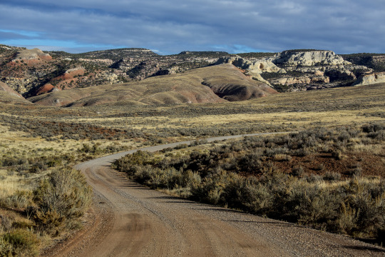
Route 66 Historic Backcountry Byway, Arizona
This 42-mile stretch of two-lane blacktop is one of the last and best-preserved segments of the original Route 66, one of America's first transcontinental highways. This portion of the highway once included one of the most fearsome obstacles for "flatland" travelers in the 1930's: the hairpin curves and steep grades of Sitgreaves Pass, which characterize Old Route 66 as it makes its way over the Black Mountains of western Arizona.
Bodie Hills, California
Always on our #roadtrip #bucketlist! California’s Eastern Sierra region is a dramatic transition zone between the snow-capped granite spires of the Sierra Nevada and the endless sagebrush covered uplands of the Great Basin. A trip at the right time of year will reward visitors with a diversity of wildflowers.
One great wildflower viewing area is just north of Mono Lake and east of Yosemite National Park in the rolling Bodie Hills – hills being an understatement since they top out at over 10,000 feet! Because of their high elevation, wildflower blooms are later here than much of California – typically arriving in May-June on the lower slopes and into July on the highest peaks. Several back roads traverse the area and offer access to view the displays of phlox, penstemon and paintbrush to name a few of the many wildflower species. More than 100,000 acres of BLM lands cover most of the Bodie Hills and include several wilderness study areas.
Bodie State Historic Park is the best-preserved ghost town in California, and arguably in the United States. Wildlife viewers can see antelope, mule deer, and if lucky, get a glimpse of a sage grouse. If you visit later, around early October, crisp clear nights will turn the scattered aspen stands to gold, giving a second opportunity to see Bodie Hills in color.
Alpine Loop National Backcountry Byway, Colorado
A #roadtrip to the #AlpineLoop should be on your #bucketlist for 2018! Located northeast of Silverton, Colorado in San Juan and Hinsdale counties, the Alpine Loop Back Country Byway is a premiere visitor destination. The epic scenery draws off-highway-vehicle enthusiasts across the country who are treated with a network of roads that climb above the timberline, accessing unparalleled vistas in an alpine environment. The hiking, biking and camping in the area is also fantastic. Scattered along the Alpine loop are remnants of our nation’s frontier history, where visitors can learn about the bustling mining towns that once thrived here.
While many roads are accessible by regular, two-wheel drive vehicles, getting into the alpine areas require high-clearance, four wheel drive vehicles. Plan your trip accordingly.
Washington-Rochambeau Revolutionary Route National Historic Trail, Virginia
Journey through early American history and walk in the footsteps of our nation’s founding fathers as you explore the Washington-Rochambeau Revolutionary Route. This National Historic Trail commemorates over 680 miles of land and water trails followed by the allied armies of General George Washington and the French Lieutenant General Comte Jean de Rochambeau. During their 1781 march from Newport, Rhode Island to Yorktown, Virginia, the French army established an encampment on what is now the Meadowood Special Recreation Management Area (SRMA). A segment of this trail connects with a BLM system of trails crossing the SRMA on the historic Mason Neck Peninsula, just a short drive from the nation’s capital. At Meadowood, the trail transects open meadows, enters into mature hardwood forests, and crosses riparian wetlands. While in the area, visit Gunston Hall, the home of Founding Father George Mason, a strong supporter of individual liberties and the author of the Virginia Declaration of Rights. Many of the concepts in that document found embodiment in the first ten amendments to the U.S. Constitution, the Bill of Rights.
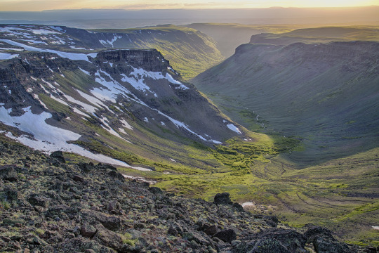
Lewis and Clark Backcountry Byway, Idaho
The Lewis and Clark Backcountry Byway and Adventure Road is a 36-mile loop drive through a beautiful and historic landscape following the Lewis and Clark National Historic Trail and the Continental Divide National Scenic Trail. Experience incredible views of the Lemhi Valley and the surrounding mountain ranges; truly some of the finest scenery in America!
The mountains, evergreen forests, high desert canyons and grassy foothills look much the same today as when the Lewis and Clark Expedition passed through in 1805. Take a slow and meandering journey along this drive with time to stop along the way for hiking, fishing, mountain biking and exploration. With a 4,000 foot gain and loss in elevation, expect some steep grades too.
Lemhi Pass is well-known for its wildflower displays in the spring and summer. Captain Lewis collected three new plant species in this area: mountain maple, common snowberry and Lewis’s monkey flower. You might see elk, mule and whitetail deer, black bear, moose, pronghorn antelope, coyotes and many smaller mammal species. Early mornings and evenings are the times to look for wildlife, particularly where the forest and meadow meet.
By late September, shorter days and cooler temperatures release hues of red, yellow, and gold in aspens, cottonwoods, willows and shrubs. Don’t miss Agency Creek in October – it’s beautiful! Download a visitor guide for your roadtrip from our website.
Big Sky Byway, Montana
The 105-mile Big Sky Back Country Byway begins in Terry, MT, and travels north and south covering badlands and rolling prairies. The byway ends in Wolf Point, MT, on the beautiful Missouri River, part of the Lewis and Clark National Historic Trail. The route is part of the National Scenic Byways Program, linking Terry with Wolf Point. Taking 2 hours one way, you can stop to take a look at the information kiosks in Terry, Circle, and Wolf Point, which describe byway attributes, local history, and culture. Visitors can enjoy the scenic badlands of eastern Montana year round from this all-weather road.
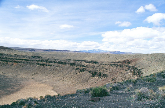
Lunar Crater Backcountry Byway, Nevada
The scenic loop (the Lunar Crater Back Country Byway) passes by the crater with a stopping point near the crater where visitors can get out to view the impressive volcanic feature. Vehicles are limited to existing roads and trails.

Lake Valley Backcountry Byway, New Mexico
A meandering 48-mile drive on paved roads takes visitors through ranching and mining country and past the ruins of the 1880s mining town of Lake Valley. The Lake Valley Backcountry Byway is nestled between the Mimbres and Caballo Mountains and the Cooke's Range in southwestern New Mexico and offers spectacular scenic views. Rich in history and scenery, the Byway offers an outstanding trip for travelers with an hour to spare.
Steens Mountain, Oregon
How about this for a scenic byway: Glacier-carved gorges, pristine alpine lakes and wild and scenic rivers, all accessible via the highest elevation road in Oregon!
Come take a drive on the 52-mile-long Steens Mountain Backcountry Byway! There are four campgrounds along the byway for those wanting to stay a little bit longer in one of the most remote places in the U.S.!
Photo/video: https://goo.gl/VOkTFg
San Rafael Swell, Utah
Make the most of your road-trip to Moab or the Skyline Drive! Take the scenic route through the San Rafael Swell. Emery County Road 332 is a gravel road that connects approximately 45 miles between Huntington, Utah to Interstate 70 in the heart of the San Rafael Swell. Enjoy the amazing desert scenery, stop at the wedge overlook for a view of the “Little Grand Canyon,” view the ancient rock art of the Buckhorn Draw Panel, and maybe even take a side trip to the Cleveland-Lloyd Dinosaur Quarry. While there is primitive-style camping in the area, there are no other services. Come prepared with everything you need, and take home everything you bring. Flat tires are common.
Red Gulch/Alkali National Backcountry Byway, Wyoming
The Red Gulch/Alkali National Backcountry Byway is a 32-mile scenic drive on improved gravel and dirt roads through the foothills of the Bighorn Mountains. Near each of the two entrances to this historic route you will see a National Backcountry Byway kiosk which provides historical information about the byway as well as road conditions. The steep, rugged canyons cut into the mountains along the byway and offer many challenging and interesting hiking opportunities. Among the wondrous sights you may see are hoodoos. These strange, artistic rock formations were carved over the centuries by Wyoming’s wind.
#bureau of land management#explore#yourpubliclands#recreation#roadtrip#byway#outdoors#getoutdoors#outside#newyearnewadventures#newyear#2018#solitude#nature#photography#wilderness#alaska#arizona#california#colorado#virginia#idaho#montana#nevada#newmexico#oregon#utah#wyoming
42 notes
·
View notes
Last Seen Blogs