#Southwest Basins and Ranges
Video

flickr
Exploring Carlsbad Caverns National Park by Mark Stevens
Via Flickr:
Big Room Trail-51 An image captured while walking the Big Room Trail in Carlsbad Caverns National Park with a view towards an amazing display of underground formations.
#Big Bend and Carlsbad Caverns National Parks#Big Room Trail#Carlsbad Cavern#Carlsbad Caverns#Cave#Cave Formation#Cavern#Caverns#Day 6#DxO PhotoLab 5 Edited#Guadalupe Mountains#Intermountain West#Landscape#Landscape - Scenery#Large Limestone Chamber#Limestone Cave#Limestone Chamber#Mineral Deposit#Nature#Nikon D850#No People#Project365#Rock Formation#Rock Formations#Scenics - Nature#Show Cave#SnapBridge#Southwest Basins and Ranges#Speleology#Stalactites
0 notes
Text
So I just wanna talk about this and the Sea of the Castout for a sec:

Here's the Sea of the Castout and its surroundings on the map:

We have the Sparklepuff Squad coming from the north down one of the rivers (red arrows), and the Dragang coming from either the east... or there is a slight possibility that Finnegrin, not having any particular urgency about getting there, chose to go all the way around the Far Reaches to give Callum some time to think things over.
(Could he have taken it even slower and gone all the way around to enter past the ruins of Elarion, thereby putting the statues of Aaravos and the Merciful One there? My opinion is that at that point Sea Legs would have to be going fast enough that the speed would be hard to ignore. The Ruthless is similar to a sloop and so would probably have a normal cruising speed of around 6-8 mph. Sea Legs can supposedly go faster than that, but sailing around to approach the Sea of the Castout from the southwest would add like... rough estimate 100 miles or more to the trip, so either they take an entire day or more doing only that or Sea Legs is going at constant top speed and that speed is really fucking fast.)
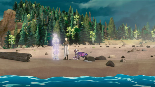
As the Dragang make their way into the Sea, we can still see the rocky horizon behind them, but not ahead:
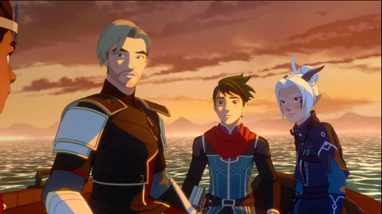
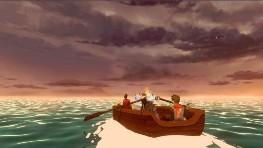
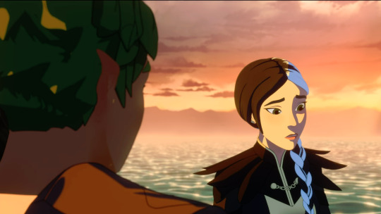
Claudia and Terry, however, can see the shoreline in at least three directions from the center:

We also cannot see the opposite shore when Claudia enters the water:
Assuming you can see the same distance in Xadia as you can here on earth (which is a big assumption, but also a reasonable one to make), that's about 3 miles—as in, the furthest away you can see something as tall as you are before the curvature of the earth obscures it is about 3 miles. However, the rocky sides of the Sea of the Castout are a lot taller than any of the characters, so they can be seen from further away. Based on extremely unscientific googling, the Sea of the Castout is probably in the range of 20-30 miles-ish across, which is consistent with the fact that it's around the same size on the map as the distance between Katolis castle and the Moon Nexus, and that's a reasonable distance for the trio to have gone in the time it takes them to get there.
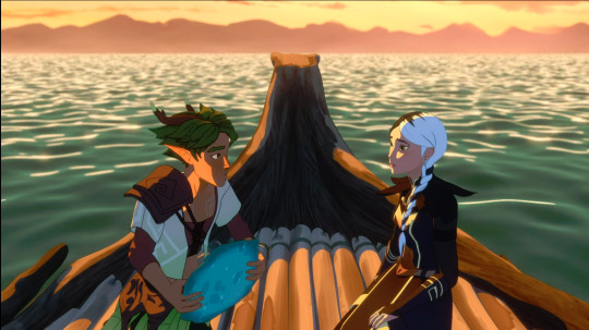
We also have a shore that looks like this oh god don't look too closely at it, that's a horrible render:
Now, you may consider how much of the edges of the Sea of the Castout appears to be mountainous, then look at the map again and wonder what the hell is going on. Well, first of all, those aren't mountains.
The basin of the Sea of the Castout was presumably created by a catastrophic impact. If it's based visually on a real place, I'd bet it's somewhere like Crater Lake in Oregon:
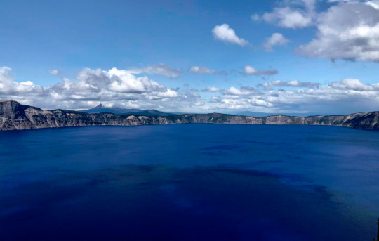
Crater Lake is a volcanic crater, not an impact crater, but same concept applies: instead of being a natural point of low elevation in the landscape, it's a reservoir that was violently punched out of the ground. That elevated rocky horizon isn't mountains, it's the edge of the hole. Crater Lake is quite a bit smaller than the Sea of the Castout probably is (only 5-6 miles across), but the elevation between its surface and the caldera rim is about 1,000 feet, which looks plenty high.
Impact crater lakes do exist, of course, but they tend to be either a lot smaller or a lot older. On earth, all the impact craters the size of the Sea of the Castout are hundreds of millions of years old. Lakes formed in older craters are also more likely to have connected with the surrounding water features, similar to the Sea of the Castout. Crater Lake is less than 10,000 years old and not connected to any rivers or other lakes (unsurprising, given that it used to be the top of a mountain).
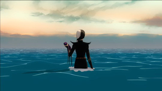
So yeah, it's absolutely possible that Aaravos is at the Sea of the Castout. But let's take a look at the opening:

Yes, that's definitely the same place as Aaravos. Is it literally the Sea of the Castout? Well, the thing is that every other time we see this place, it's in a very... metaphorical or symbolic context. Like the opening. Or here:

Or here:


We also have that Aaravos is kneeling practically on the surface:

Which suggests that either the "OG Aaravos was gigantic" theory is correct, or this is not a normal place where water and lakes behave normally. I'm not a huge (ha) fan of the giant Aaravos theory, but as I've said before... if I had a nickel for every Aaravos-related thing we all assumed was metaphorical but turned out to be literal, I'd have etc.
Basically, this is definitely a place that is connected to the Sea of the Castout thematically and possibly magically, but I don't think Aaravos is literally kneeling in the literal Sea of the Castout on the mortal plane of Xadia.
After all, where do the fabled Great Ones hide?
#i spent a lot of time looking up lakes of various sizes for this#and then i saw crater lake and was like 'OH'#anyway#aaravos#the dragon prince#geography of xadia
119 notes
·
View notes
Photo
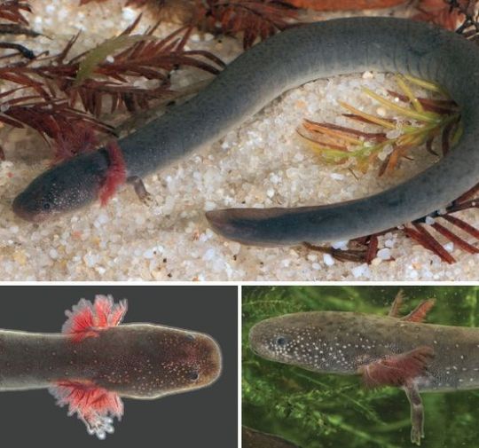
BIG NEWS IN SALAMANDER TAXONOMY!
Unraveling Siren (Caudata: Sirenidae) systematics and description of a small, seepage specialist
Fedler, Enge, and Moler
Abstract
For approximately four decades, scientists have known of the existence of several undescribed species of Siren in the southeastern United States Coastal Plain.
One of these species, S. reticulata, was recently described, but a small, seepage-dwelling species has remained undescribed until now.
To resolve outstanding questions concerning the phylogeny of Siren, we collected sequence and morphometric data from specimens across the range of Siren.
We found S. lacertina and S. reticulata to represent strongly supported monophyletic groups, with S. reticulata having a sister relationship to all other Siren. Additionally, we found five distinct mtDNA lineages within what has been recognized as S. intermedia. Siren lacertina and type-locality S. intermedia (lineage A) are sister mtDNA lineages, whereas S. intermedia lineages B and C show a high level of mitogenomic divergence from type-locality S. intermedia.
Analyses of two scnDNA loci revealed that S. lacertina is monophyletic but nested with low positional support in a clade including the three S. intermedia mtDNA lineages. Further study is needed to determine whether S. intermedia lineages A, B, and C represent distinct species or incompletely sorted lineages.
We restrict the range of S. intermedia to the region from the Escambia and Perdido river drainages of Florida and Alabama eastward through Virginia (the combined ranges of lineages A, B, and C).
We also elevate S. i. nettingi (lineage E) to species status and include the larger S. i. texana form in that taxon, generating a species that occurs from the Mobile Bay drainages westward through the Mississippi Basin and southwest into northeastern Mexico.
Lastly, we describe a new miniature species, S. sphagnicola, that ranges from the Florida Parishes of Louisiana eastward to the westernmost tributary creeks of Choctawhatchee Bay in the western Florida panhandle.
Read more here:
https://mapress.com/zt/article/view/zootaxa.5258.4.1
223 notes
·
View notes
Text
Lonesome highway across San Augustin Plains. The plains extend roughly northeast-southwest, with a length of about 55 miles and a width varying between 5–15 miles. The basin is bounded on the south by the Luera Mountains and Pelona Mountain (outliers of the Black Range); on the west by the Tularosa Mountains; on the north by the Mangas, Crosby, Datil, and Gallinas Mountains; and on the east by the San Mateo Mountains.
#roadtrip#travel#daytrip#vacation#NewMexico#ranching#cattlecountry#OptOutside#nature#landscape#geology#whataview#remote#offthebeatentrack#leavenotrace#lonesomehighway#video#lovenm#New Mexico
29 notes
·
View notes
Text
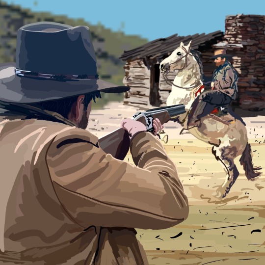
In the 1880s Apache Country, below the Mogollon Rim of Arizona a combination of events involving cattle rustlers, sheep herders, outlaws, cowboys, sharp shooters, Mormons, mountain lions, Confederates, half Indians, hooded vigilantes, lawmen, and Wild West legends culminated in the largest, most violent, and most unbelievable vendetta, feud, and range war in all of American history. This is the story of the Pleasant Valley War aka the Graham Tewksbury Feud aka the Tonto Basin War that would consume over 50 victims. It’s cinematic, heroic, tragic, and often times unbelievable. It’s filled with out-of-this-world characters, important themes, and jaw dropping, melodramatic, heartbreaking Wild West anecdotes.
14 notes
·
View notes
Text
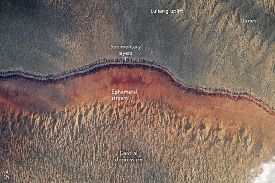
Evening Glow in the Junggar Basin
An astronaut on board the International Space Station took this photograph of northwestern China on a partly cloudy evening (local time). This view offers a small glimpse of the Junggar Basin, a low-lying area between the Altay Mountains to the northeast and the Tian Shan range to the southwest. Sedimentary rock layers and geomorphic features characterize the Junggar Basin landscape.
This photo, taken around 9 p.m. local time (13:00 Universal Time) on June 1, 2023, shows the western sides of sand dunes illuminated by the setting Sun. The space station serves as a unique remote sensing platform for photographing Earth due to its inclined equatorial orbit. This provides opportunities for crew to take images during day or night, depending on the timing of the station’s orbit path over a given ground location. Astronauts can use varied lighting conditions to highlight features that may be more visible depending on the time of day—especially smaller features such as dunes. Clouds (out of view of this picture to the northwest) cast long shadows that further darken parts of the image.
The reddish ribbon across the middle of this photo marks a change in local topography. Uplifted, older sedimentary layers to the north—part of the Luliang uplift—slope down toward a geographic depression to the south. Eroded rocks have drainage patterns that lead to an ephemeral stream at lower elevations. On both the top and bottom of the photo, long sand dunes oriented north-south overlay the bedrock. Beneath the surface, organic-rich rock layers preserve fossils and contain extensive coal, oil, and gas deposits.
Astronaut photograph ISS069-E-16826 was acquired on June 1, 2023, with a Nikon D5 digital camera using a focal length of 400 millimeters. The image was provided by the ISS Crew Earth Observations Facility and the Earth Science and Remote Sensing Unit at Johnson Space Center. The image was taken by a member of the Expedition 69 crew. It has been cropped and enhanced to improve contrast, and lens artifacts have been removed. The International Space Station Program supports the laboratory as part of the ISS National Lab to help astronauts take pictures of Earth that will be of the greatest value to scientists and the public and to make those images freely available on the Internet. Additional images taken by astronauts and cosmonauts can be viewed at the NASA/JSC Gateway to Astronaut Photography of Earth. Caption by Andrea Wenzel/Jacobs-JETS II Contract at NASA-JSC.
2 notes
·
View notes
Text
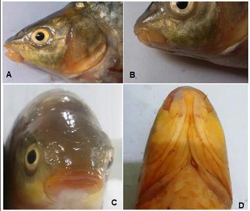
Discovery of Carasobarbus Sublimus in Al-Diwaniya River, Iraq

Abstract
During a fish survey from 2016 to 2017, we captured 83 specimens of the cyprinid fish, Carasobarbus sublimus from the Al-Diwaniya River, Middle Euphrates, Iraq. This is the first report of the occurrence of this species in this locality. Fish were captured by gill nets and electro-fishing equipment. Twenty two morphometric and eleven meristic measurements were applied to describe the species. The range of total length in the present specimens (130.4-250.1mm) is larger than the range quoted for C. sublimus. The indices characters to standard length (SL) varied from 7.4 % to 121.0 %, and the head characters to head length (HL) from 27.4% to 93.2%. The growth rate between body characters and SL varied from 0.085 to 1.118 and between head characters and HL from 0.210 to 1.091.The numbers of scales in lateral line and around the least circumference of the caudal peduncle are 27-29 and 12, respectively. The biometric data were successful in identifying of C. sublimus and confirm the presence of the species in the Al-Diwaniya River. This is the second record of the species in the Iraqi freshwaters. Based on this finding, the case would be interesting and open to discussion about the distributions of C. sublimus in the Tigris-Euphrates basin.

Introduction
According to Borkenhagen and Krupp (2013), the cyprinid genus Carasobarbus Karaman, 1971 (the himri) belong to the family Cyprinidae, subfamily Barbinae are distributed across southwest Asia and northwest Africa. They occur in all major river systems of the Levant, Mesopotamia, southern Iran, western and south-western Arabian Peninsula and in northern Morocco.
Also, Borkenhagen and Krupp (2013) revised and expanded Karaman’s (1971) diagnosis of the genus that now contains the nine following species: Carasobarbus apoensis, C. canis, C. chantrei, C. exulatus, C. fritschii, C. harterti, C. kosswigi, C. luteus and C. sublimus.
Three species from the genus, C. luteus, C. kosswigi and C. sublimus have been reported from Iranian waters (Borkenhagen and Krupp, 2013) and C. chantrei, C. kosswigi and C. luteus from Turkish waters (Çiçek et al., 2015), while C. luteus, C. kosswigi and C. sublimes were found in Iraqi waters (Coad, 2010; Mohamed et al., 2017).
C. sublimus was first described and reported by Coad and Najafpour in 1997 from Khuzestan waters, southwestern Iran. C. sublimus formerly placed in the genus Kosswigobarbus Berg, 1916, but Borkenhagen et al. (2011) placed this species in Carasobarbus.
Coad and Najafpour (1997) and Esmaeil et al. (2006) have rectified the species by comparing it with C. kosswigi and C. luteus on the basis of their morphology in Iran, while, Mohamed et al. (2017) described and compared C. sublimus obtained from the Shatt Al-Arab River for the first time in Iraq with C. luteus in Iraqi waters.
During the ichthyofauna survey for the Al-Diwania River (a branch from the Euphrates River, middle of Iraq) during November 2016 - October 2017, several specimens of cyprinid fish, C. sublimus have been caught for the first time from south the Daghghara barrier on this river.
The predominant vegetations on the both banks of this locality were reed, Phragmites australis and cattail, Typha domingensis, whereas hornwort, Ceratophyllum demersum was dominant in the deeper areas.
The water temperature of the river varied from 10.2oC in March to 32.8oC in August, dissolved oxygen fluctuated from 5.0mg/l in August to 9.6mg/l cm in February, salinity values ranged from 0.55‰ in April to 0.79‰ in October (Mohamed and Al-Jubouri, 2017).
So, the purpose of this paper is to describe the morphometric and meristic characters of C. sublimus for the first time in the middle of Iraq. Examined specimens had been placed in the fish collection of the Department of Pathology, College of Veterinary Medicine, Al-Qasim Green University, Iraq.
Source Occurrence of cyprinid fish, Carasobarbus sublimus in the Al-Diwaniya River, Middle Euphrates, Iraq
2 notes
·
View notes
Text
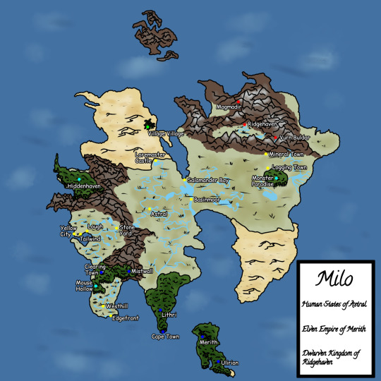
Map of Milo
The mainland, and where most of the series takes place. It is a small continent in the process of splitting over millions of years. With two mountain ranges on either side, sandwiched between them is a large plain with scattered forests and a river basin down the middle. It has a desert to the northwest that had only recently been charted by humans, and another desert to the southeast, raked by vicious sandstorms. Humans and dwarves have lived on this land for as long as history can remember, with elves recently joining them as they regularly migrate from Merith.
We’ll be seeing some of these towns and landmarks as the adventure goes on, but for now, why not learn a little more about them? (Under a read more cuz it’s a bit lengthy)
Towns and Cities
Humans States of Astral
Westhill
- Small farming village where Yugo Nora was raised in
Edgefront
- Port town on the southwestern peninsula that buys crops from Westhill and exports them to other port towns
Stone Yard
- Industrial town and the leading place for innovation and technological development
Lough
- Small village that specializes in growing grapes. Part of a three town union with Tailwind and Yellow City
Tailwind
- Town that specializes in creating wine from the grapes traded to them from Lough
Yellow City
- Port city that trades wine with other states and returns profits to Tailwind and Lough
Astral
- Capital city of the human states. A bustling town rich with culture and literature
Loremaster Castle
- Bastion at the edge of the desert where scholars train and study to become Lorekeepers
Basinmoor
- Large town in the center of Milo within the river basin. Trades goods from Astral to Ridgehaven
Salamander Bay
- Port city specializing in seafaring, though heavily populated by pirates and bootleggers
Logging Town
- Lumber town near the Monster Paradise
Mineral Town
- Village in the Iron Mountains specializing in mining
Elven Empire of Merith
Clearing Town
- Elven settlement in the middle of the Western Forest. A haven for what limited magic exists
Cape Town
- Coastal city in the southern jungle, the first and largest mainland settlement of elves
Lithri
- Village in the southern jungle and a town made of scribes and merchants
Mistwall
- Mountain settlement and mining town founded by caravaneers
Merith
- Capital of the elven empire on the southern island of the same name, and the birthplace of magical scholarship
Ulirion
- Academic town on the island of Merith that trades knowledge with humans
Dwarven Kingdom of Ridgehaven
Ridgehaven
- Large capital city inside the Iron Mountains with a specialty in smithing
Vurn Buldar
- Small mining town in the mountains that transports rare materials to Ridgehaven
Magmadir
- Village inside the mountains that is built around volcanic activity
Dunesettlers
Village Village
- Small village in an oasis in the White Desert populated by a desert-dwelling offshoot of elves
Monster Settlements
Mouse Hollow
- Small village in the unofficial kingdom of Rodentia made up entirely of rodents
The Great Cougar Clan
- Nomadic clan of big cat-like monsters that travel throughout the Plains of Mankind
Hiddenhaven
- A village in a forest by the sea protected by mountains that has remained almost entirely untouched by man
Monster Paradise
- A beautiful forest belonging to sprite monsters
Landmarks
Forests
Western Forest
- Medium sized forest on the southwest peninsula that separates the Fertile Plains. The elven towns of Mistwall and Clearing Town reside in this forest, as well as the unofficial kingdom of Rodentia. It is home to many monsters, leaving humans to typically steer clear of the forest whenever they can help it
The Secret Valley
- A coastal valley forest protected by the Diverged Range convinces most travelers to avoid them, making it a virtually untouched haven for monsters and wildlife. It is also known as Hiddenhaven
Southern Jungle
- A large, warm, semi-tropical forest on the south peninsula populated mostly by elf colonies that settle on the mainland from the island of Merith
Monster Paradise
- The largest forest on the eastern half of Milo, only recently discovered by humans. The trees in these woods are hardy and strong, making for great building material. It is home to a rare class of monsters known as sprites
Plains
Fertile Plains
- Small plains split by the Western Forest with great soil for farming
Plains of Mankind
- The largest prairie and defining feature of Milo, it stretches from the Diverged Range to the eastern coastline, and is split in the middle by a river basin
Mountains
Diverged Range
- The western mountain range that separates the two plains, and is split in two itself on the northern end
Iron Mountains
- Homeland of the dwarves, it is a super volcano that is rich in raw materials. It is the only place where dwarven cities reside
Deserts
White Desert
- Northwestern desert comprised of light colored sands. It is home to Dunesettlers, who live in an oasis within the sands
Red Desert
- Southeastern desert raked with sandstorms. It has barely been explored, and lacking in records, though rumors of ancient temples and treasures tempt adventurers into the dark desert, though most usually meet an untimely end
Islands
Merith
- Southern, tropical island and home of the elves covered almost entirely with jungles. Due to its small size, the growing population of elves often migrate to mainland Milo to prevent overcrowding
Lando
- A small mountain jutting out of the northern sea to form an island. It is shrouded in mystery, as it was where the now extinct dragons and dragon people lived. Rough seas deter most sailors, but rumors of ancient temples and vast treasure still tempt those seeking fortune.
7 notes
·
View notes
Text
Wandlore: Tamarix ramosissima, AKA: Tamarisk, or Salt Cedar.
The science:

The Tamarisk, also called the Salt Cedar, is a shrubby, red barked tree native to some parts of Eurasia and Northern Africa. Tamarisk is known for sapping salt up from any water source near it into the soil around it, as its one of the only plants capable of surviving and thriving under those conditions. In the spring, it blooms a magenta, almost lilac pink in many places.
The Tamarisk tree was introduced to the Colorado River Basin in the late 1800s in an effort to stop soil erosion and keep trails clean. Unfortunately, the Tamarisk tree is Rhizomous, which means it can spread underground as well as through seed, and cuttings or fallen limbs from the tree can also root themselves. Accompanied by its tendency to increase the PH of the soil it lands in, the Tamarisk tree became a rapid menace to the southwestern ecosystem.
Because of this, if you take a river raft down the Colorado you are more than likely going to see hundreds or thousands of these trees along the banks. Places where native Cottonwoods or Willows would normally be are filled to the brim with salty earth and red tamarisk trees.
Luckily, there is a small glimmer of hope. The tamarisk beetle, a small golden yellow weevil, no bigger than the head of a pin, eats exclusively tamarisk trees. Careful introduction of the tamarisk beetle to these trees has begun to curb their expanse. Unfortunately, there are still precious few plants that can survive the salty soil the trees leave in their wake, and the thousands of dead trees alongside the river feel an awful lot like walking through a Grove of ghosts.
Ethnobotany and Mythology:
The tamarisk tree has a vast and ancient set of mythological and religious symbolism behind it. In its native range, the tamarisk tree has long been connected to death and rebirth through the story of Osiris's death in Egyptian paganism. When Osiris is killed, his body is hidden inside the trunk of a massive tamarisk tree, for Isis to find and revive.
This connection to hidden things is also noteworthy, as in the Iliad, Odysseus and diomedes hide some of their spoils from the war inside a Tamarisk. In another Greek myth, a young woman or girl is turned into a Tamarisk tree, along with her siblings. However, it should be noted that many diffrent women, girls, nymphs and goddesses turn into trees, plants and shrubs in mythology, and they are often mixed with each other at one point or another.
In abrahamic religions, many characters are said to gain important knowlage under tamarisk trees ( such as the ever present abraham) or have been buried underneath them (Samuel)
In Islam, they take on a more spiteful turn, as Allah converts the gardens of the saba people to Tamarisk and bitter fruits as punishment.
In the southwest, where they have taken root, they symbolize that same sort of spite as well as a stubbornness for life.
In both their native and invasive ranges, the tamarisk tree is used for making sturdy and durable goods. Things like furniture, wagon wheels, and boxes. The wood itself is beautiful, if occasionally difficult to work with. Medicinally, the tree has been used in traditional practices to treat digestive issues, gut problems, diabetes and dental issues to varying degrees of success. It has also been used in soaking and purifying baths well into ancient times, as its mentioned that gilgamesh's mother took a bath in a Tamarisk soak before sending her son and his partner on their quest.
The magic
Taking all of these sources into account, it's safe to say that the tamarisk tree would have a very specific arcane niche to fill: stubbornness, secrets, and toxicity. The protective aspects of the tree are numerous of course, but often come in unexpected ways. Wands or other foci made with Tamarisk would likely do an average job with standard protective magics, but astonishingly well at protecting those who are already dead, or secrets that one would wish to hide for eternity. These Foci will aslo do an excellent job with purifying Charms and intense purification rituals, perhaps even exorcism if done correctly.
It should also be noted that the high salt content of the Tamarisk tree is two fold: it will aid in its protectiveness, of course, but it may also be a sign that the owner of the foci in question may drive others away in their personal lives. They will be steadfast and stubborn, and good at what they set themselves to task over, but God's forbid they form a true lasting relationship with anyone who isn't exactly like them. This may present itself as a mild sort of closed mindedness at best, or outright hatred of others at worst. They may be xenophobic, religious zealots, or even simply abrasive. This isn't to say every person who possesses a tamarisk foci is an asshole in this way, but it would be fair to say they are more likely to hold their own opinions in the highest regard before any other.
These will be the people who work very hard at what they do, but never really make any real connections. The people you meet who will gruffly get the job done, but demand solitude or like minded individuals in order to work at all.
Let it be known that these individuals, no matter how strong they appear to be, will have at least one glaring weakness to them, and they may be extremely suseptable to failure if they confront it. Due to their stubbornness, this could very well be their downfall if they refuse help.
These foci will pair best with others who have connections to Tamarisk, and will likely pair worst with those who have willow, cottonwood, fruit tree, or other stereotypically sweet or less hardy woods.
#wandlore#hp headcanon#botany#ethnobotany#mythology#tamarisk#salt cedar#saltcedar#magic headcannons#Tamarix ramosissima
4 notes
·
View notes
Text
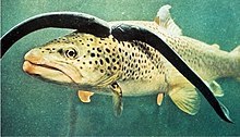
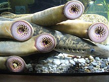
Sea lamprey facts (cause scronkle)
The sea lamprey (Petromyzon marinus) is a parasitic lamprey native to the Northern Hemisphere. It is sometimes referred to as the "vampire fish".
The sea lamprey has an eel-like body without paired fins. Its mouth is jawless, round and sucker-like, and as wide or wider than the head; sharp teeth are arranged in many concentric circular rows.
Its mouth is jawless, round and sucker-like, and as wide or wider than the head; sharp teeth are arranged in many concentric circular rows.
There are seven branchial or gill-like openings behind the eye. Sea lampreys are olive or brown-yellow on the dorsal and lateral part of the body, with some black marblings, with lighter coloration on the belly. Adults can reach a length of up to 120 cm (47 in) and a body weight up to 2.3 kg (5.1 lb).
The etymology of the genus name Petromyzon is from petro- "stone" and myzon "sucking"; marinus is Latin for "of the sea".
The species is found in the northern and western Atlantic Ocean along the shores of Europe and North America, in the western Mediterranean Sea, the Black Sea, and as an invasive species in the shores of the Great Lakes.
They have been found at depths up to 4000 meters and can tolerate temperatures of 1–20 °C (34–68 °F).
In North America, they are native to the Connecticut River basin in the United States.
The largest European populations of sea lampreys are located throughout the southwestern areas of Europe (north-central Portugal, north-northwest of Spain, and west–southwest of France).These countries also support the main fisheries of the species.
Sea lampreys are anadromous; from their lake or sea habitats, they migrate up rivers to spawn. Females deposit a large number of eggs in nests made by males in the substrate of streams with moderately strong current. Spawning is followed by the death of the adults. Larvae burrow in the sand and silt bottom in quiet water downstream from spawning areas and filter-feed on plankton and detritus.
After several years in freshwater habitats, the larvae undergo a metamorphosis that allows young, post-metamorphic lampreys to migrate to the sea or lakes, and start the adult hematophagous method of feeding
The lamprey uses its suction cup-like mouth to attach itself to the skin of a fish and rasps away tissue with its sharp, probing tongue and keratinized teeth. A fluid produced in the lamprey's mouth, called lamphredin prevents the victim's blood from clotting. Victims typically die from excessive blood loss or infection. After one year of hematophagous feeding, lampreys return to the river to spawn and die, a year and a half after the completion of metamorphosis
Lampreys are considered a delicacy in some parts of Europe, and are seasonally available in France, Spain, and Portugal. They are served pickled in Finland.
Due to its lifecycle that switches between fresh and salt water, the sea lamprey is adapted to tolerate a wide range of salinities. Cell membranes on the surface of the gills are major contributors to ionoregulation. Changes in membrane composition influence the movement of different ions across the membrane, changing amounts of components to change the membranes' environment.
the larvae are called ammocoetes
Lampreys also maintain acid-base homeostasis. When introduced to higher levels of acids, they are able to excrete excess acids at higher rates than most other saltwater fishes, and in much shorter times, with the majority of the transfer of ions occurring at the gill surface.
The lamprey genome may serve as a model for developmental biology and evolution studies involving transposition of repetitive sequences. The lamprey genome undergoes drastic rearrangements during early embryogenesis in which about 20% of the germline DNA from somatic tissues is shed. The genome is highly repetitive. About 35% of the current genome assembly is composed of repetitive elements with high sequence identity.
Sea lampreys are considered a pest in the Great Lakes region. The species is native to the inland Finger Lakes and Lake Champlain in New York and Vermont. Whether it is native to Lake Ontario, where it was first noticed in the 1830s, or whether it was introduced through the Erie Canal which opened in 1825 is not clear.

4 notes
·
View notes
Video
Navigating the Big Room in Carlsbad Caverns National Park by Mark Stevens
Via Flickr:
Big Room Trail-55 An image captured while walking the Big Room Trail in Carlsbad Caverns National Park with a view towards an amazing display of underground formations.
#Big Bend and Carlsbad Caverns National Parks#Big Room Trail#Carlsbad Cavern#Carlsbad Caverns#Cave#Cave Formation#Cavern#Caverns#Day 6#DxO PhotoLab 5 Edited#Guadalupe Mountains#Intermountain West#Landscape#Landscape - Scenery#Large Limestone Chamber#Limestone Cave#Limestone Chamber#Mineral Deposit#Nature#Nikon D850#No People#Project365#Rock Formation#Rock Formations#Scenics - Nature#Show Cave#SnapBridge#Southwest Basins and Ranges#Speleology#Stalactites
1 note
·
View note
Photo

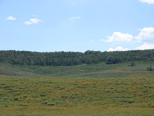
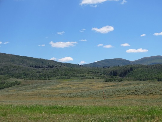


Strawberry Valley, UT (No. 2)
The Uinta Mountains are Laramide uplifted metasedimentary rocks deposited in an intracratonic basin in southwest Laurentia during the time of the breakup of the supercontinent Rodinia. The marine and fluvial metasedimentary rocks in the core of the Uinta Mountains are of Neoproterozoic age (between about 700 million and 760 million years old) and consist primarily of quartzite, slate, and shale. These rocks comprise the Uinta Mountain Group, and reach thicknesses of 13,000 to 24,000 feet (4.0 to 7.3 km). Most of the high peaks are outcrops of the Uinta Mountain Group. Many of the peaks are ringed with bands of cliffs, rising to form broad or flat tops. The mountains are bounded to the north and south by reverse faults that meet below the range, on the north by the North Flank fault and on the south by the Uinta Basin boundary fault.
The Uinta Mountain Group, from oldest to youngest, includes Uinta Mountain undivided quartz arenite, overlain by the Moosehorn Lake, Mount Watson, Hades Peak, and Red Shale formations. The flanks of the east-west trending Uinta Mountains contain a sequence of Paleozoic and Mesozoic strata ranging from the Cambrian Lodore Formation to the Cretaceous Mancos Shale, all of which have been tilted during the uplift of the mountain range.
Source: Wikipedia
#Strawberry Valley#Uinta Mountains#Wasatch National Forest#summer 2022#Uintah and Ouray Indian Reservation#Uinta National Forest#Uintah County#landscape#countryside#big sky country#Rocky Mountains#vacation#travel#original photography#Utah#Western USA#tourist attraction#meadow#flora#nature#forest#wildflower#USA
4 notes
·
View notes
Note
if you were to live in your fantasy world, which of your cities/towns/areas of countryside would you like to live in and why?
bonus: where do you thing you would actually get stuck if you were born/grew up etc. that world
So after a small overhaul I have the much needed name of my setting's supercontinent: Rokaaur. For those interested in the geopolitical interworkings of this continent and its two major empires, click here and here! For those interested in something else, click here.
The area I'd most like to live in is the idyllic countryside of Brydlen on the Western side of the sea. It's a hilly countryside full mostly of free range ranches of various kinds of animals, from normal cattle and sheep to deer and perytons to aurochs (medium to large sauropods) and oversized spiders (bred for silk). Not to put too fine a point on it - I'd like to live in a quiet place with vast expanses and Big Tame Animals.
Based on my own real-life experiences I would have actually grown up in the Southeast Basin area (a loosely Wild West American countryside, ecologically somewhat like the Mojave on most of the continent but much more like the damp American Southeast and Appalachia along a mountain range), and if not there, I would've likely grown up in one of the few city centers, like the Seat of the Iron and Silver or a merchant port in Noshor (on the northern part of the inland sea), since I grew up in the Southwest US in a suburb.
Thank you for the ask and sorry it took me so long to get back to you!
1 note
·
View note
Text
Indian Ocean
Third largest ocean.
Almost 7 times the size of the US
It borders India in the North, East Africa, Australia, and the Southern Ocean.
Because of the higher water temperature, it has limited marine life.
Since about 800 A.D. the Indian Ocean has played an important role in trading. For centuries, navigators have sailed along major ocean currents for shipment routes.
Total: 70.56 million sq km
Coastline: 66,526 km
Note: includes Andaman Sea, Arabian Sea, Bay of Bengal, Great Australian Bight, Gulf of Aden, Gulf of Oman, Mozambique Channel, Persian Gulf, Red Sea, Savu Sea, Strait of Malacca, Timor Sea, and other tributary water bodies
Climate: Northeast monsoon (December to April), southwest monsoon (June to October); tropical cyclones occur during May/June and October/November in the northern Indian Ocean and January/February in the southern Indian Ocean
Ocean Volume: 264 million cu km
Percent of World Ocean Total Volume: 19.8%
Bathymetry
Continental Shelf: A rather flat area of the sea floor adjacent to the coast that gradually slopes down from the shore to water depths of about 200 m (660 ft). Dimensions can vary: they may be narrow or nearly nonexistent in some places or extend for hundreds of miles in others. The waters along the continental shelf are usually productive in both plant and animal life, both from sunlight and nutrients from ocean upwelling and terrestrial runoff.
Exmouth Plateau
Indus Canyon
The Swatch of No Ground/Ganges Canyon (Bay of Bengal)
Sunda Shelf
Continental Slope: Where the ocean bottom drops off more rapidly until it meets the deep-sea floor (abyssal plain) at about 3,200 m (10,500 ft) water depth. The deep waters of the continental slope are characterized by cold temperatures, low light conditions, and very high pressures. Sunlight does not penetrate to these depths, having been absorbed or reflected in the water above. The continental slope can be indented by submarine canyons, often associated with the outflow of major rivers. Another feature of the continental slope are alluvial fans or cones of sediments carried downstream to the ocean by major rivers and deposited down the slope.
Bengal Fan
Indus Fan
Abyssal Plains: At depths of over 3,000 m (10,000 ft) and covering 70% of the ocean floor, are the largest habitat on earth. Sunlight does not penetrate to the sea floor, making these deep, dark ecosystems less productive than those along the continental shelf. Despite their name, these “plains” are not uniformly flat; they are interrupted by features like hills, valleys, and seamounts.
Arabian Basin
Crozet Basin
Madagascar Basin
Mid-Indian Basin
Mozambique Basin
Wharton Basin
Mid-Ocean Ridge: Rising up from the abyssal plain, is an underwater mountain range, over 64,000 km (40,000 mi) long, rising to an average depth of 2,400 m (8,000 ft). Mid-ocean ridges form at divergent plate boundaries where two tectonic plates are moving apart and new crust is created by magma pushing up from the mantle. Tracing their way around the global ocean, this system of underwater volcanoes forms the longest mountain range on Earth. Fracture Zones are linear transform faults that develop perpendicular to the line of the mid-ocean ridge which can offset the ridge line and divide it into segments.
Central Indian Ridge
Davie Ridge
Southeast Indian Ridge
Southwest Indian Ridge
Undersea Terrain Features: The Abyssal Plain is commonly interrupted by a variety of commonly named undersea terrain features including seamounts, guyots, ridges, and plateaus. Seamounts are submarine mountains at least 1,000 m (3,300 ft) high formed from individual volcanoes on the ocean floor. They are distinct from the plate-boundary volcanic system of the mid-ocean ridges, because seamounts tend to be circular or conical. A circular collapse caldera is often centered at the summit, evidence of a magma chamber within the volcano. Flat topped seamounts are known as guyots. Long chains of seamounts are often fed by "hot spots" in the deep mantle. These hot spots are associated with stationary plumes of molten rock rising from deep within the Earth's mantle. These hot spot plumes melt through the overlying tectonic plate as it moves and supplies magma to the active volcanic island at the end of the chain of volcanic islands and seamounts. An undersea ridge is an elongated elevation of varying complexity and size, generally having steep sides. An undersea plateau is a large, relatively flat elevation that is higher than the surrounding relief with one or more relatively steep sides. Although submerged, these features can reach close to sea level.
Andaman-Nicobar Ridge
Chagos-Laccadive Ridge
Kerguelen Plateau
Madagascar Plateau
Mascarene Plateau
Mozambique Plateau
Ninetyeast Ridge
Ocean Trenches: The deepest parts of the ocean floor and are created by the process of subduction. Trenches form along convergent boundaries where tectonic plates are moving toward each other, and one plate sinks (is subducted) under another. The location where the sinking of a plate occurs is called a subduction zone. Subduction can occur when oceanic crust collides with and sinks under (subducts) continental crust resulting in volcanic, seismic, and mountain-building processes. Subduction can also occur in the convergence of two oceanic plates where one will sink under the other and in the process create a deep ocean trench. Subduction processes in oceanic-oceanic plate convergence also result in the formation of volcanoes. Over millions of years, the erupted lava and volcanic debris pile up on the ocean floor until a submarine volcano rises above sea level to form a volcanic island. Such volcanoes are typically strung out in chains called island arcs. As the name implies, volcanic island arcs, which closely parallel the trenches, are generally curved.
Java/Sunda Trench; deepest point in the Indian Ocean
Atolls: The remains of dormant volcanic islands. In warm tropical oceans, coral colonies establish themselves on the margins of the island. Then, over time, the high elevation of the island collapses and erodes away to sea level leaving behind an outline of the island in the form of the fringing coral reef. The resulting low island is typified by the coral reef surrounding a low elevation of sand and coral above sea level with an interior shallow lagoon. Often times the remaining dry land is broken into a ring of islets. Some lagoons can be hundreds of square kilometers. It may take as long as 300,000 years for an atoll formation to occur. Guyots are submerged atoll structures, which explains why they are flat topped seamounts.
Bassas da India
Chagos Archipelago/Diego Garcia
Europa Island
Juan de Nova Island
Lakshadweep Islands
Maldive Islands
Seychelles
-------------------------------------------------------------------
Elevation
Highest Point:
Lowest Point: Java Trench -7,192 m unnamed deep
Mean Depth: -3,741 m
Ocean Zones: Composed of water and in a fluid state, the oceans are delimited differently than the solid continents. Oceans are divided into three zones based on depth and light level. Although some sea creatures depend on light to live, others can do without it. Sunlight entering the water may travel about 1,000 m into the oceans under the right conditions, but there is rarely any significant light beyond 200 m.
The upper 200 m (656 ft) of oceans is called the euphotic, or "sunlight," zone. This zone contains the vast majority of commercial fisheries and is home to many protected marine mammals and sea turtles. Only a small amount of light penetrates beyond this depth.
The zone between 200 m (656 ft) and 1,000 m (3,280 ft) is usually referred to as the "twilight" zone, but is officially the dysphotic zone. In this zone, the intensity of light rapidly dissipates as depth increases. Such a minuscule amount of light penetrates beyond a depth of 200 m that photosynthesis is no longer possible.
The aphotic, or "midnight," zone exists in depths below 1,000 m (3,280 ft). Sunlight does not penetrate to these depths and the zone is bathed in darkness.
-------------------------------------------------------------------
Natural Resources: Oil and gas fields, fish, shrimp, sand and gravel aggregates, placer deposits, polymetallic nodules
Natural Hazards: Occasional icebergs pose navigational hazard in southern reaches
Geography - Note: Major chokepoints include Bab el Mandeb, Strait of Hormuz, Strait of Malacca, southern access to the Suez Canal, and the Lombok Strait
-------------------------------------------------------------------
Environment
Enviornment - Current Issues: Marine pollution caused by ocean dumping, improper waste disposal, and oil spills; deep sea mining; oil pollution in Arabian Sea, Persian Gulf, and Red Sea; coral reefs threatened due to climate change, direct human pressures, and inadequate governance, awareness, and political will; loss of biodiversity; endangered marine species include the dugong, seals, turtles, and whales
Climate: Northeast monsoon (December to April), southwest monsoon (June to October); tropical cyclones occur during May/June and October/November in the northern Indian Ocean and January/February in the southern Indian Ocean
-------------------------------------------------------------------
Major Seaport(s): Chennai (Madras, India); Colombo (Sri Lanka); Durban (South Africa); Jakarta (Indonesia); Kolkata (Calcutta, India); Melbourne (Australia); Mumbai (Bombay, India); Richards Bay (South Africa)
0 notes
Text
Land of Japan:
youtube

-Taishō Pond in Kamikōchi Valley, central Honshu, Japan. Mount Hotaka behind.
The mountain arcs correlate to Japan's primary physiographic regions: Hokkaido, Northeastern (Tōhoku), Central (Chūbu), and Southwestern—as well as the Ryukyu and Bonin archipelagoes. The Chishima and Karafuto arcs merged to form the Hokkaido region. The backbone of the area runs north to south. The Chishima arc reaches Hokkaido as three volcanic chains with altitudes exceeding 6,000 feet (1,800 metres), which form a ladder and finish in the region's core. The Kitami Mountains in the north and the Hidaka Range in the south are the mountain system's main components.
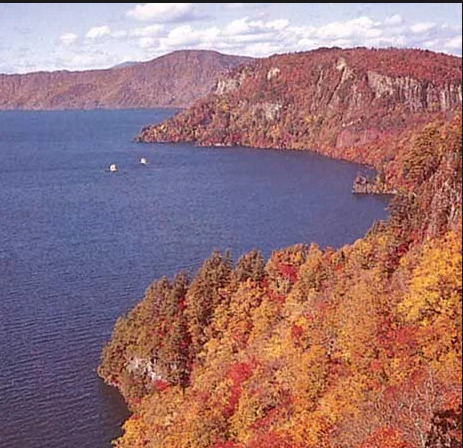
-Lake Towada, Towada-Hachimantai National Park, northern Honshu, Japan.
The Northeastern Region runs from southwest Hokkaido to central Honshu, almost paralleling the northeastern mountain arc. Several rows of mountains, valleys, and volcanic zones are closely aligned with the insular arc of this region, which is convex towards the Pacific Ocean. The Kitakami and Abukuma mountains on the east coast deviate from the normal trend; they are primarily formed of older rocks, with plateau-like landforms surviving in the core. In the western zone, the formations follow the overall trend and consist of a basement complex overlain by thick accumulations of young rocks that have undergone modest folding. The East Japan Volcanic Belt includes the Ōu Mountains, which are separated from the coastal ranges by the Kitakami-Abukuma lowlands to the east and a succession of basins to the west.
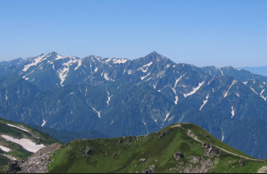
-The Hida Range, part of the Japanese Alps, in central Honshu, Japan.
The Central Region in central and western Honshu is defined by the convergence of the Northeast, Southwest, and Shichito-Mariana mountain ranges around Mount Fuji. The mountain, lowland, and volcanic zones form a nearly right-angled pattern over the island. The Fossa Magna, a massive rift valley that runs from the Sea of Japan to the Pacific, is the most remarkable physical feature on Honshu. It is largely covered by mountains and volcanoes from the southern section of the East Japan Volcanic Belt. Intermontane basins are located between the partly glaciated Akaishi, Kiso, and Hida mountains (Japanese Alps) to the west and the Kantō Range to the east. The Kantō Plain, located east of the Kantō Range, is Japan's largest lowland. Tokyo, the country's largest metropolis, occupies a significant portion of the plain.

-Coast of the Inland Sea, Okayama prefecture, Japan.
The Southwestern Region, which comprises western Honshu (Chūgoku), Shikoku, and northern Kyushu, largely correlates with the southwestern mountain arc. The overall tendency of highlands and lowlands is broadly convex towards the Sea of Japan. The area is separated into two zones: the inner zone, generated by complicated faulting, and the outer zone, formed by warping. The Inner Zone is mostly made up of ancient granites, Paleozoic rocks (250 to 540 million years old), and geologically more recent volcanic rocks that are placed in complex juxtapositions. The Outer Zone, which includes the Akaishi, Kii, Shikoku, and Kyushu mountain groups, is distinguished by a consistent zonal arrangement from north to south of crystalline schists and Paleozoic, Mesozoic (65 to 250 million years old), and Cenozoic formations. The Inner Zone, focused on the Chūgoku Range, has a complex mosaic of fault blocks, whereas the Outer Zone is continuous except for sea straits that divide it into four autonomous groupings. The Inland Sea (Seto-naikai) is the location with the most depression, resulting in seawater incursion. The northern margin of the Inner Zone is studded with massive lava domes generated by Mount Dai, which, along with volcanic Mount Aso, conceal a large portion of the western extension of the Inland Sea in central Kyushu.
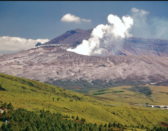
-The caldera of Mount Aso in central Kyushu, Japan
The Ryukyu Islands Region comprises the majority of the Ryukyu arc, which extends into Kyushu as the West Japan Volcanic Belt and ends with Mount Aso. The arc's effect may be observed in the pattern of elongated islands off western Kyushu, such as Koshiki, Gotō, and Tsushima. The Izu-Ogasawara Region, to the east of the Ryukyu arc, consists of a series of volcanoes on the undersea ridge of the Izu-Marina arc, and the Bonin Islands, which include Peel Island and Iwo Jima.
Havard referencing:
The Editors of Encyclopaedia Britannica. (1998). The major physiographic regions. [Online]. britannica. Last Updated: 27 October 2023.. Available at: https://www.britannica.com/place/Japan/Soils [Accessed 19 February 2024].
1 note
·
View note
Text
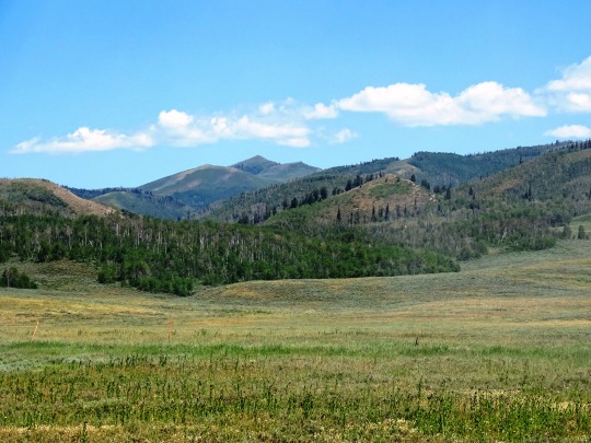
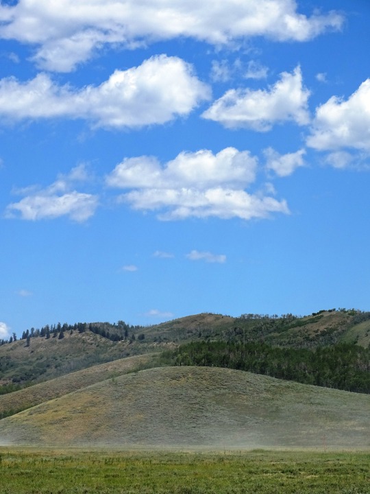
Basin and Range National Monument, Nevada

Discover the remarkable vistas of Basin and Range National Monument, Nevada - a true testament to the awe-inspiring beauty of the American Southwest.
0 notes
Last Seen Blogs

helicase-au-blog
Helicase au

globalvet
Untitled

jonnydood
Stuff.

ephemeryde
Ephemeryde

multifandom-cryptid
Multifandom_Cryptid