#vintage morocco
Text
Ancient Silky Moroccan Caftan & Bedi’ya (vest) Richly Embroidered, Tetuan, early 19th century
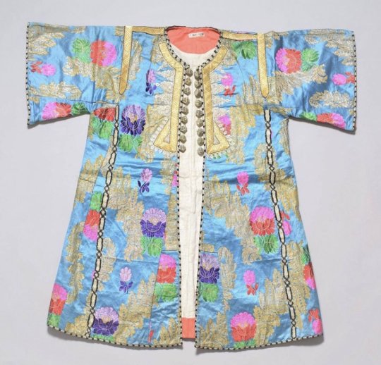
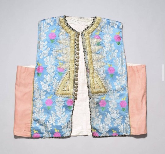
#morocco#moroccan culture#north africa#moorish#moors#moroccan#africa#moroccan history#moroccan caftan#takshita#moroccan clothing#moroccan style#vintage morocco#vintage fashion#north african#amazigh#arab#moroccan wedding#moroccan art#moroccan design#moroccan clothings#moroccan women#moroccan fashion#history of fashion#fashion#style#couture#moroccan couture#moroccan inspiration#old morocco
22 notes
·
View notes
Text

hand-colored postcard of the gateway and fountain outside Funduq al-Najjarin, Fez, Morocco. Est. 1920s
1 note
·
View note
Text
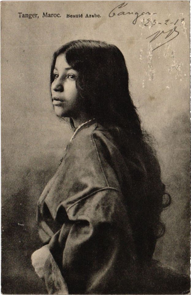
Arab beauty from Tangiers, Morocco
French vintage postcard, mailed in 1913 to Madrid, Spain
#tarjeta#postkaart#1913#spain#sepia#beauty#historic#tangiers#photo#morocco#postal#arab#briefkaart#madrid#photography#mailed#vintage#ephemera#ansichtskarte#old#postcard#french#postkarte#carte postale
92 notes
·
View notes
Text
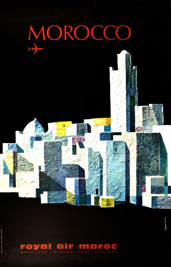
Royal Air Maroc travel poster for Morocco (c. 1970). Artwork by M. Gayraud.
#vintage poster#vintage travel poster#1970s#morocco#M. Gayraud#royal air maroc#moroccan international airlines#travel#tourism#holiday#city#buildings#airplane#aeroplane
63 notes
·
View notes
Photo
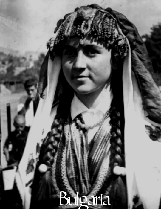
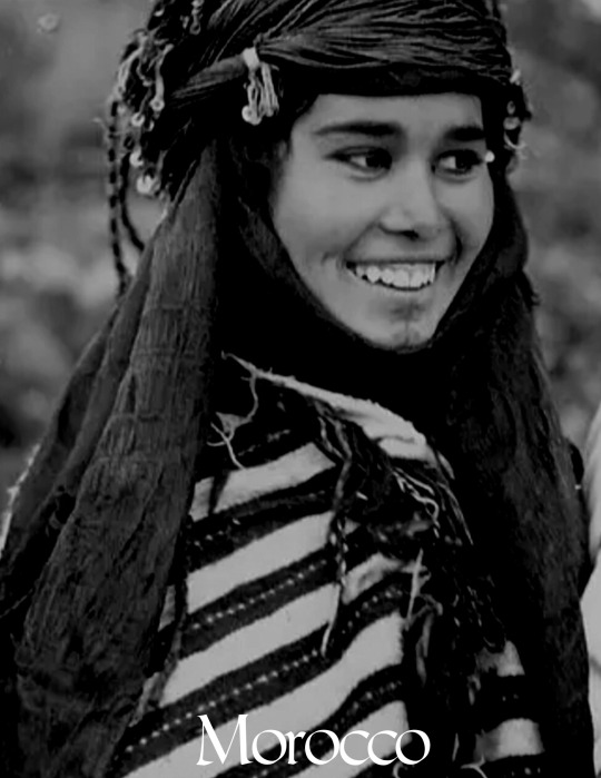


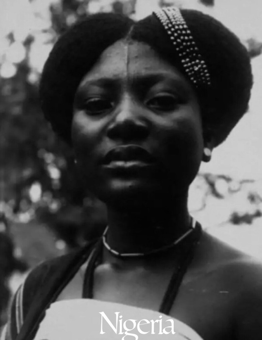


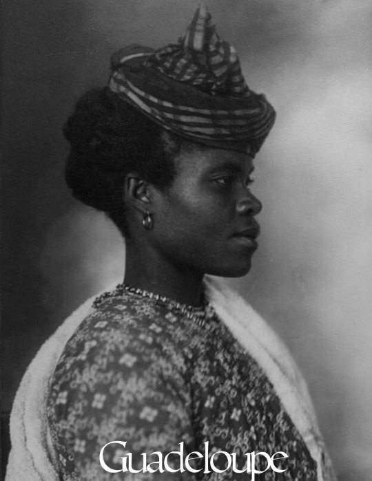
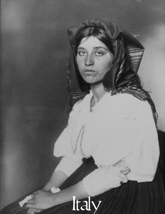
beauty around the world: pt 5
#here's the fifth part#beauty around the world#beauty#women in history#vintage photography#vintage#photography#bulgaria#morocco#canada#sudan#slovakia#nigeria#kurdistan#ireland#guadeloupe#italy#ph#history
1K notes
·
View notes
Text

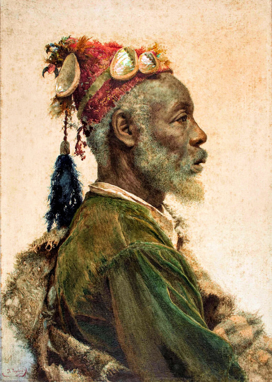

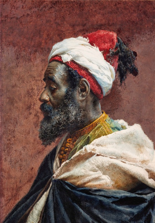
Late-nineteenth-century watercolor portraits of indigenous North-African men, by Spanish painter Josep Tapiró i Baró (1836-1913).
#africa#morocco#people#style#art history#islam#culture#art#muslim#watercolor#black men#fashion#black history#vintage#men#society#beauty#portrait#19th century#black tumblr#📚#josep tapiro y baro#🎨
44 notes
·
View notes
Text

Suzy Parker in Morocco, April 1953.
Suzy Parker au Maroc, avril1953.
Photo Georges Dambier
#suzy parker#1953#morocco#maroc#georges d#shoo#shooting stars#fashion 50s#spring/#spring/summer#printemps/été#vintage#vintage fashion
33 notes
·
View notes
Text
"Morocco" (1930), directed by Josef von Sternberg, with Marlene Dietrich and Gary Cooper
#marlene dietrich#old hollywood#hollywood#gay kiss#lesbian kiss#vintage movies#movie history#gay icons#morocco#1930s hollywood#1930
148 notes
·
View notes
Text
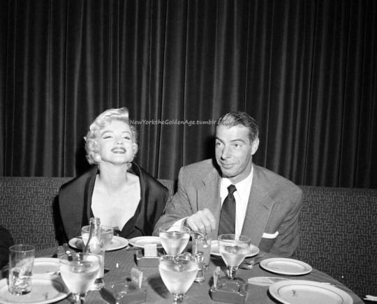
Marilyn Monroe and Joe DiMaggio at El Morocco on September 12, 1954, during their brief marriage.
Photo: Pen and Sword/mediadrumworld/The Mirror
#vintage New York#1950s#Marilyn Monroe#Joe DiMaggio#El Morocco#nightclub#Monroe DiMaggio#couples#September 12#12 September#12 Sept.#Sept. 12#vintage nightclub#vintage NYC
115 notes
·
View notes
Text
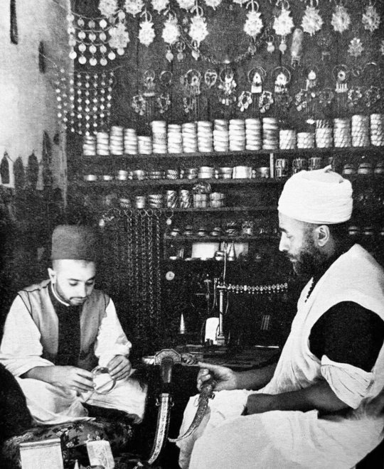
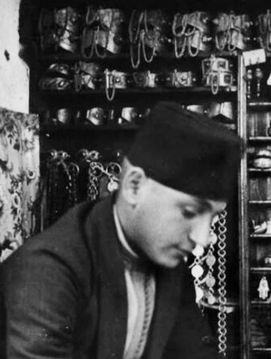
Moroccan Jewelry Craftmen in their Workshop, 1915, Fez
#morocco#moroccan culture#north africa#moorish#moors#moroccan#africa#moroccan history#moroccan patrimony#moroccan design#moroccan craftsman#moroccan craftsmanship#moroccan crafts#moroccan jewelry#moroccan jewellery#moroccan fashion#moroccan men#vintage morocco#amazigh jewellery#amazigh#maghreb#maroc#moroccan style#fes#fez#moroccans#old morocco#haik#history of morocco#tarbouche
7 notes
·
View notes
Text


#sicilia#moroccan#persian#iran#iranian#sicily#italy#italia#sicilian sunset#morocco#moors#moorish#amazigh#tamazight#imazighen#native beauty#indigenous#coquette#y2k#roman catholic#early 2000s#florida kilos#vintage americana#dollette#free palestine#middle eastern#north africa#cheetah#nativeamericans#taino
21 notes
·
View notes
Text

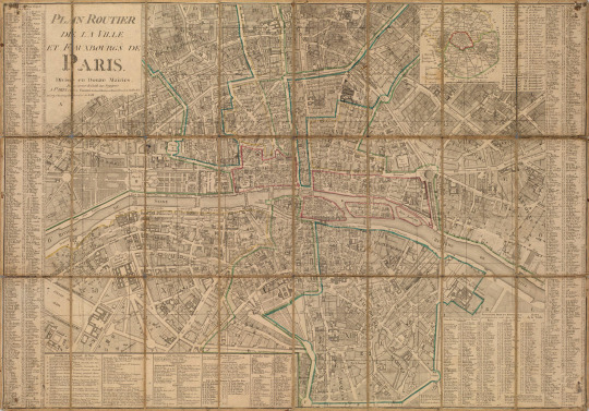
Road plan of the city and fauxbourgs of Paris in 1804-1805, divided into two town halls.
From Napoleon’s office following his coronation in December 1804 as Empereur des Français, the imperial residence then being at St Cloud. Publisher Jacques Esnaults (1739-1812).
A similar map of the city of Paris, Jean's Plan routier de la ville et faubourgs de Paris divisé en douze mairies (Paris, 1809) with a note stating that it was recovered from Napoleon's desk at Malmaison by a Prussian volunteer, was offered for sale by Karl Hiersemann in the sale Napoléon I. et son temps; catalogue... composant principalement la collection H. Buhrig, Leipzig, 1913, lot 494.
(Bonhams: Napoleon Bonaparte, The British Sale)
#Paris#France#1800s#map#Morocco leather#napoleonic era#napoleonic#napoleon#napoleon bonaparte#first french empire#french empire#19th century#history#maps#auction#bonhams#Jacques Esnaults#Esnaults#vintage book#old books#vintage
29 notes
·
View notes
Text

Map of Morocco
French vintage postcard
#postkaart#carte postale#morocco#postcard#historic#postkarte#postal#tarjeta#sepia#photo#ansichtskarte#briefkaart#old#vintage#map#photography#ephemera#french
36 notes
·
View notes
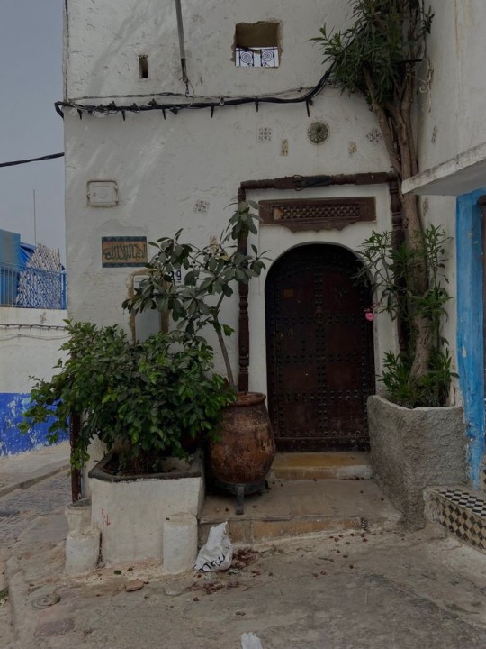
Text

Chefchaouen, Morocco,
Aziz Acharki Photography
#art#design#doorway#architecture#heavensdoorways#doors#doorsdesign#doordesign#entrance door#door#antic door#vintage door#woodwork#millwork#morocco#chefchaouen#blue#old door
43 notes
·
View notes
Photo

Tatiana, Marie Rose, Picnic, Camels, Morocco, William Klein, 1958
#photography#vintage#vintage photography#william klein#morocco#fashion#vintage fashion#camels#1950s#1958#american#french
67 notes
·
View notes
Last Seen Blogs


vampireknightcosplay-blog
Vampire Knight cosplay

meow-valley
Meow³

horrorstarz
Starrrrz

capevewor
Untitled