#british wildflowers
Text

🌼🐰Happy Easter 🐣🌱
#easter#pokemon#azumarill#torchic#togepi#pkmnart#really enjoying all the wildflowers lately uwu#and finally more sunlight with British summer time /owo/#mydraws
1K notes
·
View notes
Text
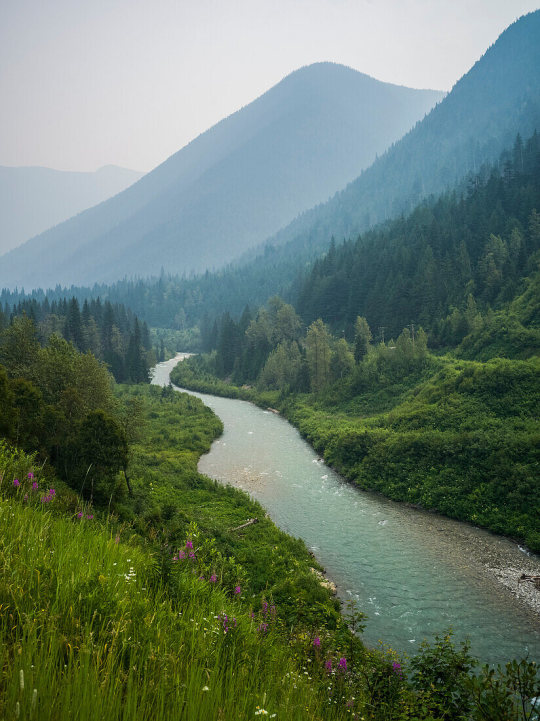
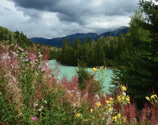
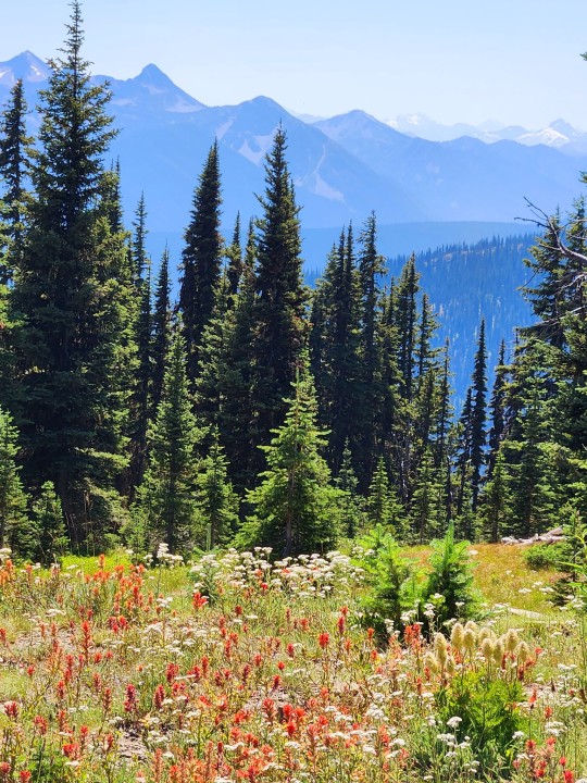
Selkirk mountains, Revelstoke, British Columbia, Canada
#Revelstoke#british columbia#canada#mountains#river#wildflowers#photography#curators on tumblr#nature#Aesthetic#nature photography#trees#forest#woods#landscapes#1k
6K notes
·
View notes
Text
Snake's-head fritillary (Fritillaria meleagris) photos I took today 30/03/2024, area around Smeaton, West Yorkshire


#nature#nature photography#british nature#wild#fritillaries#purple flower#purple floral#purple flowers#purple#wildflora#wildflower photography#wildflower#wildflowers#wild flowers#flower#flowers#flora#flower photography#wild plant#plant#plants#plant photography#botany#botanical#blooms#bloom#fritillary#lily#lilies#liliaceae
173 notes
·
View notes
Text
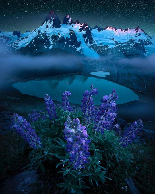
" British Columbia " //© CATH SIMARD
#British Columbia#Canada#nature#landscape#mountainscape#nightsky#wildflowers#aesthetics#wanderlust#explore#follow#discover
349 notes
·
View notes
Text
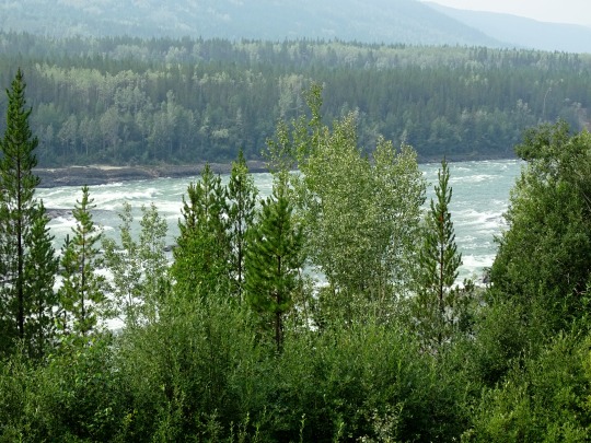


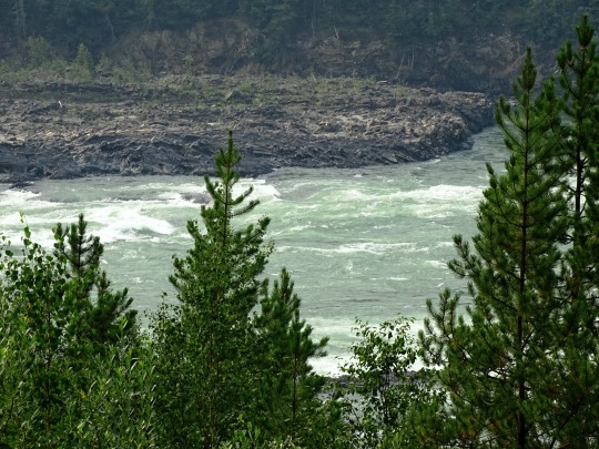


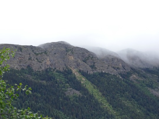
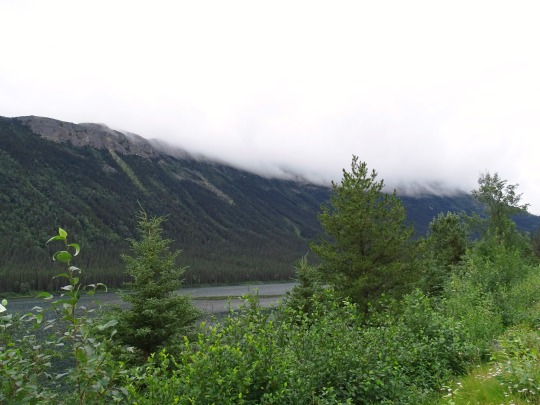
Liard River, BC
It flows south-east and east along the Alaska Highway, receiving the waters of Dease River, Kloye Creek, Trepanier Creek and Black Angus Creek. It continues east through the Dease Forest, where it receives the waters of the Hyland River south of Hyland River Provincial Park, then receives the Malcolm Creek, Tatisno Creek and Nustlo Creek. It flows along the Yukon border, where the Alaska Highway once again follows the Liard and receives the Cosh Creek, Contact Creek, Scoby Creek and Sandin Brook, then turns south around Mount Sandin, receiving water from Tsia Creek, Tsinitla Creek, Tatzille Creek and Leguil Creek. It turns eastwards along the northern margin of the Liard Plateau, where it receives the Kechika River near Skooks Landing, Niloil Creek from Niloil Lake and Coal River by Coal River. It continues east and south-east, south of Mount Reid, still followed by the Alaska Highway, receiving the waters of Geddes Creek, Grant Creek, Smith River, Lapie Creek, Teeter Creek, Mould Creek and Hoole Creek.
It enters the Liard River Hot Springs Provincial Park, where the Trout River empties into the Liard. Alaska Highway runs south along the Trout River, while the Liard flows east through the Liard River Corridor Provincial Park and Protected Area, south of the Sentinel Range of the Muskwa Ranges, receiving the waters of Deer River and Canyon Creek in the Grand Canyon of the Liard. It continues south-east between the Barricade Range and Mount Rothenberg of the Sentinel Range, where the Moule Creek and Sulphur Creek flow in the Liard. It flows east, out of the Northern Rockies and through the foothills, where it receives waters from the Brimstone Creek, Crusty Creek, Grayling River, Graybank Creek and Toad River. It turns north-west, receiving the waters from Garbutt Creek, Lepine Creek, Chimney Creek, Ruthie Creek, Scatter River and Beaver River. It then turns south-east, receives the waters from Catkin Creek, Dunedin River and Fort Nelson River. From here it turns north, receiving the waters of Zus Creek, Sandy Creek and La Biche River and crosses into the Northwest Territories, immediately east of the Yukon border.
Source: Wikipedia
#Kootenay#butterfly#wildlife#fauna#animal#BC#Liard River#travel#original photography#vacation#tourist attraction#landmark#landscape#countryside#British Columbia#woods#forest#nature#flora#tree#river bank#wildfire smoke#summer 2023#Canada#view#vista point#boreal forest#Northern Rockies#Rocky Mountains#wildflower
16 notes
·
View notes
Text
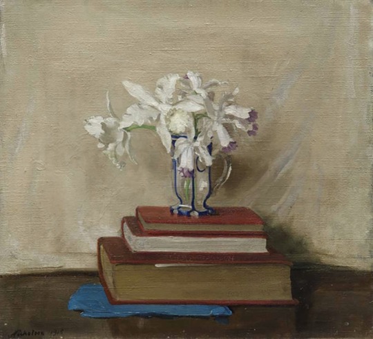
William Nicholson
White Orchids on Books
1916
#william nicholson#floral#floral painting#floral art#flower art#flowers#british artist#british art#british painter#british painting#english artist#english art#english painting#english painter#orchids#wildflower#modern art#art history#aesthetictumblr#tumblraesthetic#tumblrpic#tumblrpictures#tumblr art#aesthetic#beauty
16 notes
·
View notes
Text
5 notes
·
View notes
Text


HI <3 welcome to my page !! ✨🍒🇬🇧♥️
*these pictures are mine*
:)
#cigarettes after sex#wildflower cases#girl boss#girlblogging#downtown girl#lana del ray aesthetic#lana del slay#British#Spotify
12 notes
·
View notes
Photo
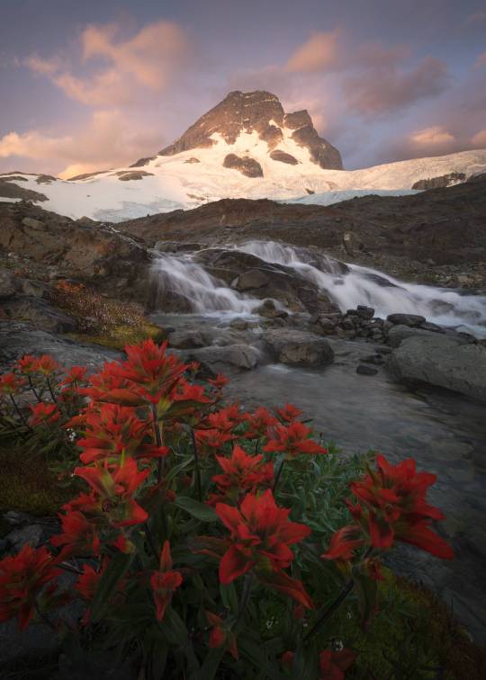
Bask in the serene beauty of BC's coastal mountains as dusk paints the sky in soft hues. A cascade of water flows among vivid wildflowers, crafting a snapshot of peaceful wilderness.
#British Columbia#coastal mountains#dusk#serene landscapes#nature photography#wildflowers#nature beauty#peaceful wilderness#mountain streams#sunset colors#outdoor adventure#Canadian wilderness#tranquility#nature lovers#environmental photography
3 notes
·
View notes
Text


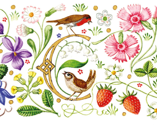
Coronation Invitation
#wildflowers#coronation invitation#King Charles#coronation#andrew jamieson#heraldic art#green man#the green man#british folklore#queen camilla#wild strawberries#royalty#the royal family
22 notes
·
View notes
Text
source
#nature#british columbia#photography#mountains#green#plants#trees#water#landscape#blue#pink#flowers#wildflowers#blue water#river
1K notes
·
View notes
Text
Marsh marigold (Caltha palustris) wildflower photos I took yesterday 15/04/2024, Stanley, Wakefield, West Yorkshire, UK


#nature#nature photography#british nature#wild#ranunculaceae#yellow flower#yellow flowers#yellow floral#yellow#wild plant#plant#plants#plant photography#wild plants#wildflora#wildflower photography#wildflower#wildflowers#wild flowers#flower#flowers#flower photography#blooms#bloom#flowering plants#blooming#botany#botanical#flora#floral
35 notes
·
View notes
Text
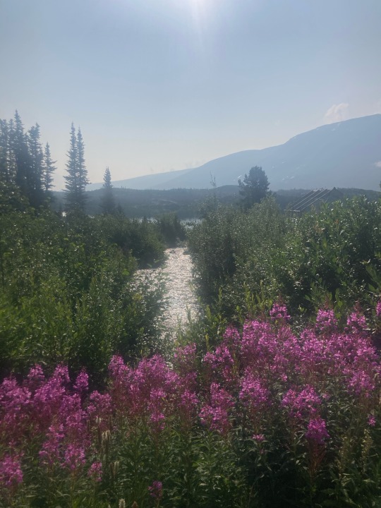
Fireweed, Fraser, BC
5 notes
·
View notes
Text
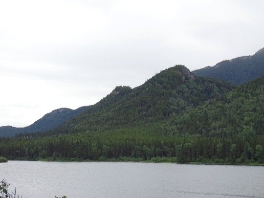
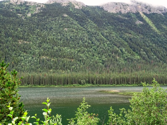


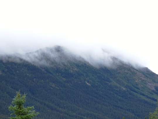


Pinetree Lake, BC (No. 2)
The region, which includes the Interior Plateau as well as various mountain ranges and the valleys between them, comprises everything inland from the Coast Mountains and reaching east to the Rocky Mountains and, in the northeast, British Columbia's sector of the Prairies, the Peace River Block. "Interior" is usually and properly capitalized but turns up in lower-case in various books and magazines. The non-coastal areas of the province are considered to be "in the Interior", although the sparsely populated regions of its northern half are usually referred to only as "the North".
The town of Hope, at the eastern end of the Fraser Valley and at the foot of the Fraser Canyon, is often considered the "Gateway to the Interior" and bears an entrance arch to that effect, though in practical terms the Interior does not begin until somewhere between Yale and Boston Bar, in the Fraser Canyon, or until the summits of the Coquihalla and Allison Passes. The boundary between "the Coast" and "the Interior" along the Highway 99 corridor is nominally between Whistler and Pemberton, as Pemberton is often described as being in the Interior, but from the inland perspective it is often seen as part of the Coast because of its wetter climate and close ties to the Lower Mainland.
There are many subregions within the Interior, some regions in their own right, and although there are no precise definitions, it is often broken up informally as the Northern Interior, the Central Interior, the Southern Interior, the Northeast Interior and Southeast Interior, and these names often appear in non-governmental organizations and company names as well as in government administrative districts and ministerial regions, and in weather reports.
Source: Wikipedia
#Pinetree Lake#original photography#travel#vacation#tourist attraction#landmark#landscape#countryside#nature#Canada#summer 2023#fir#the North#cityscape#forest#woods#flora#British Columbia#wildflower#Stikine Highway#clouds#British Columbia Highway 37#Skeena Region#lake shore#Skeena Country#British Columbia Interior
21 notes
·
View notes
Text

4 notes
·
View notes
Text


on the left is old man’s beard, which i believe is the only wild clematis native to the UK! it’s one of my favourite ones to spot and it was growing on the banks of the canal when i was walking into town with my friend. on the right is a pretty flower i found in a plant pot next to the bookshop.
#cottagecore#nature#naturecore#grandmacore#plantblr#british flowers#flowers#uk wildflowers#wildflowers
14 notes
·
View notes
Last Seen Blogs

ladykarssa
Lady_Karissa

logicalstansadvice
The 👑 Cunt-esses 👑 of Standom Blog

artsyco3xist
@artsy_co3xist
jadaisnotgroovy
jada

tovakiin
tovakiin!