#satellite photo
Text
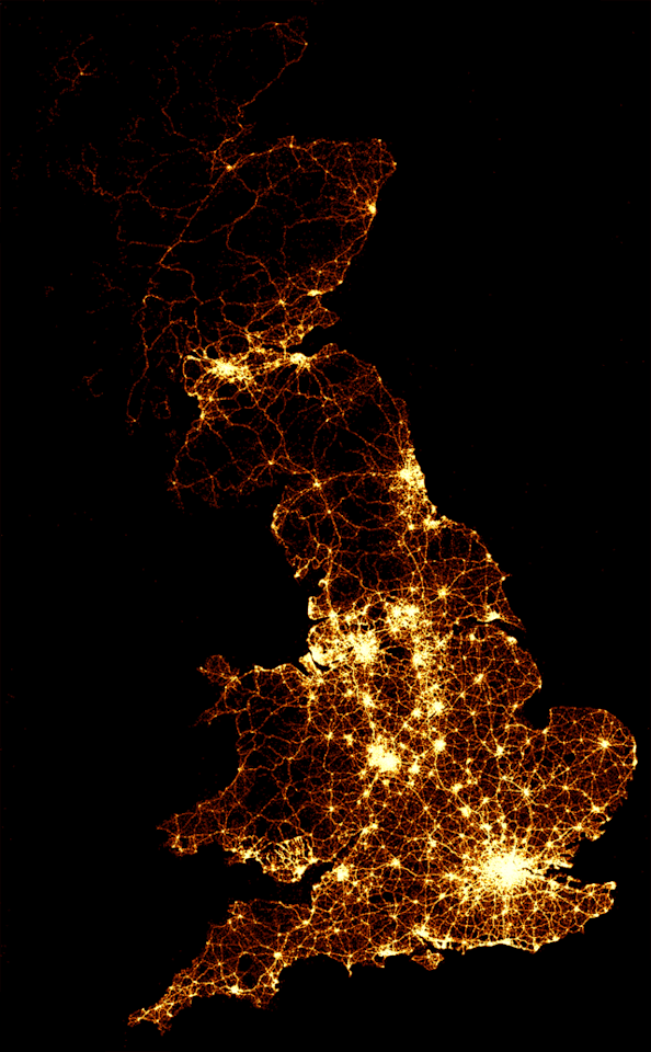
A tender good-night to my British friends & followers. Here's to a Happy New Year of peace & prosperity throughout the Anglosphere.
#Happy New Year#1 January 2024#night map of Britain#UK#England#Scotland#Wales#satellite photo#Anglosphere
136 notes
·
View notes
Text

Mt Fuji from the International Space Station
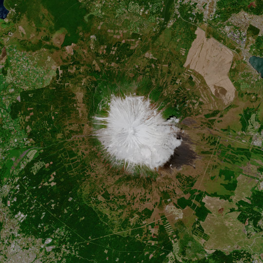
Mt. Fuji is often shrouded in cloud and fog, but this image was captured on a clear day, by the Copernicus Sentinel-2A satellite - flying 800 km above.
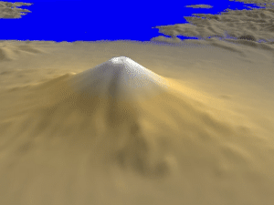
3D panoramic view of Mount Fuji. Picture made using SRTM data, provided by NASA.

Mount Fuji is an active volcano that erupts approximately every 500 years. Its last confirmed eruption was in 1707. Mount Fuji is about 62 miles away from Tokyo.

Tokyo is the largest & most populated city on earth.
#mt fuji#satellite photo#space station photo#panoramic view#japonica#fujiyama#japan#mount fuji#tokyo
115 notes
·
View notes
Text

30 notes
·
View notes
Text
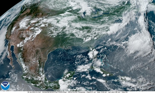
Montana is still getting wildfire smoke from western Canada, but the old Northwest Territory seems fairly clear of it for now. The sweep of haze this afternoon looks like it's over the Eastern Seaboard, though, and even part of the Gulf of Mexico as it's pushed out over the Atlantic.
0 notes
Text

We love this image of Earth captured by the Orion capsule launched on Artemis I
#we are going#to#moon#space#earth#wonderful#photography#planet#artemis#artemis i#amazing#photo#satellite#galaxy#astronomy#astronaut#awesome#color#tumblr#nebula#solar system#nasa#national aeronautics and space administration#world#magic#god#creation
1K notes
·
View notes
Text

Columbia Records via Twitter! (30 April 2023)
x
223 notes
·
View notes
Text
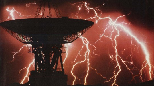
Satellite Lightning
#art#nostalgia#1980s#vaporwave#aesthetic#vintage#magazine#neon colors#1990s#neon#90s#lightning#storm#satellite#weather#clouds#night#electronic#photography#photo#science
73 notes
·
View notes
Video
Mysterious Flash Over Kyiv, Ukraine
A mysterious flash which lit up skies over Ukraine's capital on Wednesday night generated much speculation.
Officials in Kyiv initially suspected it was a Nasa satellite falling to Earth but the US space agency said it was still in orbit.
Ukrainian space officials said later the flash had probably come from a meteor entering the atmosphere.
The air force was confident it was not a Russian air attack - an event all too familiar since the invasion last year.
The bright glow was observed in the sky over the capital around 22:00 local time (19:00 GMT).
An air raid alert was activated but "air defence was not in operation", the head of Kyiv's military administration, Serhiy Popko.
#ukraine#kyiv#mysterious flash over kyiv ukraine#meteor#nasa#nasa photos#nasa picture of the day#nasa video#video#satelite#rhessi satellite
208 notes
·
View notes
Text
This image shows the “moonrise” of the satellite as it emerges from behind asteroid Dinkinesh as seen by the Lucy Long-Range Reconnaissance Imager (L’LORRI), one of the most detailed images returned by NASA’s Lucy spacecraft This image was taken at closest approach, from a range of 270 miles (430k).

#astronomy#nasa#astronomers#universe#astrophotography#nasa photos#astrophysics#outer space#nasawebb#hubble space telescope#i love astronomy#astronomy facts#astronauts#astronaut#astro community#planetary science#planetary nebula#space exploration#space#science#science facts#space science#cosmos#the universe#our universe#asteroid observations#asteroidbelt#asteroid astrology#asteroid#satellite
30 notes
·
View notes
Text
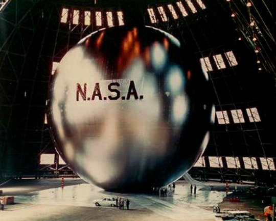
NASA’s Echo 1 communications satellite - 1960.
#nasa#nasa photos#satellites#communication satellites#echo 1#technology#vintage tech#vintage technology#space#space exploration#project echo#space balloons#bell telephone laboratories#jet propulsion laboratory#mylar
26 notes
·
View notes
Text

Harry for Satellite music video via sonymusicuk
120 notes
·
View notes
Text
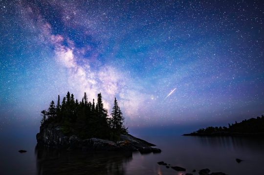
Katie Steig’s photograph of the Milky Way with an Iridium satellite flare over The Rock at Lake Superior in Hovland, Minnesota.
Summer Snaps Photo Contest
#katie steig#photographer#landscape#night sky#milky way#iridium satellite flare#the rock at lake superior#hovland#minnesota#nature#summer snaps photo contest
15 notes
·
View notes
Text
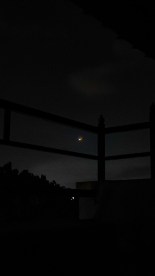
🌒❤️.
#moon#moon lovers#moon photography#photography#photo of the day#moonlight#beautiful#selenophile#moon art#sky#night sky#space#stars#galaxy#aesthetic#moon aesthetic#clouds#moonshine#vibez#milky way#nasa#100 likes#like my post#follow#astrophile#selene#love moon#pretty moon#natural satellite#🌙
14 notes
·
View notes
Text
5 hryven - 60th Anniversary of the Launching of the First Earth Satellite

From 5 hryvnia coin - 60th Anniversary of the Launching of the First Earth Satellite | Ukraine 2017 (coin-database.com)
#ukraine#collector coin#coin#space#earth#satellite#astronomy#outer space#5 hryvnia#five hryvnia#photo
6 notes
·
View notes
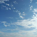
Text

Aaaaaand: the wildfire smokey haze is back! Looks like the smoke from the western wildfires is being funneled down toward the southeast, sending the AQI back into cautionary territory:
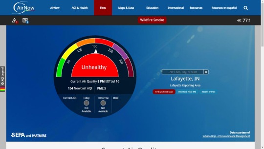
Eastern Montana has the worst smoke in the U.S. right now.
The haze over the middle countryside was all too evident as well:
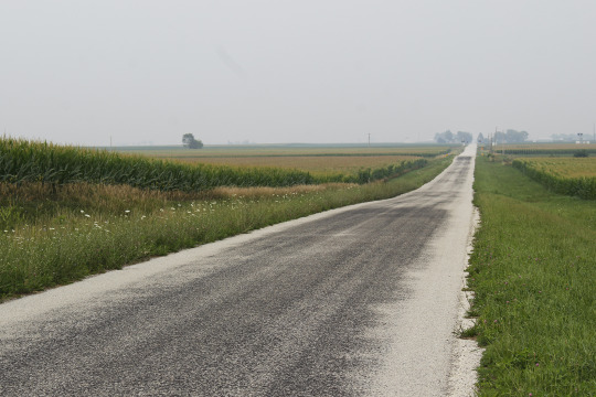
Humidity might add some haziness to the scene, but it's mostly smoke. For further comparison:

Just north of Hoopeston, IL on July 16 (above) and when the air was clearer (below) on June 12:

Satellite view: National Weather Service
Air Quality monitor: AirNow.gov
Photos: Rachel Bradshaw and Jake Wood, 2023.
0 notes
Text
It makes so much sense that if this really is the eggs trying to communicate that it was Ramon who figured out how to do it. He’s been building and working on ways for Fit to send messages secretly outside of the island for months. Of course that little egg has some ideas on how to send a message from a distant place.
12 notes
·
View notes
Last Seen Blogs

evaruths
EvaRuth's

clasone
clas
caflovetree
AnyWhere

forherpleasure123
Proud Stag 🦌

la-m3xicana
Between Me and You...